Updated 08.31.22 @ 7:33a
You must be logged in to view this content. Click Here to become a member of IndyWX.com for full access. Already a member of IndyWx.com All-Access? Log-in here.

Aug 31
Updated 08.31.22 @ 7:33a
You must be logged in to view this content. Click Here to become a member of IndyWX.com for full access. Already a member of IndyWx.com All-Access? Log-in here.
Permanent link to this article: https://indywx.com/2022/08/31/video-wrapping-up-august-on-a-gorgeous-note-heat-builds-and-storm-chances-return-over-the-holiday-weekend/
Aug 30
Updated 08.30.22 @ 7:40a
You must be logged in to view this content. Click Here to become a member of IndyWX.com for full access. Already a member of IndyWx.com All-Access? Log-in here.
Permanent link to this article: https://indywx.com/2022/08/30/reviewing-rainfall-amounts-cooler-and-less-humid-through-the-remainder-of-the-work-week-heat-returns-over-the-holiday-weekend/
Aug 28
Updated 08.28.22 @ 8:18a
You must be logged in to view this content. Click Here to become a member of IndyWX.com for full access. Already a member of IndyWx.com All-Access? Log-in here.
Permanent link to this article: https://indywx.com/2022/08/28/video-cold-front-passes-tuesday-unsettled-open-to-the-work-week-gives-way-to-pleasant-weather-leading-up-to-labor-day/
Aug 27
Updated 08.27.22 @ 6:15p
You must be logged in to view this content. Click Here to become a member of IndyWX.com for full access. Already a member of IndyWx.com All-Access? Log-in here.
Permanent link to this article: https://indywx.com/2022/08/27/video-cooler-regime-to-open-september-doesnt-last-long-warmer-than-normal-start-to-meteorological-fall-expected/
Aug 27
Updated 08.27.22 @ 7:53a
First and foremost, happy college football season! Sure, this weekend’s games aren’t terribly exciting, but LIVE college football is back and sets the stage for an incredible slate this upcoming weekend! I’m looking forward to being on the Plains of southern Alabama next weekend to celebrate the return of another special Auburn football season!
I will still be posting a Client Video later today, but wanted to dedicate this post to the two test cases in the week ahead:
I. Strength and magnitude of the cooler air to open September
II. Pre Labor Day tropical excitement in the Gulf of Mexico
Let’s start with the cooler potential. The European has trended closer to the GFS solution in recent runs, opening September on a cooler than normal note. The GFS is still more aggressive with the cool down to open up meteorological fall, but the European is trending more and more towards this solution. What’s at stake? A couple of days to open the month with lows into the lower 50s (mid to upper 50s inside the circle, itself) and highs in the upper 70s with that classic autumn sky. Side note: a significantly warmer (hotter) pattern looms thereafter.


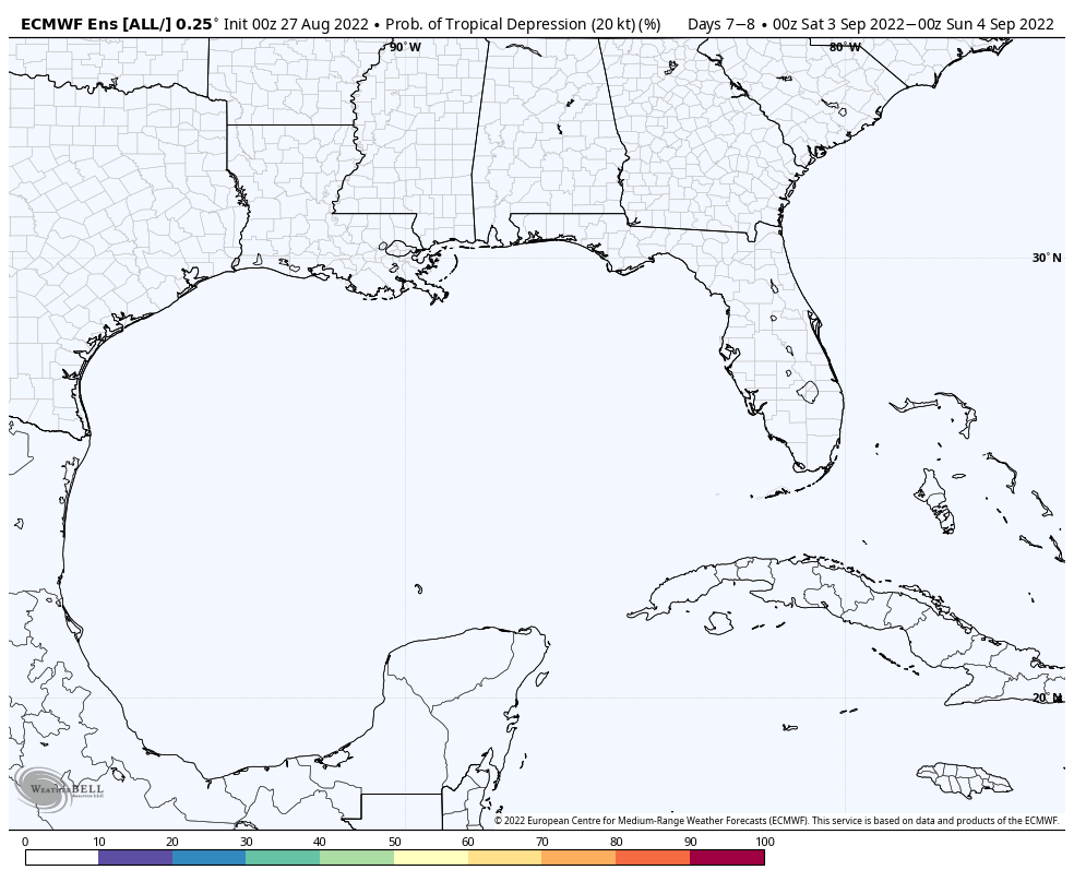
Now let’s talk about the tropics. Not much has changed here with the vast differences in handling the lead feature (threat in the Gulf of Mexico as Labor Day weekend nears). This morning, the GFS continues to beat the drum on this potential while the European isn’t excited in the least. We note the European ensemble product isn’t even hinting at the threat of a depression to develop during this period. It’ll be mighty interesting to see how this plays out in the coming days. We should gain more clarity early in the work week. I will say, should something form, it appears to be an eventual southern of western Gulf threat from this distance.


Video discussion looking over 12z data and jumping ahead to the next big surge of warmth will be online later today.
Permanent link to this article: https://indywx.com/2022/08/27/checking-in-on-those-test-cases/
Aug 24
Updated 08.24.22 @ 7:31a
You must be logged in to view this content. Click Here to become a member of IndyWX.com for full access. Already a member of IndyWx.com All-Access? Log-in here.
Permanent link to this article: https://indywx.com/2022/08/24/video-moisture-levels-increase-unsettled-times-return-over-the-weekend-and-into-early-next-week/
Aug 23
Updated 08.23.22 @ 7:23a
You must be logged in to view this content. Click Here to become a member of IndyWX.com for full access. Already a member of IndyWx.com All-Access? Log-in here.
Permanent link to this article: https://indywx.com/2022/08/23/video-model-differences-to-open-up-september/
Aug 22
Updated 08.22.22 @ 6:52a
You must be logged in to view this content. Click Here to become a member of IndyWX.com for full access. Already a member of IndyWx.com All-Access? Log-in here.
Permanent link to this article: https://indywx.com/2022/08/22/video-warmth-and-humidity-builds-this-week-scattered-storm-chances-return-late-week/
Aug 21
Updated 08.21.22 @ 4:48p
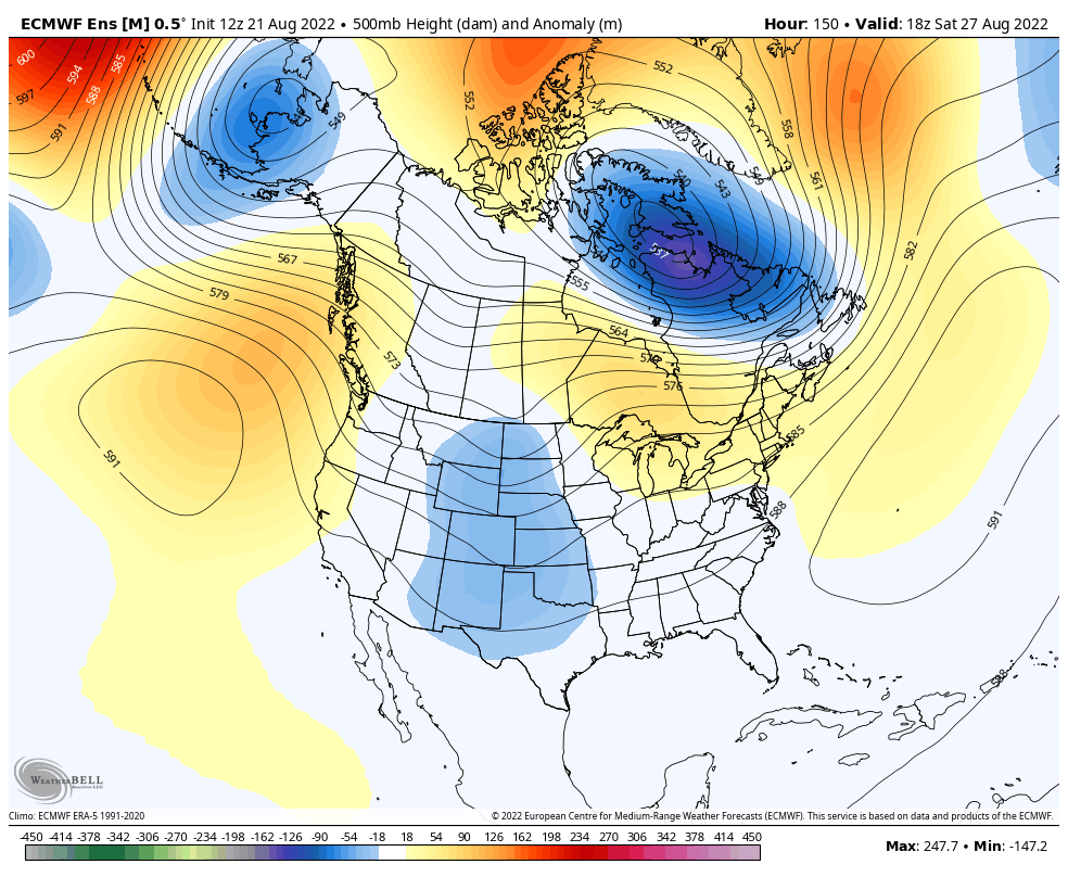
We’ve enjoyed quite the pleasant stretch of temperatures and humidity levels as of late, but there are increasing signs of a return of heat and humidity to close out August. In particular, we target the latter part of the week into early Week 2 for a stretch of 90° (plus?) to make a return visit as an upper ridge builds over the Great Lakes and Northeast.

For the most part, the pattern will also embrace a drier theme. As moisture levels return, isolated to widely scattered coverage of storms will likely return by the weekend, but we don’t envision any organized rain and storms through the upcoming week- after today.

This aligns with the pattern drivers (developing positive EPO and a hyper MJO into Phases 2 and 3). That said, there are growing indications the MJO will remain in an amplified state as we roll into September. If this is indeed the case, it appears as if we’ll move into Phase 4 early September. Certainly not set in stone but this is noteworthy as the correlation delivers an unseasonably cool stretch of temperatures for our area, including into the central Plains.

At times, the GFS can be too “quick” in displaying pattern changes, but should we get into Phase 4, we’ll have to pay attention for the threat of a shot of true early fall temperatures (at least for a couple of days) come early September. We’ll keep a close eye on things…


Permanent link to this article: https://indywx.com/2022/08/21/surge-of-warmth-to-close-out-meteorological-summer-but-what-comes-after/
Aug 20
Updated 08.20.22 @ 2:05p I. Unsettled weather will continue at times through early next week. The primary culprit has to do with an upper level area of low pressure slowly…
You must be logged in to view this content. Click Here to become a member of IndyWX.com for full access. Already a member of IndyWx.com All-Access? Log-in here.
Permanent link to this article: https://indywx.com/2022/08/20/saturday-afternoon-rambles-2/