 Highlights:
- Strong to severe storm potential Wednesday
- Cooler Thursday
- Nice close to the week
- Another cold front delivers late storms Sunday then another pop of cool air
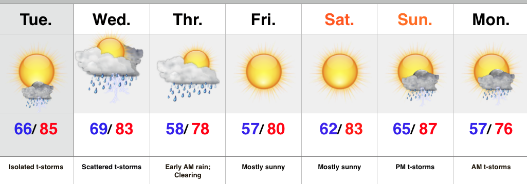
Monday afternoon turned wet across central IN as a disturbance lifted north across the state, including Gulf of Mexico moisture. Localized strong storms and torrential rainfall impacted many neighborhoods.
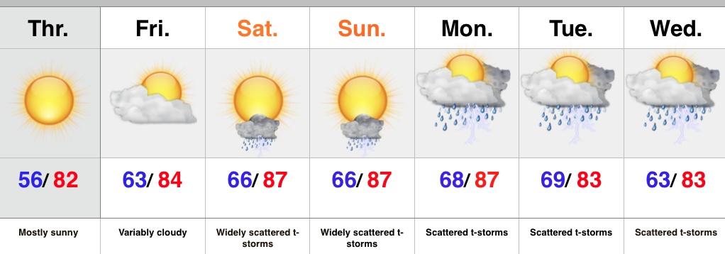
Coverage of showers and storms will be much less Tuesday, but we still will maintain an isolated storm as a possibility.
Attention will then shift to two cold fronts that will impact the region between mid week and early next week. Strong to severe storms are possible Wednesday afternoon and evening followed by much cooler air moving in for Thursday. We’ll keep a close eye on things. After nice weather Thursday through Saturday, another cold front will swing into the Hoosier state Sunday night/ early Monday with another round of showers and thunderstorms. Yet another pop of unseasonably cool air will follow to open next week.
Upcoming 7-Day Rainfall Forecast: 1″ – 1.5″ (locally heavier totals)
Tonight’s “@cryptics Cam” shows a very nice time lapse of storms as they blew through Danville earlier today. Be sure to follow @cryptics on Twitter for awesome views of the sky and associated weather conditions here across central IN!