Times, They Are A Changing…
 Highlights:
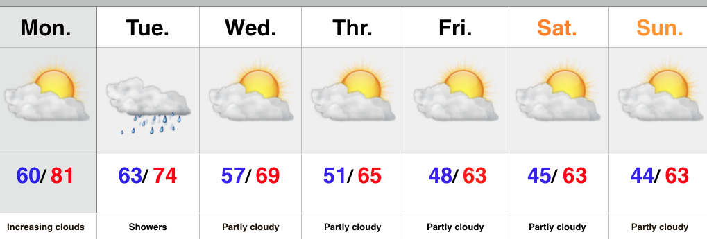
- Much cooler and breezy for mid week
- Windy, chilly, and wet end to the week
- Drier early next week
A complicated series of events will lead to a memorable week/ weekend of weather along the eastern seaboard. Between the cold front that moved through here last night, Joaquin (well on it’s way to becoming a hurricane this morning), and energy that moved out of the Gulf of Mexico, the eastern seaboard is in for a major flood event, and long duration wind/ beach erosion event.
Before we discuss potential impacts closer to home, let’s talk the short term. Showers will continue to push south this morning and a dry, breezy, and cooler day is coming. Thursday will be breezy and cool, but dry also.
It’s when we get to the weekend that things begin to shift. We know windy and chilly conditions are a given this weekend (you can take that to the bank). We caution that much fine tuning will be required as we progress through the next couple days in regards to rainfall. Here’s our best stab as of this morning.
1.) Showers pinwheel west Friday afternoon and evening as east winds strengthen- gusts 25-30 MPH.
2.) Steadier rains fall Saturday and Sunday with east and northeast winds gusting to 30-40 MPH.
3.) Steady rains diminish and give way to scattered showers Monday before we’re back to dry weather Tuesday. Winds also begin to diminish during this period, but gusts to 20-30 MPH are still possible Monday out of the north.
Stay tuned, as the rainfall forecast is still up for much debate and will have to be fine tuned.
Upcoming 7-Day Rainfall Forecast: 0.25″ – 0.75″