VIDEO: More on Hermine and the Labor Day Weekend…
You must be logged in to view this content. Click Here to become a member of IndyWX.com for full access. Already a member of IndyWx.com All-Access? Log-in here.
You must be logged in to view this content. Click Here to become a member of IndyWX.com for full access. Already a member of IndyWx.com All-Access? Log-in here.
Meteorological fall runs from Sept. 1st through Nov. 30th. With that said, it’s only fitting we feel more fall-like on this the first day of meteorological fall. We note 24 hour dew point changes below. The browns indicate much drier air pressing south over the next 24-36 hours.
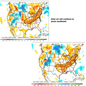 You’ll definitely notice the drier, crisp feel to the air upon stepping outside this morning. If you try hard enough, you can almost smell fall! 🙂
That drier air will support multiple nights with low temperatures into the lower and middle 50s tonight through Sunday morning. We may even have a few neighborhoods dip into the upper 40s Friday or Saturday morning.
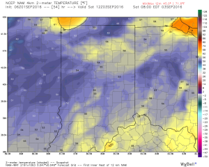 We know this is the beginning of the transitional time of the year. Eventually, these cold fronts will back more and more of a punch as we rumble deeper into fall. On the flip side, summer isn’t ready to go away without a fight. In fact, temperatures well above normal will return for Labor Day, itself, and continue into the majority of next week. A string of highs in the upper 80s to lower 90s will be common next week.
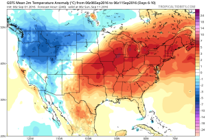 Longer term, there are indications that continue to support the idea of a potentially more significant cool down around mid September. Stay tuned…
 Highlights:
Cold Front Inbound…We’re getting to that time of the year where cold fronts will begin to pack more and more of a punch, offering up increasingly cool to, eventually, cold air… An early fall-like front will surge south this evening. Ahead of the boundary, scattered thunderstorms will develop this afternoon into the evening- particularly from central into southern portions of the state. Storms will be moving relatively quickly this evening so flash flood concerns are limited.
Behind the front, much drier and cooler air will ooze into the region tonight and set us up for an absolutely delightful few days of weather, complete with dry skies and low humidity. Temperatures into the upper 40s wouldn’t surprise us Saturday morning for outlying communities.
Eventually the heat will return from Labor Day into most of next week. As moisture surges north, scattered storm chances will also return to our forecast by Tuesday.
Upcoming 7-Day Precipitation Forecast:
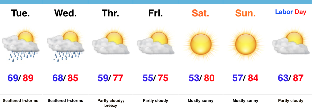
Today into Wednesday will offer up more of what we’ve grown so accustomed to over the past several days- incredibly humid air, along with scattered heavy thunderstorms. Similar to days past, the humid, “heavy” nature to our air will help fuel localized torrential downpours.
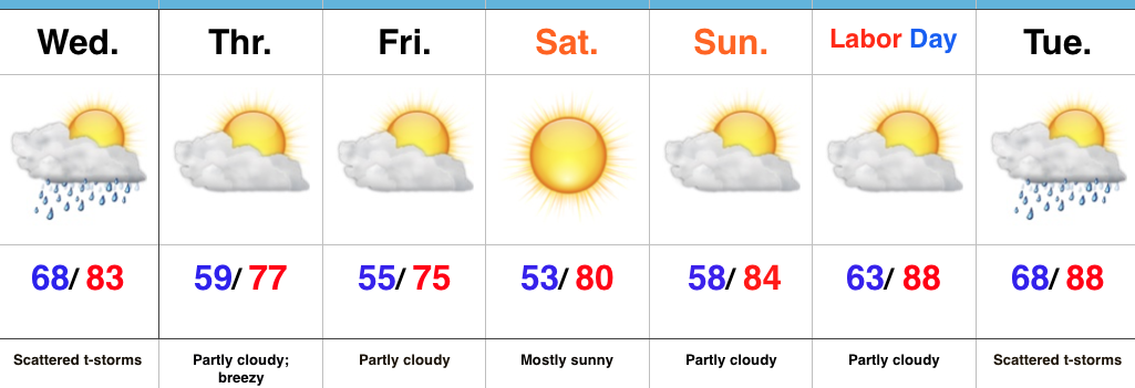
Thankfully, the hour glass has been “flipped” and time is running out on the humid air mass. In fact, as early as Thursday morning, we’ll notice a huge change. A northeast flow will provide a much drier brand of air and temperatures will also cool significantly. Several mornings (Thursday through Sunday) will feature lows in the 50s with highs in the 70s. Lows into the upper 30s will drive southeast into the high ground of the beautiful east TN mountains.
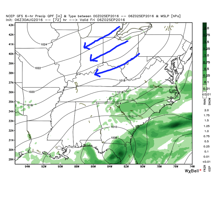
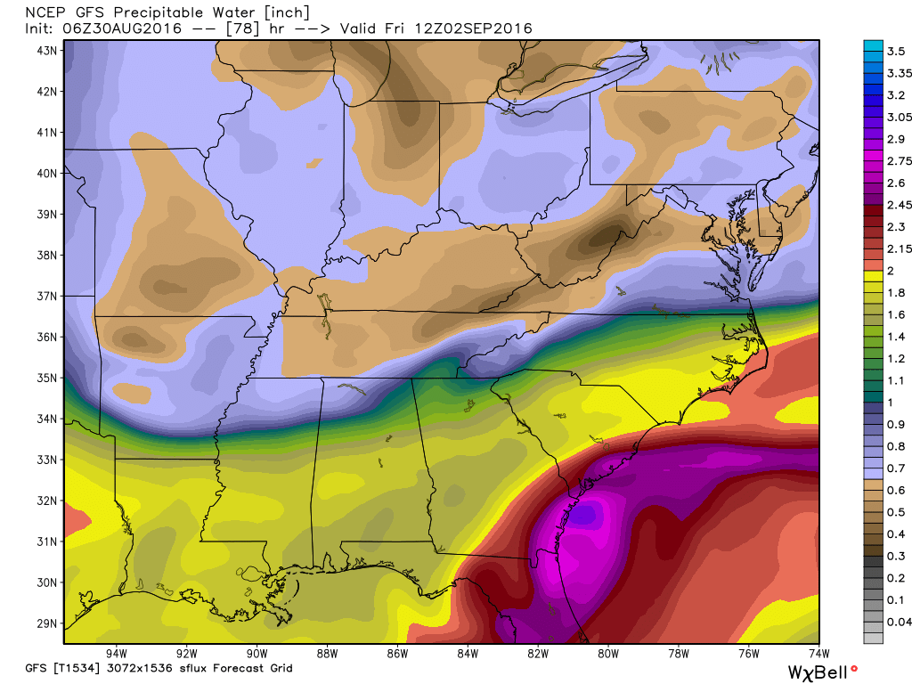
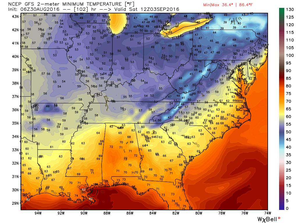 Eventually, our air flow will back around to the southwest and help push Labor Day into the “hot” territory. Highs in the upper 80s to around 90 will be common for Labor Day, itself.
The balance of the first half of September looks warm, but there are indications for changes to begin showing up towards mid to late month that would lead towards more sustained, consistent pushes of cool…
 Highlights:
Breath Of Fresh Air Awaits…Once we get through the next (48) hours, a much more pleasant, early fall-like, air mass awaits. Beforehand, we still have plenty of heat and humidity to deal with, along with the all-too-familiar mention of scattered (but heavy) thunderstorms. Thankfully, a cold front will push through the state Wednesday night into Thursday morning and usher in a much cooler and drier air mass to wrap up the work week and head into the long holiday weekend. High pressure will supply a refreshing northeasterly flow Thursday into Friday, supporting breezy conditions and much cooler air. It’ll be the type air mass that will make you take notice fall isn’t that far off, after all.
As we push closer to Labor Day, itself, our air flow will back around to the southwest and assist with a warmer and increasingly moist brand of air for the holiday, into the majority of the Week 2 period…
Upcoming 7-Day Precipitation Forecast: