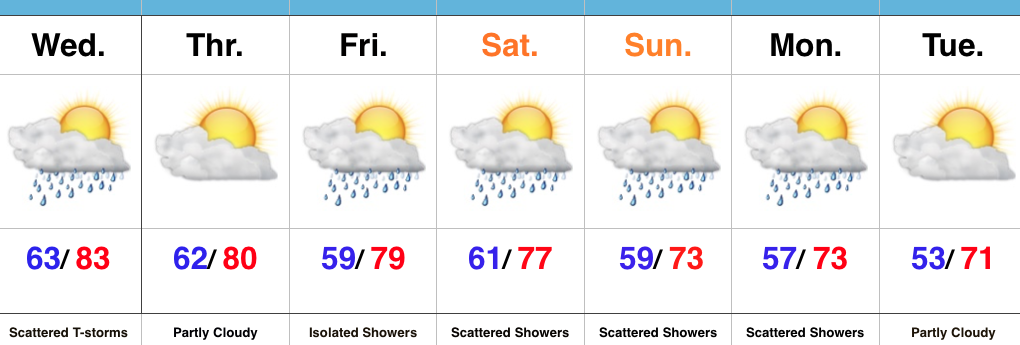
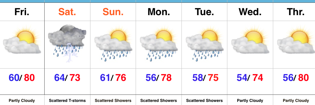
Wet Saturday On Deck…
It’s been a nice Friday across central IN, including filtered sunshine and lower humidity levels. Unfortunately, the pleasant weather won’t last as we welcome in the weekend.
A warm front will lift north late tonight and should help moisten things up enough to allow rain to reach the surface across most of central IN during the overnight into the predawn Saturday.
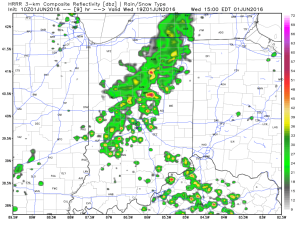
 Steady rain and embedded thunderstorms will continue through the morning hours and into the afternoon.
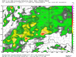
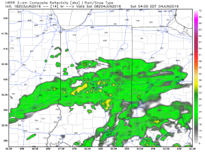
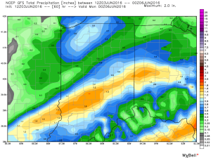
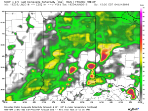 Eventually, a cold front will sweep through the state Saturday night and help “slosh” the widespread rain shield east of the region. By the time this happens, we expect widespread rainfall totals between 0.50″ and 1.00″ across central IN (with locally heavier totals).
 Cooler weather will push in this weekend and continue into early and middle parts of next week. While the widespread rain will come to an end, upper level energy will remain and could help ignite scattered showers at times (particularly during the afternoon and evening hours) into early next week.
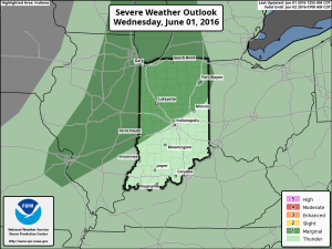
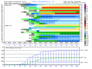
 As precipitable water values climb to around 2″, locally heavy rainfall will accompany any storms that develop.
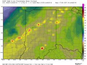 We caution that the key word here is “scattered.” There will be “haves and have nots” when it comes to rainfall totals by tonight. Some neighborhoods may receive less than 0.10″ while others receive over 1″.
 Unseasonably cool air will follow for the mid range.
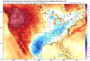 A fresh 7-day will be up later today! Have a nice Wednesday, friends.