Updated 12.21.22 @ 6:42p
You must be logged in to view this content. Click Here to become a member of IndyWX.com for full access. Already a member of IndyWx.com All-Access? Log-in here.

Dec 21
Updated 12.21.22 @ 6:42p
You must be logged in to view this content. Click Here to become a member of IndyWX.com for full access. Already a member of IndyWx.com All-Access? Log-in here.
Permanent link to this article: https://indywx.com/2022/12/21/detailed-video-discussion-on-the-blizzard-conditions-ahead-and-the-longer-range-january-pattern-drivers/
Dec 21
Updated 12.21.22 @ 6:40a I. We still have another 24 hours where weather won’t have any sort of impact across central Indiana. Dry conditions will hold through early Thursday morning.…
You must be logged in to view this content. Click Here to become a member of IndyWX.com for full access. Already a member of IndyWx.com All-Access? Log-in here.
Permanent link to this article: https://indywx.com/2022/12/21/wednesday-morning-notes-on-our-upcoming-winter-storm/
Dec 20
Updated 12.20.22 @ 7:46a
You must be logged in to view this content. Click Here to become a member of IndyWX.com for full access. Already a member of IndyWx.com All-Access? Log-in here.
Permanent link to this article: https://indywx.com/2022/12/20/video-blizzard-conditions-develop-friday-into-christmas-eve-another-snow-system-likely-follows-monday/
Dec 19
Updated 12.19.22 @ 5:46p
Type: Severe Winter Weather
What: Heavy snow, blizzard conditions, dangerously cold temperatures
When: Thursday PM through Saturday
Temperatures: Falling from the lower 40s (Thursday afternoon) to 0° to 10° below zero (Friday morning).
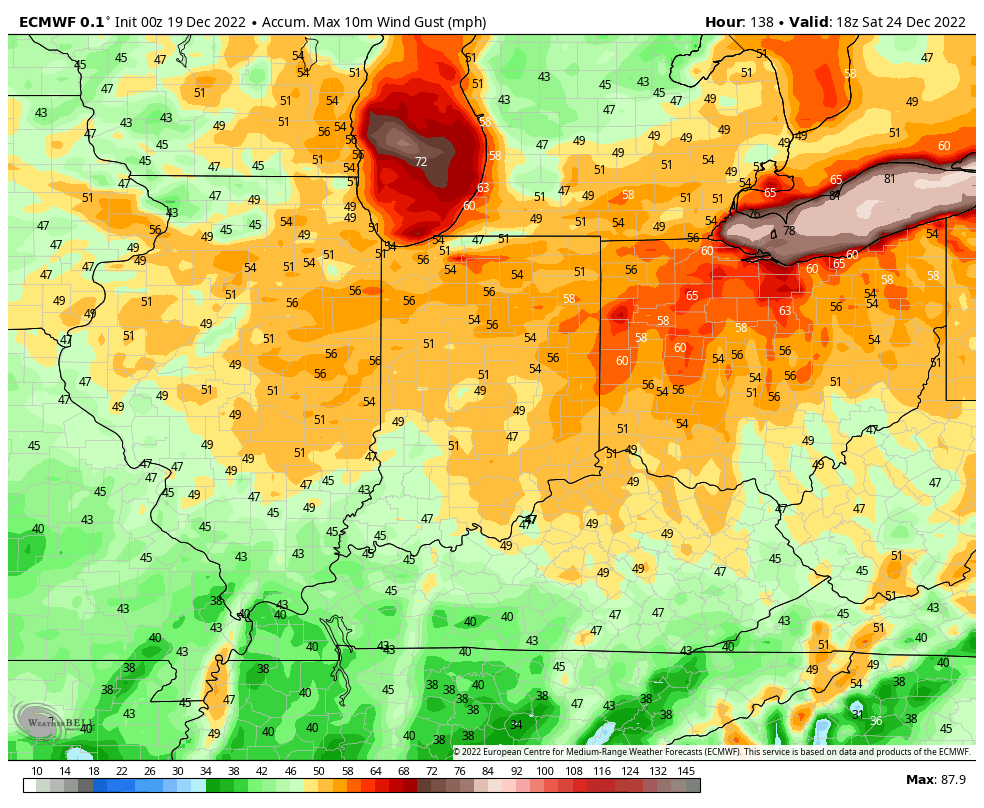
Wind: WSW 15-25 MPH, increasing to 25-40 MPH with gusts to 55-60 MPH
Blowing/ Drifting: Severe
Pavement Impacts: Plowing and salting will be required throughout the region.
Summary: Normally, we wait another 24 hours closer to the onset of the storm before we initiate our official Client Briefs, but the combination of the intensity of this storm along with the timeframe when many folks will have travel plans, we wanted to get this product out earlier than normal. We strongly encourage having travel completed by Thursday evening.
In short, a severe winter storm continues to look like it’ll take aim on the region as we navigate the day Thursday. Rain is expected to develop during the day before mixing with and transitioning to snow Thursday night. Snow will become heavy at times Thursday night into the day Friday. Initially, this will be a heavy, wet snow, but as the arctic airmass engulfs the area, the “paste-like” snow will quickly transition to powder. Needless to say, the standard 10:1 measurements won’t work with this storm as the fluff factor kicks into high gear.
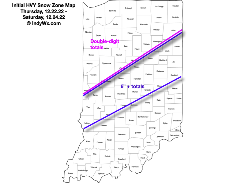
Unfortunately as this transition in snow type is taking place, winds will begin to increase. We anticipate major problems from severe blowing and drifting of snow by Friday, continuing through Christmas Eve. During the aforementioned time period, wind gusts in excess of 55 MPH will be possible. This will lead to impassable roadways across many areas, especially within the heavier snow zones below. Speaking of snow, we need another 24 – 36 hours before we can get more specific than included below. Areas across southern and eastern IN not currently within the “heavy snow zones” will still see several inches of accumulation and their own blowing/ drifting issues. Blizzard conditions can be expected across the entire area from a combination of the falling snow, snow already on the ground, and damaging wind gusts Friday into Christmas Eve. Drifts will be measured in feet, especially in the “open country.”
I’d like to encourage everyone to prepare for the bitterly cold airmass that will also grab headlines. Be thinking of ways to keep warm should you lose power. Unfortunately, with the expected wind, power outages will become an issue across the region. Please take the time now to inspect your winter storm safety kit and heed all products from the National Weather Service.
Confidence: High
Next Update: Tuesday morning (video discussion)
Permanent link to this article: https://indywx.com/2022/12/19/client-brief-blizzard-conditions-develop-friday-into-christmas-eve/
Dec 19
Updated 12.19.22 @ 7:20a
You must be logged in to view this content. Click Here to become a member of IndyWX.com for full access. Already a member of IndyWx.com All-Access? Log-in here.
Permanent link to this article: https://indywx.com/2022/12/19/video-severe-winter-storm-takes-aim-on-the-region-late-week-january-pattern-discussion/
Dec 18
Updated 12.18.22 @ 2:09p
You must be logged in to view this content. Click Here to become a member of IndyWX.com for full access. Already a member of IndyWx.com All-Access? Log-in here.
Permanent link to this article: https://indywx.com/2022/12/18/video-makings-of-a-memorable-winter-storm/
Dec 17
Updated 12.17.22 @ 7:11a
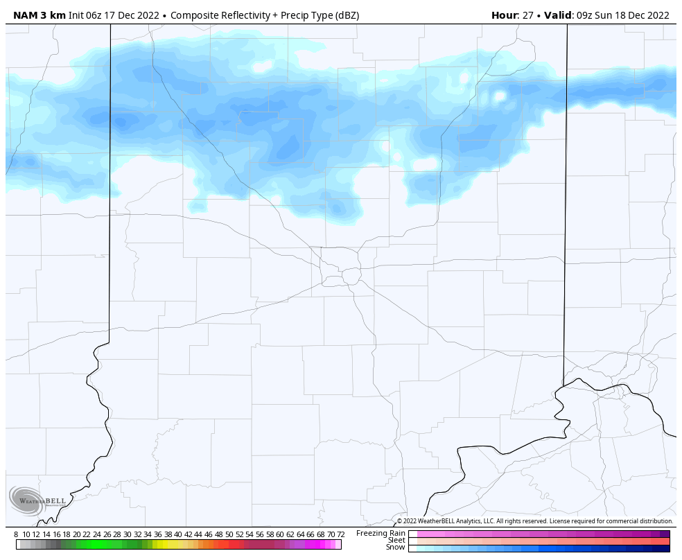
Just enough upper level energy will linger around the region to help generate occasional snow flurries or light snow showers into Sunday morning. Like the past 24 hours, these won’t amount to much if any accumulation.
High pressure will then dominate our weather through the early and middle part of the work week with dry and seasonably cold conditions.
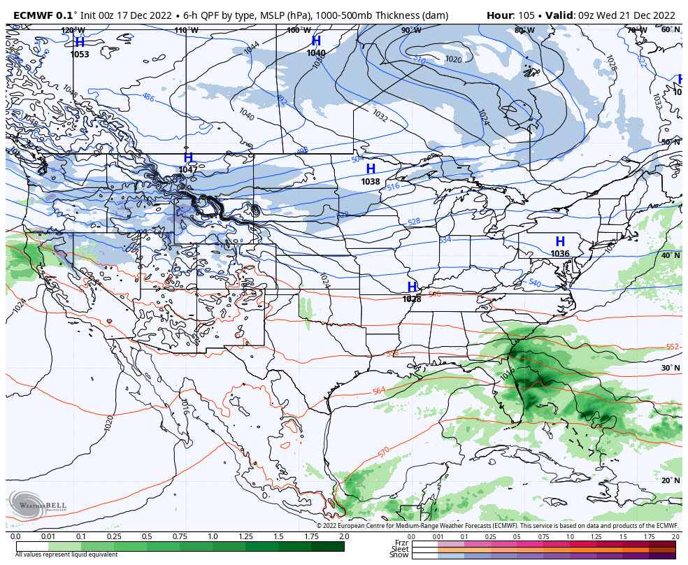
By this point, all eyes will be on the developing winter storm in the Plains. We expect snow to overspread the region Thursday (possibly beginning as a brief period of rain), continuing, potentially heavy at times, through the day on Friday. This still has the potential to be a significant, if not severe, winter storm but we’re still a couple days away from being able to talk specifics in respect to snowfall totals. Another item to note will be the wind. Blowing and drifting will likely be a major problem by Friday, into Christmas Eve. If there’s anyway to move travel to Wednesday, we’d highly recommend it.
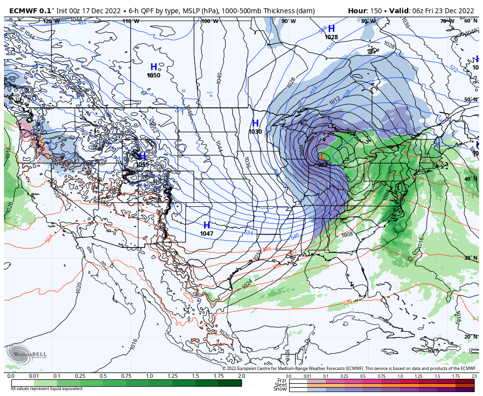
A nasty shot of bitterly cold arctic air will plunge into the region Christmas weekend. How do highs in the 0s to low 10s sound and overnight lows below 0°? Wind chill values of 20° to 40° below zero (not a typo, unfortunately) are on the table.

Permanent link to this article: https://indywx.com/2022/12/17/light-snow-showers-today-pre-christmas-winter-storm-precedes-dangerous-cold-next-weekend/
Dec 16
Updated 12.16.22 @ 7:48a
You must be logged in to view this content. Click Here to become a member of IndyWX.com for full access. Already a member of IndyWx.com All-Access? Log-in here.
Permanent link to this article: https://indywx.com/2022/12/16/lr-update-into-mid-january-short-term-focuses-on-accumulating-snow-prospects-next-week/
Dec 15
Updated 12.15.22 @ 8:07p December month-to-date has opened up much differently than expected (at least here) from way back in the summer. Long time subscribers of IndyWx know that’s when…
You must be logged in to view this content. Click Here to become a member of IndyWX.com for full access. Already a member of IndyWx.com All-Access? Log-in here.
Permanent link to this article: https://indywx.com/2022/12/15/thursday-night-rambles-pre-christmas-storm-potential-and-beyond/
Dec 15
Updated 12.15.22 @ 7:45a
You must be logged in to view this content. Click Here to become a member of IndyWX.com for full access. Already a member of IndyWx.com All-Access? Log-in here.
Permanent link to this article: https://indywx.com/2022/12/15/video-players-align-for-potential-of-a-significant-pre-christmas-winter-storm/