Mostly Tranquil…
 Highlights:
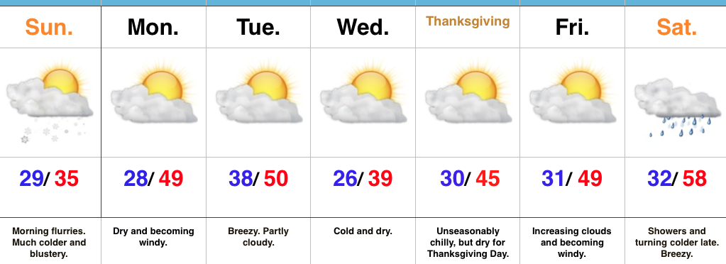
- Colder than normal, but dry
- Windy, but mostly dry this weekend
- Moderating ahead of the next storm
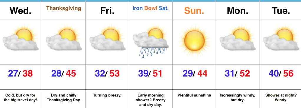
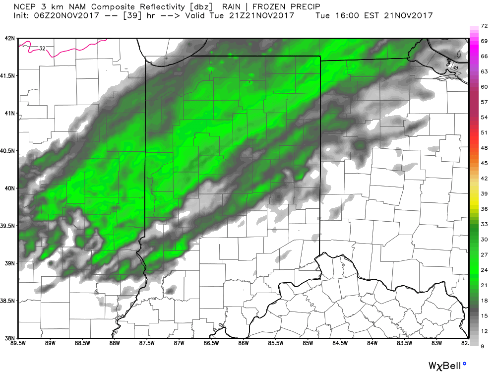
Dry For The Big Travel Day…A cold front is passing through the state as we type this forecast with a light band of moisture (light rain ending as light snow). This will serve up cold, but dry conditions for the big travel day, and continued dry conditions Thanksgiving Day. “Average” temperatures Thanksgiving feature lows around 30° and highs in the middle 40s, and we’ll be pretty close to those values. Black Friday will feature dry, but increasingly breezy conditions.
Thankfully, weather conditions will be tranquil for “Iron Bowl Saturday” (WARRRR EAGLE)!!! With the exception of an early shower, look for dry conditions along with a shifting breeze that will help push colder air in for the second half of the weekend.
Those chilly conditions won’t last long as we get into an increasingly gusty southwesterly flow and milder conditions next week ahead of the next approaching storm system…
Upcoming 7-Day Precipitation Forecast:
- Snowfall: Trace
- Rainfall: 0.10″


 Highlights: