VIDEO: Cold Pattern Remains For Now; Window For Warmth In The 8-10 Day…
You must be logged in to view this content. Click Here to become a member of IndyWX.com for full access. Already a member of IndyWx.com All-Access? Log-in here.
You must be logged in to view this content. Click Here to become a member of IndyWX.com for full access. Already a member of IndyWx.com All-Access? Log-in here.
Meteorological spring began March 1st (though you wouldn’t know it with all of the cold and snow lately). Snow dominated the headlines in March with nearly a foot that fell. Cold also was a story as temperatures ran significantly below normal. Check out these impressive stats, courtesy of the Indianapolis National Weather Service:
Though we’re only a few days into the month of April, the fourth month of the year is already trying to “out do” March. Sleep has been few and far between here in the good ole forecast office with such an active start to the month. From the heaviest Easter snow on record to setting the wettest day in April ever and widespread flooding, we’ve had it all in just the first (3) days!
At one time what looked like another snow-starved snow season is now getting oh so much closer to “average,” with the late season rally. As the saying goes, “it’s never over until it’s over!” In Whitestown, we’re now over 30″ on the season! Indianapolis is up to 22.7″ on the season and only 3″ below average.
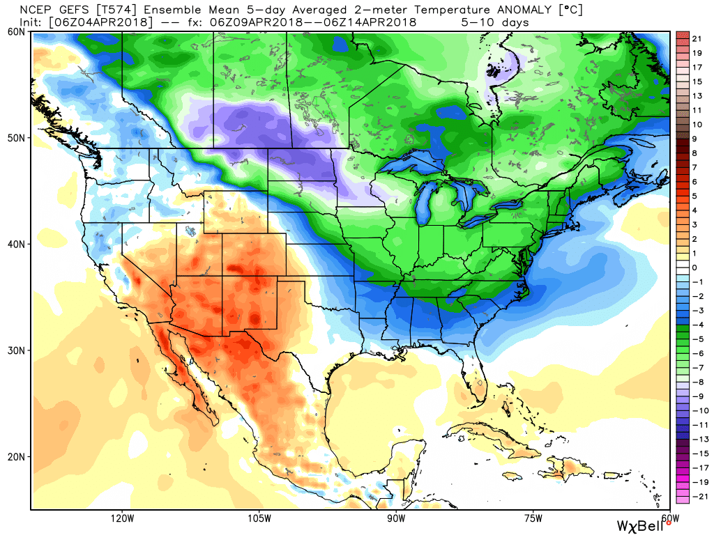
Looking ahead, the upcoming couple weeks should continue to promote an active pattern. Temperatures should follow the colder than normal theme and precipitation should run above average. For the snow, we’re not done with that yet, either! Speaking of snow, we’re tracking additional opportunities for snowfall this weekend and again early next week… Hang in there, spring will get here eventually…


I. On the heels of a record-setting Easter snow event, attention will turn to showers (by this evening) and even the potential of gusty thunderstorms (Tuesday).
Best chance of the possibility of a strong to severe thunderstorm will lie within the southern half of the state, primarily south of the I-70 corridor. Greatest threats are large hail and damaging straight line winds.
All of us stand the chance of a thunderstorm as the cold front sweeps through the state Tuesday night.
II. Much colder air will rush back into Indiana Tuesday night and the air will grow cold enough to allow lingering precipitation to transition to snow showers Wednesday morning. Don’t expect any accumulation this go around.
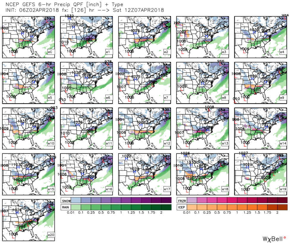
 III. Our next focus is on the prospects of late week/ weekend snow. Models will continue to struggle with the finite details over the next few days. I’m not so sure the suppressed look displayed currently is the correct one. Let’s remember, this time last week models were taking our Easter storm well to our south. We’ll keep a close eye on things over the next few days.
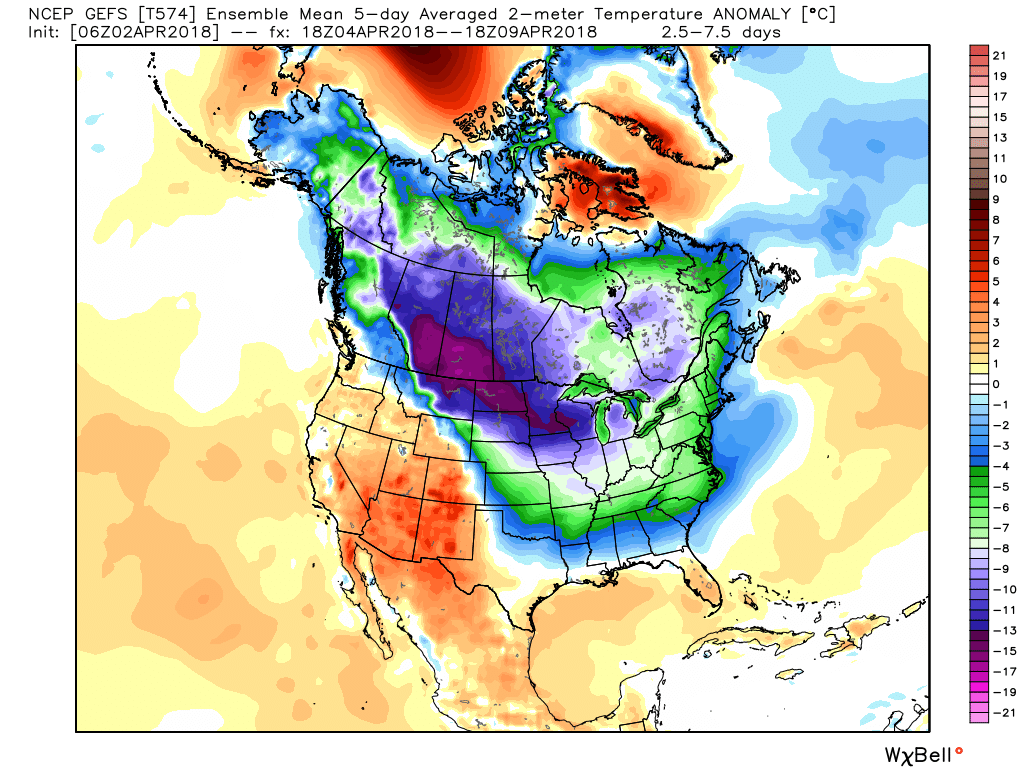
 IV. Regardless of whether we get additional snow down or not, a first-class late season arctic blast will drill south this weekend. This will be cold enough to keep temperatures in the 30s for highs Friday and Saturday. Brutal stuff for early-April when average highs are around 60…
You must be logged in to view this content. Click Here to become a member of IndyWX.com for full access. Already a member of IndyWx.com All-Access? Log-in here.
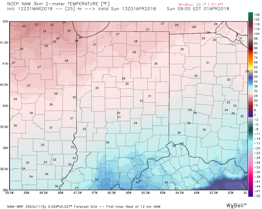
A cold front will blow through central Indiana this evening and colder air will spill into the region overnight. We’ll wake up with temperatures in the upper 20s to lower 30s Easter morning with dry conditions in place.
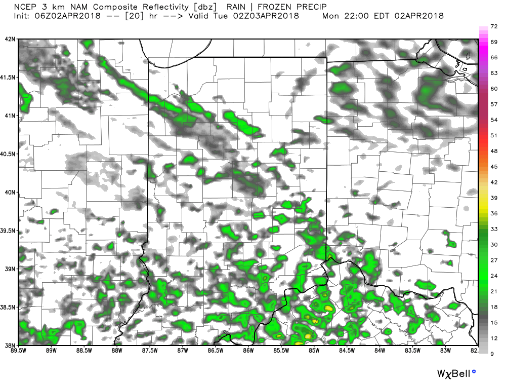
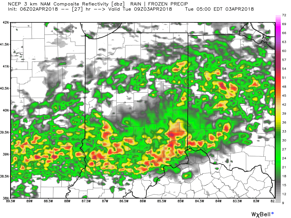
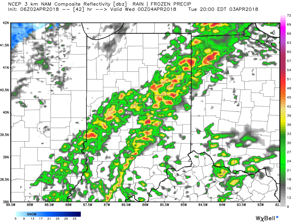
 Most of the daytime Easter Sunday will feature dry conditions. Clouds will increase, lower, and thicken through the afternoon ahead of an area of low pressure that will track through the lower Ohio Valley Easter night. This will spread precipitation into central Indiana towards 5p-6p. Initially, precipitation is likely to begin as a cold rain, but we expect a rather quick transition to wet snow shortly after the onset. Periods of moderate to heavy snow will fall into the nighttime across the I-70 corridor. This will lead to reduced visibility and slick travel as snowfall rates will (once again) overcome marginally cold surface and pavement temperatures. If you must travel tomorrow night and early Monday, expect roadways to be slick at times- including being slush and snow covered.
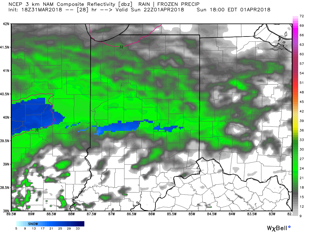
Here’s an idea of what the radar may look like tomorrow night, courtesy of weatherbell.com:
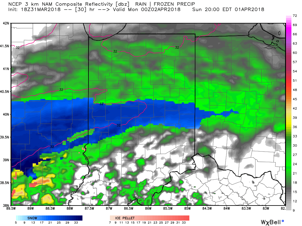
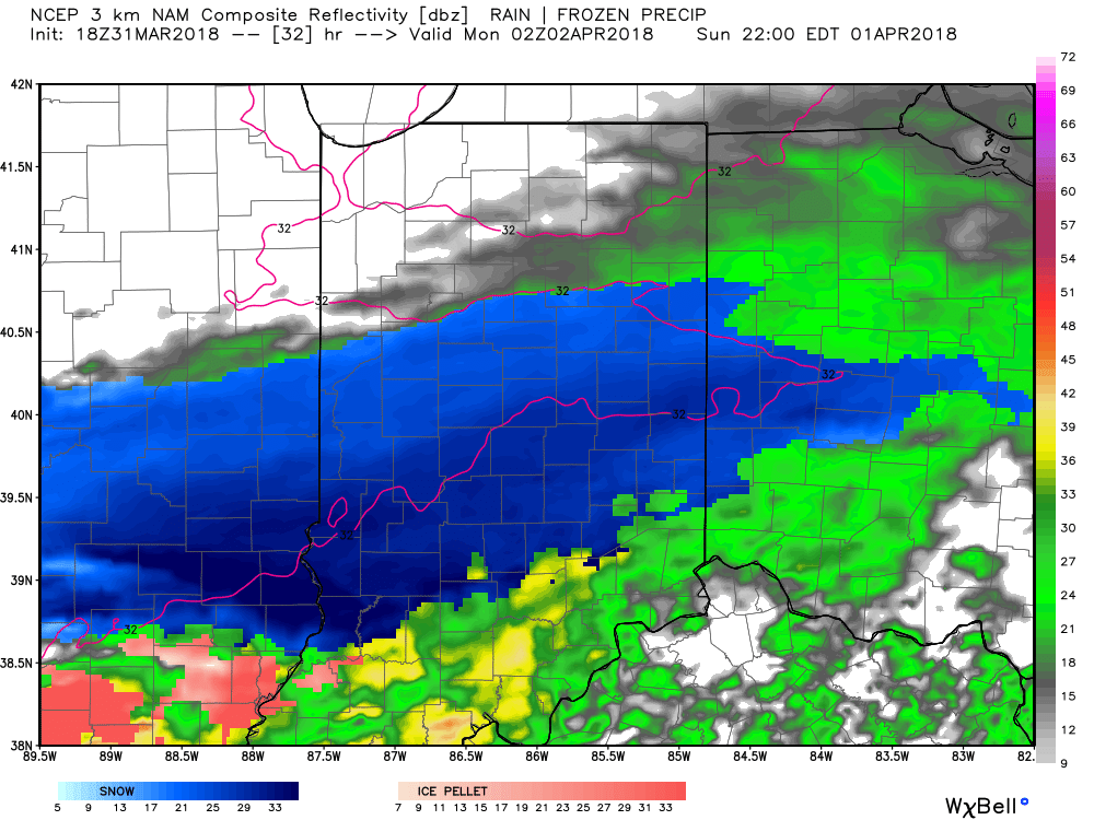
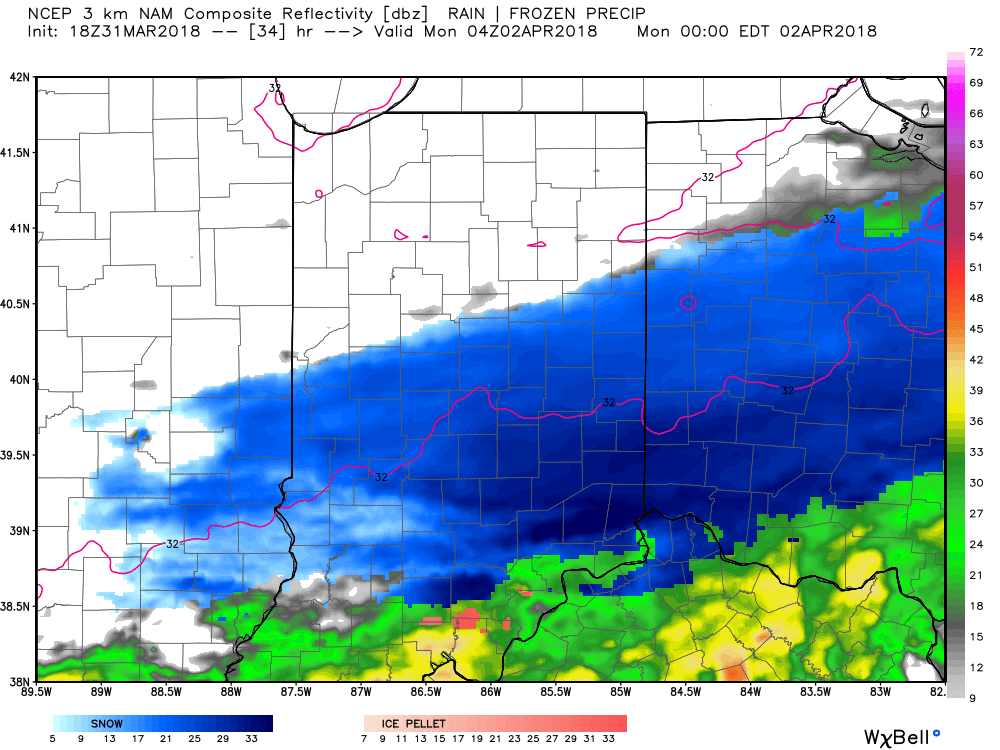
This will be a rather quick-hitting event, but “thump” potential is written all over it, including localized intense banding. These localized bands could result in a couple of reports of 4″+ in spots. We think heaviest snow falls in the 6p-midnight window.
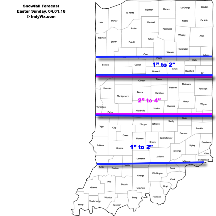
Our current snowfall forecast:
 Another winter event is possible next weekend, including the potential of additional accumulating snow. Should we get snow down, the possibility of near-record cold is present with the late season blast of arctic air next weekend. Lows in the 10s aren’t out of the question at least one night next weekend- likely Sunday.