Updated 03.20.23 @ 5:34p
You must be logged in to view this content. Click Here to become a member of IndyWX.com for full access. Already a member of IndyWx.com All-Access? Log-in here.

Mar 20
Updated 03.20.23 @ 5:34p
You must be logged in to view this content. Click Here to become a member of IndyWX.com for full access. Already a member of IndyWx.com All-Access? Log-in here.
Permanent link to this article: https://indywx.com/2023/03/20/video-still-targeting-a-heavy-late-week-rain-event-new-european-weeklies-are-in/
Mar 19
Updated 03.19.23 @ 12:40p
I. By late-March standards, we’re looking at another downright frigid day (yes, even with that increasingly high sun angle these days). Overnight lows bottomed out deep into the 10s this morning. We’ll, thankfully, begin to moderate this afternoon and that same trend will carry us into the 60s by Thursday. Hang in there.

II. Unfortunately, that moderating trend will also come with renewed unsettled weather. While the work week will get off to a nice start, rain returns Tuesday night as an increasingly moist southwesterly air flow takes hold.

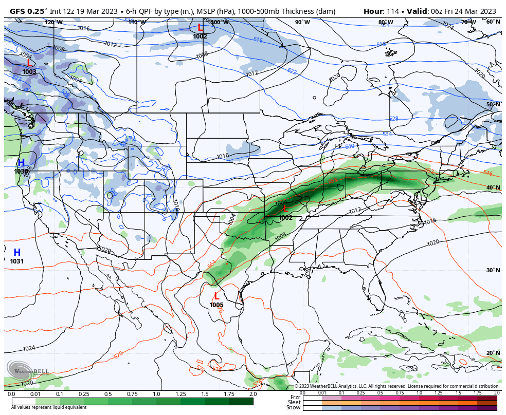
III. It still doesn’t appear as if the lead wave of moisture Tuesday night and Wednesday morning will be a big deal but it will set the tone for what lies ahead to close the work week. We continue to circle Friday as the day that will bring heaviest rain and an associated flood threat. Widespread 3”+ rain amounts remain on the table and we’ll be able to hone in on more specific placement and amounts as we get through the next 24-48 hours.

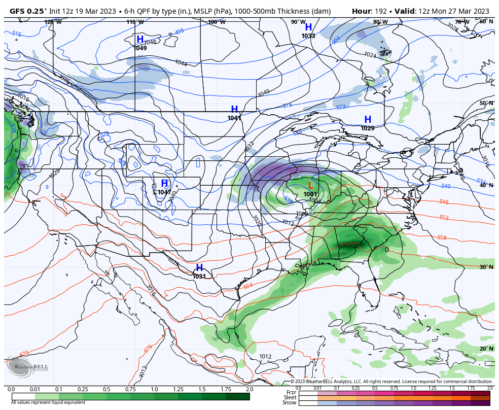
IV. If that’s not enough, guidance brings another organized system through the region late next weekend, as well. Needless to say, well above normal precipitation is expected over the course of the upcoming 7-10 days and flood risks will have to be monitored closely as this pattern evolves.


V. A reinforcing chilly airmass will likely follow next Sunday’s system.

Side note: Monday’s normally scheduled client video discussion will be posted Monday evening due to travel. I apologize for any inconvenience and look forward to reviewing fresh 12z guidance concerning the items above (and more) tmrw evening.
Permanent link to this article: https://indywx.com/2023/03/19/sunday-afternoon-rambles-6/
Mar 17
Updated 03.17.23 @ 6a
You must be logged in to view this content. Click Here to become a member of IndyWX.com for full access. Already a member of IndyWx.com All-Access? Log-in here.
Permanent link to this article: https://indywx.com/2023/03/17/long-range-update-to-close-out-march-and-open-april/
Mar 16
Updated 03.16.23 @ 7:32a
You must be logged in to view this content. Click Here to become a member of IndyWX.com for full access. Already a member of IndyWx.com All-Access? Log-in here.
Permanent link to this article: https://indywx.com/2023/03/16/video-wet-windy-weather-returns-by-evening-cold-weekend-on-tap/
Mar 15
Updated 03.15.23 @ 6:58a
Let’s start with the good news and that’s today’s forecast. Despite a bitterly cold start (most are waking up to temperatures between 18° and 22°), expect plentiful sunshine today. Though it’ll be unseasonably chilly, that March sun angle will go a long way in making it feel a lot better by this afternoon.
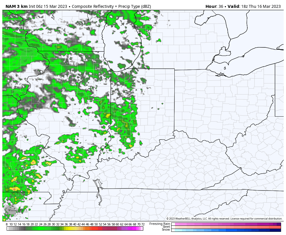
Clouds will increase overnight and Thursday morning and eventually give way to light rain by afternoon. We anticipate rain to reach the city, itself, between 2p and 3p.

Rain will become steadier and more widespread as we progress through the evening and Thursday night.

Precipitation may end as a brief period of snow Friday morning, but “brief” is the key word. In general, heaviest rain is expected to fall across the southern half of the state, mostly along and south of the I-70 corridor. This is a 0.25” to 0.75” type event for most.
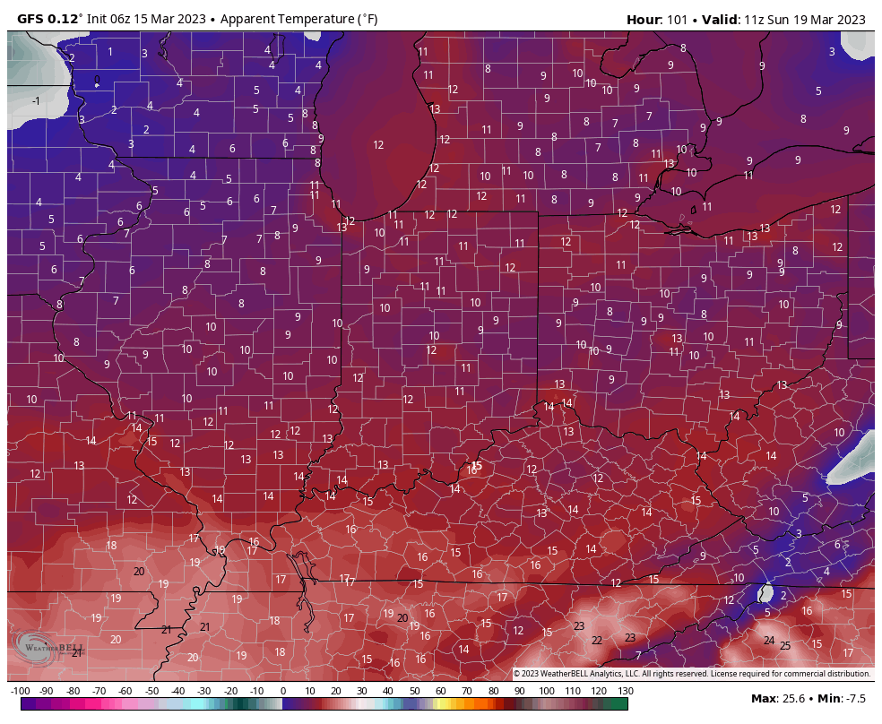
The bigger story comes in the form of another late season arctic “jab” behind the frontal passage. Highs both Saturday and Sunday will remain stuck in the 30s with overnight lows once again dropping into the upper 10s to lower 20s. Wind chill values will fall into the single digits to lower 10s.

Permanent link to this article: https://indywx.com/2023/03/15/unsettled-close-to-the-work-week-cold-weekend-on-tap/
Mar 14
Updated 03.14.23 @ 6:04a
You must be logged in to view this content. Click Here to become a member of IndyWX.com for full access. Already a member of IndyWx.com All-Access? Log-in here.
Permanent link to this article: https://indywx.com/2023/03/14/video-cold-air-reinforcements-just-in-time-for-the-weekend/
Mar 13
Updated 03.13.23 @ 7:54a
You must be logged in to view this content. Click Here to become a member of IndyWX.com for full access. Already a member of IndyWx.com All-Access? Log-in here.
Permanent link to this article: https://indywx.com/2023/03/13/video-snow-squalls-increase-this-afternoon-evening-reinforcing-late-season-arctic-air-arrives-this-weekend/
Mar 12
Updated 03.12.23 @ 6:30p
You must be logged in to view this content. Click Here to become a member of IndyWX.com for full access. Already a member of IndyWx.com All-Access? Log-in here.
Permanent link to this article: https://indywx.com/2023/03/12/setting-the-table-for-the-upcoming-7-10-days/
Mar 11
Updated 03.11.23 @ 6:40a
Today will be a quiet and calm weather day across the region. It’s not until we get into the late evening hours when precipitation will overspread central IN from the west. We target an arrival of light rain into the area between 9p and 11p west to east. This light rain should then increase in intensity and begin to transition to wet snow towards midnight, continuing into and through the mid morning hours Sunday.


With only marginally cold temperatures in place and a lack of overly heavy precipitation rates, the thought here is that wet snow accumulation will be in the dusting to 1” range for the bulk of central IN. North of the city, including northern ‘burbs stand a better shot of 1”-2” of wet snow accumulation.
Our attention then shifts to the cold. A couple blasts of late season arctic air will plunge into central IN Monday and Tuesday (lows in the lower 20s and highs in the upper 30s), followed by another cold blast St. Patrick’s Day weekend. We’ll have to also monitor for the potential of additional snow prospects next weekend, but will get through this event first. Speaking of this event, snow should diminish in intensity and come to an end towards 8 to 9a and we don’t anticipate widespread pavement issues due to the recent relative warmth.
Permanent link to this article: https://indywx.com/2023/03/11/rain-mixes-with-and-changes-to-snow-overnight-2-shots-of-late-season-arctic-air/
Mar 10
Updated 03.10.23 @ 7:44a
You must be logged in to view this content. Click Here to become a member of IndyWX.com for full access. Already a member of IndyWx.com All-Access? Log-in here.
Permanent link to this article: https://indywx.com/2023/03/10/video-rain-snow-mix-saturday-night-and-sunday-morning-shot-of-much-colder-air-inbound-early-next-week/