New Month; New Pattern (In Some Aspects) Around The Corner…
October got off to a warm start, but unseasonably chilly conditions have dominated over the past couple of weeks. In fact, we’re on a stretch of (12) consecutive days below average after the summer-like start. The other common theme? Dry, dry, dry. Officially, IND is running close to 1″ below average through the first few weeks of the month. Changes loom- at least to some extent.
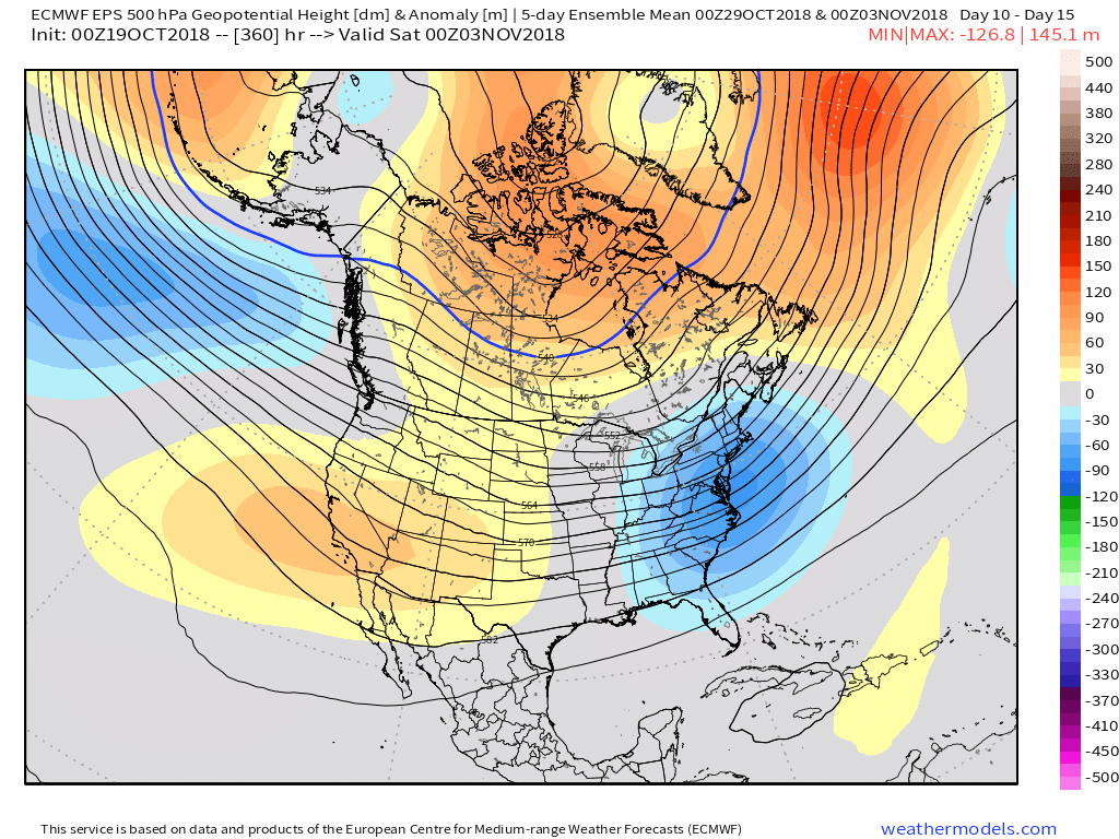
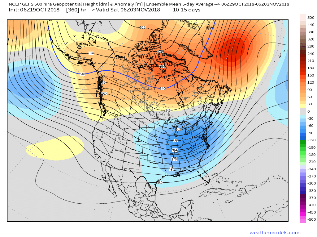
 We notice the ensemble data (both the European and GFS) is painting a more active, wetter regime as we move through early November. Given the upper air pattern, we would tend to agree.
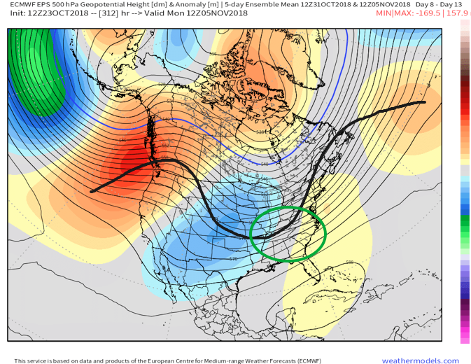


While confident on the return of wet conditions as we traverse the first week or two of November, data is struggling to get a handle on the PNA past the short-term. The PNA, or Pacific North American Pattern, teleconnection is one of our favorites this time of year to “key in” on the medium range pattern. While the NAO and AO get a lot of attention the deeper we get into the cold season, the PNA can be a tremendous tool during transition seasons. We note latest data is trending significantly more towards a positive PNA (compared to previous runs)- which is a colder signal.
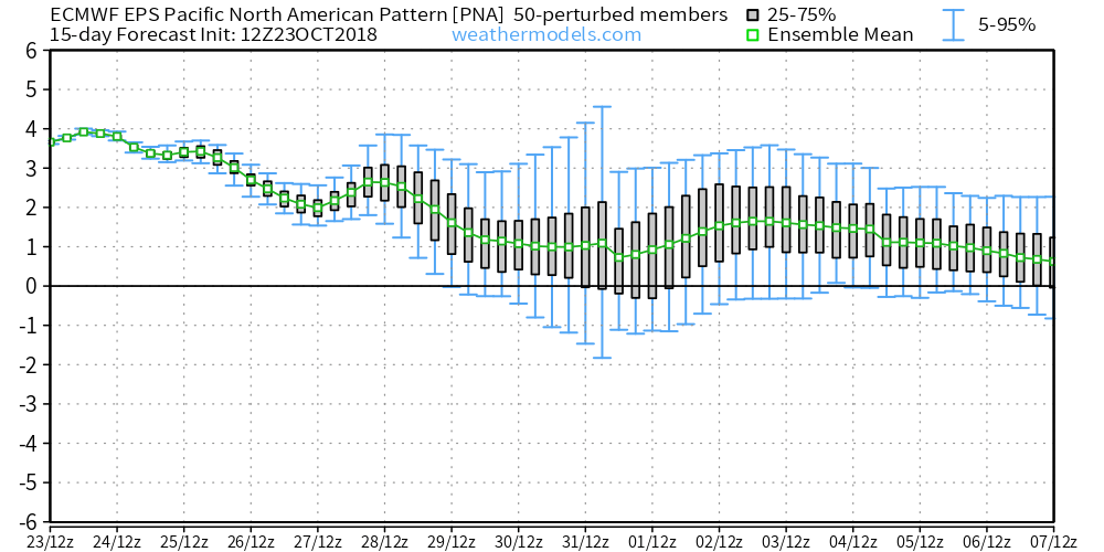 To no surprise, data has trended chillier during today’s 12z update.
 To close, bank on a return of the wet conditions as we move into the mighty month of November. From a temperature perspective, the forecast is much tougher for the first half of November. As things stand now, we continue to favor a relaxation of the anomalous chill overall, but can certainly see where “pops” of cold air can easily sweep in behind what should be an active storm track from the mid-south up into the Mid West and Ohio Valley. Stay tuned.