Briefly Milder Ahead Of Next Cold Stretch; Late Week Snow Makers…
After a cold stretch (8 of the past 12 days have been below average here across central Indiana), we’ll be on the milder side of a storm for a change tonight into Wednesday.
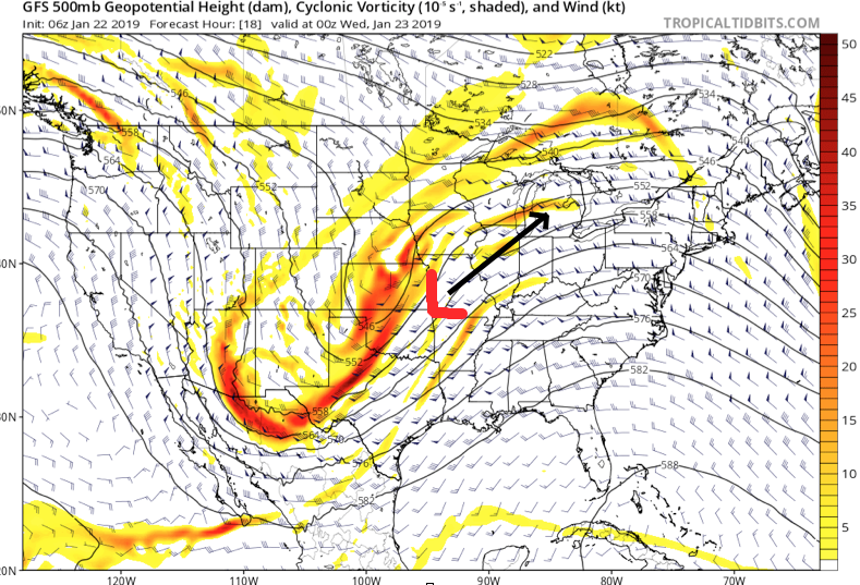 This will not only lead to a briefly milder period (and by brief, we mean BRIEF) late tonight into early Wednesday, but will also deliver a round of rain. While we’ll rise into the 30s later this evening, temperatures will continue to rise during the overnight- potentially into the lower 40s ahead of the cold front. Drizzle (perhaps freezing drizzle at the onset) will move in later this evening, but the heavier rain will hold off until after midnight. Periods of moderate rain can be expected between 2a and 8a Wednesday.
 Widespread 0.50″ to 0.75″ can be expected across central Indiana.
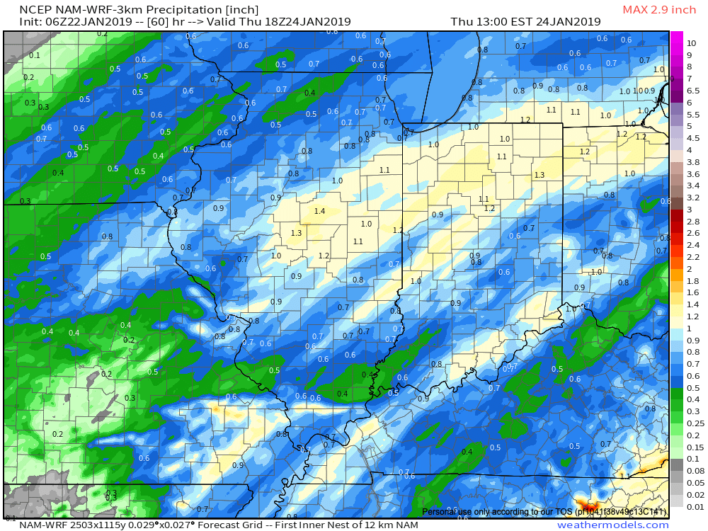 The cold front will sweep through the state during the day Wednesday and temperatures will begin to fall once again Wednesday afternoon. A brief period of light snow is possible as the precipitation shield departs Wednesday afternoon, but this isn’t expected to be a big deal. We should be back below freezing around 5p to 6p Wednesday.

From there, the pattern will remain active and quite wintry. We’re tracking (3) individual pieces of upper level energy that will likely be enough to generate at least light snow into the weekend. The initial disturbance is associated with an arctic front that will blow through town Thursday evening. These are notorious for igniting snow showers and heavier “bursts.” You’ll certainly notice an increasingly bitter feel Thursday PM.
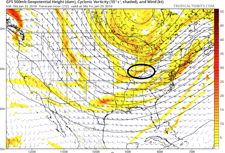 A couple additional disturbances are likely ahead of a reinforcing plunge of arctic air early next week. The system Saturday evening into early Sunday looks strongest at this time and will be capable of depositing a more widespread light accumulating snow across the region.
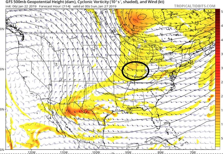 Yet another arctic intrusion is set to invade before we put a wrap on January. This will likely also be accompanied by additional opportunities of accumulating snow early next week.

 As upper level energy tracks northeast this evening, strong frontogenesis will help a “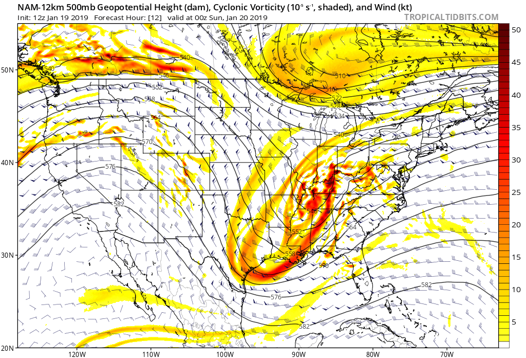
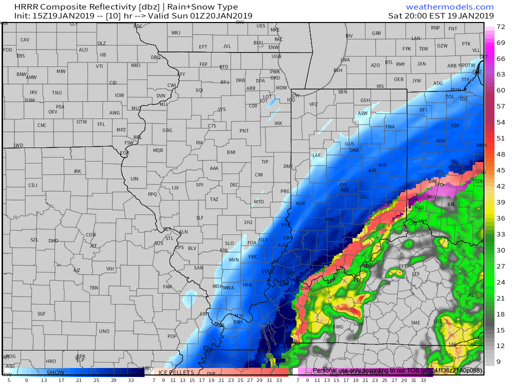
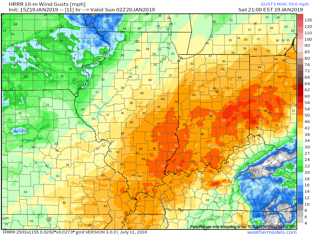 Obviously this will create concerns for power outages, but the other major worry is for developing blizzard-like conditions and whiteouts through the late afternoon into tonight.
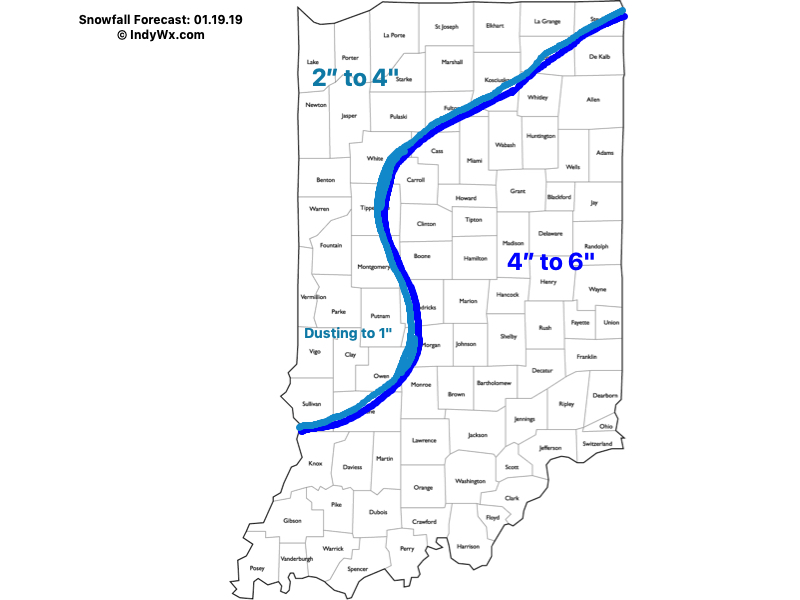 We’ll have additional updates later this afternoon here on IndyWx.com and on our social media accounts.
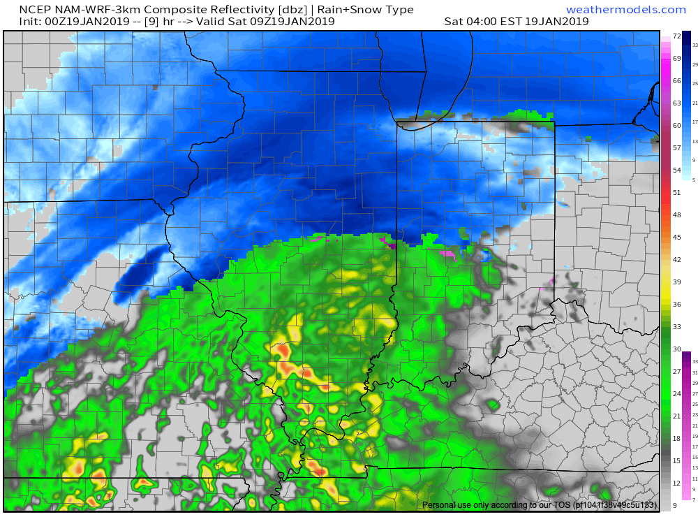 The bulk of the northern half of the state is still expected to receive predominantly snow with this storm. However, things get much more tricky along the I-70 corridor (10 to 20 miles either side) as temperatures will be “marginal” early on in the event (aloft and at the surface) and will lead to quite the headache for the first several hours of this storm. Even as of this update, confidence is low on precipitation type for the I-70 corridor, itself. A difference of half a degree (F) can mean a world of difference with precipitation type (snow, freezing rain, sleet, or rain). Admittedly, concern is growing for the potential of icing in this area before the deeper cold air can arrive and switch things over to snow. On the other hand, should precipitation rates be heavy enough, it’s certainly possible these heavier rates will cool the entire column of air quicker than high resolution modeling currently suggests and a quicker transition to snow would result. “Boom or bust” potential is higher than normal along the immediate I-70 corridor.
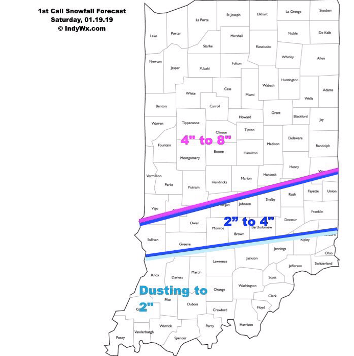 Stay tuned and please know we’ll have another update posted Saturday morning.