Week Ahead Outlook: Relatively Quiet Times Remain…

I. Today won’t feature nearly as much sunshine as we enjoyed Saturday, but considering it’s early-January, we can’t complain about mid-upper 40s and dry conditions.  Morning fog in spots will burn off to increasing mid and high level cloudiness today ahead of our approaching Monday storm system.

II. A cold front will push rain back into the state as we open the work week.  Rain will reach greatest coverage around the lunchtime hour into the early afternoon.  Overall, central Indiana rain gauges can expect to accumulate somewhere between 0.10″ and 0.25″ Monday.

Note this storm system won’t have a Gulf of Mexico (GOM) connection. Thus, the reason behind the lighter rainfall numbers compared to recent events.

III. Colder air will pour in behind the storm system.  Highs will struggle to reach the freezing mark Wednesday and Thursday. Dry times return.

IV. A weak system may deliver rain or snow next weekend, but modeling differs on how they handle this energy.  We’ll keep an eye on things and update accordingly.

Trying to Answer Questions When Winter Will Show Up…

Daily, we’re receiving questions around if and when winter will show up. While admittedly later than originally thought here, we’ve never been in the camp of “throwing the towel” in on winter. Our winter outlook that includes below normal cold and near average snowfall remains unchanged.

Before we get into some of our reasons why we think winter will show up (and likely make up for lost time), the upcoming week will remain much warmer than average.

We’re tracking (3) storm systems that will deal the region rain over the upcoming week:

  1. Southern IN this afternoon and evening
  2. All of the state Monday
  3. All of the state next Friday into Saturday

As a whole, rainfall amounts won’t be particularly impressive for most, with 7-day totals between 0.25″ to 0.75″ for central portions of the state. Heavier amounts can be expected across southern areas.

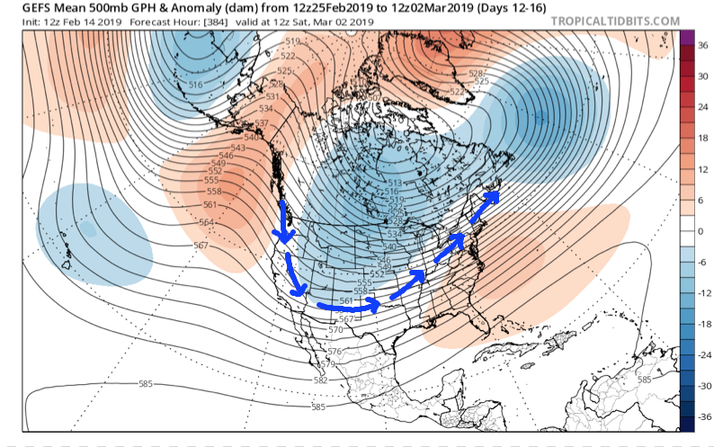
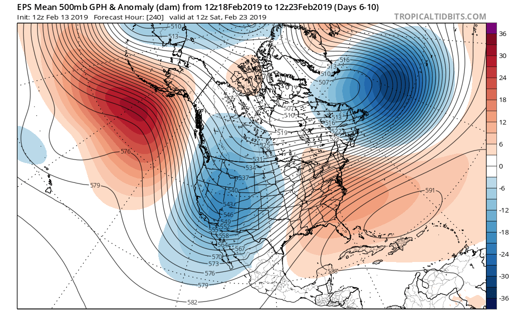
Now, let’s look ahead to some potentially colder times. Before moving forward, it’s important that we recognize models have attempted once already to drive in a wholesale pattern change to colder (originally thought to be underway now). Perhaps it’s a case of “delayed, but not denied.” There’s a lot going on behind the scenes:

  • Sudden stratospheric warming event and potential polar vortex displacement, etc.
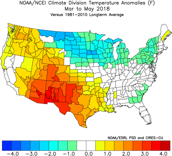
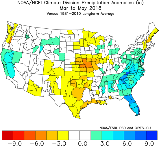
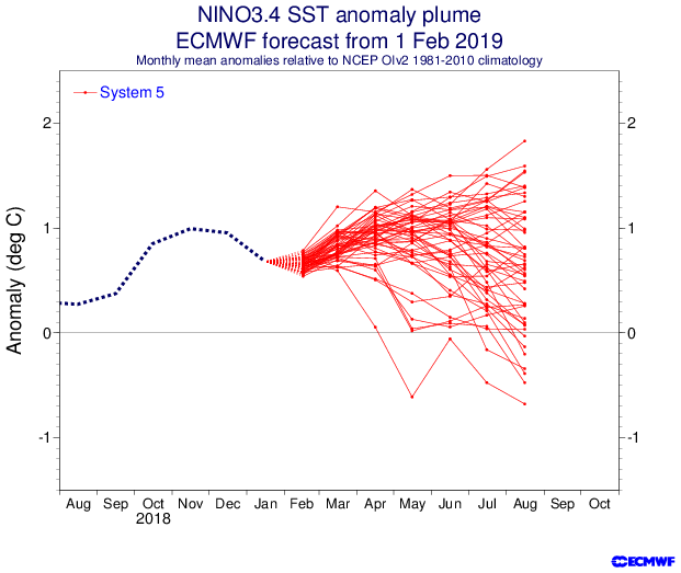
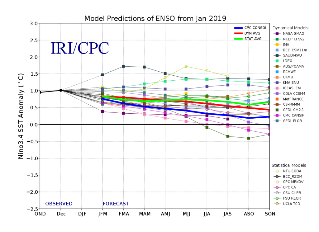
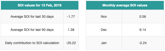
  • SOI flipping from a Niña-like state to one we’d expect to see associated with an El Niño
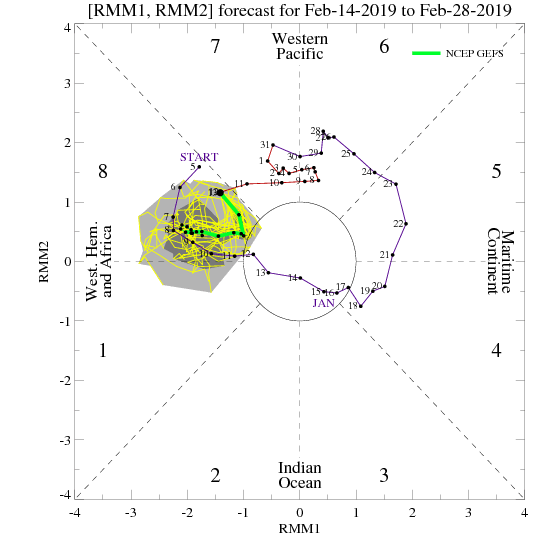
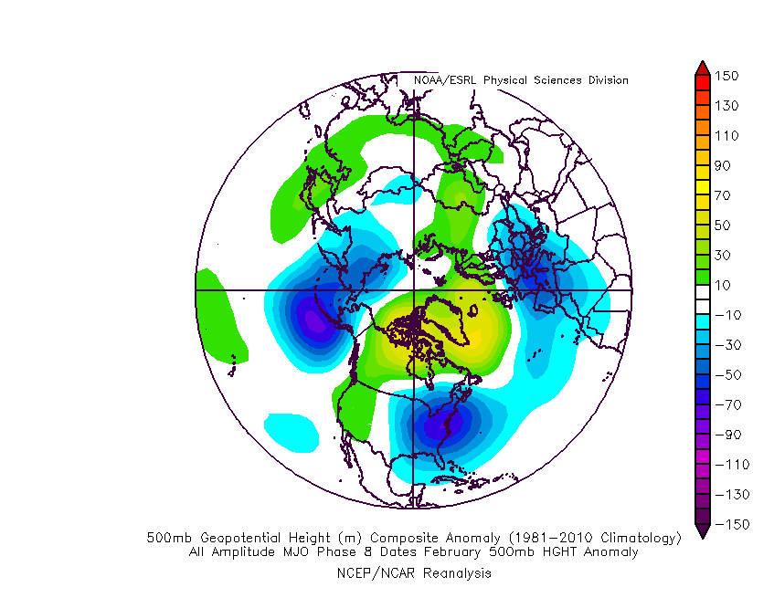
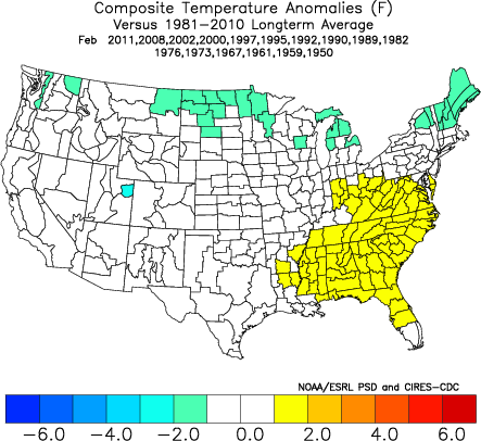
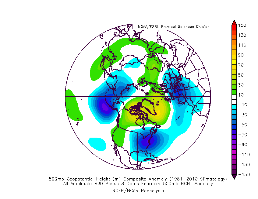
  • Active MJO remains

There are significant changes brewing in the arctic/ higher latitudes that have to raise an eyebrow at the very least.

Today

Mid-January

Note the higher pressures building over the upcoming 10-14 days in the arctic regions.

Not surprisingly, the models begin to tank the AO.

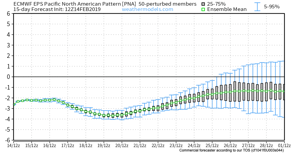
The PNA rises…

Something that also lends credence to a potential pattern shift is the recent SOI drop.

This would tend to suggest that an active storm track may be in place as the more bonafide cold shift is underway.

The moral of the story? Despite the milder period being extended a couple weeks longer than originally thought, there’s still a lot on the table this winter. It’s far too early to think winter’s over before it’s really even begun for most. We expect to see increasingly wintry conditions show up around the middle of January…

Stay tuned.

NEW JMA Weeklies Highlight Overall Mild Pattern…

Winter has been on hold over the past few weeks, and there’s really nothing that looks to shake that up anytime soon (at least through the upcoming 10-14 days).

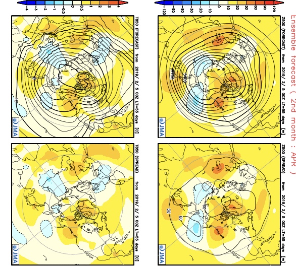
The new JMA Weeklies are in this morning and they continue to highlight the mild times:

Week 1

Week 2

Weeks 3-4

This is a rather dramatic reversal from what this particular model was saying only last week- when it was bringing winter back with authority by Week 2 on.  One could easily argue that even out to the Weeks 3-4 time frame that this certainly isn’t an ideal look for “stick and hold” cold to eventually push into the East.

There is a lot going on “behind the scenes” right now and this isn’t us saying winter’s over before it really even began, but it continues to look more and more likely that any sort of sustained cold and potentially snowy times will have to remain on hold until potentially late month.  The roaring PAC jet will likely continue to have it’s say until then…

(More later tonight on some of the items that argue for winter to get going as we progress into late January and beyond).

Tracking 2 Rain Events; Cold Open to 2019…

Highlights:

  • Wet with a few t-storms
  • Dry weekend
  • Wet then cold to open 2019

Rain Gear Needed…The pattern is transitioning from the predominantly mild stretch of the past couple weeks to one that will turn much colder as we move into January.  In between?  Active times, as we’re tracking two big storm systems between now and NYE.

The initial push of moisture has reached the I-65 corridor as of this forecast issuance early Thursday morning.  Periods of rain will continue through a good chunk of the day and we may even throw in some thunder into the mix later this evening- especially across southern portions of the state.  The other big story today?  Strong and gusty southerly winds.

Rain will end later tonight with dry, blustery, and colder times returning as we close the week.  Highs tomorrow will come predawn before falling through the day.  Dry and seasonable times will continue as we move through the last weekend of 2018.

A new storm system promises a return of wet times as we get set to ring in the new year.  Definitely plan on having the rain gear handy as you head out to those New Year’s Eve parties Monday.  Heavy rain is possible at times.  As the area of low pressure tracks northeast, it’ll swing a cold front through here Monday night and we’ll turn sharply colder with snow showers on New Year’s Day, itself.