Cold’s A Given, What About Snow?
Now that everyone is aboard the cold train through the 1st half of March, it’s time to turn our attention to other things and that’s the chance(s) of meaningful late season snow.
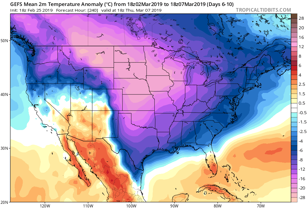
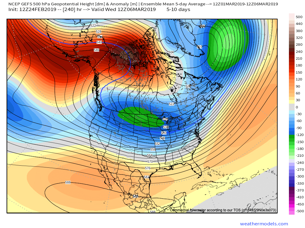
Before we talk about snow prospects, it’s important to know the magnitude of this cold. On the table is a period with multiple single digit days and highs in the lower to middle 20s- and those numbers will turn even colder if we can get a snowpack down. “Frigid” doesn’t begin to describe things- especially considering the average high is in the middle 40s and the average low is around 30 during the first week of March.

While we’re highly confident on the bitterly cold feel as we open meteorological winter, opportunities for snow are still fuzzy. There’s certainly a lot of potential in this pattern over the next couple of weeks, but honing in on the specifics are more of a challenge as the pattern transition gets underway.
With all of that said, Saturday continues to look like the best shot at accumulating snow potential in the near term as a coast-to-coast storm system travels across the country. As things stand today, this appears to be an I-40 to I-70 special from the Plains into the Ohio Valley before trending northeast towards the I-80 corridor in the Northeast. We caution, it’s far too early for specifics here.
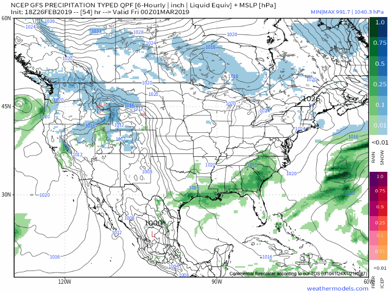
Here’s a “ridiculously” early call of where we think the greatest chance of accumulating snow will lie Friday through Sunday.

Thereafter, a bitterly cold week is ahead before our attention will turn to the threat of another storm “attacking” the cold by the middle to latter part of next week (3/6 through 3/9 time frame)…