VIDEO: Turning Briefly Warmer Before Another Chilly Plunge…
You must be logged in to view this content. Click Here to become a member of IndyWX.com for full access. Already a member of IndyWx.com All-Access? Log-in here.
You must be logged in to view this content. Click Here to become a member of IndyWX.com for full access. Already a member of IndyWx.com All-Access? Log-in here.
You must be logged in to view this content. Click Here to become a member of IndyWX.com for full access. Already a member of IndyWx.com All-Access? Log-in here.
The big story in the immediate term is centered squarely on the temperature forecast. Frost Advisories are up for our friends across northern parts of the state, northwestern OH, and into southwestern MI. Even a few folks outside of the city, itself, can expect patchy frost (a few weeks early mind you, and another byproduct of the recent dryness) across central Indiana.
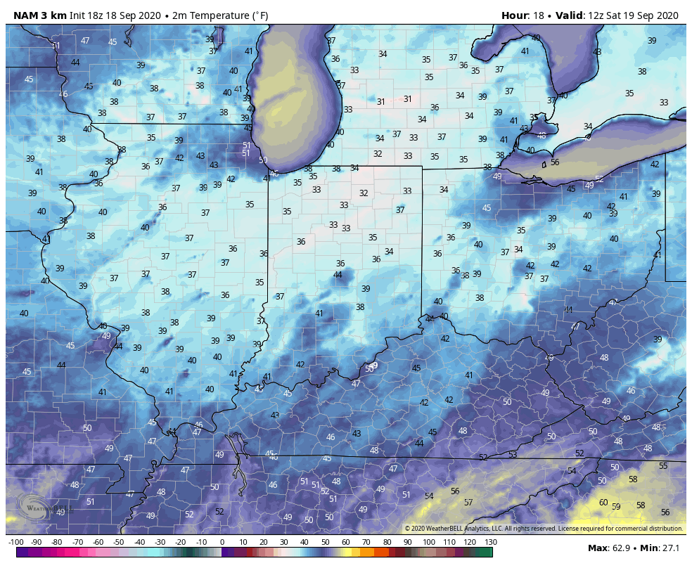
There’s no reason to waste a lot of pixels on the short-term forecast as quiet conditions prevail. High pressure will remain in control for the upcoming work week with slowly moderating temperatures. We’ll go from below, to seasonal, to slightly above normal by week’s end.
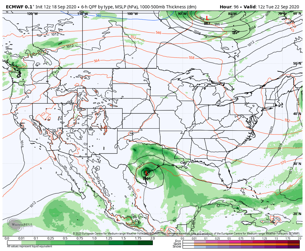
The next “problem” arises by next weekend as forecast models sort out what to do with remnant tropical moisture from now TS Beta and an approaching cold front. In this morning’s client video (never posted due to the connectivity issues), we walked through the various solutions. We’ll be “back to normal” from a video perspective late tomorrow and appreciate your patience more than you know.
There’s two windows that are open late next week/ next weekend, including the Deep South and the Ohio Valley dealing with remnant tropical moisture. Given the overall pattern, we favor the southern solution from this distance, but should Beta “dilly dally” in the western Gulf, there will be an opportunity for that next approaching trough to pull that remnant tropical moisture northward into an area desperately needing rainfall. Stay tuned. Interestingly, the European and GFS both agree on the northern trend at 12z.

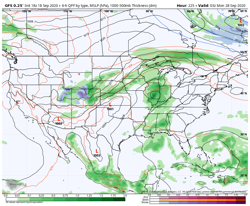
Notes and Asides: We’ll be back at home base tomorrow night after being down on the Gulf for the past week and will resume normal video production at that point. Despite the quiet times right now, it’ll be interesting to see how things begin to ramp up late next week. Much more later. Have a relaxing Friday evening.
Unfortunately there likely won’t be any significant changes to our precipitation pattern until late autumn and winter. Until then, we’ll have to take any drop of rain we can find. Once the pattern flips though, it may do so in quick and rather dramatic fashion (still expecting a wet winter).
The consensus of long range data shows the dry pattern continuing over the upcoming few weeks, including the JMA Weeklies, CFSv2 Weeklies, and ensemble products.
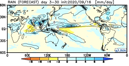
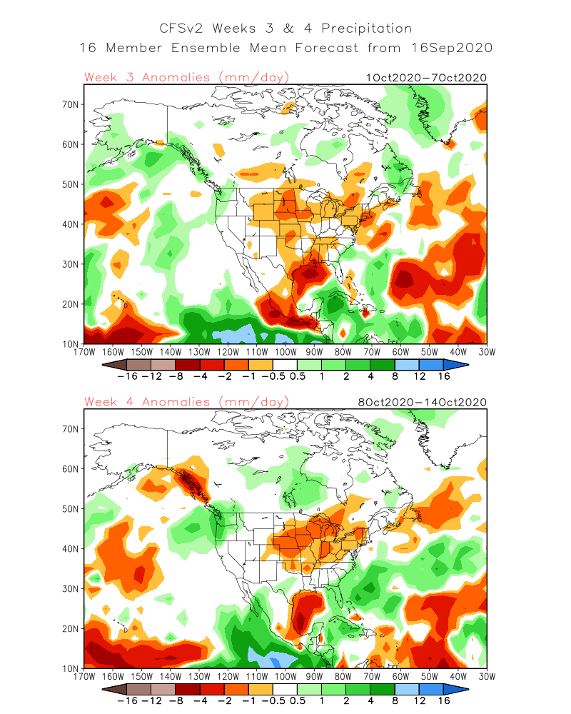
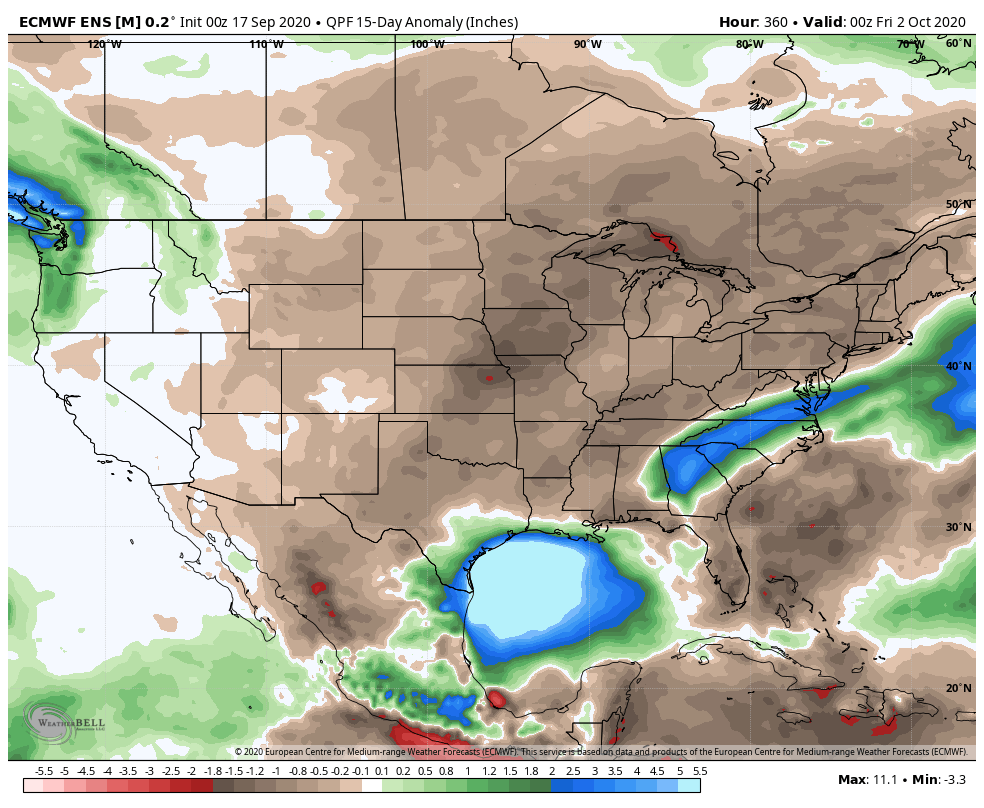

Analogs and other teleconnections support this dry theme. At least in the immediate range (through mid October) the only way to bust up this dry pattern is to get tropical moisture involved.
The new JMA Weeklies maintain the ‘mean’ ridge position across the West for the majority of the upcoming few weeks, but there will likely be attempts to expand the ridge across the northern tier Week 2 and 3 that would lead to at least transitional periods of much warmer air, after the cool period in the short term.
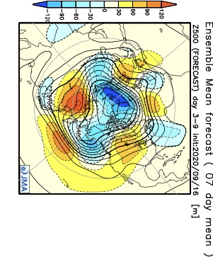


The model sees the ridge expanding Weeks 3-4 and the associated warmth that spreads east after the chilly regime.

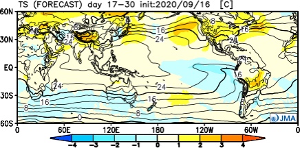
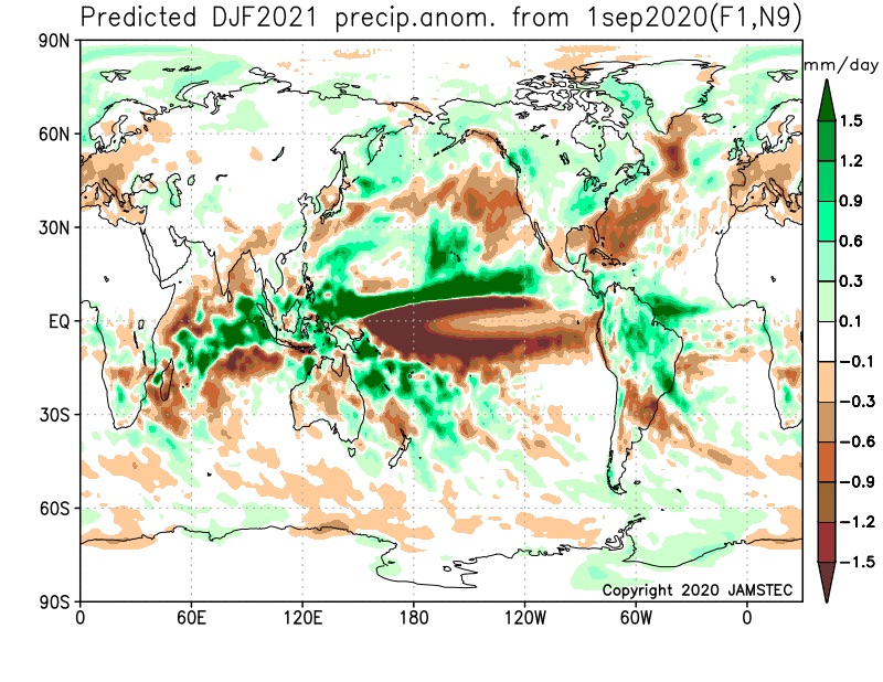
The new JAMSTEC seasonal data is also in and maintains a warm look this winter. A lot of this has to do with an expected persistent southeastern ridge. We agree with this but, as is the case each winter, there will be challenges that have to be dealt with.
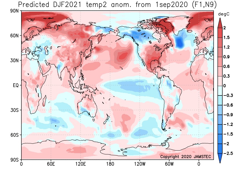
We also agree with the active storm track through the Ohio Valley and associated well above normal precipitation in the December through February period.
You must be logged in to view this content. Click Here to become a member of IndyWX.com for full access. Already a member of IndyWx.com All-Access? Log-in here.