June 2021 Outlook…
Updated 05.31.21 @ 9a
With the exception of the far Southwest and Northeast, May 2021 has been a relatively cool month, overall:

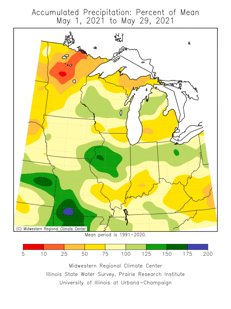
More closely to home, May featured “haves and have nots” in the precipitation department. Officially, (as of 5/30), Indianapolis is running more than 2.6° below normal on the month and 1.03″ below normal in the precipitation department.
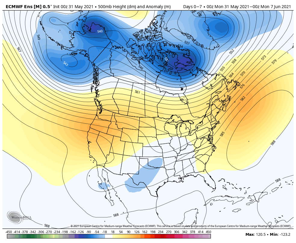
As we look to June, the first week, overall, should open with slightly below normal temperatures, but there are changes in the offing that will promote significant warming in the Week 2 time frame (June 7-14). Note how the trough providing the cooler air in the immediate term is replaced with the expanding ridge over the Great Lakes.
This should provide us a shot to touch the 90° mark during the aforementioned period at least on a couple of days. Regardless, we can expect rising humidity levels and a more summer-like feel. (I suppose that’s appropriate here on the first day of the unofficial start of summer).
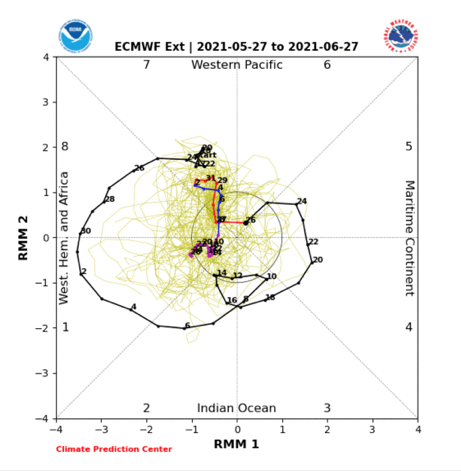
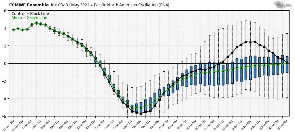
Longer term, we need to keep close tabs on the MJO. Longer range data suggests the amplitude we’ve seen as of late will collapse.

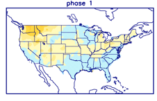
A big drop negative in the PNA will promote the Week 2 heat that we mentioned above. Thereafter, it appears as if the PNA will want to rebound closer to neutral (heat shouldn’t hold).
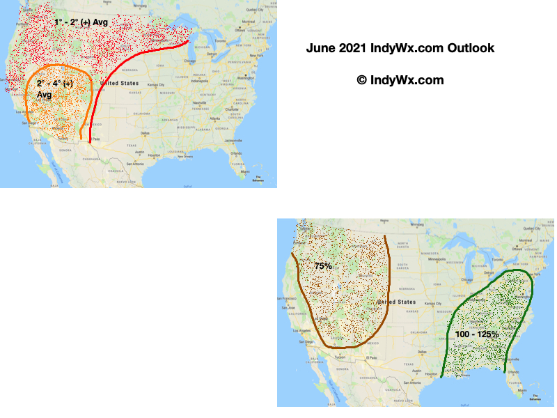
As a whole, we believe the drought-stricken West will be the breeding ground for big time heat while things are much more transitional across the East (leading to near seasonal temperatures. As for precipitation, we’re expecting a wetter pattern to emerge for the Deep South, TN Valley, and into the eastern Ohio Valley in the month ahead. Meanwhile, the already dry ground across the West is likely to only worsen, unfortunately.
For perspective, averages for the month of June here in central Indiana include highs in the lower 80s (82.0° at IND), lows in the lower 60s (62.9° at IND), and nearly 5″ (4.95″ at IND) of rain.