You must be logged in to view this content. Click Here to become a member of IndyWX.com for full access. Already a member of IndyWx.com All-Access? Log-in here.
You must be logged in to view this content. Click Here to become a member of IndyWX.com for full access. Already a member of IndyWx.com All-Access? Log-in here.
You must be logged in to view this content. Click Here to become a member of IndyWX.com for full access. Already a member of IndyWx.com All-Access? Log-in here.
You must be logged in to view this content. Click Here to become a member of IndyWX.com for full access. Already a member of IndyWx.com All-Access? Log-in here.
Now that we’re past Labor Day and the days are becoming noticeably shorter, there’s increased interest in what the upcoming winter may include. In case you missed it during the hustle and bustle of the summer, we’ve laid out some initial thoughts here:
Our complete and finalized annual IndyWx.com Winter Outlook will be issued in October.
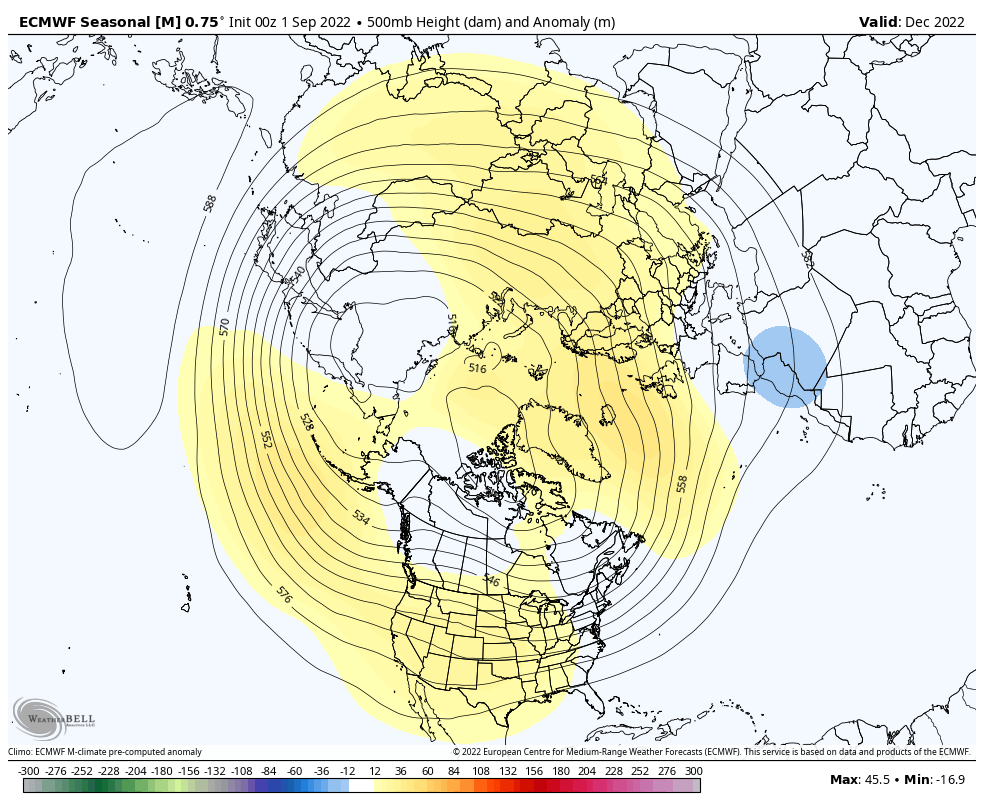
Now, onto the details from the updated European Seasonal (updates at the beginning of each month). Simply put, taken at face value, the “trend isn’t your friend” if you’re a fan of a quick start to winter. The model has really pulled back on the bullish look from its previous update regarding the December 500mb pattern. The model suggests another blow torch of a December is upon us. (Note last December, Indianapolis finished nearly a whopping 9° above average).
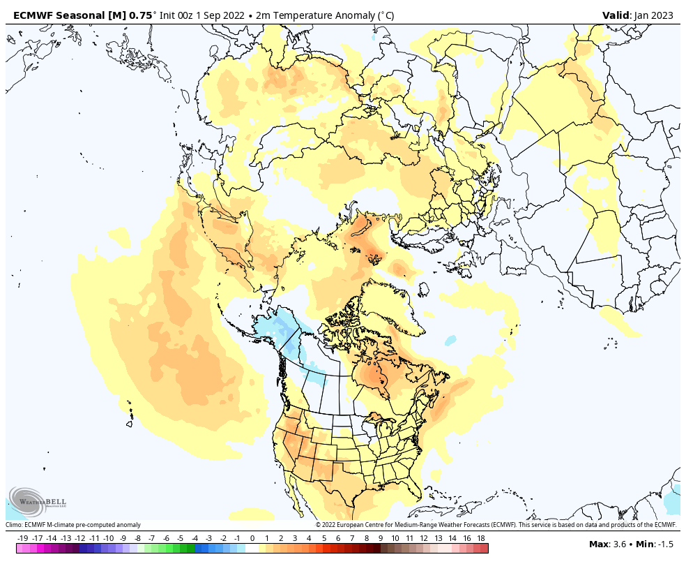
However, things do begin to change as we head into the new year. Note the reflection of a downstream (eastern trough) trying to be shown on the model. One could easily make an argument that if we do, indeed, go to this look at the upper levels, the surface temperatures would be significantly colder than what’s currently being modeled (meaning on or the other is likely to be wrong here: either the 500mb look or the model not being able to see cold).
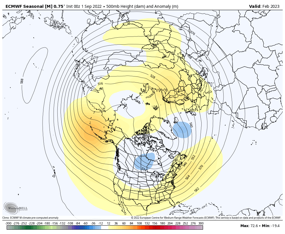
By the time we get into the last month of met. winter (Feb), the model is keying in on a pull back of the said trough and resulting in a much warmer regime across the eastern portion of the country (relative to average, of course).
Despite some of the changes (most notably to December) from the previous model update, we don’t see any reason to throw the analog research from back in the summer in the trash just yet. Yes, that’s in the face of recent trends not being fond of the fast start to winter. The average December temperature in Indianapolis is 33.3°. We have to go back to December of ’17- weak La Nina in place (30.2°) and December of ’16 – a moderate El Nino (30.3°) to find our last “colder than average” Decembers.
Finally, it should be noted we don’t lean on one particular model when formulating our winter outlook. Like any longer range, seasonal forecast, we blend multiple models together, compile analog data, and do extensive research of sea surface temperature configurations across the globe before publishing our final product. Needless to say, we have a lot of work left to do for this year’s version.