Welcome to 2023…

Updated 01.01.23 @ 7a

The first few days of January will open up with more of a spring-like feel. In fact, each of the next (4) days should feature high temperatures well into the 50s and even 60s Tuesday.

That boost in the mercury Tuesday is all thanks to a strong southerly air flow ahead of our next significant storm system. Rain will overspread the area Monday evening and become heavy at times into Tuesday. Embedded thunder (even a couple stronger storms) is a good bet south of I-70 Tuesday.

Rainfall will be a plenty.

Seasonably chilly air will filter into the region midweek behind the front. While far from anything terribly cold for the time of year, temperatures will fall enough to allow lingering upper level energy to generate light snow and snow showers around these parts by Wednesday night into Thursday.
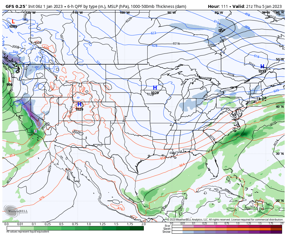
Another (at this time, appears fairly weak) system will arrive a week from today.
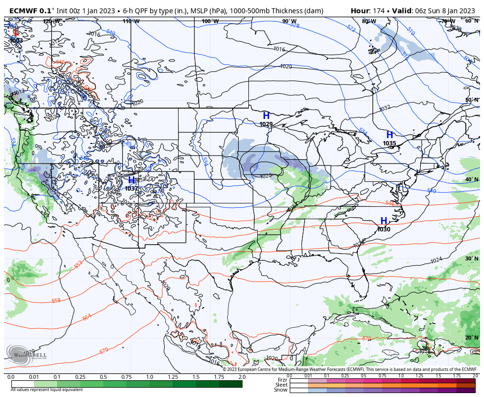
Longer range, we continue to eye mid month for more of a dramatic shift back towards cold and wintry conditions. More on that in a video discussion later this afternoon.

Reasons Why Another Significant Pattern Change Likely Looms In January…

Updated 12.30.22 @ 7:50a

You must be logged in to view this content. Click Here to become a member of IndyWX.com for full access.  Already a member of IndyWx.com All-Access?  Log-in here.

What A Flip…

Updated 12.28.22 @ 6:45a

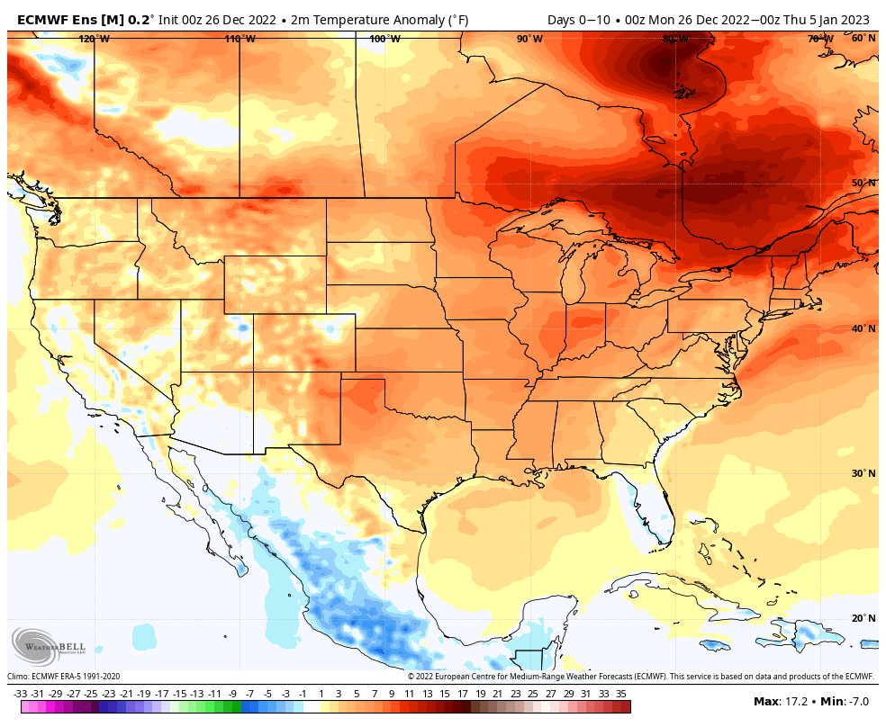
The past 7 days have featured temperatures running anywhere from 10° to 25° colder than average from the Ohio Valley into the upper Mid West.

As a whole, temperatures are running anywhere from 2° to 10° below normal for the month across the region. Officially, Indianapolis is running 2.3° below normal.

The upcoming 7-days will feature a major flip to close December and open January. Note the significant eastern ridge. This will help power temperatures into the 50s for highs into the middle of next week, with a couple 60°+ days possible.

The pattern is also going to turn quite wet as the mean storm track pulls to the northwest. Multiple low pressure systems will be able to tap into that Gulf connection, leading to periods of moderate to heavy rain at times into the middle of next week.

Significant Thaw Ahead, But Bullish On Winter’s Return…

Updated 12.26.22 @ 9:40a

It’s certainly no secret that a big thaw is ahead. As we set the bar with this current cold spell, we’ll set the bar for the upcoming period of warmth: minimum of (2) days of highs of 60°, or greater, between Jan. 1 and Jan. 5. It’s another case of a significant thaw following a bitter blast of arctic air. In researching classic arctic outbreaks of the past, this happens many more times than not.

In any event, we continue to see the relatively mild and wet pattern carrying us through the first week of January.

But seeds are already being planted for a renewed wintry spell. In particular, the teleconnections are bullish on cold returning around, or just after, Jan. 10. We note the longer range charts keep these pattern drivers in a favorable position for more of a prolonged period of cold, as well:

Forecasters have to love the overall alignment as this helps build medium to longer range confidence in the overall pattern progression.

Then we add in the MJO rumbling into Phase 7 for early January. While there will be a bit of a lag, this is another signal for a cold look across the eastern portion of the country, especially by that Jan. 10 time frame.

While I can’t say we’ll see another arctic shot to the magnitude of this current frigid regime, I am more confident than normal from this distance in the period that runs from Jan. 10 through Jan. 25 being colder than normal as a whole. I would anticipate the longer range modeling (Weeklies, in particular) becoming increasingly cold with updates this week during that aforementioned period.

More updates to come as we rumble through this holiday week…