VIDEO: Snow Overspreads The Region And Becomes Moderate-Heavy At Times; Bitter Open To The Weekend Gives Way To A Milder Week Ahead…

Updated 02.16.24 @ 6:40a

A widespread accumulating snow event will get underway over the coming few hours across all of central IN. At times, localized moderate to heavy snow intensity is anticipated this afternoon before diminishing this evening. A brief, but bitter jab of arctic air will flow into the region tonight and Saturday, including wind chill values that fall into the single digits. Sunshine returns over the weekend.

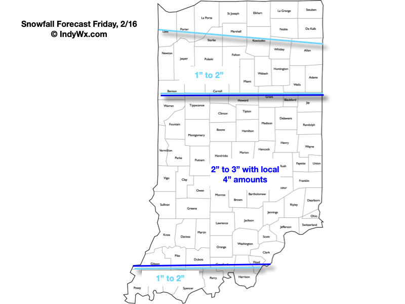
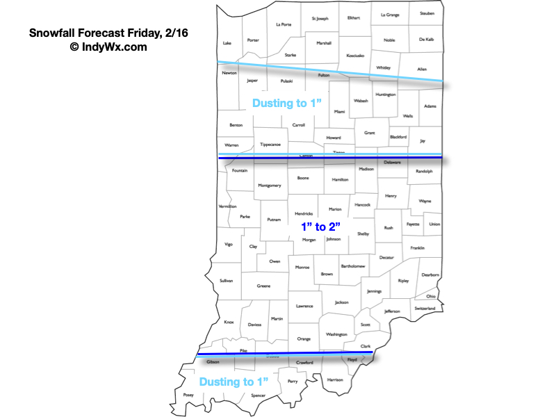
Snowfall forecast- most of which will accumulate on grassy and elevated surfaces. Slushy pavement conditions will develop during times of more intense snow this afternoon. Salting and plowing will be required throughout most of central IN today.
VIDEO: Snow Overspreads The Region Friday; Fresh Medium-Long Range Thoughts…

Updated 02.15.24 @ 9:42p

Evening update: Looks like we’ll need to “beef” totals up a bit tmrw. We’ll watch overnight guidance but wouldn’t be surprised if we need to build in banding potential that may generate local 3”-4” amounts by Friday evening with tomorrow morning’s update.


A fast moving band of light rain will scoot across central IN mid-morning, but the bigger deal today will be the strong and gusty winds. Gusts upwards of 40 MPH can be expected at times. Hold onto your hats! Attention then will quickly shift to an area of light snow that will overspread the region Friday morning. While the unseasonably mild surface temperatures of late will prevent some of this snow from accumulating, a general 0.50″ to 2″ area-wide snow is expected.

More on the snow, a brief “jab” of arctic air and a look into the updated long range guidance in this morning’s Client video below:

VIDEO: Valentine Sunshine; Brief Jab Of Arctic Air And Snow To Close The Week…

Updated 02.14.24 @ 7:51a Plentiful sunshine will be with us as we move through our Valentine’s Day along with unseasonably mild temperatures. A brief “jab” of arctic air will be…

You must be logged in to view this content. Click Here to become a member of IndyWX.com for full access.  Already a member of IndyWx.com All-Access?  Log-in here.

VIDEO: Keeping An Eye On Friday; Brief Jab Of Arctic Air To Follow…

Updated 02.13.24 @ 5:32a Quiet weather will be with us as we move through the next couple of days before a fast moving and weak disturbance delivers a few showers…

You must be logged in to view this content. Click Here to become a member of IndyWX.com for full access.  Already a member of IndyWx.com All-Access?  Log-in here.

Pre Super Bowl Rambles: Cooler Week Ahead, But Milder Late Month Trends…

Updated 02.11.24 @ 3:31p

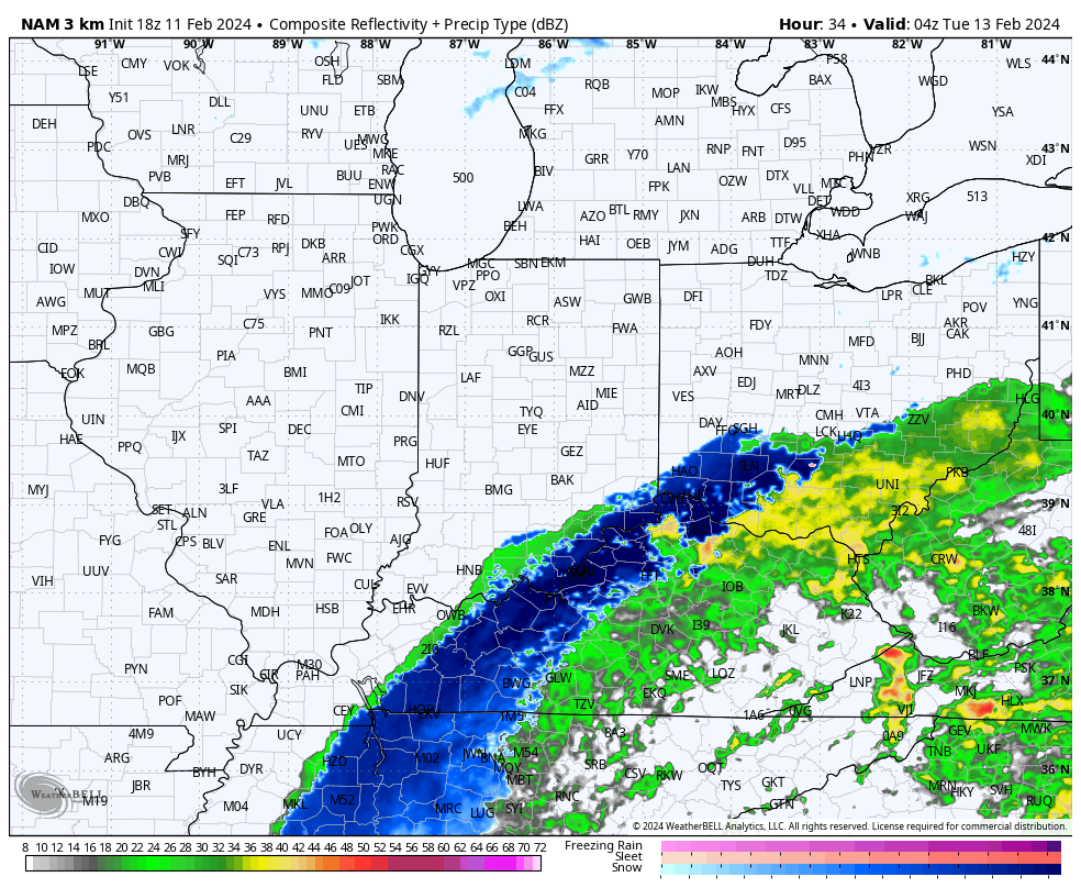
I hope this finds you enjoying a relaxing and fun Super Bowl Sunday afternoon! Before we talk longer range, trends this afternoon have been to shove the heavier snow banding potential further south tomorrow night. We’ll keep an eye on overnight model trends but the threat of accumulating wet snow is looking more likely to impact far downstate into portions of northern KY and even western and portions of north-central TN now.

Monday night’s system has trended further south today.

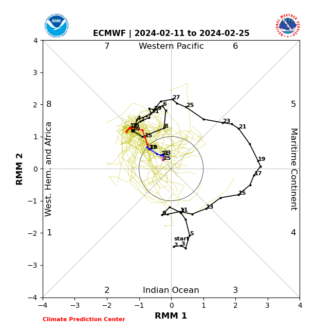
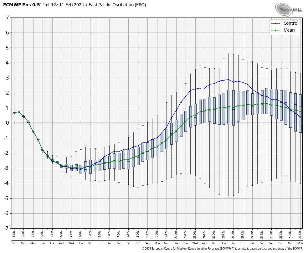
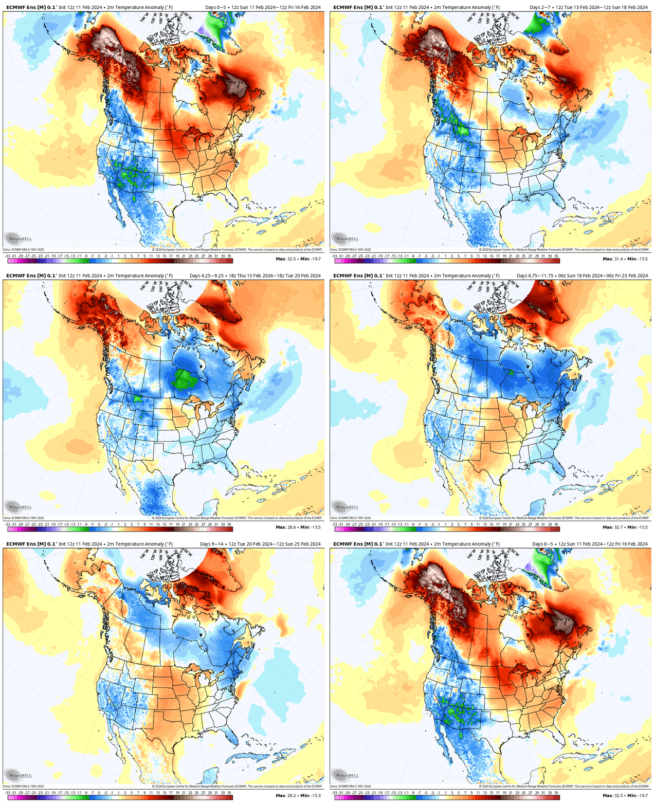
While we’ll trend at least closer to seasonal levels in the upcoming 10-day period (also need to keep an eye on the potential of late week snow and a brief arctic “jab”), the impact of a lack of MJO amplitude into the colder phases (8, 1) and the positive trends on the EPO late month suggest the once cold idea during the period here will be a fail.

In fact, latest ensemble guidance in today shows a milder than normal pattern to return during the last week, or so, of February.

Just a couple quick updates prior to the big game! Enjoy, friends!