Category: Unseasonably Cool Weather

Long Range Update: Closing Out August…

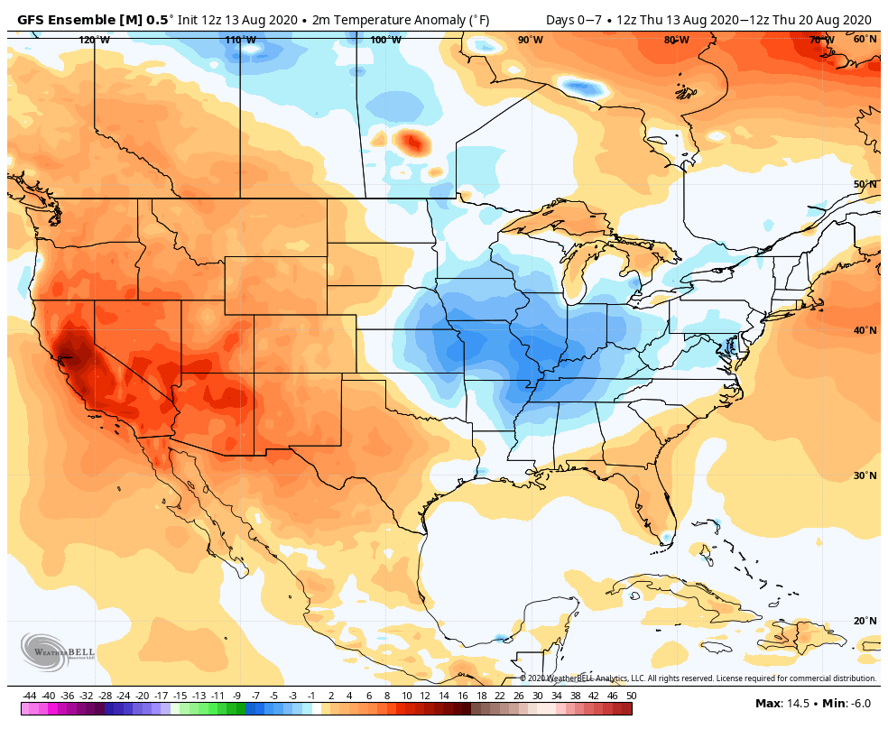
With a little over 2 weeks to go in meteorological summer, model data disagrees in the way the month- and season ends. That is, after the upcoming week where the consensus is cooler and drier than normal (we agree, as well). Let’s take a look at the data:

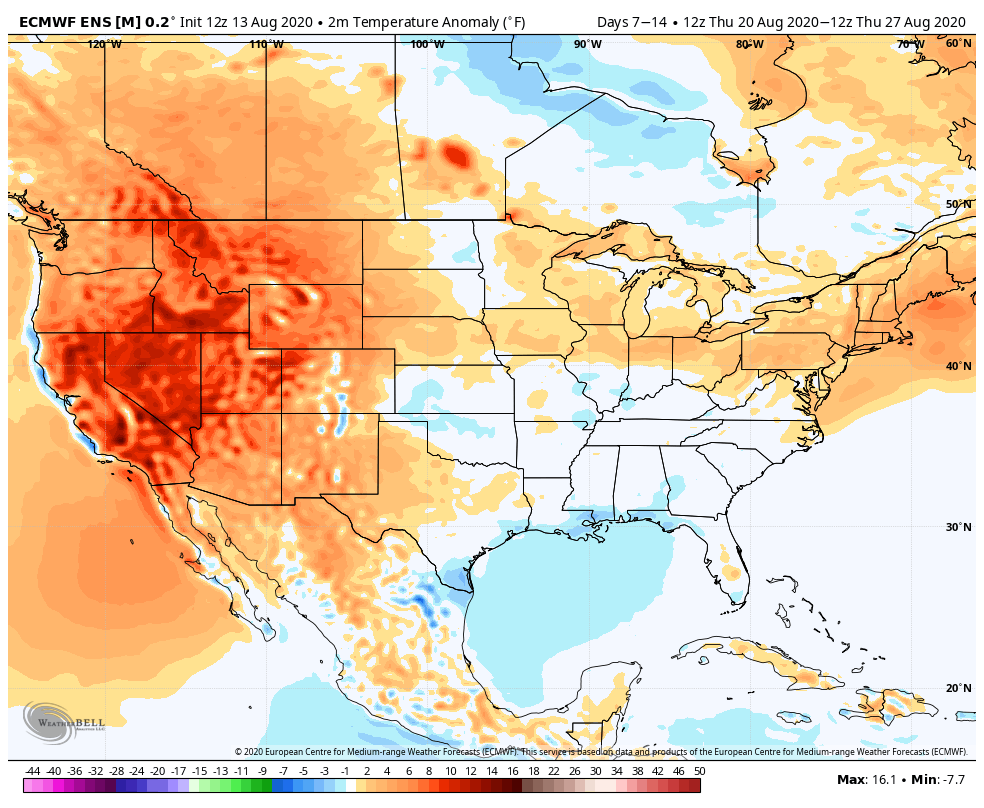
European Weeklies
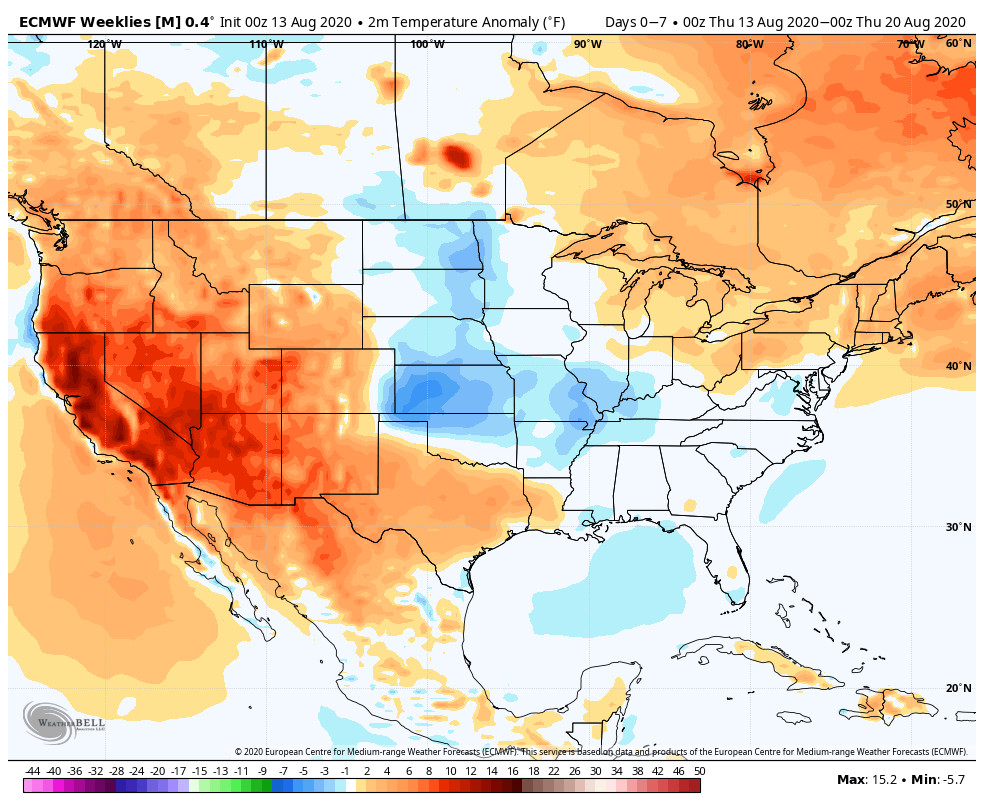
Week 1

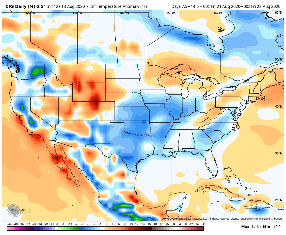
CFSv2

Week 1

GEFS

Week 1

EPS

Week 1

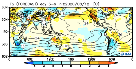
JMA

Week 1

The American data and JMA Weeklies are coolest (compared to the European), but compared to Weeks 2 and 3, there’s better consensus. The initial week is also looking drier than normal- especially after a “smattering” of storms tomorrow and Saturday.
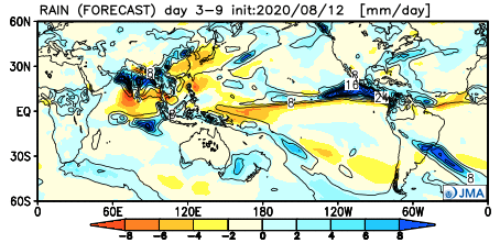
Week 1 Precipitation anomalies- JMA Weeklies
Week 1 Precipitation anomalies- European ensemble

Let’s now take a look at Week 2:

European Weeklies
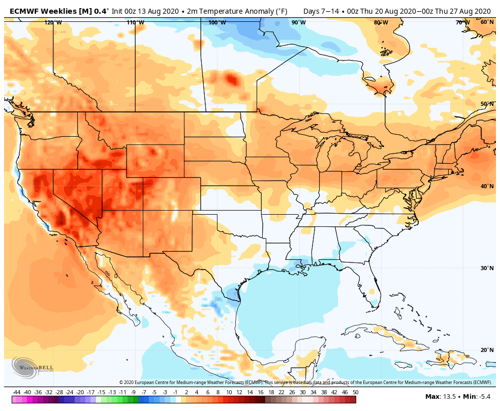
Week 2

CFSv2

Week 2

GEFS

Week 2

EPS

Week 2

JMA

Week 2

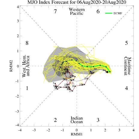
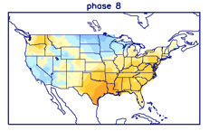
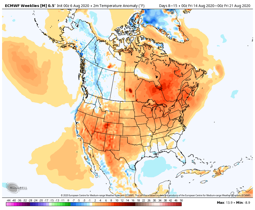
This is where our idea begins to pivot more towards the JMA Weeklies and European data (warmer look). The reason primarily has to do with the MJO moving back into Phase 8 during this time period.
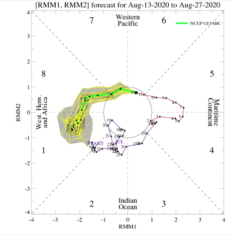
This is a warm phase in August.

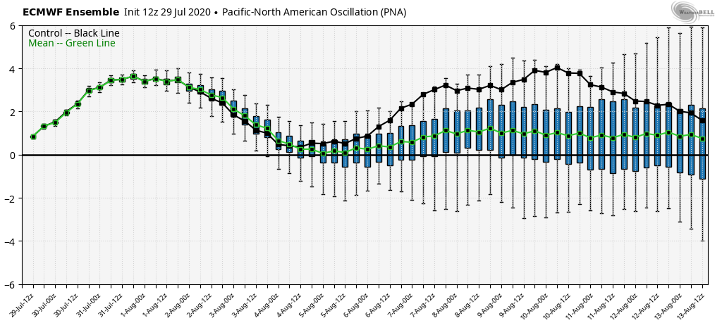
Furthermore, the PNA ‘mean’ is forecast to trend off the positive “mountain” (that will help drive the cooler pattern for the upcoming week) and more towards neutral.
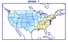
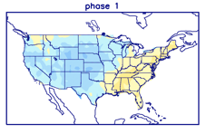
Phase 1 is also a warmer look for our part of the country and that’s the way we’re leaning for the last week of the month (despite the very cool CFSv2).
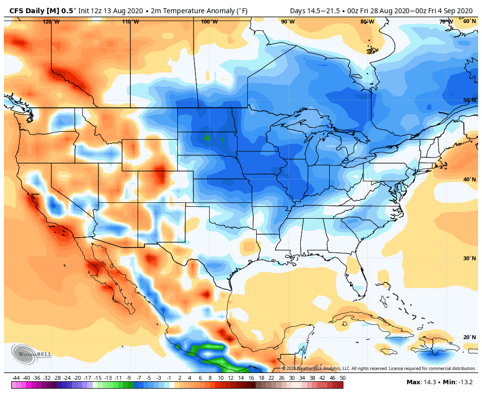
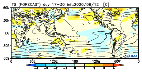
While not overly warm, we think the JMA has the best handle on the temperature pattern in the Week 3 timeframe, locally (seasonable to slightly above normal).
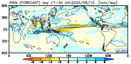
The pattern should also begin to trend wetter during this time period:
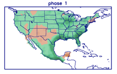
This matches up with Phase 1 of the Madden Julian oscillation:
So, to summarize, after a cool and dry period next week, we anticipate the pattern to trend warmer (more seasonable) and wetter to close the month and head into early September. One other item of note is that the tropics should really begin to heat back up during this period, as well. Of course, as is the case from time to time, that can be a wild card from a precipitation perspective. The Gulf of Mexico (GOM) looks particularly busy late August through late September, but there’s simply no way to get more specific from this distance, including potential inland impacts. It’s worth keeping a close eye though.

Before we leave, the latest JAMSTEC seasonal data updated this morning and features a “torch” of a fall, along with a warm, wet winter, locally. That southeast ridge will have to be dealt with this winter. While still early, the early lean is for a warm start to winter (including holiday season). While there are some ingredients that may keep things more interesting than what they could be otherwise, from at least this point, this doesn’t appear as if it’ll be an “exciting” winter for lovers of snow and cold. Much more later- and again, we still have a long way to go…

Permanent link to this article: https://indywx.com/2020/08/13/long-range-update-closing-out-august/

VIDEO: Unsettled Weather Returns To Close The Week; Unseasonably Cool Air Arrives Next Week…

You must be logged in to view this content. Click Here to become a member of IndyWX.com for full access.  Already a member of IndyWx.com All-Access?  Log-in here.

Permanent link to this article: https://indywx.com/2020/08/12/video-unsettled-weather-returns-to-close-the-week-unseasonably-cool-air-arrives-next-week/

VIDEO: Timing Out Storm Chances Into The Weekend; Looking Ahead To Another Taste Of Fall-Like Air…

You must be logged in to view this content. Click Here to become a member of IndyWX.com for full access.  Already a member of IndyWx.com All-Access?  Log-in here.

Permanent link to this article: https://indywx.com/2020/08/11/video-timing-out-storm-chances-into-the-weekend-looking-ahead-to-another-taste-of-fall-like-air/

VIDEO: Couple More Nice Days Before Humidity Increases (And Storm Chances)…

You must be logged in to view this content. Click Here to become a member of IndyWX.com for full access.  Already a member of IndyWx.com All-Access?  Log-in here.

Permanent link to this article: https://indywx.com/2020/08/07/video-couple-more-nice-days-before-humidity-increases-and-storm-chances/

Long Range Update: Changes Loom For Mid-Late August…

August has opened unseasonably cool and refreshing. There’s even been a hint of fall to the air the past couple of mornings. The refreshing feel will continue as we wrap up the week, but changes for the warmer and muggier loom.

The first (5) days of the month are running more than 5° below normal for Indianapolis.

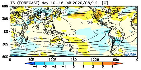
Even before we look at the respective model data for mid-late August, it’s important to note we’re basing our long range forecast (this was a byproduct in building our August Outlook) on the MJO heading into Phases 8 and 1 over the next couple of weeks. These are considerably warmer and wetter phases for our region and that fits our idea. Perhaps of interest beyond the next couple of weeks is that the amplitude should continue into Phases 2-3 as we wrap the month and head into early September. That, combined with other factors, will likely serve to re-ignite the tropics to close the month and head into the 1st month of meteorological fall.

Note the warmer, wetter look associated with Phases 8 and 1:

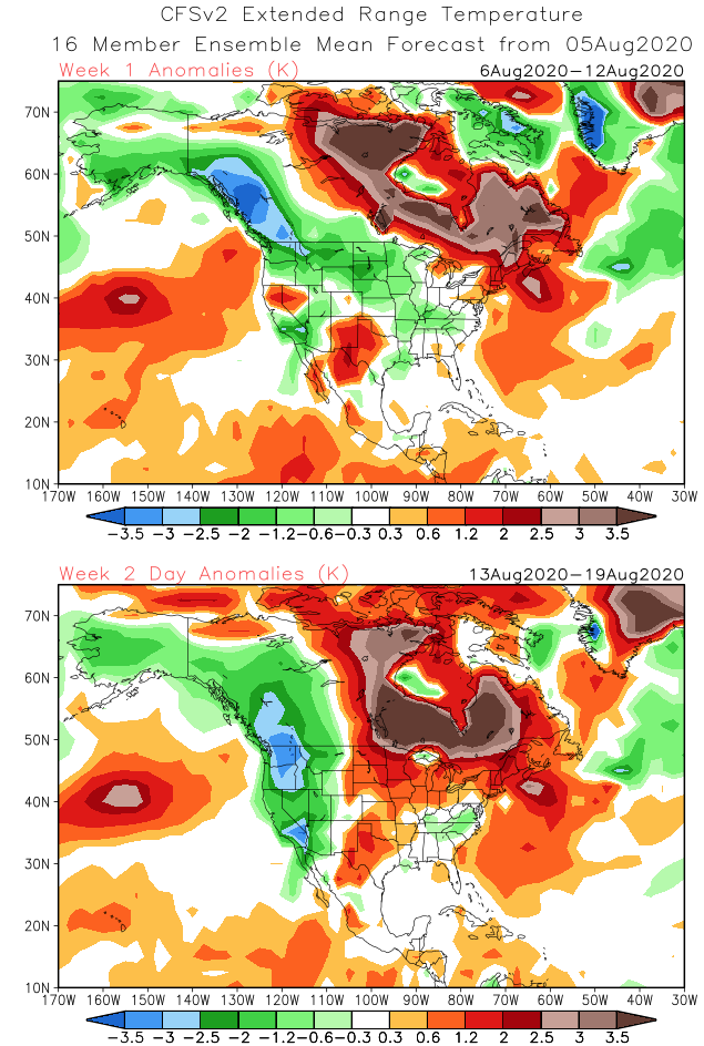
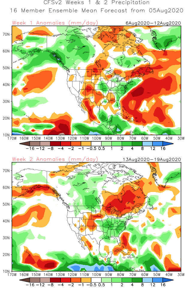
The CFSv2 is following this trend in the latest Weeks 1-2 outlook:

The latest European Weeklies are also in and paint a similar picture:

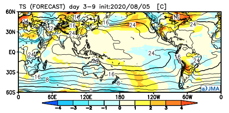
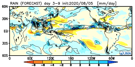
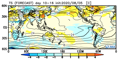
The JMA Weeklies follow a like path, but not as wet as we believe Week 2 will be:

The thinking here is that while we’re certain to warm in the mid-late month period, we still aren’t talking about any sort of prolonged periods of excessive heat. The more active upper air pattern will result in multiple frontal boundaries and disturbances scooting through the region to serve up more widespread, organized rain and storm chances. In short, we feel good about the rebound coming that should result in a month, as a whole, close to average in the temperature department with above to well above normal rainfall.

Permanent link to this article: https://indywx.com/2020/08/06/long-range-update-changes-loom-for-mid-late-august/

VIDEO: Dry, Pleasant Weather Continues Before Humidity Builds Over The Weekend…

You must be logged in to view this content. Click Here to become a member of IndyWX.com for full access.  Already a member of IndyWx.com All-Access?  Log-in here.

Permanent link to this article: https://indywx.com/2020/08/06/video-dry-pleasant-weather-continues-before-humidity-builds-over-the-weekend/

VIDEO: Fall-Like Now; Timing Out When Rain/ Storms Return…

You must be logged in to view this content. Click Here to become a member of IndyWX.com for full access.  Already a member of IndyWx.com All-Access?  Log-in here.

Permanent link to this article: https://indywx.com/2020/08/05/video-fall-like-now-timing-out-when-rain-storms-return/

VIDEO: Taste Of Fall Now; Looking Ahead To Mid-Late August…

You must be logged in to view this content. Click Here to become a member of IndyWX.com for full access.  Already a member of IndyWx.com All-Access?  Log-in here.

Permanent link to this article: https://indywx.com/2020/08/04/video-taste-of-fall-now-looking-ahead-to-mid-late-august/

Isaias Makes Landfall Tonight; One More Day Of Storms Followed By A Taste Of Early Autumn…

You must be logged in to view this content. Click Here to become a member of IndyWX.com for full access.  Already a member of IndyWx.com All-Access?  Log-in here.

Permanent link to this article: https://indywx.com/2020/08/03/isaias-makes-landfall-tonight-one-more-day-of-storms-followed-by-a-taste-of-early-autumn/

VIDEO: Unseasonably Cool Air Dominates This Week; Changes Down The Road?

You must be logged in to view this content. Click Here to become a member of IndyWX.com for full access.  Already a member of IndyWx.com All-Access?  Log-in here.

Permanent link to this article: https://indywx.com/2020/08/02/video-unseasonably-cool-air-dominates-this-week-changes-down-the-road/

IndyWx.com