Fall Arrives In Earnest Here…
You must be logged in to view this content. Click Here to become a member of IndyWX.com for full access. Already a member of IndyWx.com All-Access? Log-in here.
You must be logged in to view this content. Click Here to become a member of IndyWX.com for full access. Already a member of IndyWx.com All-Access? Log-in here.
High pressure and warm southwesterly winds will lead to one more summer-like day before significant changes take place. Plentiful sunshine can be expected Tuesday with temperatures closer to a record high (88° set in 1939) than the average of 68°.
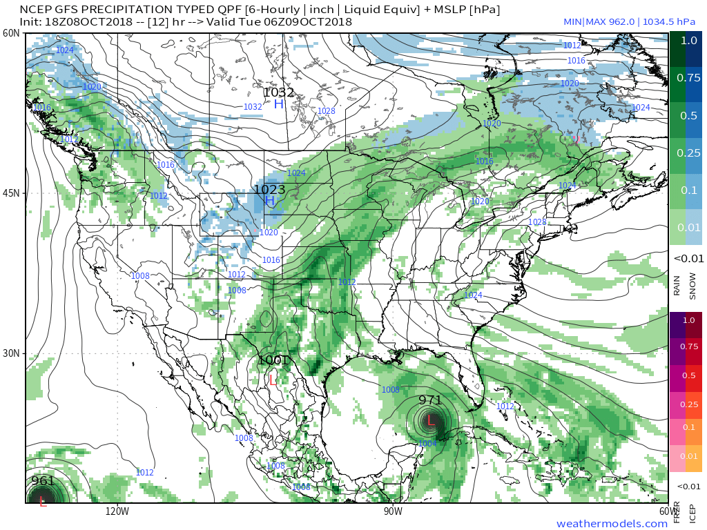
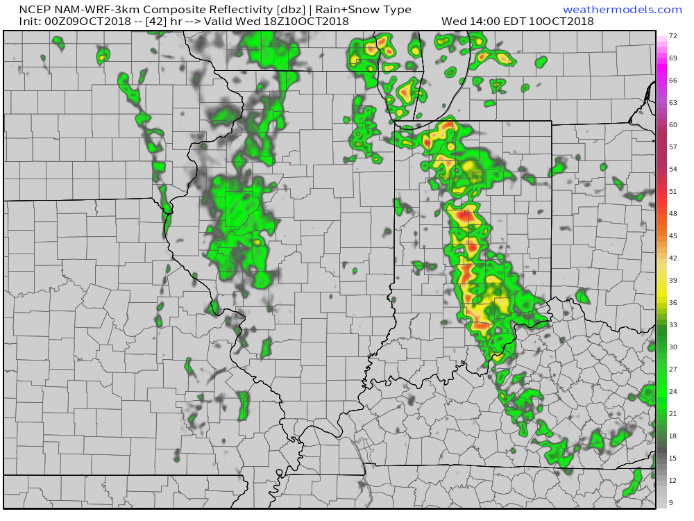
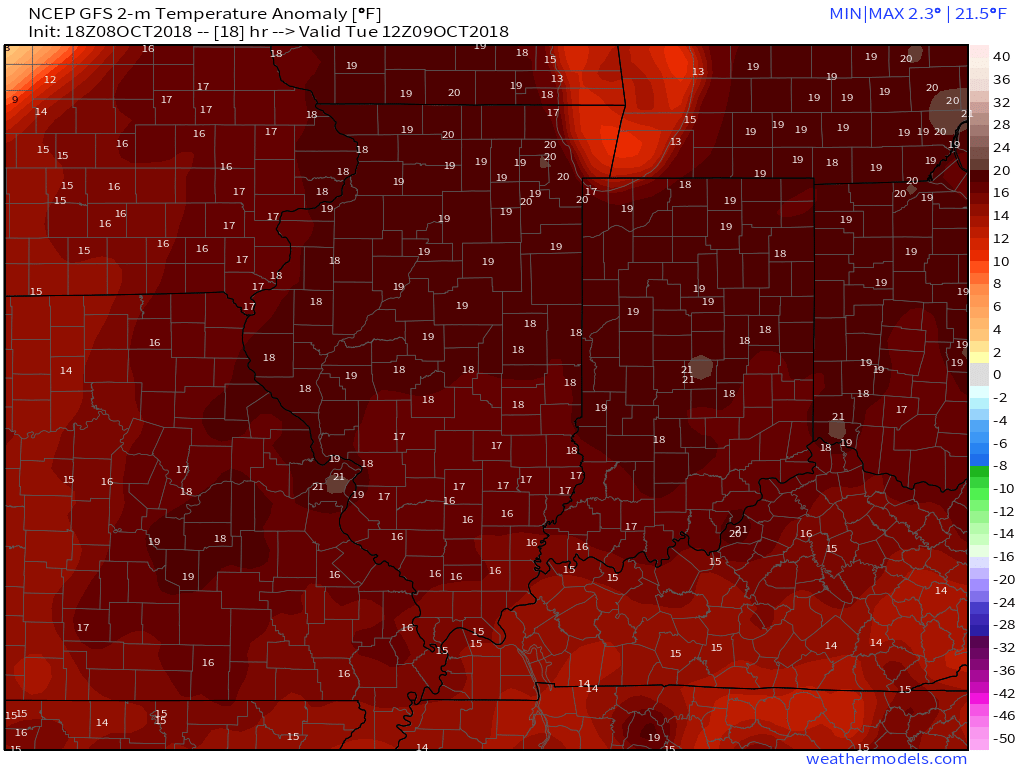 A cold front will sweep through the region Wednesday evening and will lead to a better chance of more concentrated showers and thunderstorms for our hump day. Precipitable water values (PWATs) will approach 2″ Wednesday afternoon which is almost unheard of by October standards. As a result, a couple of the storms may be accompanied by locally heavy rainfall.

 Winds of change will be blowing in earnest Wednesday night and Thursday morning and a legit fall feel will greet us out the door! Most of central Indiana can expect temperatures to be falling into the 40s Thursday morning along with a nice northwest breeze.
 Longer term, a new storm system (including remnant moisture from Sergio) is expected to impact our weekend weather. We’ll trend our forecast wetter with reviewing some of the latest data. Sunday appears to be the wettest day.

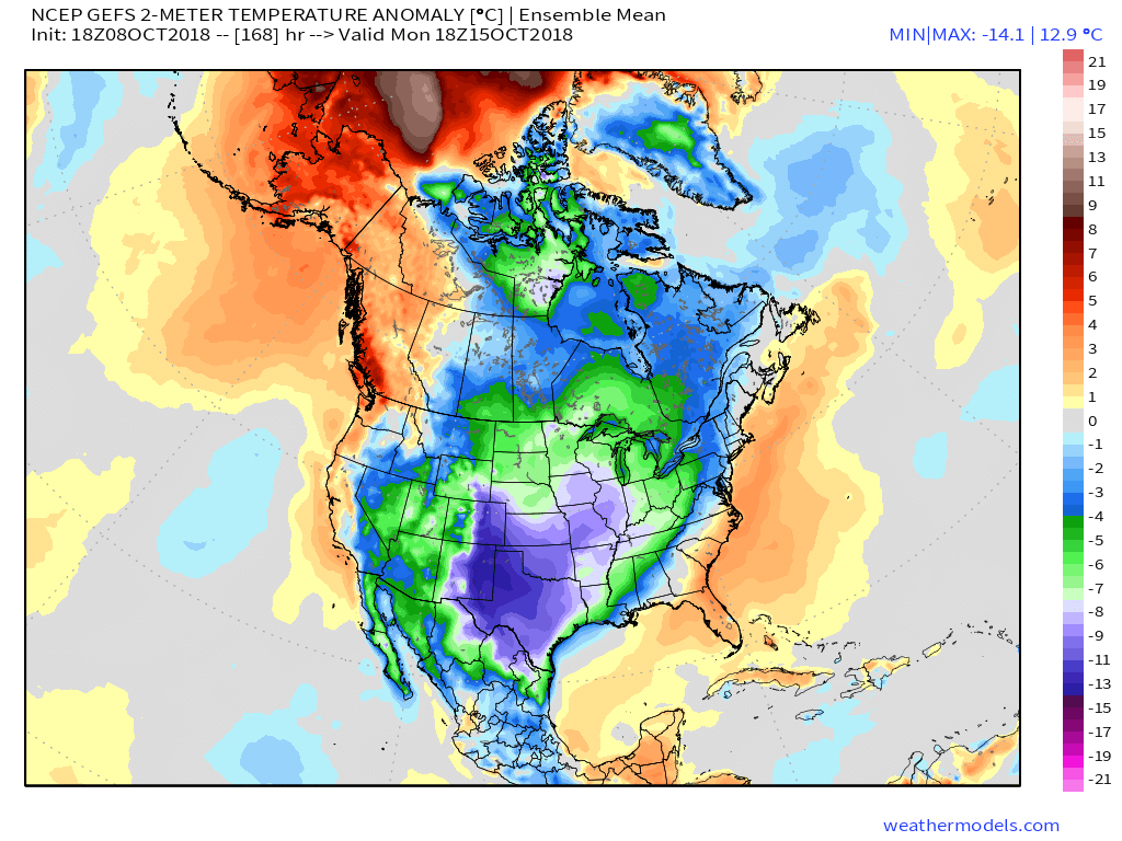
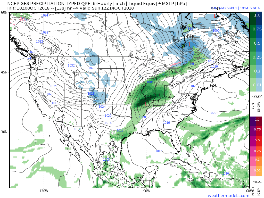 An even more impressive push of fall air will follow on the heels of Sergio’s remnants early next week, including the potential of frost for more of the Ohio Valley, including central Indiana.
You must be logged in to view this content. Click Here to become a member of IndyWX.com for full access. Already a member of IndyWx.com All-Access? Log-in here.
We’re opening the new week with the same old unseasonably warm and muggy weather pattern that was with us the majority of last week, but significant changes loom during the week ahead. Ultimately, summer will be laid to rest (finally) and a legitimate, “stick and hold” fall pattern will take hold. The transition will feature a “game changer” of a midweek cold front that will take us from an August to a November feel in as little as 24 hours. Here are some highlights between now and then:
I. A strong ridge will continue to promote an unseasonably warm and muggy feel by early-October standards. Scattered “splash and dash” storms are possible through the early portion of the week, but organized significant rain isn’t anticipated.
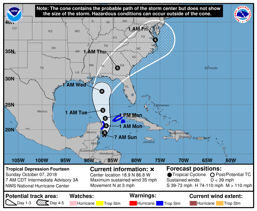
 II. TD 14 will strengthen into Tropical Storm Michael later today and eventually a hurricane before making landfall along the Florida panhandle during the middle of the week. The remnant moisture of Michael will then race northeast and impact the flood-ravaged Carolinas during the latter stages of the work week.
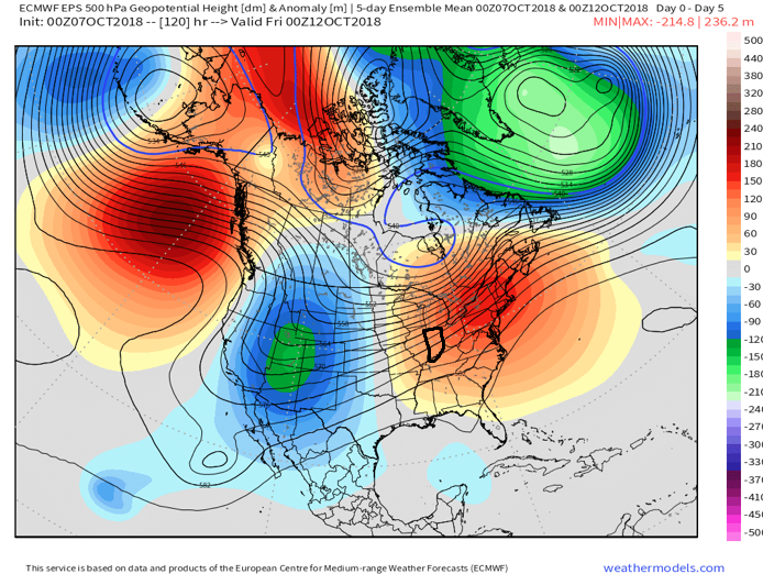
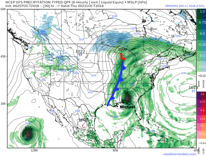
 III. As Michael’s remnant moisture tracks northeast into the Carolinas, a strong cold front will sweep through the Mid West and Ohio Valley. Better chances of organized showers and thunderstorms will arrive ahead of the front Wednesday. Once the front passes, a dramatic wind shift to the northwest will push a MUCH cooler and drier air mass into the region.
 IV. We note the PNA (Pacific North America pattern) is flipping to a positive state and that will drive a more sustained period of colder air during the medium and longer range period- or mid and late October.
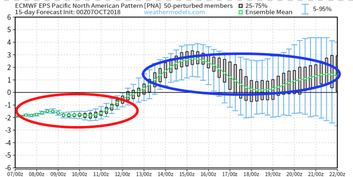
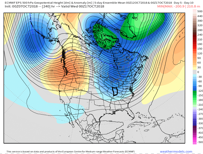
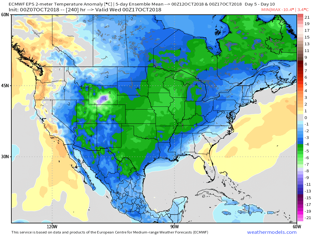 The air will grow cold enough to support the potential of frost during the 5-10 day period on at least a couple of nights. Additionally, reinforcing chilly air may ignite the lake effect to our north and northeast during Week 2… “Times, they are a changing!”
You must be logged in to view this content. Click Here to become a member of IndyWX.com for full access. Already a member of IndyWx.com All-Access? Log-in here.