2019 IndyWx.com Summer Outlook

2019 is absolutely flying by! Before you know it, we’ll be releasing our 2019-2020 Winter Outlook. Kidding- sort of. 😉

Is a blazing hot summer in store for central Indiana, or perhaps wet and cool? Let’s dig in to the details…

As we look at current sea surface temperature anomalies, a few items stand out:

I. We expect a weak El Nino to continue through meteorological summer (June through August), and perhaps even into next winter.

II. MDR (Main Development Region for tropical entities) is running cooler than normal and would suggest an overall “less busy” hurricane season from a long-track perspective

III. SSTs are running much warmer than normal in the Gulf of Mexico and off the East Coast. This is important as while the long-track tropical systems may not be as frequent, we’ll have to remain on guard for the potential of active times closer to home this season. Additionally, these warmer anomalies tend to lead us to believe precipitation will run above normal across coastal areas into the Deep South this summer.

Let’s look at some of the climate computer model data for the summer season:

The latest IRI model (International Research Institute) shows relative warmth along the coastal areas and the west with greatest wet anomalies across the Northwest.

The CFSv2 is leaning towards an anomalously wet summer across a widespread portion of the country (exception being New England).

As we review the CanSIPS, it likes the idea of a cool, wet summer across the Heartland with warmth along the coasts.

The European Seasonal Forecast has a seasonal summer for most of the country with warmth along the coasts, and a reflection of wetter anomalies across the northern Plain into the Northwest.

(The JMA Seasonal hadn’t updated as of this post).

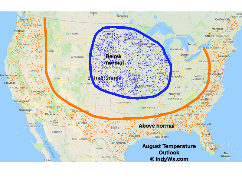
After taking into account the various seasonal model data above (which is in remarkable overall agreement for a LR forecast idea), along with the current SST configuration, and analog data, this is how we see the Summer of 2019 playing out.

Specific to central Indiana, we’re forecasting a rather wet and cooler than average summer. Frequent storm systems should keep things active around these parts for the balance of the summer season, with the temperature scale tipping a touch cooler than normal.

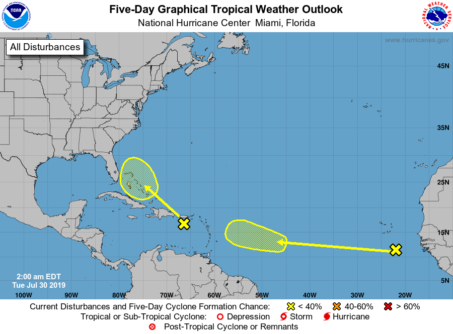
While the number of named storms should be down compared to normal (highlighted by the Euro seasonal precipitation idea), we’ll have to keep close tabs on the Gulf of Mexico and off the Southeast coast for the potential of “last minute” development. Those warmer than normal sea surface temperatures lurking off the coast does warrant concern for at least the threat of another active year from a landfall perspective.

One More Summer-Like Day Before A Big Change…

High pressure and warm southwesterly winds will lead to one more summer-like day before significant changes take place.  Plentiful sunshine can be expected Tuesday with temperatures closer to a record high (88° set in 1939) than the average of 68°.

A cold front will sweep through the region Wednesday evening and will lead to a better chance of more concentrated showers and thunderstorms for our hump day.  Precipitable water values (PWATs) will approach 2″ Wednesday afternoon which is almost unheard of by October standards.  As a result, a couple of the storms may be accompanied by locally heavy rainfall.

Winds of change will be blowing in earnest Wednesday night and Thursday morning and a legit fall feel will greet us out the door!  Most of central Indiana can expect temperatures to be falling into the 40s Thursday morning along with a nice northwest breeze.

Longer term, a new storm system (including remnant moisture from Sergio) is expected to impact our weekend weather.  We’ll trend our forecast wetter with reviewing some of the latest data.  Sunday appears to be the wettest day.

An even more impressive push of fall air will follow on the heels of Sergio’s remnants early next week, including the potential of frost for more of the Ohio Valley, including central Indiana.

Looking At The Week Ahead: Significant Changes To A MUCH Cooler Pattern Loom…

We’re opening the new week with the same old unseasonably warm and muggy weather pattern that was with us the majority of last week, but significant changes loom during the week ahead.  Ultimately, summer will be laid to rest (finally) and a legitimate, “stick and hold” fall pattern will take hold.  The transition will feature a “game changer” of a midweek cold front that will take us from an August to a November feel in as little as 24 hours.  Here are some highlights between now and then:

I. A strong ridge will continue to promote an unseasonably warm and muggy feel by early-October standards. Scattered “splash and dash” storms are possible through the early portion of the week, but organized significant rain isn’t anticipated.

II. TD 14 will strengthen into Tropical Storm Michael later today and eventually a hurricane before making landfall along the Florida panhandle during the middle of the week.  The remnant moisture of Michael will then race northeast and impact the flood-ravaged Carolinas during the latter stages of the work week.

III. As Michael’s remnant moisture tracks northeast into the Carolinas, a strong cold front will sweep through the Mid West and Ohio Valley.  Better chances of organized showers and thunderstorms will arrive ahead of the front Wednesday.  Once the front passes, a dramatic wind shift to the northwest will push a MUCH cooler and drier air mass into the region.

IV. We note the PNA (Pacific North America pattern) is flipping to a positive state and that will drive a more sustained period of colder air during the medium and longer range period- or mid and late October.

The air will grow cold enough to support the potential of frost during the 5-10 day period on at least a couple of nights.  Additionally, reinforcing chilly air may ignite the lake effect to our north and northeast during Week 2…  “Times, they are a changing!”