Updated 08.16.22 @ 8:02p
It’s not very often that these unseasonably cool, pleasant stretches of weather greet us in mid to late August. I’ve heard from many that the recent dip in temperatures (and more notably, humidity levels) has ignited fall fever. (Self included). With that said, we wanted to take a few minutes this evening to lay out our fall and Harvest ’22 forecast.
In simple forms, we’re not expecting drastic changes from the past couple of autumns around these parts (milder than normal, overall). But, as we always say, no one season is identical to another, so there will, undoubtedly, be some challenges we’ll face over the course of the upcoming September through November time period.
A weak La Nina is expected to be in place through meteorological fall (side note: and beyond, however, guidance suggests we very well may be heading for an El Nino starting next summer). We can see this nicely with the latest SST (sea surface temperature) configuration.
We also continue to closely monitor the SST configuration in the north-central PAC and off the Northeast US coast. The dueling warm pools will likely have a say in the pattern as we rumble into late fall and winter.
Given this overall look and factoring in other forcing from analog guidance, one can easily make the argument that meteorological fall should open on a warmer than normal note. We think this will carry into October, as well. The 3rd consecutive Nina has us personally excited for a potential rather significant flip in the regime as we get into mid to late November. Recall, analog data loads the West and Central up with cold in November before spilling east. We’ll want to monitor that potential closely as time goes on.
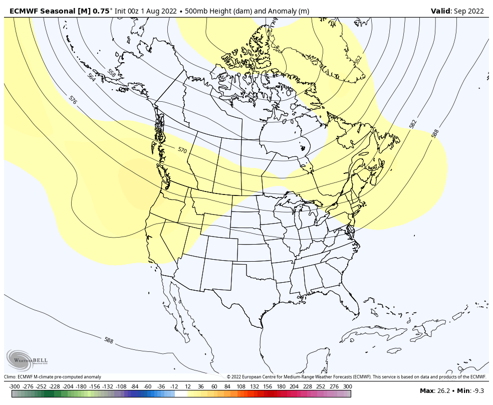
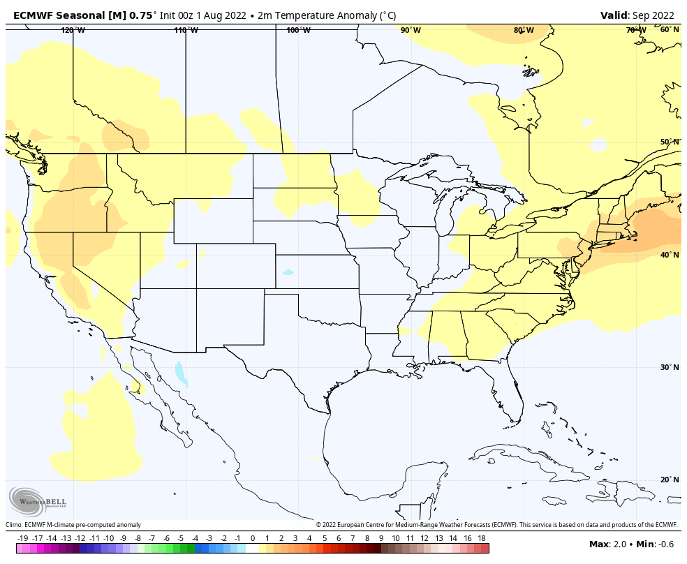
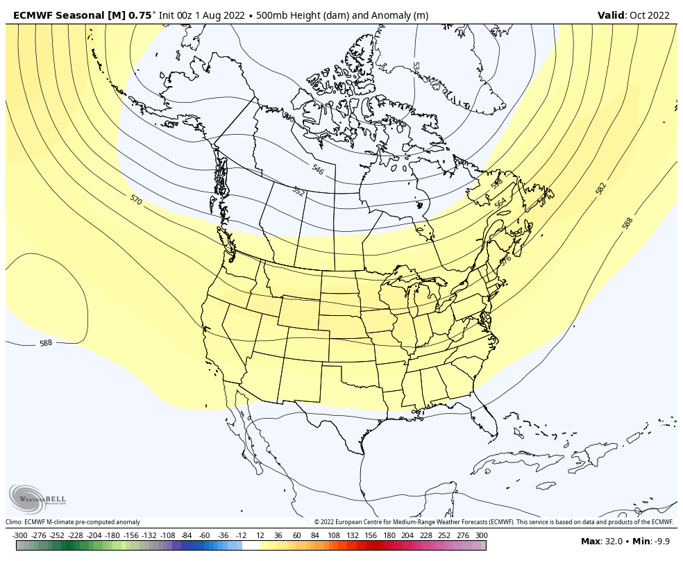
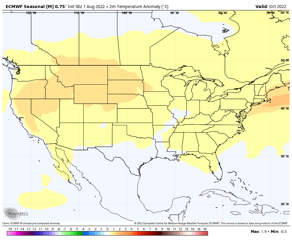
As it is, thinking here is that Sept and Oct balance out slightly warmer than normal, locally. Upper ridging should take up shop across the northern Great Lakes into the Northeast through the better part of the 1st half of fall.
We note that’s what the latest European Seasonal shows:
September 500mb pattern
September Surface Temperature Anomalies (C)
October 500mb pattern
October Surface Temperature Anomalies (C)
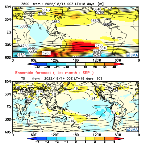
The JMA Seasonal guidance backs up the European idea above
September
October
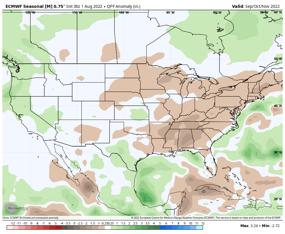
The thought here is that precipitation should run slightly to moderately below normal during the bulk of met. fall, as a whole. A lot of this has to do with the expected persistent upper ridging. As always, should tropical remnants find themselves up this way, that can wreck havoc on the seasonal precipitation forecast.
Both the Euro seasonal and JMA show this drier regime, locally:
We shall see if our colder thinking comes to fruition as we get towards the latter part of November and certainly have our early idea put to the test as we flip the calendar to December. The research never stops…
Understanding the “wild card” is November, we’ll go with meteorological fall running 2° to 3° above average, locally. Rainfall will likely be 85% of average unless tropical remnants can make it up this way.
In the meantime, happy fall, y’all!