A weak weather system will zip across the southern half of the state during the overnight into Monday morning. This will toss moisture into central Indiana towards midnight, continuing into the morning rush before scooting off to the east well before lunchtime. While this won’t be a big event, air will be just cold enough to allow the northern periphery of moisture to transition to wet snow after midnight into the predawn hours.

Areas along and just north of the I-70 corridor stand the best shot of awaking to a slushy wet snow of a dusting to around 1″.
Dry conditions quickly return during the mid to late morning hours and then we await cold air reinforcements and associated light snow showers Tuesday morning.
Winter’s off to a fast start, heh? Speaking of that, our annual Winter Outlook will be posted Black Friday. Here’s a hint, you may want to put a snow shovel/ blower on the shopping list this year…
 II. As we look ahead, our next weather system will scoot into the region over the weekend. This will be a weak event and we only expect a light mixture of snow and rain Saturday evening.
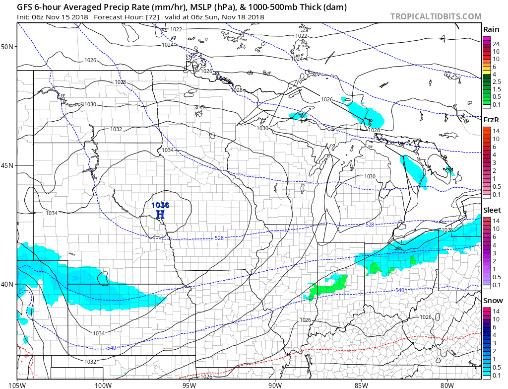 III. The balance of Thanksgiving week looks rather quiet, but chilly, thanks to high pressure. The stretch of below to well below normal temperatures will continue, overall.
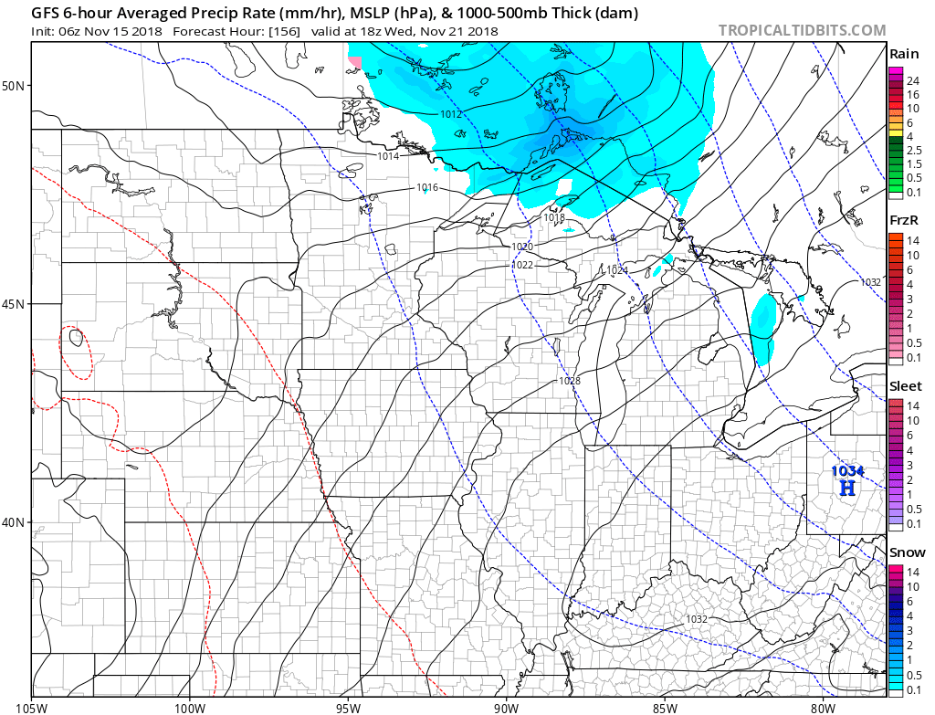
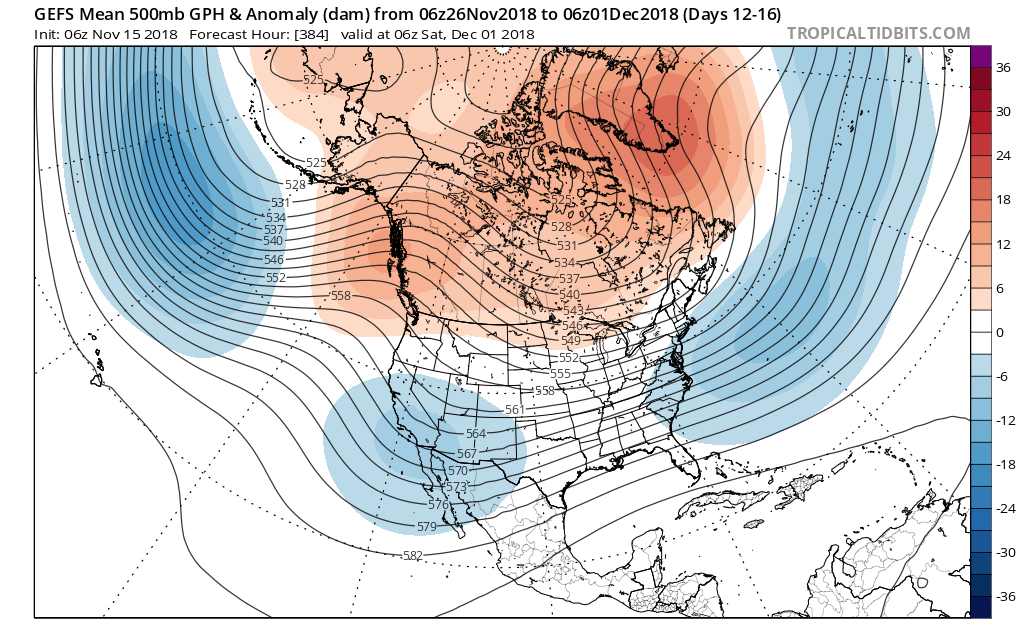
 IV. As we look ahead, the pattern sure looks cold and stormy as we open December. On that note, the majority of data continues to trend colder for the month of December, as a whole, and with high latitude blocking in place, we’d expect to see an active storm track across the country. If you like it cold and active for the holidays, you just might be in luck this year… More on that later!