Category: Thanksgiving

January In November…

Updated 11.13.22 @ 8a

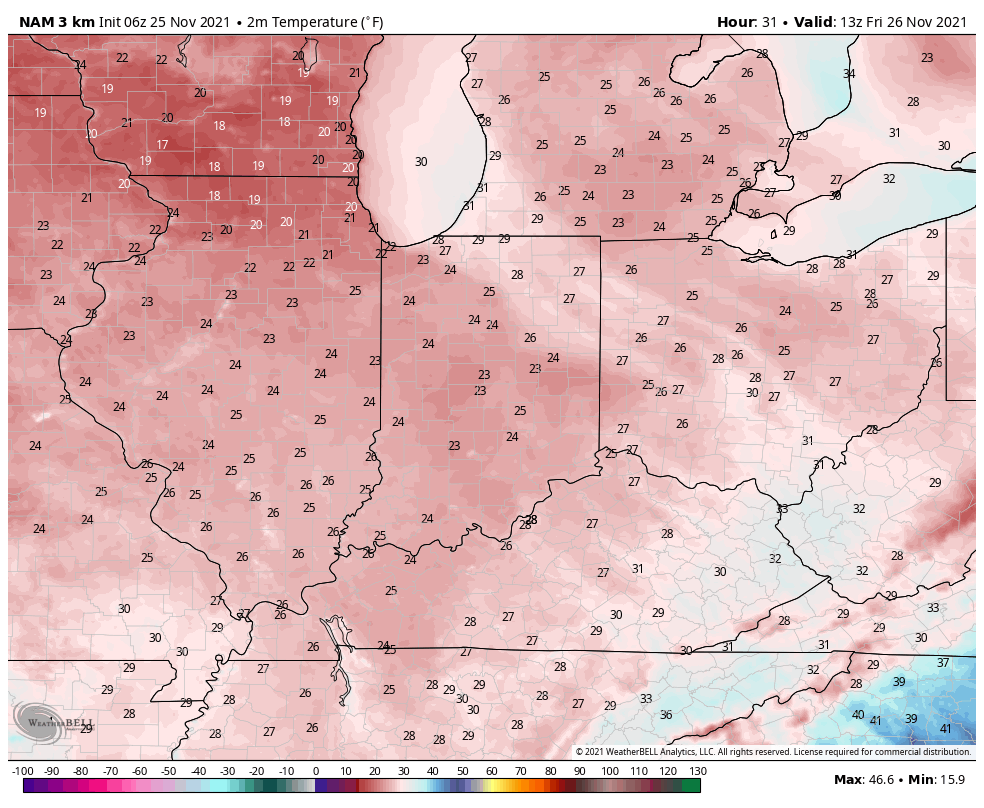
After a record snowfall Saturday, we’re left with a dry and unseasonably cold start to the new week. Quick tip: we suggest getting accustomed to the cold as it’s not going anywhere fast.

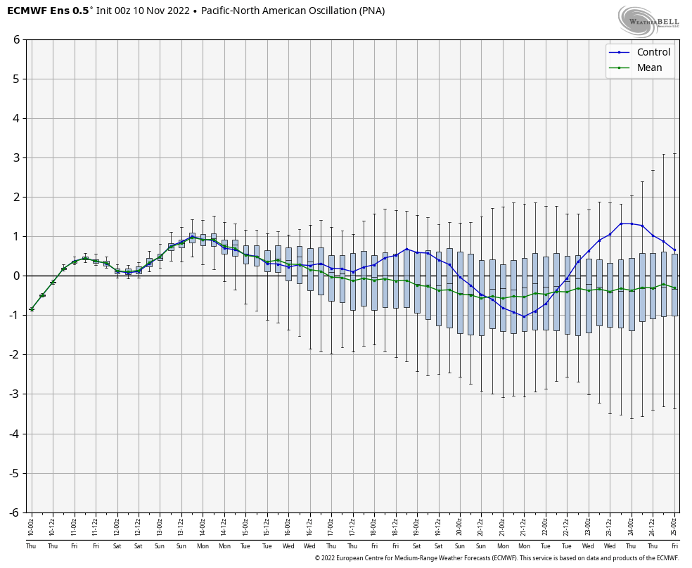
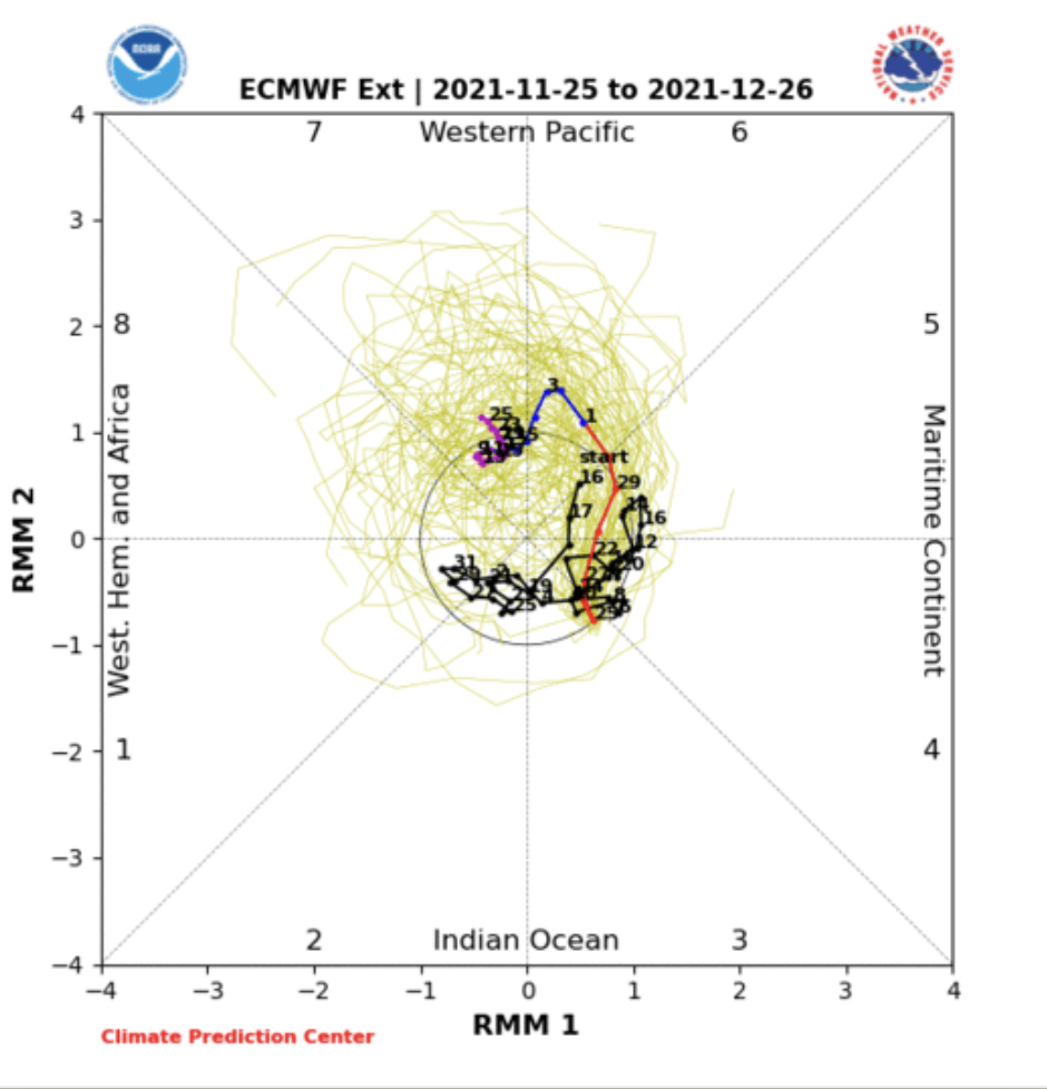
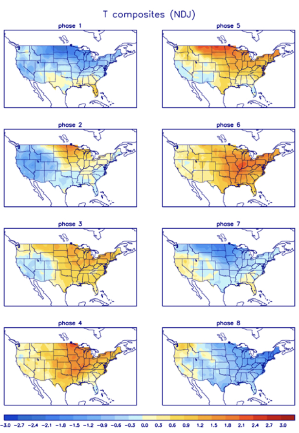
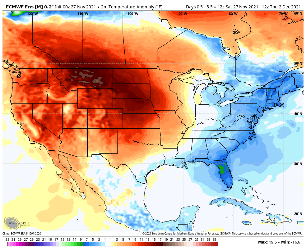
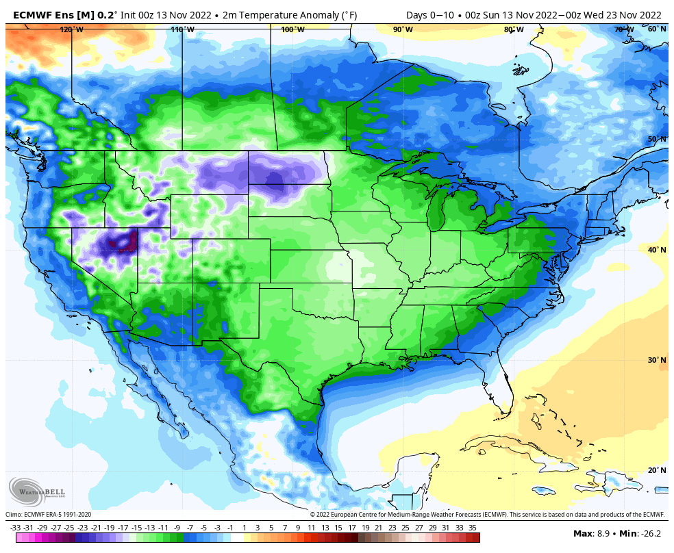
Note how the ensemble guidance below keeps well below normal temperatures locked in over the upcoming couple weeks.

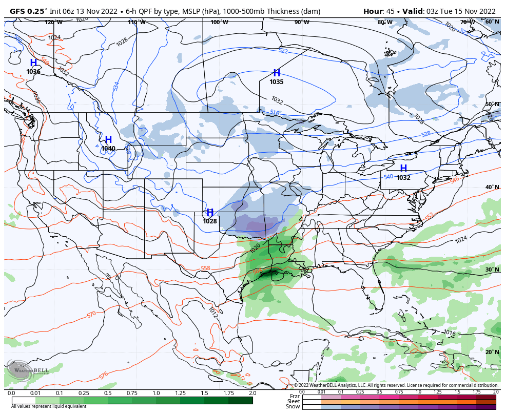
Our next storm system will approach quickly. Low pressure will track out of the southern Plains into the lower Ohio Valley Tuesday. This will allow precipitation to overspread the region from southwest to northeast early Tuesday morning (likely before sunrise for most). With the unseasonably cold air in place, most, if not all, of this precipitation should take the form of light snow. Additional light accumulation of snow is a good bet for Indiana, including southern portions of the state, Tuesday.

Behind this system, reinforcing cold air will pour southeast midweek with wrap around snow showers along with a gusty northwest breeze. Temperatures will likely be hard pressed even to make it above freezing by late next week and early Thanksgiving week, including overnight lows deep into the 10s.

Permanent link to this article: https://indywx.com/january-in-november/

Long Range Outlook: Jab, Jab, Boom?

Updated 11.10.22 @ 9:18a

After a warm open to November, things are progressing to plan as our much anticipated mid month shift to cold takes place.

A quick glance at the teleconnections over the course of the next couple weeks (remember, we still lean heaviest on the PNA and EPO at this time of the year) reveals agreement in the short term of the cold shift but note movement back towards neutral towards the end of the period.

While this may give reason for panic to some, we note the MJO scheduled to move out of Phase 8 (currently), whip across the “null” phase before moving into textbook phases for eastern cold for late November (Phases 5-6).

The analogs for such phases this time of year will make winter weather fans salivate.

Despite this setup laid out above, the new JMA Weeklies want none of my idea of a cold start to December. Despite the chilly look Weeks 1-2, the model rolls right into an eastern ridge by early December. It’s safe to say as of now, I remain in the cold camp, especially given what the MJO amplitude should provide as we rumble into the last month of the year. Nonetheless, it’s less than ideal to see a normally trusted model in such disagreement and we’ll have to keep an eye on trends over the course of the next couple weeks…


Perhaps the model is seeing a transitional move through Phase 7? That would allow a milder pattern in briefly, but again I would reiterate the look of what should be an amplified MJO as we move into December and a jaunt through Phase 8, 1, and 2 is likely in my opinion. Just for fun, this is what those phases provide.

One way or another, we have a lot of work (and fun) ahead. My hunch tells me any long range (what would currently be Week 4 in particular) data will be forced to cool, and perhaps significantly so, as time draws closer.

In the meantime, don’t sleep on next week. There should be at least one attempt for some sort of winter weather maker into the Ohio Valley, if not two.

Permanent link to this article: https://indywx.com/long-range-outlook-jab-jab-boom/

LR Update: Alignment For A Wintry Stretch Through The Holiday Season?

Updated 11.03.22 @ 9:43

You must be logged in to view this content. Click Here to become a member of IndyWX.com for full access.  Already a member of IndyWx.com All-Access?  Log-in here.

Permanent link to this article: https://indywx.com/lr-update-alignment-for-a-wintry-stretch-through-the-holiday-season/

Long Range Rambles On Iron Bowl Saturday…

Updated 11.27.21 @ 5:56a

The theme of the better part of the autumn season has been a story of contradicting signals- teleconnections and MJO alike. When we look ahead to the beginning of meteorological winter (Dec. 1st), it sure appears that will continue to be the story. For a brief moment the East Pacific Oscillation (EPO) tries to go negative. This is interesting in and of itself as only a couple days ago the EPO was forecast positive during this period.

Meanwhile, the PNA is forecast negative to open the month.

The “wildcard” in this entire December outcome has to do with the MJO. If (still a big if) we can get things to amplify, then a whip around the historically December cold phases (7, 8, and 1) appear in order.

If the MJO doesn’t get in the game, the pattern, at best, will be one of continued transition (colder and warmer than normal periods) and that’s what the majority of ensemble guidance currently shows. Without a favorable MJO, it’s tough to see how meaningful, more sustained arctic air can get into the mix, locally.

As far as storm systems of note, we’re in an incredibly quiet period and that looks to continue through the upcoming 5-6 days. We’ll keep eyes to our north where weak systems will zip by in the fast flow aloft, but most, if not all, of these should remain to our north and east. It’s not until early next weekend (looks like Friday or early Saturday as of now) when our next system of more significance is slated to impact the area.

War Eagle and happy Iron Bowl Saturday! 😀

Permanent link to this article: https://indywx.com/long-range-rambles-on-iron-bowl-saturday/

Rain Moves Out; Much Colder Air Arrives…

Updated 11.25.21 @ 6:53a

Our Thanksgiving morning is off to a wet start but the rain won’t last all day. A cold front will push across the state this afternoon (arriving into Indianapolis around noon) putting an end to the rain and allowing much colder air to blow in. Before that takes place, anywhere from 0.25” – 0.50” of rain is expected through the morning hours.

The airmass will grow cold enough by evening to allow snow showers and squalls to fire up off Lake Michigan and track into north and east central parts of the state (not expecting any significant accumulation).

Black Friday will feature a return of dry and sunny conditions but it’ll be cold. A gusty northwest wind will mean you’ll want to grab the heavier coat out the door as temperatures that start out in the lower 20s won’t rise out of the 30s Friday afternoon.

The upcoming week will showcase a series of storm systems zipping by across the northern tier but most, if not all, of those systems will remain north of our immediate area. A generally quiet week of weather is forecast for now, once we get the upcoming 12-24 hours behind us.

From our family to yours, have a safe, happy, and blessed Thanksgiving.

Permanent link to this article: https://indywx.com/rain-moves-out-much-colder-air-arrives/