You must be logged in to view this content. Click Here to become a member of IndyWX.com for full access. Already a member of IndyWx.com All-Access? Log-in here.
Category: Thanksgiving
Permanent link to this article: https://indywx.com/2018/11/18/looking-at-the-thanksgiving-week-forecast-and-on-towards-early-december/
Nov 16
Weak Weekend System; Dry Stretch For Thanksgiving…
You must be logged in to view this content. Click Here to become a member of IndyWX.com for full access. Already a member of IndyWx.com All-Access? Log-in here.
Permanent link to this article: https://indywx.com/2018/11/16/weak-weekend-system-dry-stretch-for-thanksgiving/
Nov 15
Waking Up To An Ice Storm And Looking At The Rest Of The Month…
I. A mixture of sleet and freezing rain transitioned mostly to freezing rain during the overnight and many across central Indiana are waking up to a significant “glaze” this morning (.2″ to .3″). Power outages are growing and travel is tricky in spots. If you don’t have to travel, please remain indoors.
After a “lull” in the precipitation, a burst of light snow will develop this afternoon into the early evening hours before dry conditions return tonight.
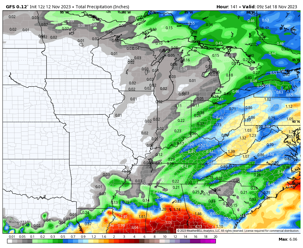
II. As we look ahead, our next weather system will scoot into the region over the weekend. This will be a weak event and we only expect a light mixture of snow and rain Saturday evening.
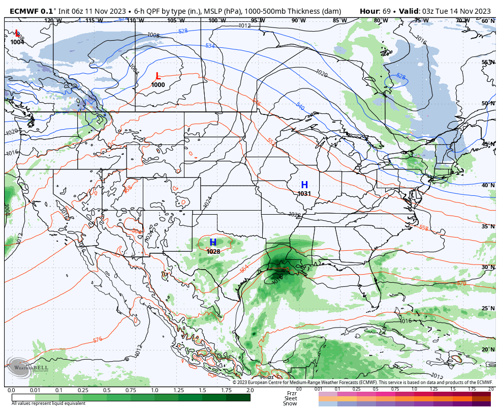
III. The balance of Thanksgiving week looks rather quiet, but chilly, thanks to high pressure. The stretch of below to well below normal temperatures will continue, overall.
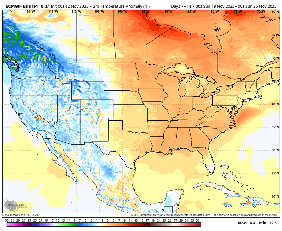
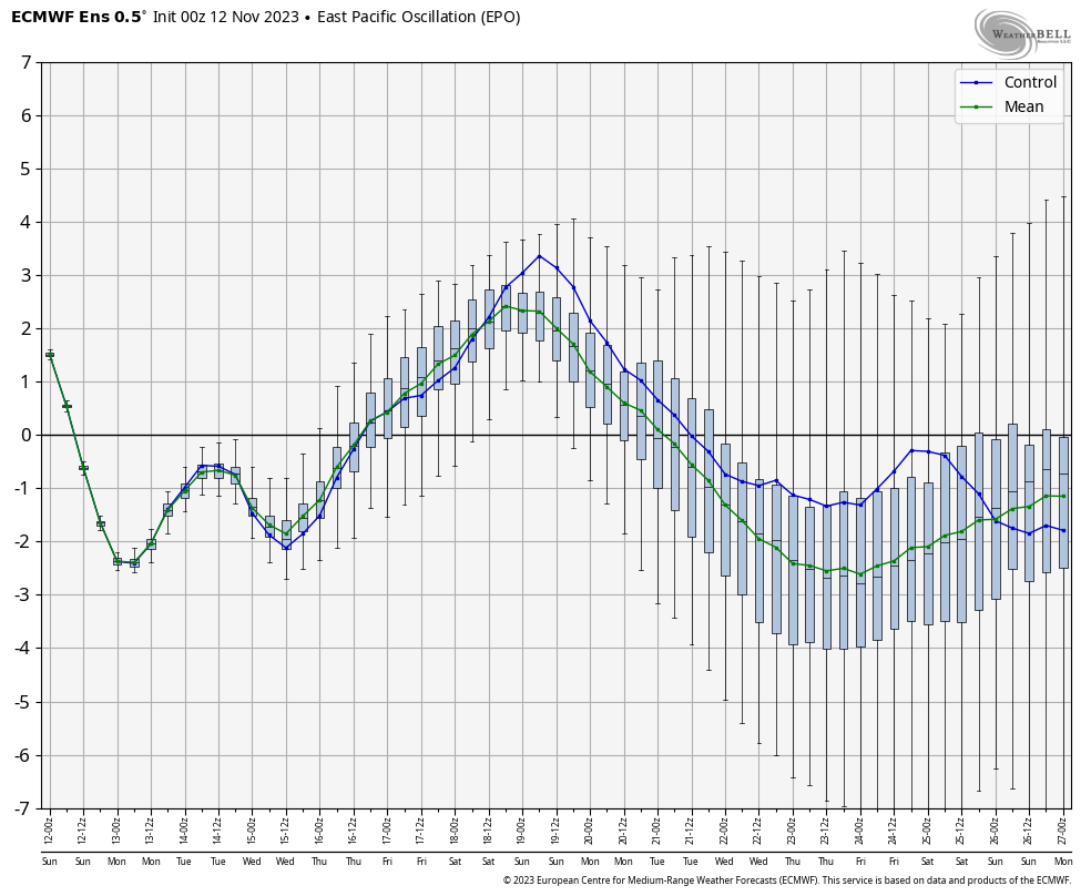
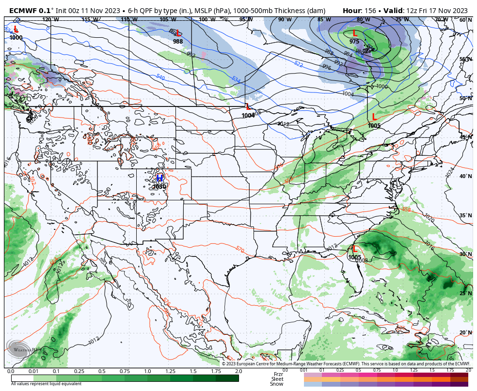
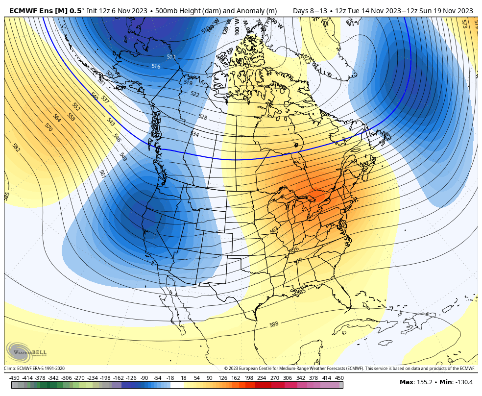
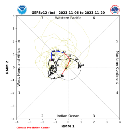
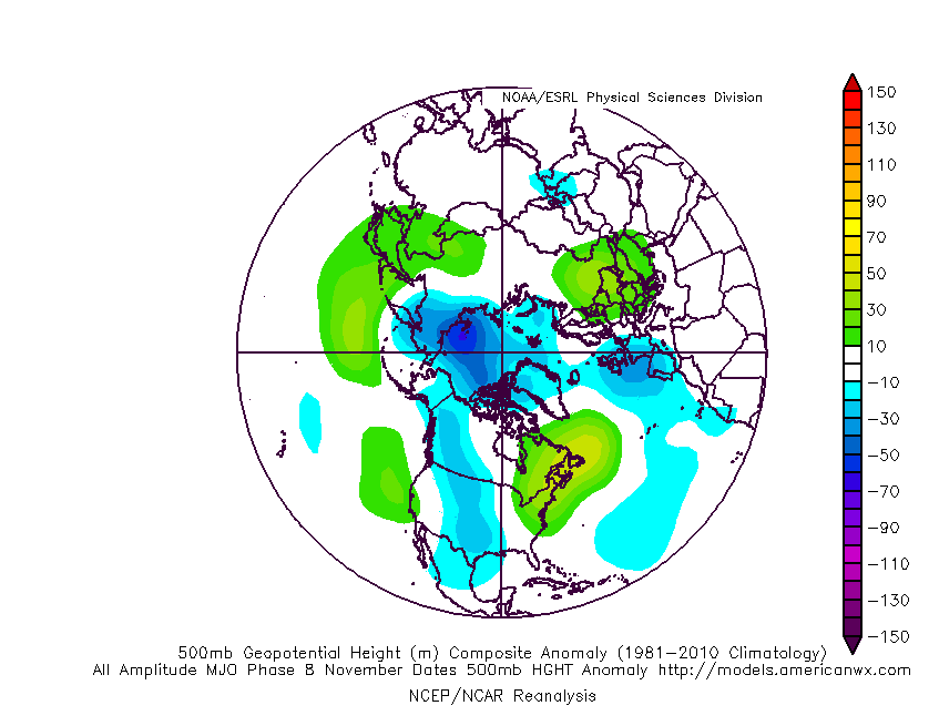
IV. As we look ahead, the pattern sure looks cold and stormy as we open December. On that note, the majority of data continues to trend colder for the month of December, as a whole, and with high latitude blocking in place, we’d expect to see an active storm track across the country. If you like it cold and active for the holidays, you just might be in luck this year… More on that later!
Permanent link to this article: https://indywx.com/2018/11/15/waking-up-to-an-ice-storm-and-looking-at-the-rest-of-the-month/
Nov 13
Complex Thursday Event; Looking Ahead To Thanksgiving Week…
A complicated storm system will result in a mixed bag of precipitation for some and mostly wet snow for others Thursday. We need another 24 hours to “firm up” the…
You must be logged in to view this content. Click Here to become a member of IndyWX.com for full access. Already a member of IndyWx.com All-Access? Log-in here.
Permanent link to this article: https://indywx.com/2018/11/13/complex-thursday-event-looking-ahead-to-thanksgiving-week/
Nov 10
Bitter Saturday By November Standards; Looking At Snow Chances Early Next Week…
You must be logged in to view this content. Click Here to become a member of IndyWX.com for full access. Already a member of IndyWx.com All-Access? Log-in here.
Permanent link to this article: https://indywx.com/2018/11/10/bitter-saturday-by-november-standards-looking-at-snow-chances-early-next-week/
Nov 05
Milder Period Late Month? Perhaps, But Cold Is The Story Now…
You must be logged in to view this content. Click Here to become a member of IndyWX.com for full access. Already a member of IndyWx.com All-Access? Log-in here.
Permanent link to this article: https://indywx.com/2018/11/05/milder-period-late-month-perhaps-but-cold-is-the-story-now/
Nov 23
VIDEO: Happy Thanksgiving; Early December Chatter…
First and foremost, from our family to yours, we wish you a blessed Thanksgiving. Enjoy the day with loved ones, eat a ton, and ensure you get a little football…
You must be logged in to view this content. Click Here to become a member of IndyWX.com for full access. Already a member of IndyWx.com All-Access? Log-in here.
Permanent link to this article: https://indywx.com/2017/11/23/video-happy-thanksgiving-early-december-chatter/
Nov 21
Mostly Tranquil…
Highlights:
- Colder than normal, but dry
- Windy, but mostly dry this weekend
- Moderating ahead of the next storm
Dry For The Big Travel Day…A cold front is passing through the state as we type this forecast with a light band of moisture (light rain ending as light snow). This will serve up cold, but dry conditions for the big travel day, and continued dry conditions Thanksgiving Day. “Average” temperatures Thanksgiving feature lows around 30° and highs in the middle 40s, and we’ll be pretty close to those values. Black Friday will feature dry, but increasingly breezy conditions.
Thankfully, weather conditions will be tranquil for “Iron Bowl Saturday” (WARRRR EAGLE)!!! With the exception of an early shower, look for dry conditions along with a shifting breeze that will help push colder air in for the second half of the weekend.
Those chilly conditions won’t last long as we get into an increasingly gusty southwesterly flow and milder conditions next week ahead of the next approaching storm system…
Upcoming 7-Day Precipitation Forecast:
- Snowfall: Trace
- Rainfall: 0.10″
Permanent link to this article: https://indywx.com/2017/11/21/mostly-tranquil/
Nov 20
Extended Stretch Of Unusually Quiet Weather…
High pressure will remain in control of our weather as we open the short Thanksgiving week. This will supply plentiful sunshine today, along with an increasingly gusty southwest wind by this afternoon (30 MPH). A cold start (most in the middle 20s) will moderate to near seasonal norms by this afternoon (upper 40s to around 50).
Reinforcing chilly air will blow into town Tuesday night. Ahead of this, weak moisture return will lead to a few showers Tuesday afternoon. Winds will shift to the northwest Tuesday night and help push a colder air mass into the state. This colder than average theme will continue for Thanksgiving Day, itself. Highs in the lower 40s Wednesday and Thursday can be expected with lows in the middle to upper 20s. Dry weather will quickly return Wednesday and Thursday.
Finally, another weak weather maker will approach late Black Friday into the holiday weekend. This cold front will be enough to generate showers Saturday and will help push another shot of chill into the area as we close the weekend. Similar to Tuesday afternoon’s rain, amounts will be very light. In fact, total rainfall with both systems should fall in the 0.10″-0.25″ range.
Permanent link to this article: https://indywx.com/2017/11/20/extended-stretch-of-unusually-quiet-weather/
Nov 17
Weekend Of Changes: Storms To Snow…
Highlights:
- Big changes this weekend
- Relatively calm Thanksgiving week
- Chilly Thanksgiving
Storms To Snow This Weekend…An approaching storm system will lead to an active open to the weekend. Beforehand, thankfully, we’ll close the work week out on a rather quiet note. The daytime hours will remain dry before moisture begins to return this evening. An initial round of showers will move across central Indiana (thinking between 8p-9p) before steadier and heavier rain and embedded thunderstorms blow into town Saturday. A strengthening surface low will move from the central Plains tonight and into the southern Great Lakes Saturday. This will lead to a briefly milder surge of air Saturday morning into the early afternoon before a cold front sweeps through the state and leads to a sharply colder close to the day. Right ahead of the cold front, a skinny, but potentially intense, line of thunderstorms will track across central Indiana late Saturday morning into early Saturday afternoon. Damaging wind gusts are possible as this thin line of storms advances across central and southern Indiana. Winds will then shift around to the northwest and help drive much colder air into the region through the afternoon and evening. In fact, we’ll turn cold enough to allow precipitation to end as a touch of wet snow Saturday evening.
We’ll wrap up the weekend and kick off Thanksgiving week on a much calmer note. Chilly high pressure will build in Sunday, allowing sunshine to return, but temperatures will run around 15° below normal. A dry cold front will pass through the state Tuesday. With the exception of a wind shift and a few more clouds we really shouldn’t expect much more in the way of “excitement.” This will allow unseasonably cool air to return for Thanksgiving, itself.
Upcoming 7-Day Precipitation Forecast:
- Snowfall: Trace – Dusting
- Rainfall: 1.00″ – 1.50″
Permanent link to this article: https://indywx.com/2017/11/17/weekend-of-changes-storms-to-snow/