Updated 03.21.24 @ 7a The area will receive a glancing blow from our late week low pressure “tag team” that will deliver light rain Friday (most areas will be under…
You must be logged in to view this content. Click Here to become a member of IndyWX.com for full access. Already a member of IndyWx.com All-Access? Log-in here.
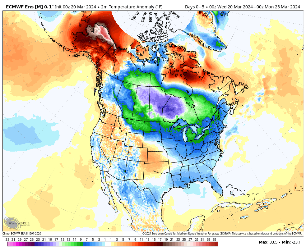
Up until this week, March was off to a toasty start. Despite the recent transition to cooler air, the month is still running nearly 9° above normal.
Another surge of chilly weather will descend into the state today. A hard freeze is dialed up Thursday morning.
Light rain Friday will interrupt the otherwise dry, quiet pattern we’ve been enjoying.
This will be a nuisance variety type of rain, along with “raw” conditions to close the work week. Despite the insignificant showers, this does signal another transition towards a wetter, more active pattern ahead next week.
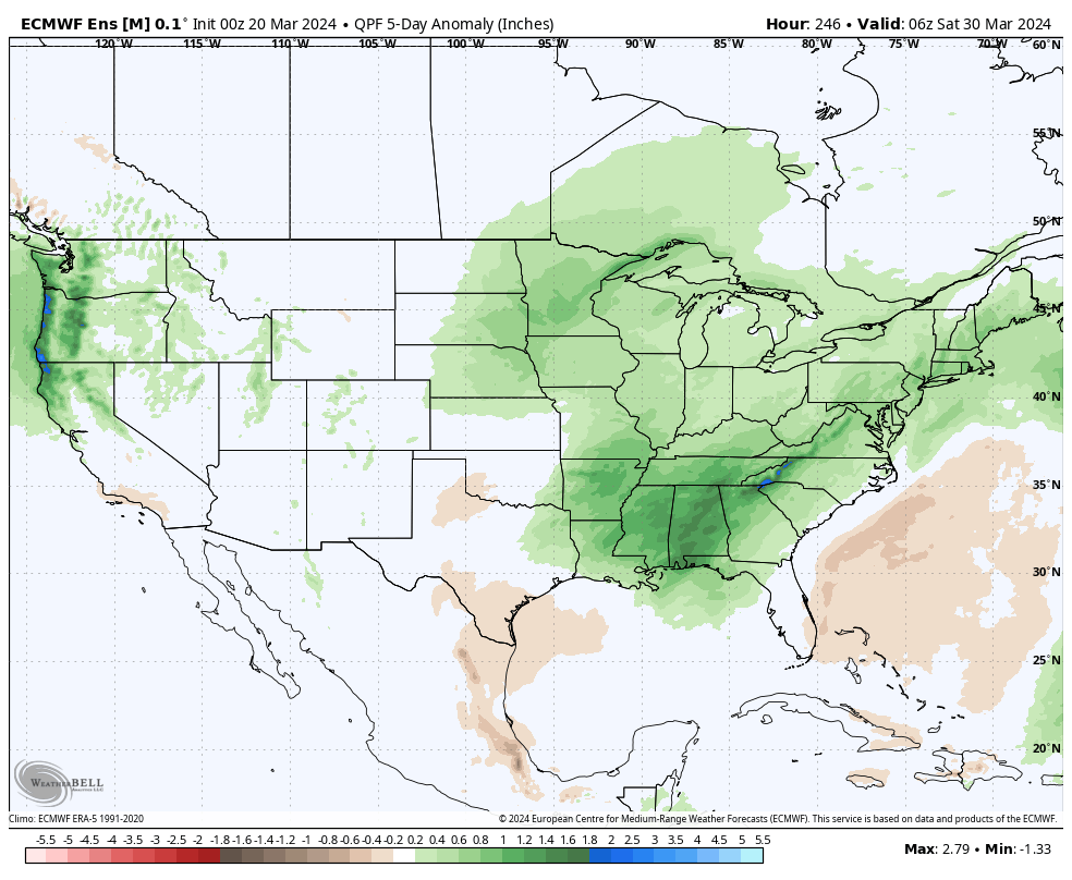
We continue to watch the threat of a heavier rain/ stronger storm event Monday night into Tuesday followed by another soaker late week.
A more active pattern can be expected as we close the month of March.
While the pattern does look cooler than we started the month, I still don’t see any reason to beat the drum for out of season, “harsh” cold some other sources are signaling as we go through the next couple weeks- at least not for our neck of the woods.
Updated 03.19.24 @ 5:34a It’s a cold start to the day across central IN, but this time of year, especially with enough sunshine, we can warm-up nicely. That’ll be the…
You must be logged in to view this content. Click Here to become a member of IndyWX.com for full access. Already a member of IndyWx.com All-Access? Log-in here.
Permanent link to this article: https://indywx.com/video-turning-gusty-later-today-damp-close-to-the-work-week-and-looking-ahead-to-a-chance-of-severe-weather-early-next-week/
Updated 03.17.24 @ 8:10a The theme for the bulk of the week ahead will be both cooler and drier. A few mornings will feature a hard freeze, including overnight lows…
You must be logged in to view this content. Click Here to become a member of IndyWX.com for full access. Already a member of IndyWx.com All-Access? Log-in here.
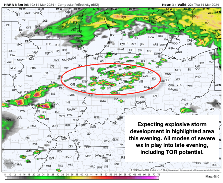
Wind: Potential of straight line winds in excess of 60 MPH
Temperatures: Lower 70s falling into the 40s after midnight
Summary: While all is quiet on the radar as we type this, things will change quickly through the next hour, or so. We anticipate storms to initialize across the region around 6p and quickly intensify. Downstream radar and satellite trends pose a concerning look this afternoon, including several super cells and this activity is expected to expand into central IN through the evening. All modes of severe weather are possible, including large hail, damaging winds, and a few tornadoes. Please heed all warnings and have your severe weather safety plan activated through the evening. Thankfully, we still anticipate rapidly improving conditions north to south towards 11p to midnight.