Catching Up On A Tuesday Morning!
Good morning and happy Tuesday! We’re looking forward to a beautiful, and warm, few days ahead before unsettled conditions return by late week. The video covers those details below.
Monday’s highs displayed quite the spread across the state- ranging from near 90 down state to the upper 50s across far northeastern Indiana. Here across central Indiana, many enjoyed upper 60s to near 70 on Monday. (Click on the image to enlarge).

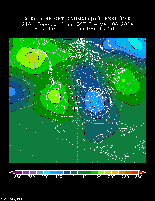
Despite the surge of warmth coming mid week, and likely again early next week, the overall theme is one that’s cooler than normal for mid May. Note the strong trough developing over the Great Lakes and Ohio Valley.
Video discussing today’s forecast and looking ahead to the weekend and beyond:
