
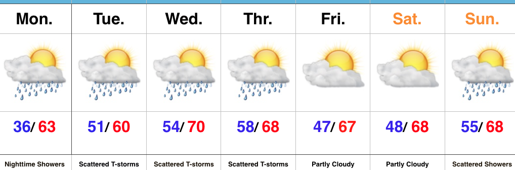
Central Indiana was blessed with a very pleasant start to the work week (despite that frosty open to the day), with plentiful sunshine and highs in the lower to middle 60s. Unfortunately, the pleasant weather won’t hold, as changes are in the offing as early as the overnight period. We’ll enter a rather challenging northwest flow regime over the next couple of days and periods of showers and thunderstorms will ride in a northwest to southeast fashion from time to time.
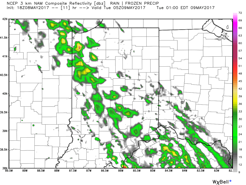
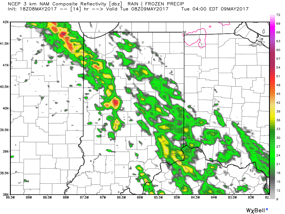
We believe greatest coverage of thunderstorms will ride into north-central Indiana during the overnight period, and bracket an arrival between midnight and 1a, with heavier rain and embedded thunderstorms increasing in overall coverage from 3a-4a.
Here are a couple images of what the radar may look like overnight: 1a and 4a.
 Showers and thunderstorms will continue to impact the central portion of the state through the rush hour before storms diminish and give way to dry time early Tuesday afternoon.
Another batch of showers and thunderstorms may fire during the prime heating hours Tuesday evening and impact areas from mainly Indianapolis and points south.
 Unsettled weather will continue as we push through midweek, including another round of showers and thunderstorms late Wednesday into Thursday (likely following a similar path to what tonight’s storms take).
While we’re confident on the overall setup, details with regard to timing and rainfall amounts are much less certain in this fast-moving northwest flow aloft. There will likely be some neighborhoods that receive between 1″-2″ of rain between Tuesday morning and Thursday morning, while other neighborhoods receive an 1″, or less. It would appear heaviest rainfall totals will paint themselves in a thin line from northwest Indiana, through central Indiana, including Indianapolis, and on into far southeastern portions of the state.
 Highlights:
 Highlights:
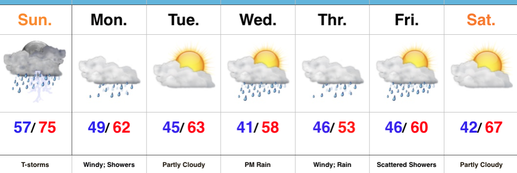 Highlights:
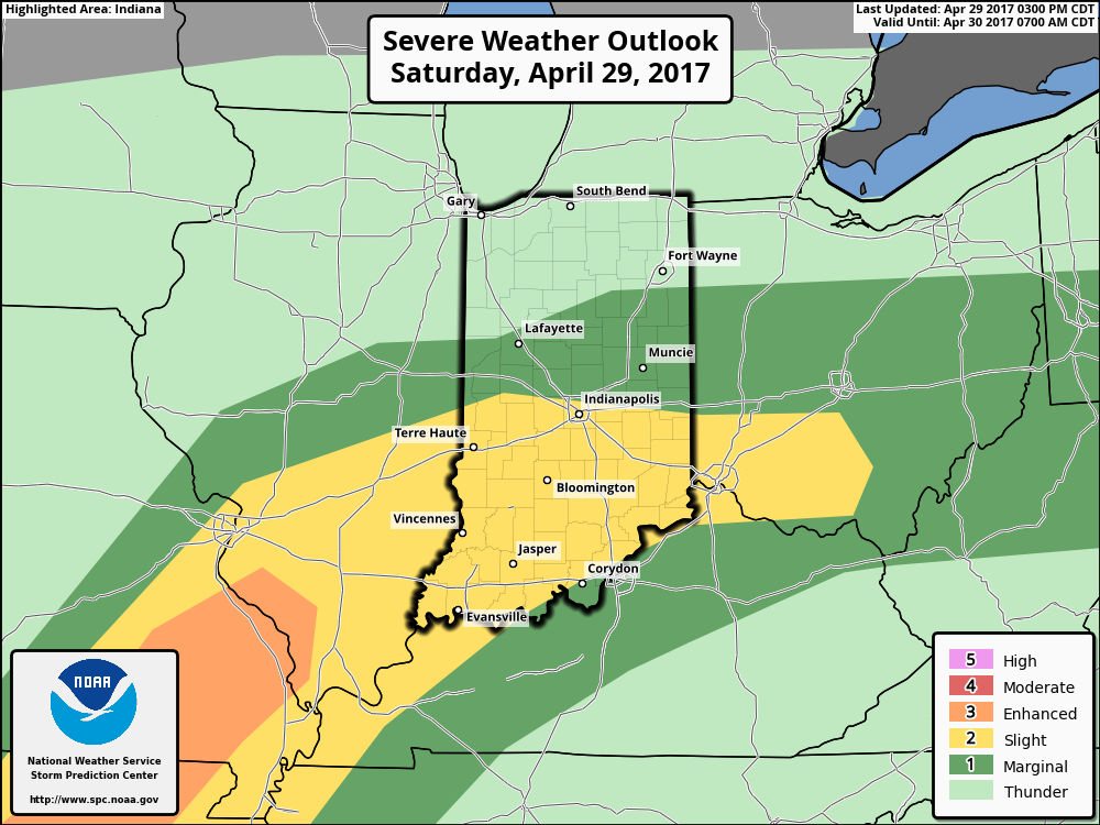 We think an eastward-advancing line of thunderstorms will blow into central Indiana later this evening (between 9p and midnight). Some of these may reach strong to severe levels with damaging straight line winds of greatest concern. Additionally, torrential downpours will occur within this line of storms.