Whole Lot Of Weather Going On…
There’s sure no shortage of active weather, and unfortunately (or fortunately- depending on your perspective), there’s no letup in sight. As we look ahead, we see a fascinating battle of heavyweights set to duke it out for control of our mid and late February pattern. Before we get into some of the longer range model updates, let’s focus on the short and medium term challenges.
Heavy Rain
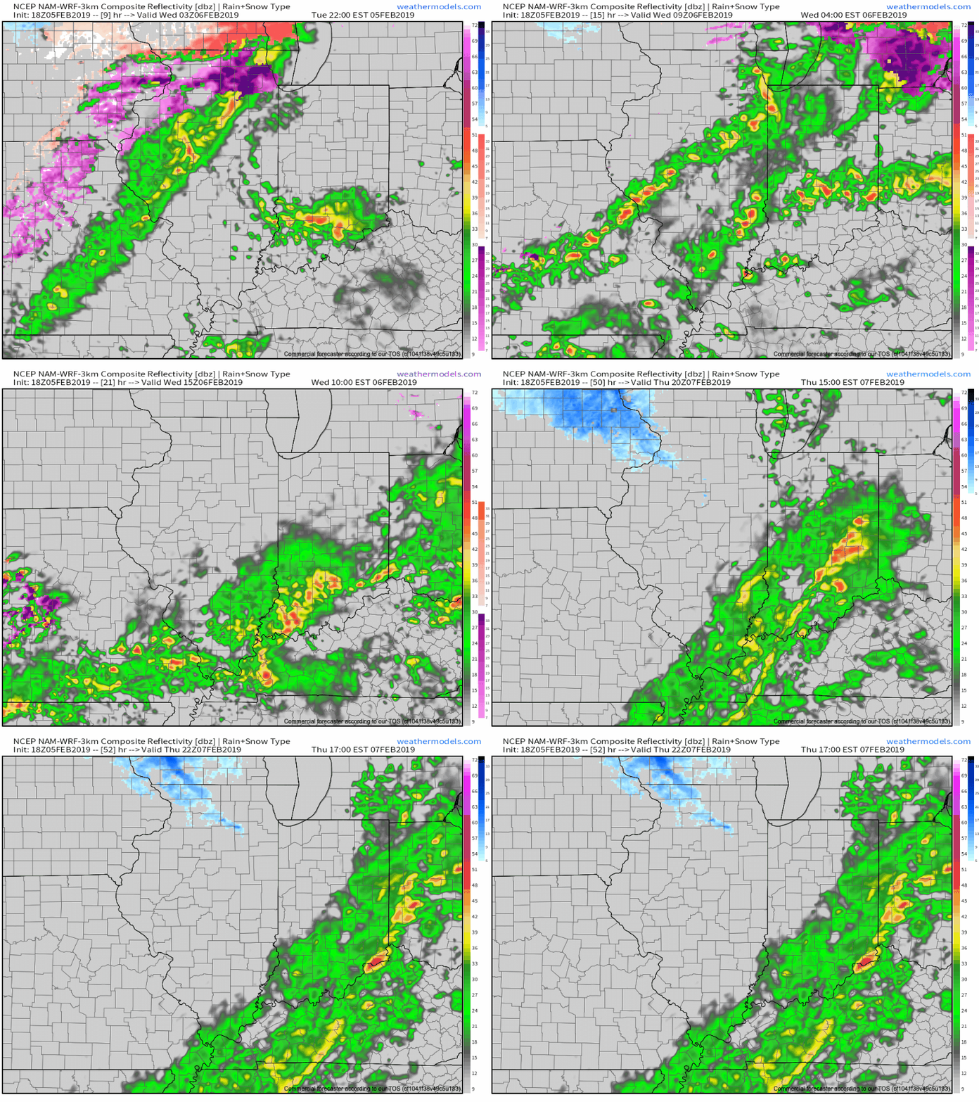
We continue to target (3) distinct windows where rainfall will be heaviest:
I. Late tonight-Wednesday morning
II. Wednesday night-Thursday morning
III. Thursday evening
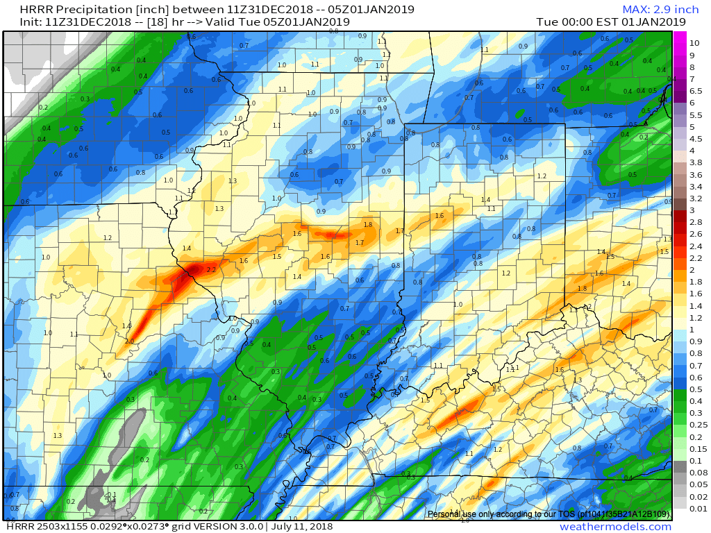
In general, widespread 2″ to 2.5″ totals are expected in area rain gauges with heavier amounts across south-central Indiana (where flood risks are highest).
The other item to note? The potential of strong and gusty thunderstorms Thursday afternoon into the early evening. These would be located directly ahead of the cold front. While we’re not anticipating a widespread major event, temperatures and dew points will approach 60 deg. and the atmosphere will be favorable to support a few strong gusts that may mix down to the surface.

Sharply Colder
The cold front that will deliver the heavy rainfall for our midweek will sweep through central Indiana around 4p-5p. Behind the boundary, sharply colder air will blow in on strong and gusty northwest winds Thursday night. Daytime highs (actual highs will occur at midnight Friday) will only top out in the lower 20s with wind chill values in the 0s most of the day.

Winter Threat Late Weekend-Early Next Week?
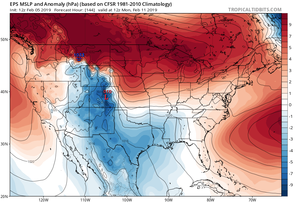


The fresh batch of cold air in here to wrap up the work week will lay the ground work for potential wintry mischief late weekend into early next week. While the cold still isn’t set to truly establish itself (still think we’re a week-10 days away from that), just enough cold may be around to present the opportunity for an accumulating central and northern Ohio Valley winter threat in the Sunday-Tuesday period. Stay tuned as we fine tune things.
The hesitation that we still have from beginning to “ring the bells” a little louder in the aforementioned period is the position of the high in front of the storm and forecast strongly positive AO. Both of these argue against the idea of this being a widespread wintry event for the southern, and potentially as far north as central Ohio Valley. The early idea here as of now is that we’ll be looking at a wintry mix event to rain for central and southern areas with more of an opportunity for substantial snow across the northern portions of the Ohio Valley. Again, stay tuned as we continue to fine tune things.
Longer term, today’s MJO update continues to take things into Phase 8 and you don’t need us to cover the end result again (think cold) at this point. Should we get the other teleconnections to line-up (AO, PNA, NAO) then a 2-3 week period of significant winter weather would ensue during the 2/20-3/10 timeframe…
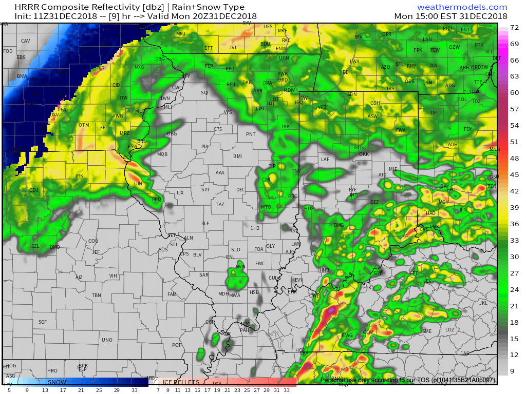
 We’re also still monitoring the potential of strong to severe thunderstorms across southern portions of the state. The Storm Prediction Center now includes far southern Indiana in a Slight Risk for severe weather today. The primary concerns remain strong, damaging winds with a line of thunderstorms that may develop between 2p and 4p. If your travels take you south towards Louisville today remain weather-aware.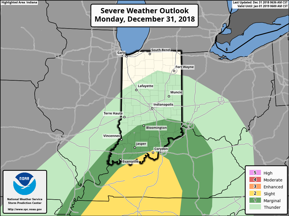
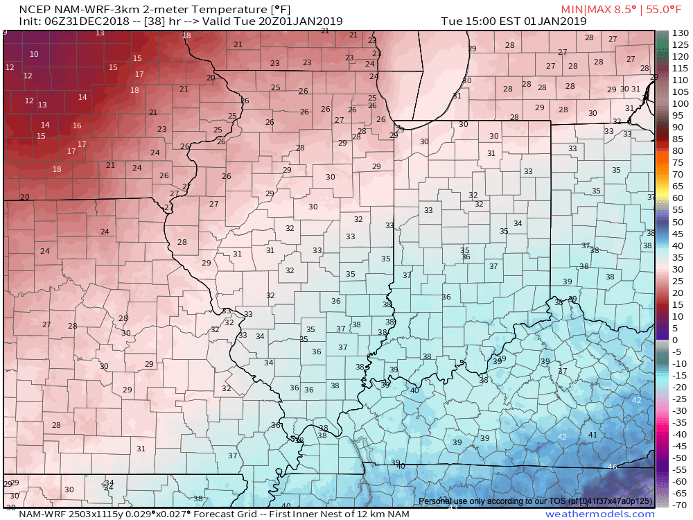
 Temperatures will run 25° to 30° colder New Year’s Day and a couple of scattered snow showers may fly- especially across the favored snowbelt areas to our north.
 Have a happy and safe New Year’s Eve, friends!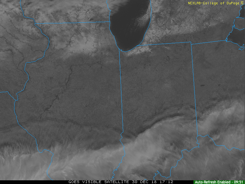
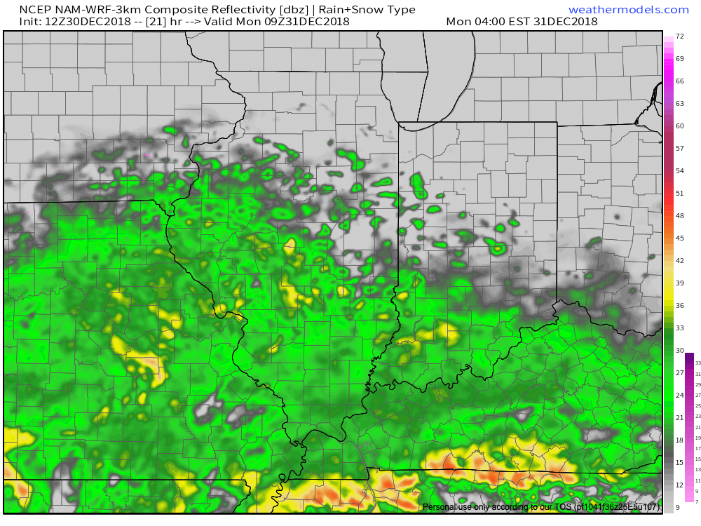

 Colder air will whip in here late tomorrow night and help lingering moisture fall as scattered snow showers New Year’s Day. More later on the potential of wintry “mischief” later in the week…
 Highlights: