Now We’re Talking…

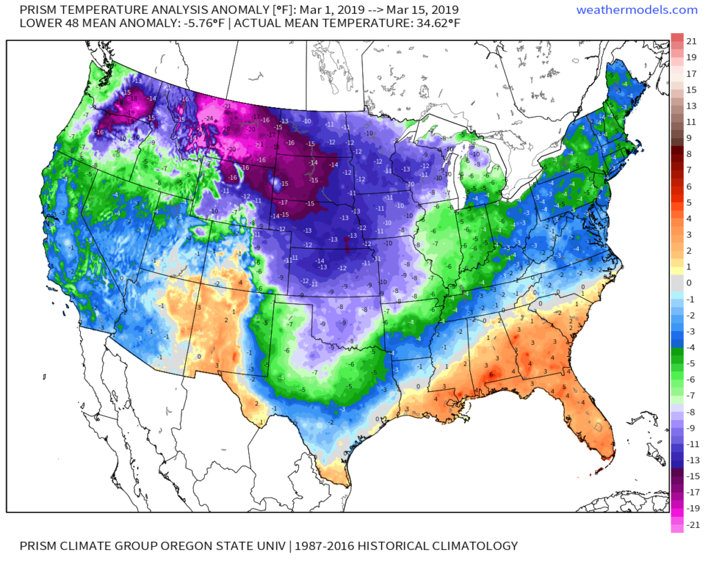
Meteorological Spring has gotten off to a cold start- to the tune of nearly 5 degrees below average at IND through 3/15.

Note the brutal cold across the Northern Plains and Rockies.
The upcoming week will feature a positive PNA pattern and associated cooler than average theme to open, before beginning to moderate mid-to-late in the work week.
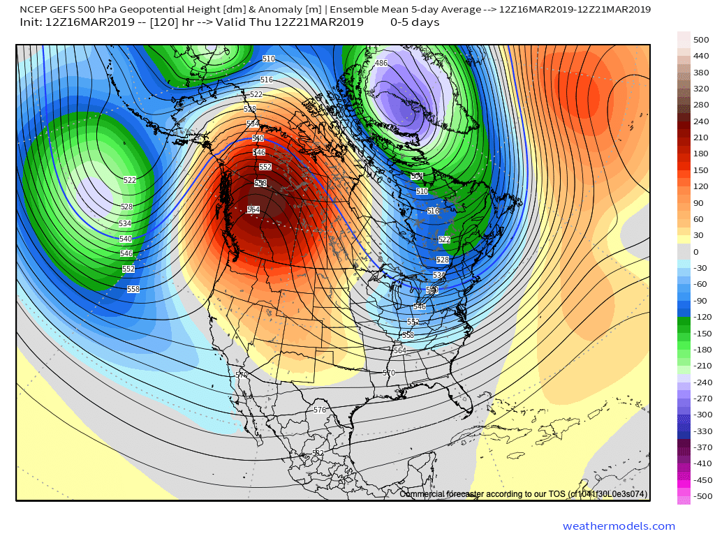
That said, time is limited on the chilly pattern and an overall significant shift to more of a sustained spring-like pattern awaits to close March and as we head into April.
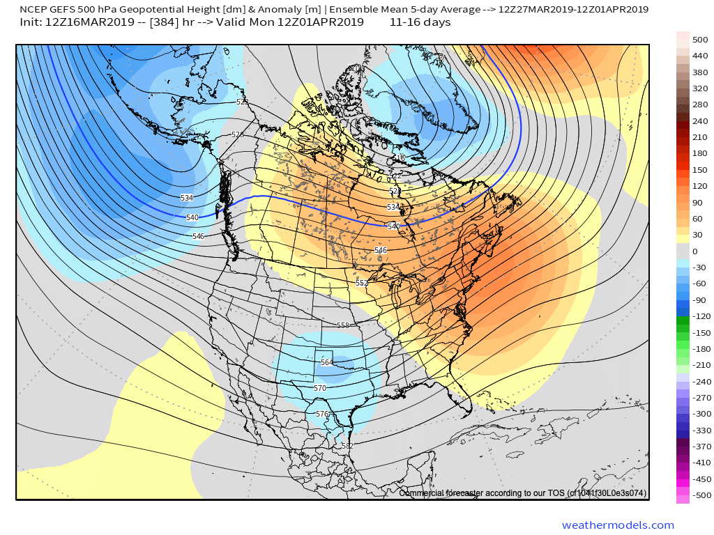
Note the warmth that follows:
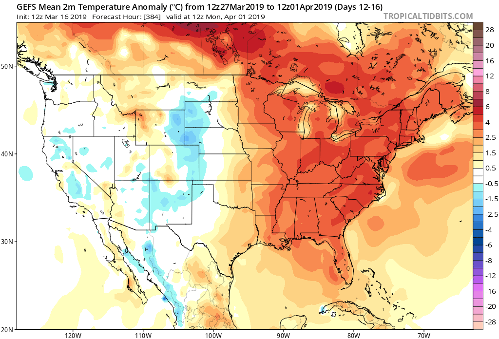
This will result in many more days in the 60s and 70s as we put a wrap on March and open April.

While weak systems will continue to impact the area (tomorrow, Wednesday, and again next Sunday), the deeper, moisture-laden storms will take a “backseat” during the fast-moving northwest flow. That begins to change during the last few days of the month and on into April. The latest ensemble guidance sees the return of a more active pattern, likely complete with heavier rain events and the potential of stronger storms.

VIDEO: 50/50 Weekend; Closer Look At The Late March-Early April Pattern…

A quiet open to the weekend is replaced with accumulating snow for portions of the state Sunday…

You must be logged in to view this content. Click Here to become a member of IndyWX.com for full access.  Already a member of IndyWx.com All-Access?  Log-in here.

Long Range Update: Cool “Set Back” Doesn’t Last; Looking Ahead To April…

You must be logged in to view this content. Click Here to become a member of IndyWX.com for full access.  Already a member of IndyWx.com All-Access?  Log-in here.

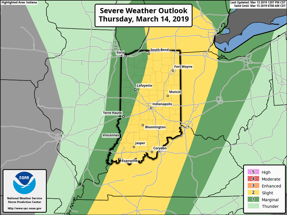
Client Brief: Thursday Severe Weather Update…

Type: Damaging Winds And Severe Potential

What: All modes of severe weather, including tornadic potential. Damaging wind gusts.

When: Damaging wind gusts develop late tonight into the predawn Thursday. Severe storms are most likely Thursday afternoon into early Thursday evening.

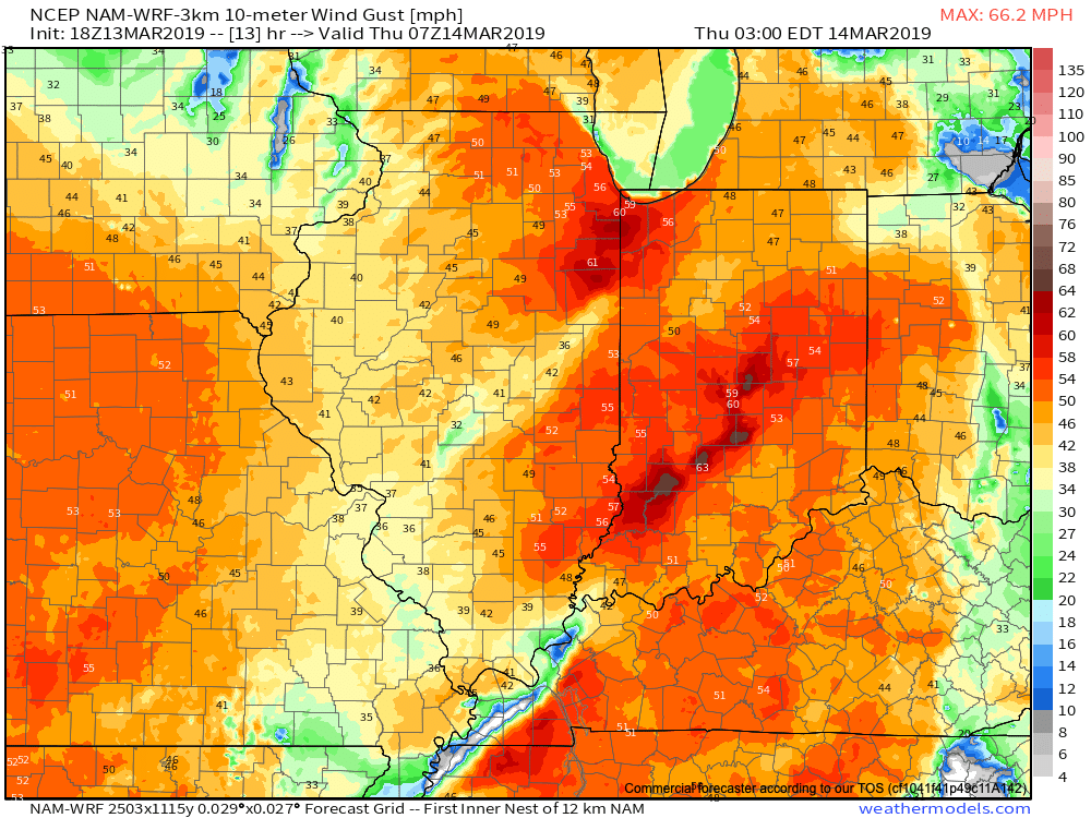
Wind: SW 45-55 MPH with gusts of 60 MPH+

Winds will begin to gust to potentially damaging levels during the overnight tonight.

A couple of rounds of thunderstorms will impact central Indiana during the overnight and again Thursday afternoon and evening. It’s the second round tomorrow afternoon that has us most concerned for the potential of strong to severe thunderstorms. A lot of this hinges on just how much clearing takes place from the morning round of showers and embedded thunder. Should we clear things out in significant fashion, and introduce some sunshine, the threat of severe weather tomorrow afternoon will grow significantly. Conversely, should we hold onto a mostly overcast sky, this will limit the overall severity of afternoon storms. The sun would help destabilize things in rather rapid fashion and given some of the other parameters in place, would lead to all modes of severe weather with storms that develop tomorrow afternoon- including large hail and tornadoes.

Additionally, due to the sheer strength of the storm system, damaging winds are still in play tomorrow (even outside of thunderstorms). In fact, winds will begin to gust upwards of 50 MPH+ during the overnight period tonight. If you haven’t already, please take the time now to tie down or secure loose objects to keep them from being blown about in the wind.

Conditions will begin to improve as early as tomorrow night, although we’ll turn much colder. Air will grow cold enough to promote “wrap around” moisture to fall in the form of snow by Friday afternoon.

Threat of strong to severe storms will be greatest Thursday afternoon into the early evening hours.