
You must be logged in to view this content. Click Here to become a member of IndyWX.com for full access. Already a member of IndyWx.com All-Access? Log-in here.
Category: T-storms
Permanent link to this article: https://indywx.com/video-gorgeous-second-half-of-the-weekend-storm-chances-return/
Jun 23
Another Active Week Ahead…
Saturday will feature unseasonably refreshing conditions as we’ll remain under the influence of an area of low pressure tracking off to our northeast. Look for considerable cloudiness today along with highs around 10° below average. Enjoy it as significant heat looms late next week.
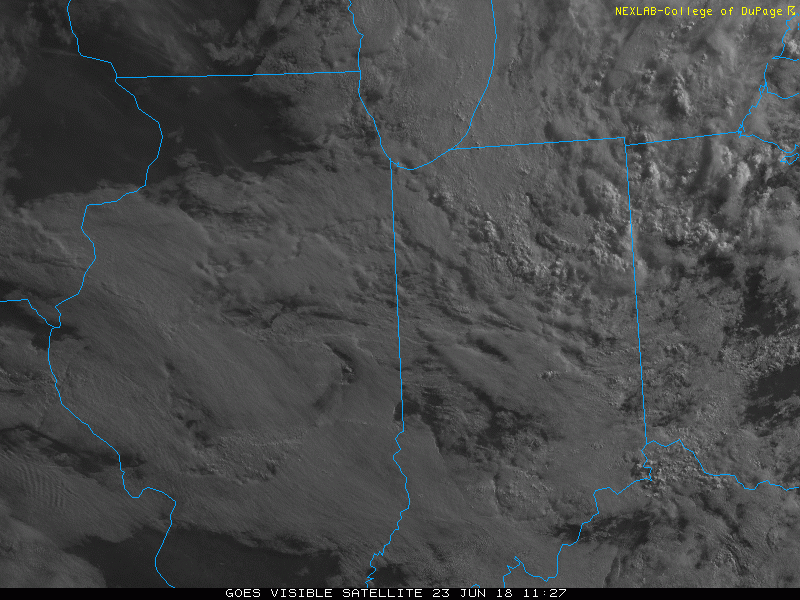 Sunshine will increase for the second half of the weekend and highs will respond- mid 80s after a refreshing start Sunday morning.
High pressure will briefly build in and control our weather through the early part of the new week. An attempt of a thunderstorm complex to impact central Indiana Monday should be thwarted by a drier air mass in place. That said, moisture will increase Tuesday and beyond and a more active regime will return. Multiple thunderstorm complexes (some heavy) will rumble across the Ohio Valley and Mid West Tuesday through Thursday.
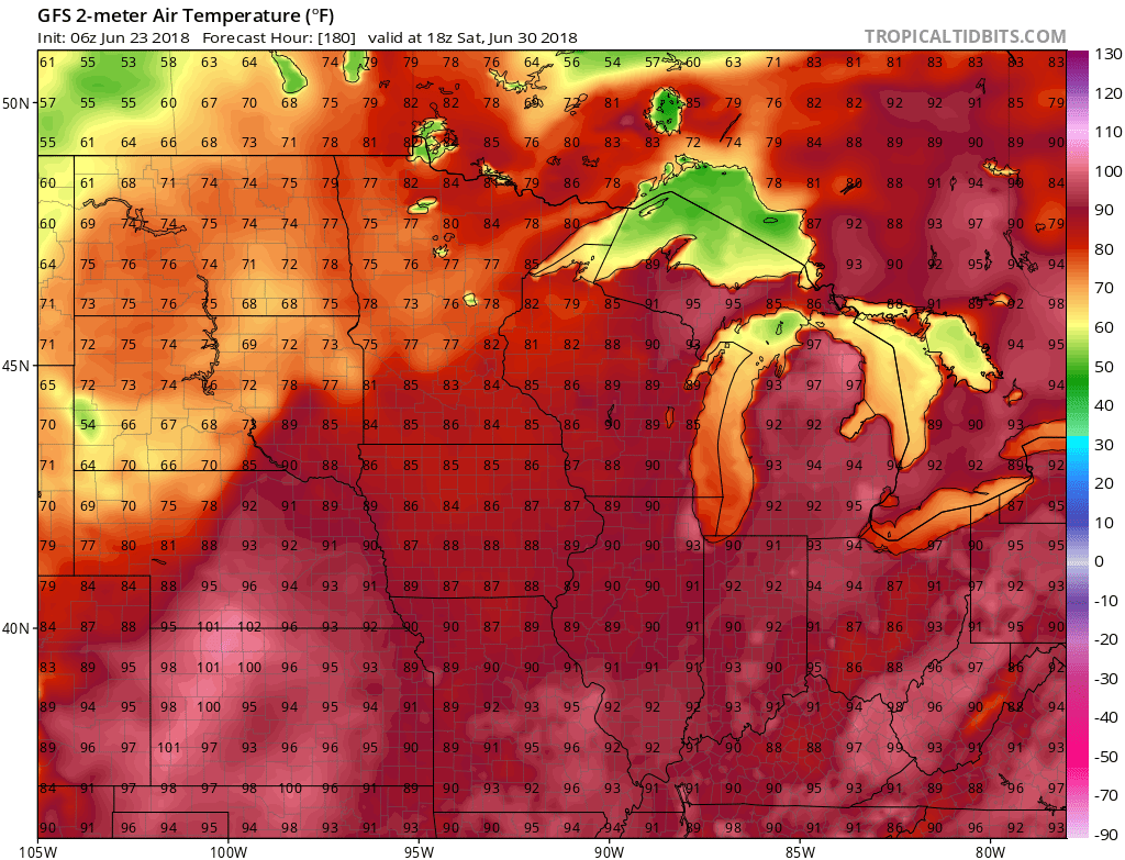
 While it’ll certainly turn more humid through midweek, the rain and storms will keep temperatures at seasonable levels. All of that changes once to Thursday and Friday as a building ridge of high pressure expands across the Ohio Valley.
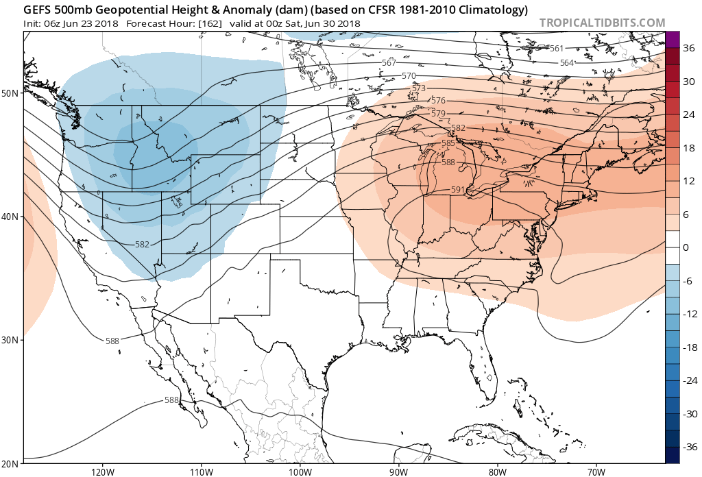 This will limit rain chances and potentially offer up the hottest air of the summer. We expect 5-6 days of low-mid 90s for highs and oppressive overnight lows in the lower to middle 70s.
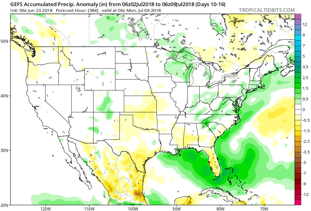
 Thankfully, the hot dome will retrograde west and lead to “less hot” and increasingly stormy conditions after the first week of July. An active northwest flow pattern will take hold and provide an active time of things during this period.

Permanent link to this article: https://indywx.com/another-active-week-ahead/
Jun 22
VIDEO: Stormy Close To The Week; July Chatter…
You must be logged in to view this content. Click Here to become a member of IndyWX.com for full access. Already a member of IndyWx.com All-Access? Log-in here.
Permanent link to this article: https://indywx.com/video-stormy-close-to-the-week-july-chatter/
Jun 19
VIDEO: Heat Relaxes And Storm Coverage Increases…
You must be logged in to view this content. Click Here to become a member of IndyWX.com for full access. Already a member of IndyWx.com All-Access? Log-in here.
Permanent link to this article: https://indywx.com/video-heat-relaxes-and-storm-coverage-increases/
Jun 18
Stormy Pattern Returns; Localized Flash Flood Threat Emerges…
A cold front will sink south into the Ohio Valley Tuesday afternoon before stalling out through the remainder of the work week and into the weekend.
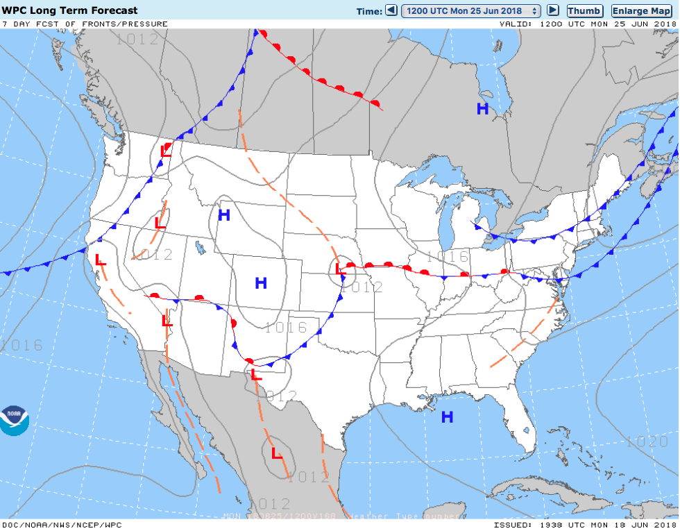
Unsettled weather returns as a frontal boundary stalls out across the region into the upcoming weekend.
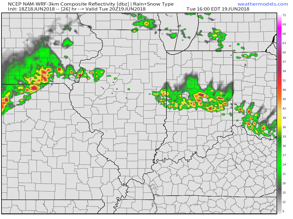
Rain and storm chances will increase in overall coverage and intensity as we move into Tuesday- particularly during the afternoon hours. With precipitable water values exceeding 2″ at times, locally heavy downpours can be expected.
 Despite cooler (still mighty humid) temperatures arriving, the overall pattern won’t change significantly into late week and this weekend. With the frontal boundary draped across the Ohio Valley, periods of showers and thunderstorms will remain in the forecast. At times, disturbances will track along the boundary and lead to increased coverage of storms. Perhaps Thursday and Friday will serve up the greatest coverage of thunderstorms as a surface wave moves out of the central Plains into the Great Lakes.
 The combination of a juicy air mass and a stationary boundary draped overhead spells a flash flood risk. The lack of any sort of overall steering current suggests the potential of thunderstorms that may train over the same communities at times. As mentioned earlier, precipitable water values (PWATS) will approach and exceed 2″ and this will support torrential downpours at times.
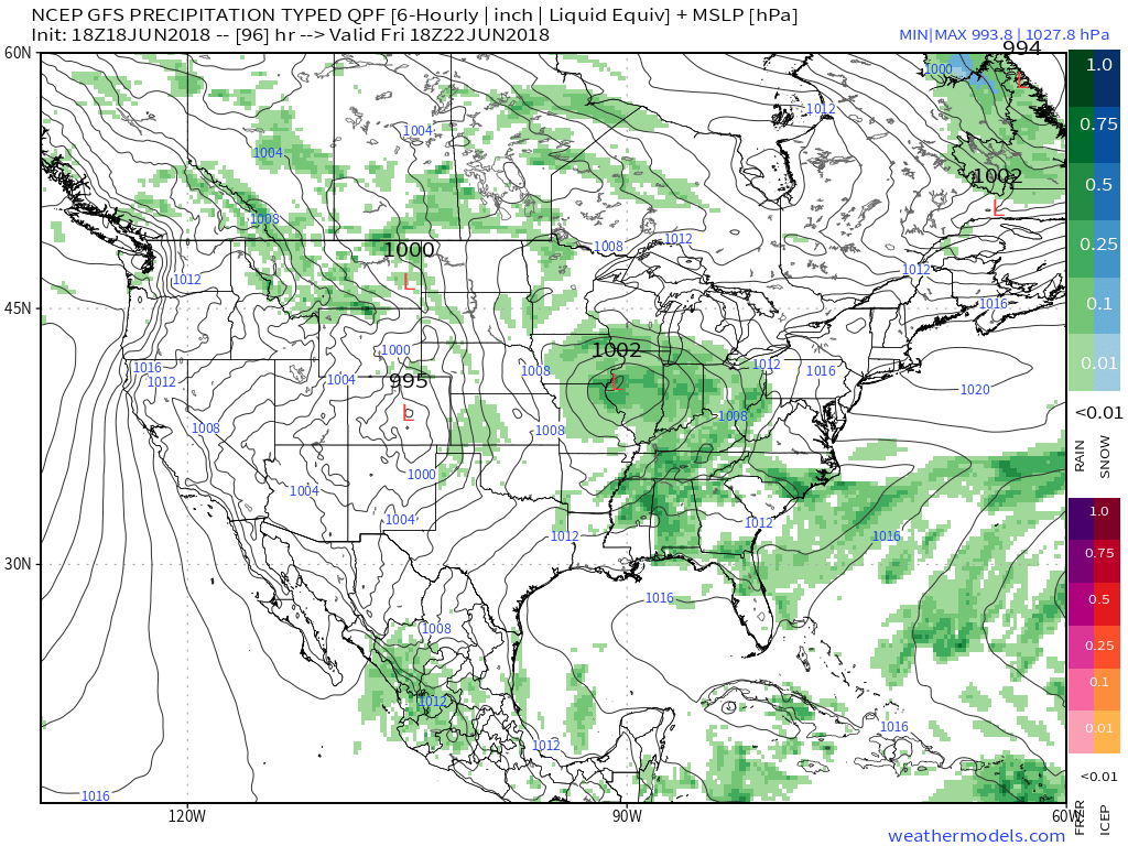
 Officially, we think the upcoming 7-day period will deal out widespread 2″ to 3″ rainfall totals across central Indiana, but there will be locally heavier amounts where thunderstorms train.
After a dry few days with exceptional heat, the unsettled and cooler pattern, overall, will be welcomed with open arms!
Permanent link to this article: https://indywx.com/stormy-pattern-returns-localized-flash-flood-threat-emerges/