Category: T-storms

Barry’s Moisture Arrives; Dangerous Heat Builds And More On The Cool Pattern To Close The Month…

The remnant circulation of what at one time was Hurricane Barry is over north-central Arkansas and south-central Missouri as of Monday evening.

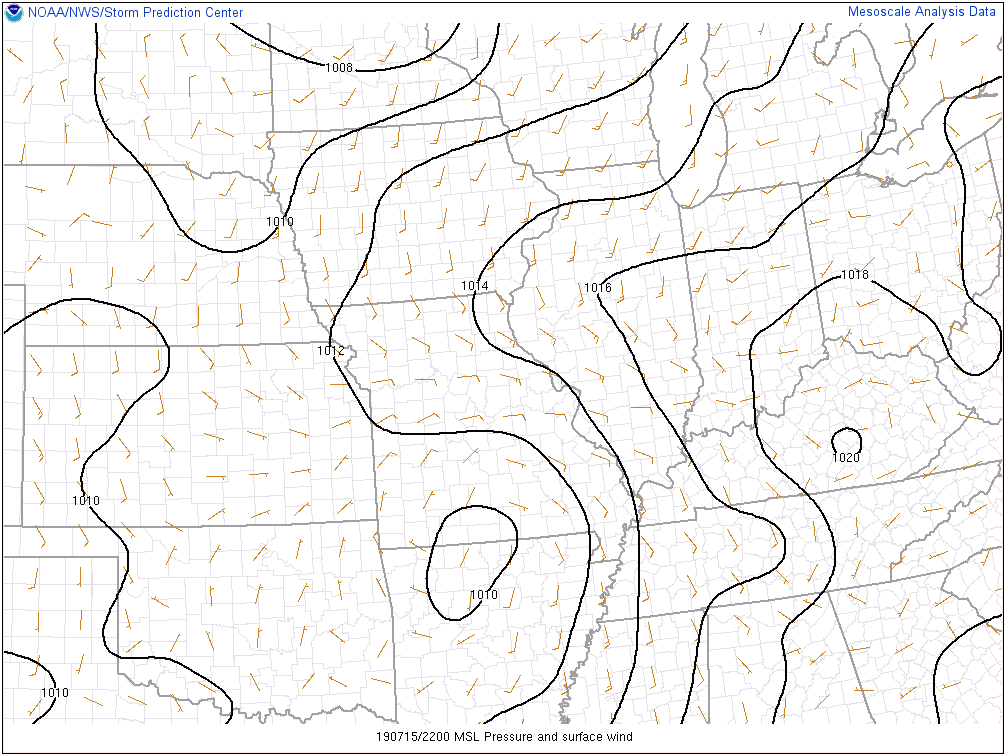
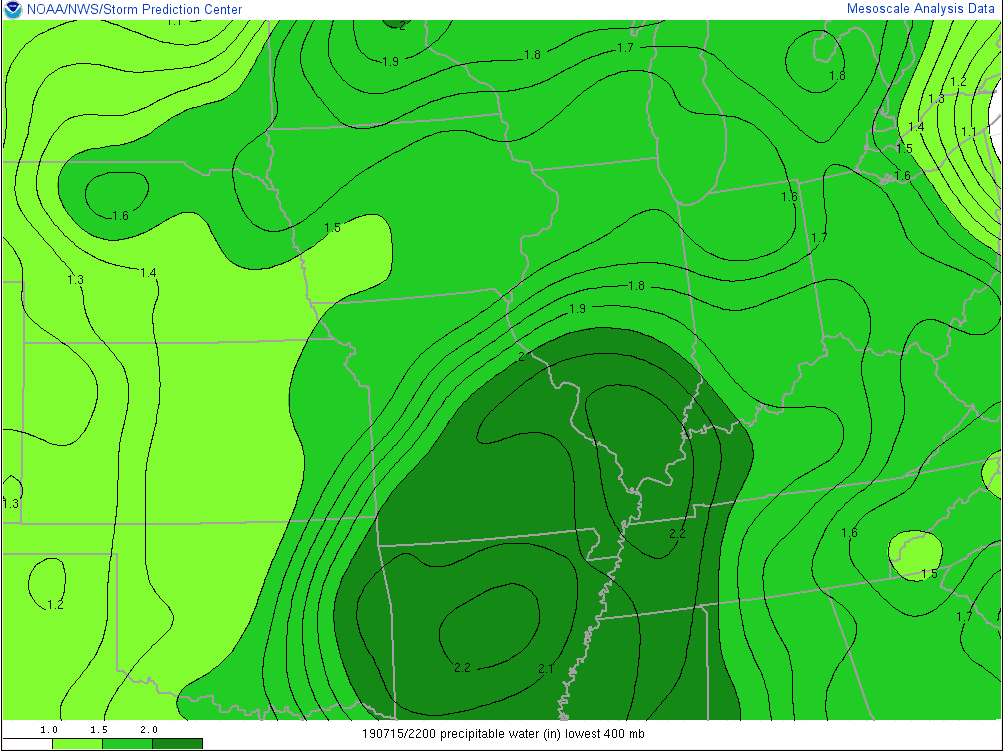
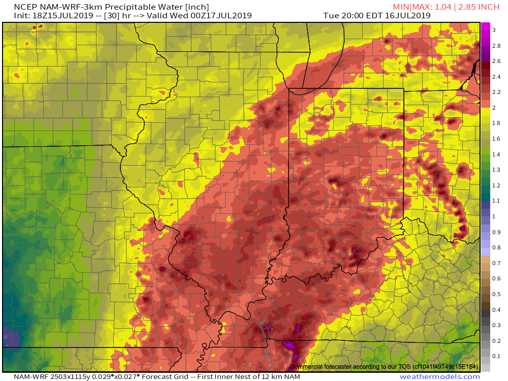
As you might imagine, this is helping pull juicy tropical air northbound. Note precipitable water values are exceeding 2″ now as far north as central Illinois and southwestern Indiana.

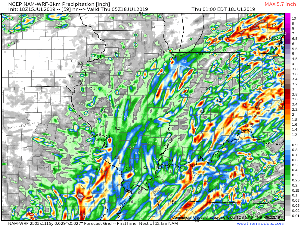
Rich, tropical air will continue to surge north and spread over central Indiana tonight and Tuesday. While we still don’t anticipate a widespread uniform soaking rain across central parts of the state, this will help lead to locally heavy downpours in scattered fashion over the upcoming 24-36 hours.

Precipitable water values will exceed 2″ Tuesday across most of the state.

In general, we still think most central Indiana rain gauges will accumulate between 0.50″ and 1″ of rain as Barry’s remnant moisture scoots across the state. That said, there will be locally heavier totals. Latest data continues to not only hint at these heavier totals being located across southeast portions of the state, but perhaps across northwest Indiana, as well.

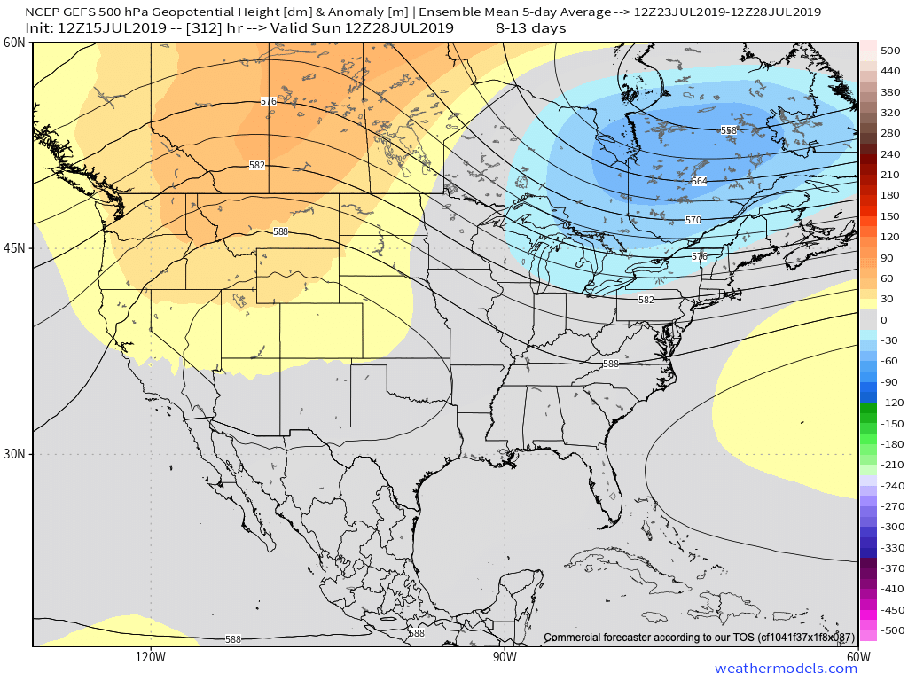
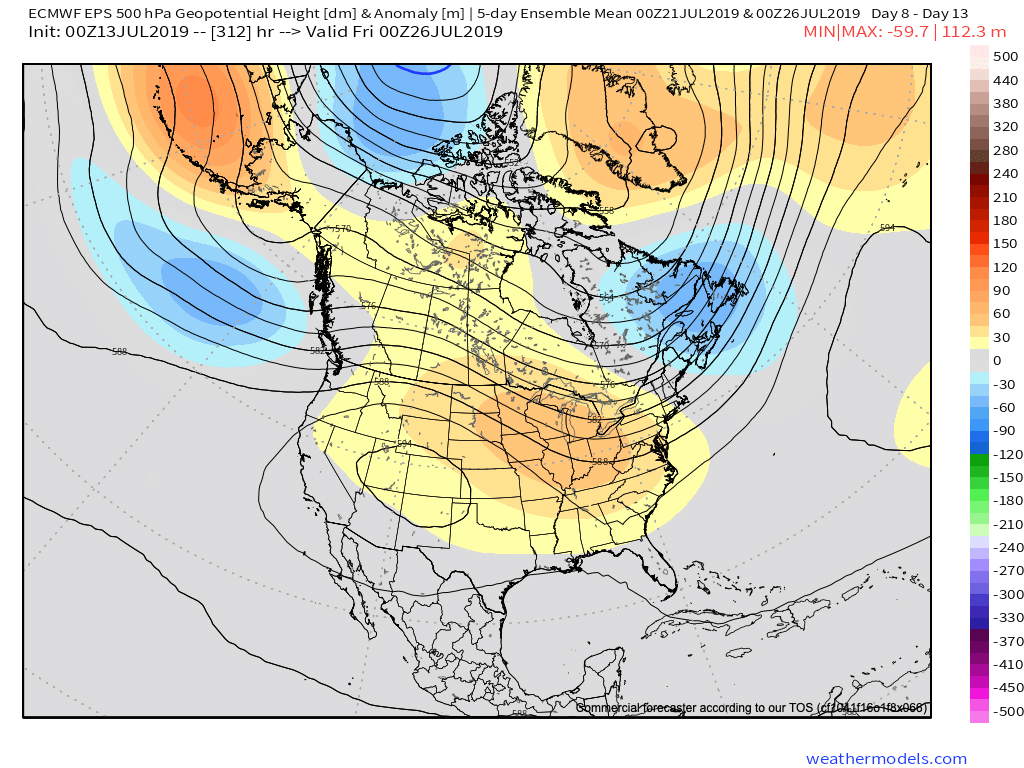
Once we dry things out (through the day Wednesday) the big story will become the heat and humidity. A 5-day stretch of dangerously hot, humid conditions will claim headlines during the period Thursday through Monday, featuring overnight lows between 75-80 and daytime highs in the lower to middle 90s.

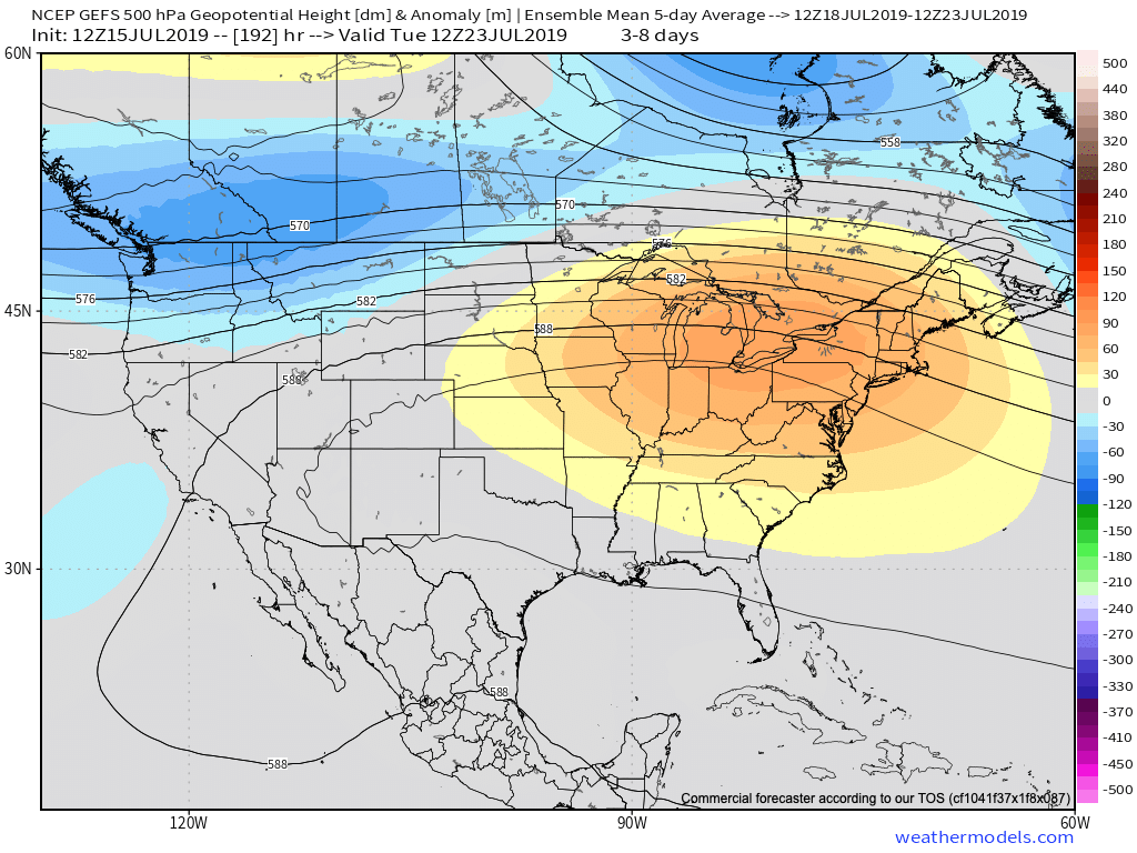
Thankfully, there are drivers that will result in a rather significant pattern change by early parts of next week. A “game changer” of a cold front is expected to sweep across the Ohio Valley Sunday into Monday with gusty storms followed by much cooler conditions as we head into Week 2. These cooler temperatures are expected to carry the day as we put a wrap on the month of July. We’ll replace highs in the lower to middle 90s with upper 70s to lower 80s and overnight lows in the upper 50s to lower 60s for the better part of the late month stretch.

Permanent link to this article: https://indywx.com/barrys-moisture-arrives-dangerous-heat-builds-and-more-on-the-cool-pattern-to-close-the-month/

VIDEO: Dealing With Barry’s Remnant Moisture; What’s Beyond The Heat Wave?

You must be logged in to view this content. Click Here to become a member of IndyWX.com for full access.  Already a member of IndyWx.com All-Access?  Log-in here.

Permanent link to this article: https://indywx.com/video-dealing-with-barrys-remnant-moisture-whats-beyond-the-heat-wave/

VIDEO: What Does The 2nd Half Of July Have In Store?

You must be logged in to view this content. Click Here to become a member of IndyWX.com for full access.  Already a member of IndyWx.com All-Access?  Log-in here.

Permanent link to this article: https://indywx.com/video-what-does-the-2nd-half-of-july-have-in-store/

Barry Moves Inland; Pattern Progression Into Late July…

Tropical Storm Barry will make landfall today along the central LA coast as a strong tropical storm or hurricane (further strengthening is likely before making landfall later today). Gusts along the LA coast already this morning have reached 81 MPH. Once inland, the biggest concern with Barry’s remnants will come from a heavy rain and flooding situation. The heaviest rainfall will fall to the east of the center of circulation, encompassing central and eastern LA, western MS, eastern AR, and into western TN.

While Barry’s moisture will get into central Indiana early next week, we continue to believe the steady, heavier rainfall will remain across southern portions of the state. Overall, we don’t see any reason to alter our ongoing idea of where the heaviest axis of rain will set up shop. Tuesday into Wednesday appears to be the wettest period for the Ohio Valley from Barry. It’s possible a good portion of southern IN into central and southern OH receives 1″ to 2″ of rain with locally heavier totals during this time period. Understanding we’re talking about tropical remnants still roughly 72-84 hours away, some additional tweaking is likely to the forecast rainfall numbers.

Once Barry’s remnants exit to the east, the heat will be the big story for the 2nd half of the work week and into next weekend. Highs in the lower to middle 90s with overnight lows in the middle 70s can be expected as a ridge of high pressure expands over the region.

As we look beyond next week, the pattern should promote the axis of the ridge retrograding west. This would put the Ohio Valley in a more active northwest upper air flow, resulting in a backing off of the extreme heat and better rain/ storm chances as we progress through the last week of the month.

More later this afternoon with our video update! Enjoy your Saturday morning, friends.

Permanent link to this article: https://indywx.com/barry-moves-inland-pattern-progression-into-late-july/

VIDEO: Updated Thoughts On Barry; Heat Wave Gets Underway Late Next Week…

You must be logged in to view this content. Click Here to become a member of IndyWX.com for full access.  Already a member of IndyWx.com All-Access?  Log-in here.

Permanent link to this article: https://indywx.com/video-updated-thoughts-on-barry-heat-wave-gets-underway-late-next-week/