Category: T-storms

Localized Bands Of Flooding Rain Possible This Afternoon-Evening…

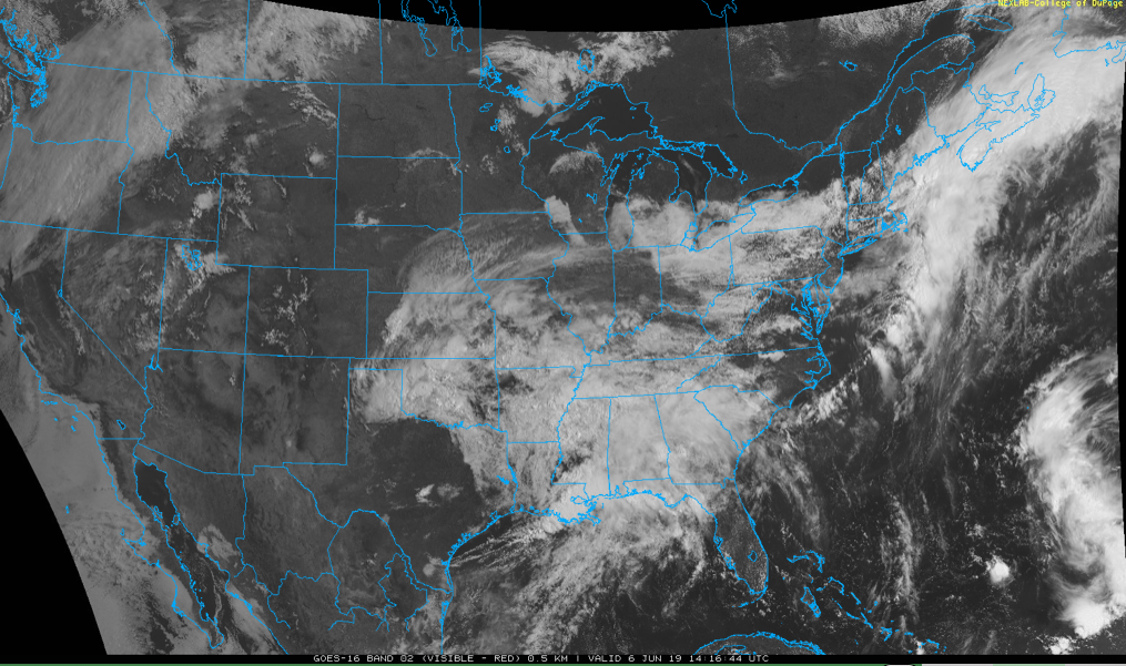
An upper level low will have control of our weather today. We’re seeing widespread mostly light rain this morning and that will begin to diminish as we move into the late morning and early afternoon.

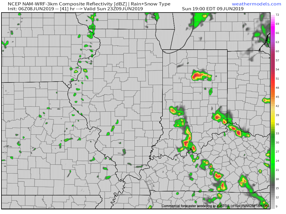
We’ll then likely see a few breaks in the cloud cover and that will serve to provide just enough energy to help showers and thunderstorms redevelop by mid to late afternoon. With a juicy air mass in place (precipitable water values will exceed 2″ in spots), locally heavy rain is likely.

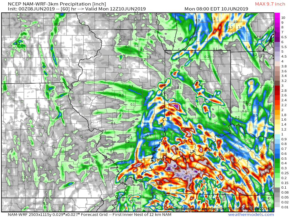
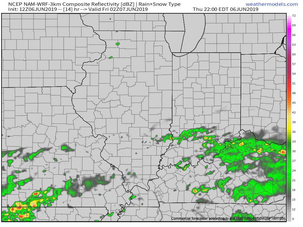
With weak steering flows in place this afternoon and evening, the concern we have is that localized bands of this heavy rain/ embedded thunder will “train” over the same areas, potentially leading to flash flooding in localized spots across central Indiana.

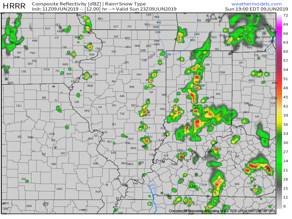
We expect these south-to-north moving bands of rain to begin to organize towards the 4p to 6p time frame, continuing into the evening and nighttime hours. Where the heavier rain bands organize, a quick 2″ to 3″ of rain is likely this evening.

More around the #AGwx report for the upcoming week will be posted later this morning!

Permanent link to this article: https://indywx.com/localized-bands-of-flooding-rain-possible-this-afternoon-evening/

Rain Coverage Increases Over The Weekend; Blast Of Fall-Like Air Next Week…

Upper level energy will get pulled north into the Ohio Valley region over the weekend. This will result in an increase in cloudiness and better coverage of showers at times this afternoon through

As we time things out, light showers will move northwest (opposite of the usual direction) across the region beginning this afternoon, but more concentrated heavier downpours are a good bet tonight into Sunday morning.

Forecast radar 5a Sunday shows widespread rain across central Indiana.

We’ll likely get into some drier conditions Sunday afternoon, but redevelopment of scattered showers and thunderstorms is likely by evening.

Forecast radar 7p Sunday shows scattered thunderstorms in place.

While there will be plenty of dry time this weekend, do expect periods of wet weather at times. Everyone won’t see heavy rain (0.5″ to 1″ on average for weekend totals), but with this kind of system, there will likely be heavier bands of rain over the next couple of days. High resolution guidance is likely picking up on this, understanding it’s nearly impossible to pinpoint with certainty where those heavier rain bands set up.

Drier air will arrive on the scene early in the work week with increasing sunshine anticipated Monday into Tuesday. Temperatures will run well below average for midweek with reinforcing unseasonably cool air blowing into town to wrap up the work week (40s still a good bet with highs only in the 60s).

Permanent link to this article: https://indywx.com/rain-coverage-increases-over-the-weekend-blast-of-fall-like-air-next-week/

Pleasant Stretch Of Weather; Unseasonably Cool Temperatures Dialed Up Next Week…

After an active evening across central Indiana on Wednesday, I’m excited to say the upcoming 48-72 hours looks much calmer overall. All of the “action” will be off to our south the next couple of days with mixed clouds and sun and seasonable warmth dominating across central Indiana.

Sunshine returns across central Indiana today and will remain in place as we close out the work week.

Highs today and Friday will top out in the lower to middle 80s.

While we’ll remain dry across central Indiana to wrap up the work week, better chances of showers will remain across far southern portions of the state (closer to the influence of the upper low swirling across the southern Plains and into the Ark-La-Tex region tomorrow).

The upper low will move closer to the region over the weekend and result in better shower coverage as we move into Saturday and Sunday (still not looking at wash-outs either day).

An average of various computer models prints out rainfall amounts between 0.50″ and 1″ in the Saturday through Monday time period.

High pressure will build in Tuesday and Wednesday, supplying a return of dry conditions.

A cold front and associated area of low pressure will approach Thursday and this will serve to deliver a round of scattered thunderstorms as we make the transition towards next weekend. A few gusty storms are a good bet Thursday with this frontal system. With this being a week out, we’ll continue to keep an eye on things and be able to get more specific with time. Perhaps as big of a story will be the unseasonably cool air that will blow into town behind the front to close next week. Lows in the 40s and highs in the upper 60s to lower 70s seem likely and a far cry from what we’d normally expect for mid-June.

Permanent link to this article: https://indywx.com/pleasant-stretch-of-weather-unseasonably-cool-temperatures-dialed-up-next-week/

VIDEO: Damaging Wind Potential With Storms This Evening; Quiet Close To The Week…

You must be logged in to view this content. Click Here to become a member of IndyWX.com for full access.  Already a member of IndyWx.com All-Access?  Log-in here.

Permanent link to this article: https://indywx.com/video-damaging-wind-potential-with-storms-this-evening-quiet-close-to-the-week/

Evening All-Access Video: It’s Not All “Doom And Gloom;” Updated Thoughts Around Late Week-This Weekend…

You must be logged in to view this content. Click Here to become a member of IndyWX.com for full access.  Already a member of IndyWx.com All-Access?  Log-in here.

Permanent link to this article: https://indywx.com/evening-all-access-video-its-not-all-doom-and-gloom-updated-thoughts-around-late-week-this-weekend/