
You must be logged in to view this content. Click Here to become a member of IndyWX.com for full access. Already a member of IndyWx.com All-Access? Log-in here.
Category: T-storms
Permanent link to this article: https://indywx.com/video-better-rain-chances-arrive-over-the-weekend-longer-range-rambles/
Sep 17
MJO/ EPO Telling Of Where The Pattern Is Heading To Close September & Open October?
The short-term period will continue to be dominated by unseasonably warm and dry weather. While we’ll notice a drier air mass (lower humidity) in place the next couple of days, temperatures will remain much warmer than where we should be in mid to late September.
As we close out the month and head into early October, there’s opportunity for a cooler change and we can look to the MJO and EPO for these clues.
Let’s start with the EPO. The GEFS has been leading the way on the negative transition late September for some time now. The EPS is now trending more strongly negative as of the past couple of days. This argues for a cooler than normal period of weather as we put a bow on September and open October.


(The strongly positive EPO will promote more well above normal warmth in the short to medium term period).
The MJO is becoming more amplified and the result is that we can add another “tool to the belt” moving forward in determining the overall direction of the longer range pattern.

Phase 8 argues for widespread warmth, but as we transition from Phase 1 into Phase 2 (easy to see that’s where the MJO wants to head), cooler air swings into the East/ South.


That transition may also result in needed moisture. Note the wetter period that develops during the movement from Phase 1-2.

Speaking of moisture, Sunday appears to offer up the best chance of widespread, organized rain/ storms we’ve seen month-to-date. Models are keying in on the potential of 0.50″ to 1″ (fingers crossed) as a cold front moves into the region.
The CFSv2 is following the plan outlined above- transitioning towards a wetter and eventually cooler pattern Weeks 2-3.


Permanent link to this article: https://indywx.com/mjo-epo-telling-of-where-the-pattern-is-heading-to-close-september-open-october/
Sep 16
VIDEO: Week Ahead Outlook; Reviewing The New JAMSTEC Winter Update…
You must be logged in to view this content. Click Here to become a member of IndyWX.com for full access. Already a member of IndyWx.com All-Access? Log-in here.
Permanent link to this article: https://indywx.com/video-week-ahead-outlook-reviewing-the-new-jamstec-winter-update/
Sep 15
VIDEO: Generally Quiet Pattern This Week; Late Month Thoughts…
You must be logged in to view this content. Click Here to become a member of IndyWX.com for full access. Already a member of IndyWx.com All-Access? Log-in here.
Permanent link to this article: https://indywx.com/video-generally-quiet-pattern-this-week-late-month-thoughts/
Sep 12
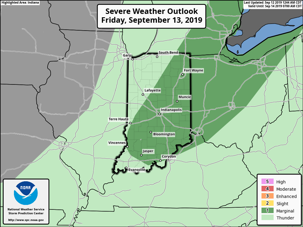
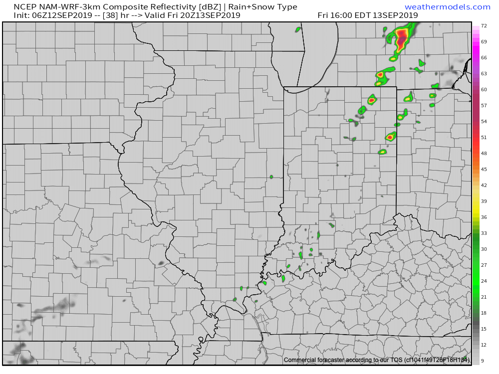
Thursday Morning Rambles: Warmth Continues To Dominate Over The Next 10 Days…
A “cold front” will pass Friday evening. Despite the threat of a couple widely scattered storms this afternoon/ evening, a broken line of storms may accompany the front Friday afternoon and evening. We’re not expecting widespread rain or storm activity with the passage of this front and some yards won’t see a drop of rain over the next couple of days.
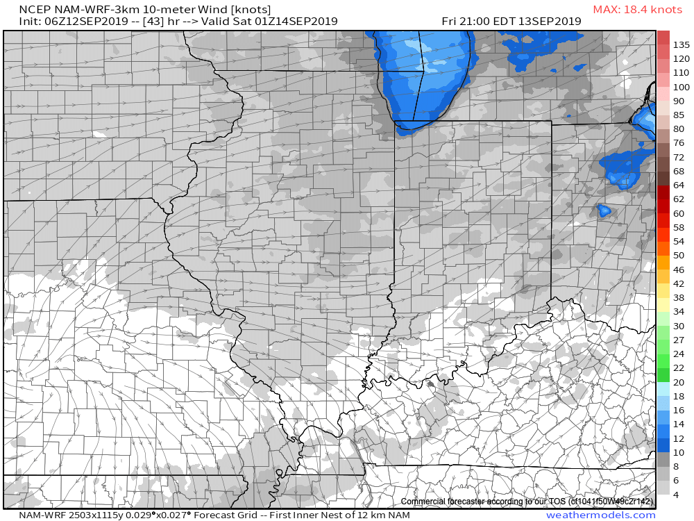
While somewhat drier air will briefly work into the region Saturday, temperatures will remain well above average. The humidity will return next week.
As we look ahead over next week, generally quiet conditions are anticipated. The big story in the weather department will be the continuation of summer-like heat and an active time of things in the tropics.
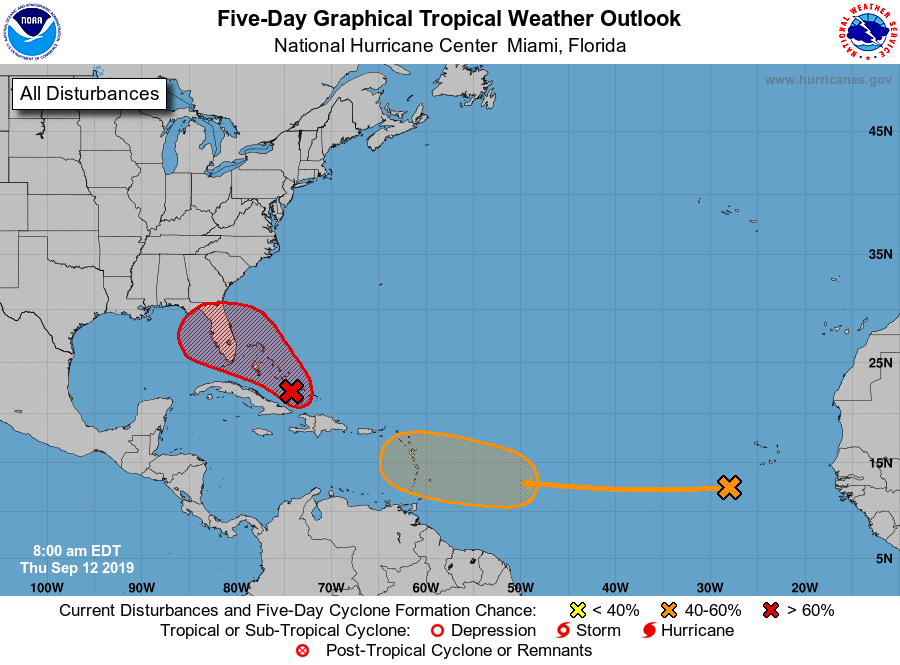
Let’s start with the tropics. Guidance overnight has trended further east with the disturbance that at one time appeared it was heading for the Gulf of Mexico. Instead, our East Coast friends should take note of the disturbed weather in the Caribbean. Some model guidance spins this up into a hurricane over the upcoming weekend as it at least “flirts” with the Southeast US coast (perhaps in an eerily similar fashion as Dorian). The item in the open Atlantic is another we’ll have to keep close eyes on for Week 2 for the Gulf of Mexico. Unfortunately, the upper pattern is a favorable one for the Southeast US coastline to experience a landfall over the next couple of weeks…
That same pattern through the next couple of weeks is also one that will continue to produce an “extended summer” across the East.
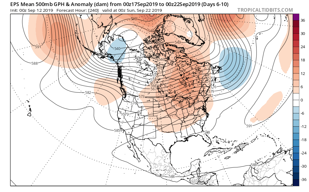

As we look ahead to next weekend, there’s the potential of a stronger cold front offering up more organized rain/ storm chances followed by a stronger cool shot. We’ll have more on this threat in our Weekly AG/ Severe Weather Outlook published this weekend.
Permanent link to this article: https://indywx.com/thursday-morning-rambles-warmth-continues-to-dominate-over-the-next-10-days/