Category: T-storms

Cooler Today; Heavy Rain Arrives Over The Weekend…

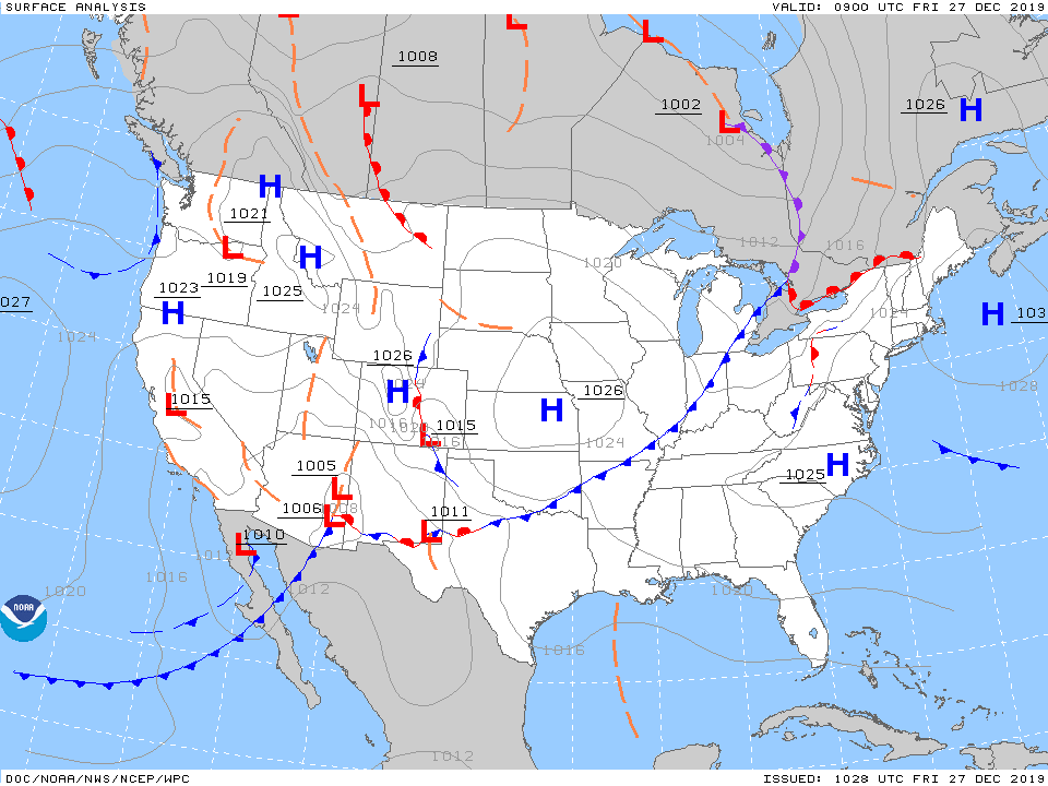
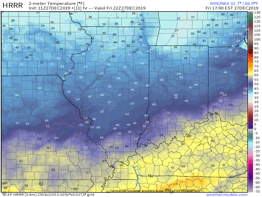
A cold front will slip south through central Indiana over the next couple of hours. This will result in a much cooler feel when compared to the past couple of days, but still milder than normal for late-December. We’ll note temperatures generally holding steady in the mid 40s before falling into the 30s this evening.

As we flip the page to Saturday, changeable weather can be expected by evening. For the majority of the daytime, expect considerable cloudiness and cool conditions. Our wind direction will back around to the south Saturday night and this will result in rising temperatures (into the lower 60s by Sunday morning) along with periods of showers and thunderstorms developing during the overnight hours into Sunday.

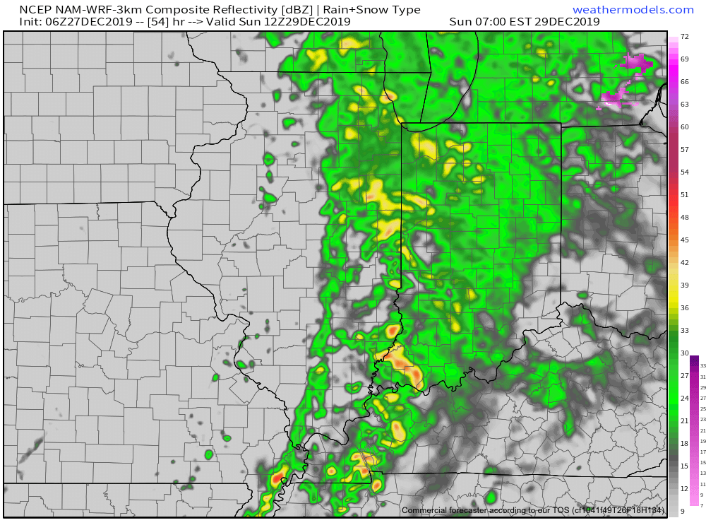
We’ll keep close eyes on a secondary wave of moisture that will develop Sunday afternoon. While it still appears as if the bulk of the heavy rain associated with this secondary wave will remain to our east, portions of east-central Indiana can expect heavier storm totals. The large majority of central Indiana can expect total rainfall amounts of 0.75” to 1.25”, with 1.25” to 2” across east and southeast areas.

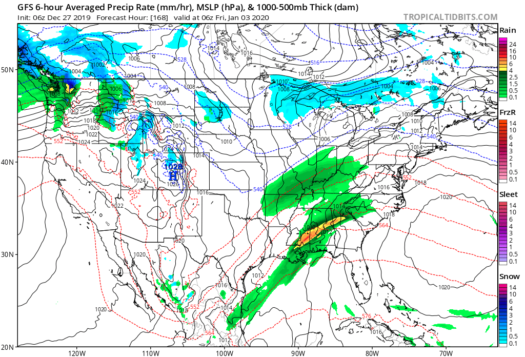
We’ll turn windy and colder for New Year’s Eve (northwest gusts of 30-40 MPH), but dry things out. Our next system of note won’t arrive until late next week.

More later this evening in our latest video update. Make it a great Friday!

Permanent link to this article: https://indywx.com/cooler-today-heavy-rain-arrives-over-the-weekend/

Evening Video Update: “Different” Feel Friday Is Replaced By Sunday Morning Thunder; Colder Next Week…

You must be logged in to view this content. Click Here to become a member of IndyWX.com for full access.  Already a member of IndyWx.com All-Access?  Log-in here.

Permanent link to this article: https://indywx.com/evening-video-update-different-feel-friday-is-replaced-by-sunday-morning-thunder-colder-next-week/

Merry Christmas! The Weather Pattern Takes On A More Active Look To Close The Year…

You must be logged in to view this content. Click Here to become a member of IndyWX.com for full access.  Already a member of IndyWx.com All-Access?  Log-in here.

Permanent link to this article: https://indywx.com/merry-christmas-the-weather-pattern-takes-on-a-more-active-look-to-close-the-year/

VIDEO: Short-Term Update On Our High Wind Event; Fresh December Ideas…

You must be logged in to view this content. Click Here to become a member of IndyWX.com for full access.  Already a member of IndyWx.com All-Access?  Log-in here.

Permanent link to this article: https://indywx.com/video-short-term-update-on-our-high-wind-event-fresh-december-ideas/

Plot Thickens Around Halloween Into Early November…

As we look ahead to Halloween, the pattern continues to look mighty “interesting” to say the least. A deeply negative EPO (East Pacific Oscillation) will take the drivers seat and potentially lead to some early wintry “fun and games” as we close out the month and head into early November.

Ensemble data, centered on Halloween, is in excellent agreement with respect to the overall upper air pattern. That said there are subtle differences in the handling of the southeast ridge.

These seemingly subtle differences at 500mb can mean a world of difference in terms of the resulting weather we deal with here at the surface.

We’re confident there will be a rather significant weather event on or around Halloween, but caution we’re far from being able to provide details around the specifics. The early thinking is that a storm system provides a round of showers and thunderstorms just before the holiday with sharply colder conditions pouring into the area on Halloween, itself, with the threat of the first lake effect snow outbreak of the year heading into next weekend. Stay tuned. Run-to-run differences within the operational suites will be significant in the days ahead. It’s far too early to latch on to any one particular solution.

Regardless, with high latitude blocking in place, a colder than average period of weather is likely as we move through early November. The brunt of the cold, relative to normal, should be featured across the central Plains.

More on the longer range November pattern in the days ahead. Our official November Outlook will be posted over the weekend.

Permanent link to this article: https://indywx.com/plot-thickens-around-halloween-into-early-november/