Updated 04.28.22 @ 7a The periods of light rain over the next couple of days will give way to the potential of stronger storms Saturday evening and sets the tone…
You must be logged in to view this content. Click Here to become a member of IndyWX.com for full access. Already a member of IndyWx.com All-Access? Log-in here.
You must be logged in to view this content. Click Here to become a member of IndyWX.com for full access. Already a member of IndyWx.com All-Access? Log-in here.
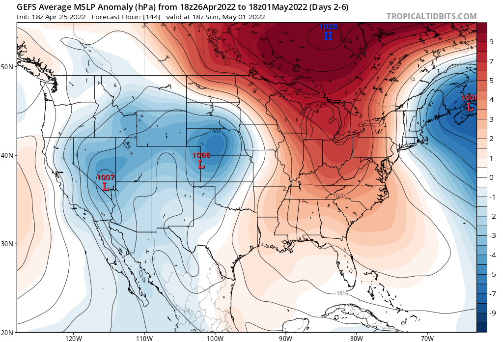
Now that our cold front is to our east, it’s time to look ahead to the next weather maker. Headlines over the next 48 hours will come from patchy frost potential (or “widespread” if north of the city, itself).
Weak systems will try and push into the Ohio Valley over the next 72 hours but most, if not all, of these systems should run into a drier, more stable airmass, locally and a rather significant weakening of any sort of organized areas of rain.
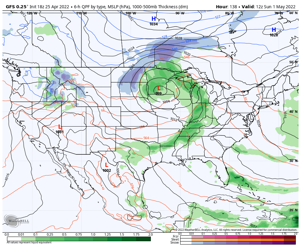
There will be times of mostly cloudy conditions and light shower chances midweek but most, if not all, of any sort of “organized” rain chances will hold off until the weekend. What at times will look like appreciable rain heading in our direction will diminish in significant fashion as it pushes east into the region. The blocking pattern will breakdown and allow more organized rain and storm chances to enter the picture from the west this weekend.
Rain and storm chances should increase in earnest Saturday night into Sunday morning, including the potential of locally heavy downpours.
Another storm system awaits on deck for a Sunday evening and Monday morning arrival…
More on this and more in this evening’s client video update.
You must be logged in to view this content. Click Here to become a member of IndyWX.com for full access. Already a member of IndyWx.com All-Access? Log-in here.
You must be logged in to view this content. Click Here to become a member of IndyWX.com for full access. Already a member of IndyWx.com All-Access? Log-in here.
Permanent link to this article: https://indywx.com/video-quiet-start-to-the-day-gives-way-to-evening-rumbles-pattern-heading-in-the-right-direction-for-more-persistent-warmth-as-we-move-beyond-the-1st-week-of-may/