Updated 07.18.23 @ 7:27a
You must be logged in to view this content. Click Here to become a member of IndyWX.com for full access. Already a member of IndyWx.com All-Access? Log-in here.

Jul 18
Updated 07.18.23 @ 7:27a
You must be logged in to view this content. Click Here to become a member of IndyWX.com for full access. Already a member of IndyWx.com All-Access? Log-in here.
Permanent link to this article: https://indywx.com/video-brief-window-to-catch-our-breath-before-active-times-return/
Jul 17
Updated 07.17.23 @ 7:35a
You must be logged in to view this content. Click Here to become a member of IndyWX.com for full access. Already a member of IndyWx.com All-Access? Log-in here.
Permanent link to this article: https://indywx.com/video-another-stormy-afternoon-evening-before-drier-air-builds-in-timing-out-additional-storm-chances-later-in-the-week/
Jul 16
Updated 07.16.23 @ 7:44a
I. More of that good ole Canadian wild fire smoke is making for a hazy start to our day but thankfully all else is quiet. Unfortunately that won’t remain the case as we progress into the afternoon and evening hours. We’ll watch for darkening skies towards the mid to late afternoon and some potent storms will likely fire up by evening. A couple of these could pulse to severe levels and include a damaging wind and hail threat.
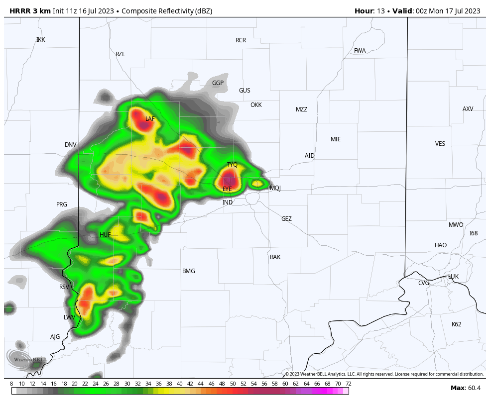
II. A cold front will take aim on the region from the northwest as we kick off the new work week. Additional scattered showers and thunderstorms will develop ahead of this boundary Monday afternoon and evening. Like this evening, a few of the storms will likely turn strong to severe (damaging wind and large hail the greatest concerns with the stronger cells).

III. The cold front will push south of our region Tuesday morning before stalling along the Ohio River. Rain and storm chances should shift downstate Tuesday as a drier brand of air takes hold for the northern half of the state. Dew points into the 50s are always nice in July, heh?!
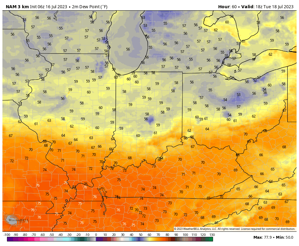
IV. A secondary front will blow through the state as we wrap up the work week and help to reinforce the unseasonably refreshing airmass going into next weekend. Lows will likely even dip into the 50s at night.
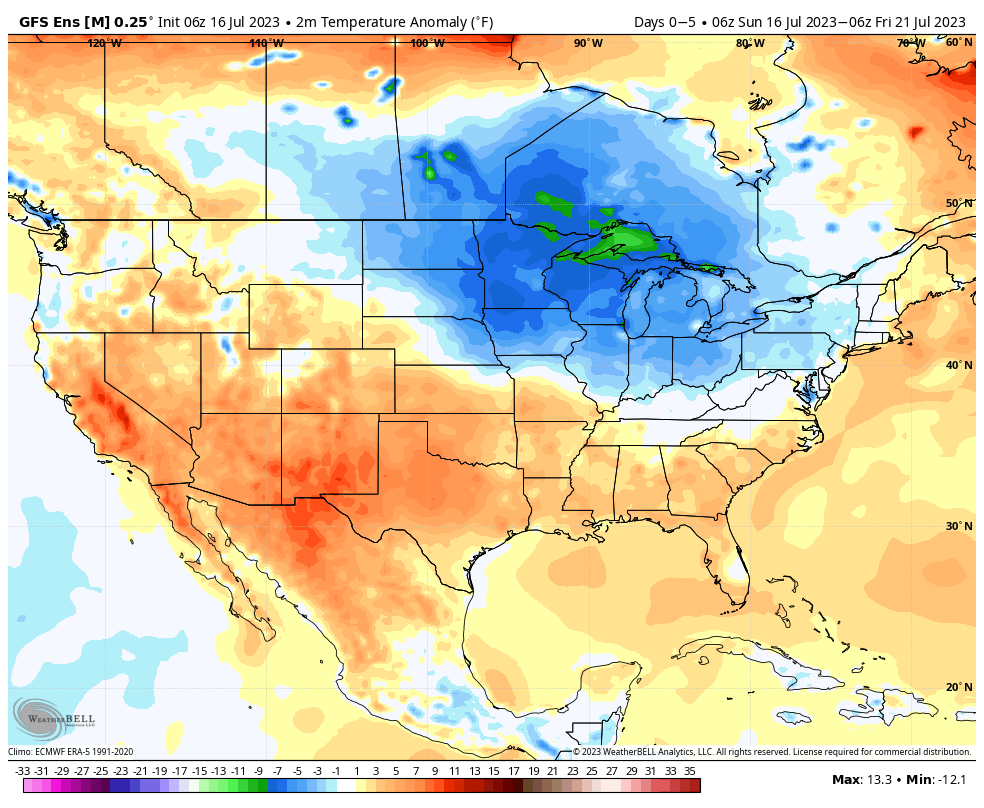
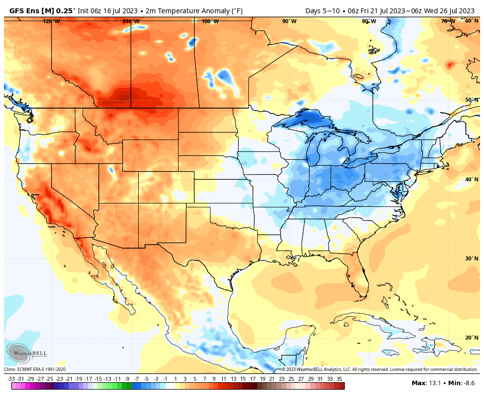
That brings us to our closing point and that’s the lack of any sort of significant heat. In fact, it’s just the opposite over the next couple weeks. The general thinking is the cooler than normal regime will likely make up the bulk of August as well, especially if we can sneak into Phase 5-6 of the MJO.
Permanent link to this article: https://indywx.com/sunday-morning-rambles-another-round-of-strong-storms-and-lack-of-significant-heat-grab-headlines/
Jul 15
Updated 07.15.23 @ 7:34a
Heavy rain fell overnight across northern ‘burbs and now a general rain is falling across central Indiana with some embedded thunder. This will continue for the next few hours before a bit of a break in the action.
We’ll then watch for some brightening of the sky and this should be just enough to allow a few stronger storms to fire up this afternoon into the evening hours. Coverage of these storms should be greatest for central and south/ eastern parts of the state.

Most of our Sunday should feature quiet weather conditions but our attention will need to shift to the northwest by Sunday evening. Higher resolution models are seeing a storm cluster initiating in the upper Midwest before potentially dropping into central Indiana late Sunday evening into the overnight hours. It’s a tricky setup but we’ll watch for consistency over the next couple models runs and update accordingly.
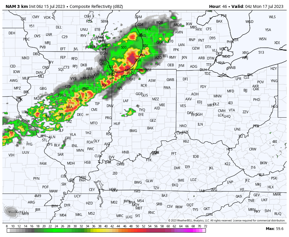
Beyond this period, most of the upcoming work week will feature a general drier brand of air blowing into the state. We’ll notice lower dew points and downright comfy conditions by late July standards early week (then as you’ll see below for late week).

The exception to the drier brand of air will be in the middle of the work week when dew points briefly return to the tropical 70° range and likely fuel resurgent storm coverage.
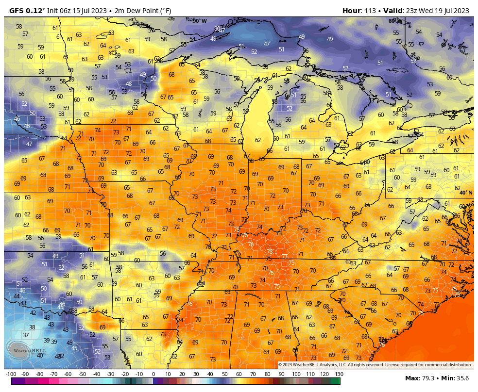
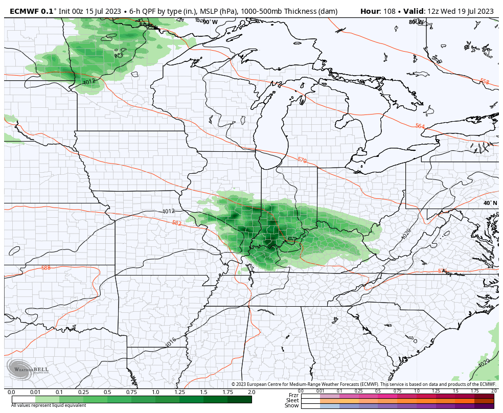
As of now, the early call on the latter part of next week is that lower humidity and reduced rain chances will help us kick off a pleasant stretch for the weekend. 🤞🏻
Permanent link to this article: https://indywx.com/wet-morning-additional-storm-chances-ahead/
Jul 14
Updated 07.14.23 @ 6:15a
You must be logged in to view this content. Click Here to become a member of IndyWX.com for full access. Already a member of IndyWx.com All-Access? Log-in here.
Permanent link to this article: https://indywx.com/video-storm-chances-ramp-up-saturday-looking-into-the-pattern-evolution-into-mid-late-august/