
You must be logged in to view this content. Click Here to become a member of IndyWX.com for full access. Already a member of IndyWx.com All-Access? Log-in here.
Category: T-storms
Permanent link to this article: https://indywx.com/2019/10/10/video-friday-will-feature-major-weather-changes-across-the-region/
Oct 08
VIDEO: Classic Early-Oct Weather Now; Strong Cold Front Hits Friday Evening…
You must be logged in to view this content. Click Here to become a member of IndyWX.com for full access. Already a member of IndyWx.com All-Access? Log-in here.
Permanent link to this article: https://indywx.com/2019/10/08/video-classic-early-oct-weather-now-strong-cold-front-hits-friday-evening/
Oct 05
Saturday Morning Rambles…
I. Our Saturday will get off to a stunning start. Despite some patchy fog here and there, look for plentiful sunshine and chilly temperatures in the low-mid 40s rising into the low-mid 70s for afternoon highs with increasing clouds.
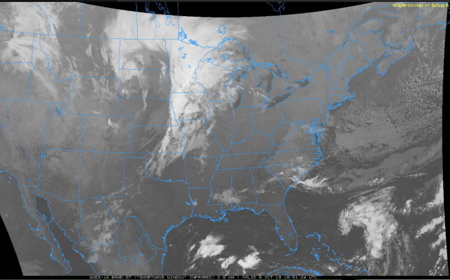
II. Those increasing clouds will deliver showers by tonight across central Indiana and then more concentrated heavier rain downstate Sunday evening into the predawn Monday. Southern Indiana is needing a good soaking in a bad way and this system will at least help things slowly begin to improve…


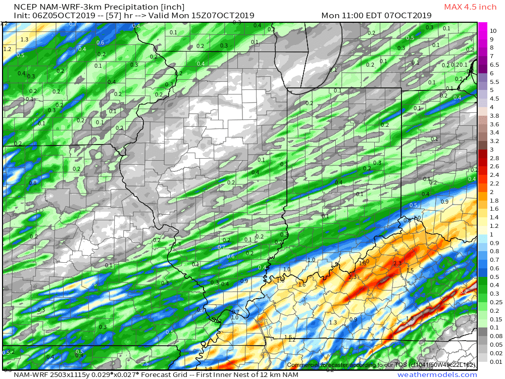
Rainfall totals with this system across central Indiana should accumulate to the tune of 0.20 to 0.40 for most with heavier amounts approaching 1” across the IN-KY border.
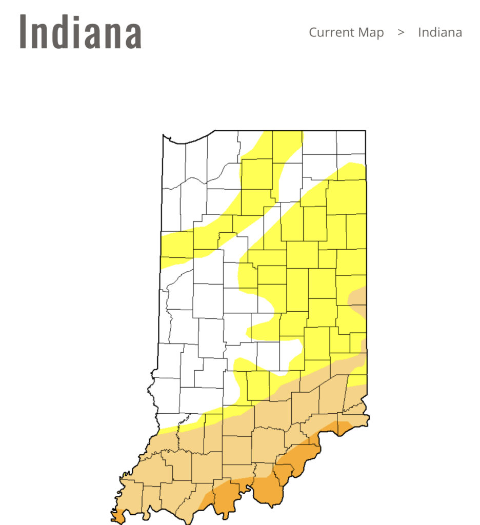
Note this is where things are driest across the state per Thursday’s drought update.
III. Our next storm system will swing through here late in the work week. We’re timing Thursday PM into early Friday for a round of showers and potentially gusty thunderstorms as a cold front pushes through.
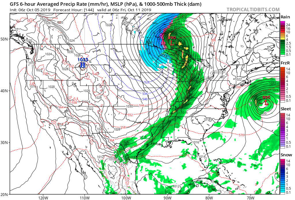
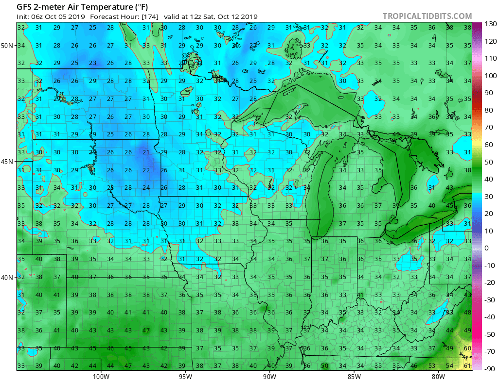
Behind this boundary, the coldest air of the fall so far will blow into town. We’re continuing to think many of the area can expect the first frost of the season next weekend.
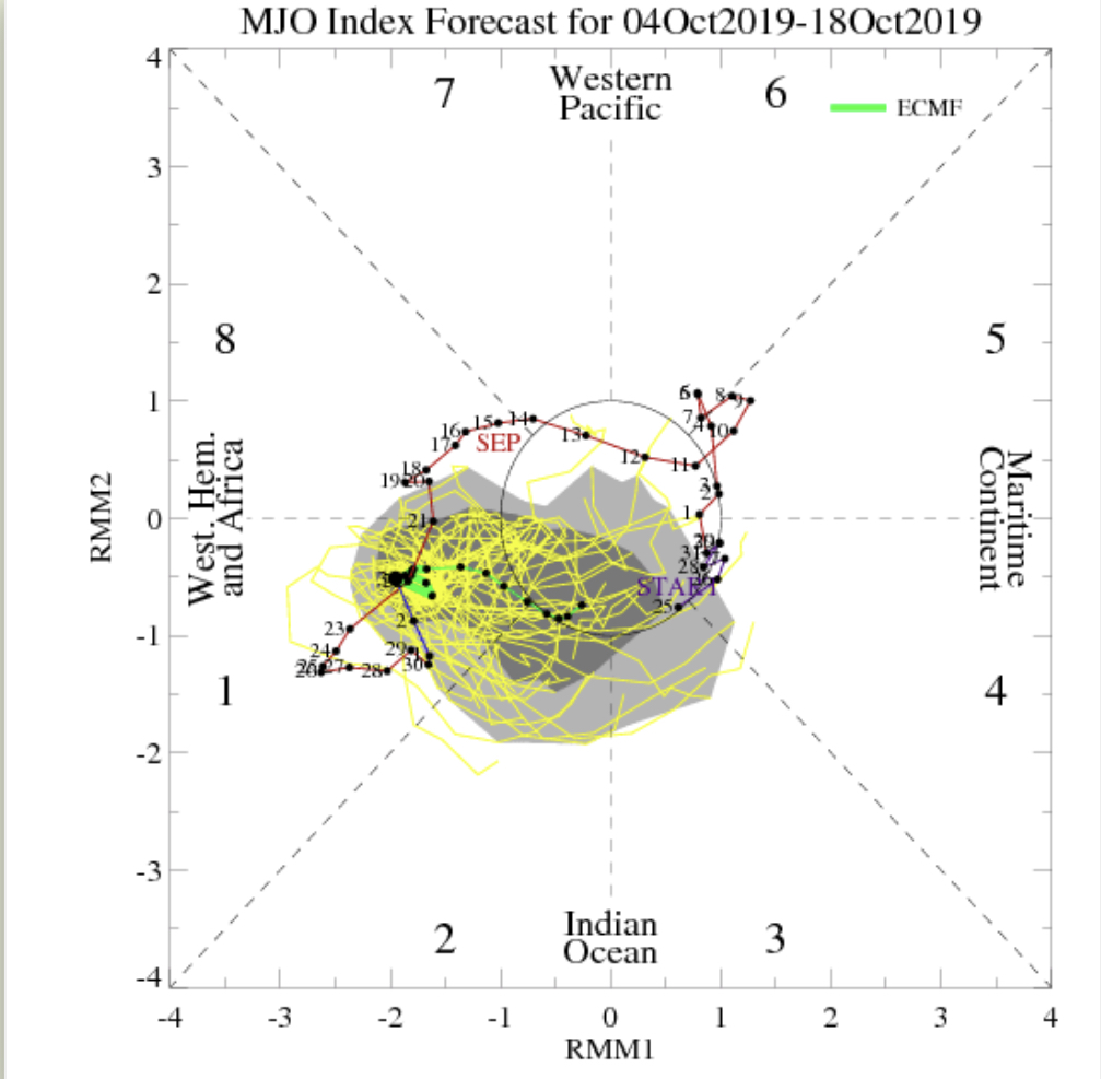
IV. As we look ahead, it’s time to start putting more stock into other tools in the box. Case in point, the MJO is showing signs of less amplitude over the upcoming couple weeks followed by a strongly positive PNA. This supports colder signals in the period. We’ll dig in further in the days ahead.

Permanent link to this article: https://indywx.com/2019/10/05/saturday-morning-rambles-10/
Oct 04
VIDEO: Welcoming An Autumn Like Feel; Fairly Active Pattern In The Week Ahead…
You must be logged in to view this content. Click Here to become a member of IndyWX.com for full access. Already a member of IndyWx.com All-Access? Log-in here.
Permanent link to this article: https://indywx.com/2019/10/04/video-welcoming-an-autumn-like-feel-fairly-active-pattern-in-the-week-ahead/
Sep 29
VIDEO: Summer Heat Gives Way To A Classic Fall Feel…
You must be logged in to view this content. Click Here to become a member of IndyWX.com for full access. Already a member of IndyWx.com All-Access? Log-in here.
Permanent link to this article: https://indywx.com/2019/09/29/video-summer-heat-gives-way-to-a-classic-fall-feel/
Sep 27
VIDEO: From Record Heat To A Predominantly Cooler Pattern Ahead…
You must be logged in to view this content. Click Here to become a member of IndyWX.com for full access. Already a member of IndyWx.com All-Access? Log-in here.
Permanent link to this article: https://indywx.com/2019/09/27/video-from-record-heat-to-a-predominantly-cooler-pattern-ahead/
Sep 26
VIDEO: Game Changing Week Ahead; From Summer To Fall…
You must be logged in to view this content. Click Here to become a member of IndyWX.com for full access. Already a member of IndyWx.com All-Access? Log-in here.
Permanent link to this article: https://indywx.com/2019/09/26/video-game-changing-week-ahead-from-summer-to-fall/
Sep 25
VIDEO: Discussing Short-Term Rain Chances; Unseasonable Heat, But Cooler Air Is On The Horizon…
You must be logged in to view this content. Click Here to become a member of IndyWX.com for full access. Already a member of IndyWx.com All-Access? Log-in here.
Permanent link to this article: https://indywx.com/2019/09/25/video-discussing-short-term-rain-chances-unseasonable-heat-but-cooler-air-is-on-the-horizon/
Sep 24
VIDEO: Pick Of The Week; Heat Builds This Weekend…
You must be logged in to view this content. Click Here to become a member of IndyWX.com for full access. Already a member of IndyWx.com All-Access? Log-in here.
Permanent link to this article: https://indywx.com/2019/09/24/video-pick-of-the-week-heat-builds-this-weekend/
Sep 23
VIDEO: Cooler, Drier Air Arrives This Afternoon; Major Model Differences This Weekend…
You must be logged in to view this content. Click Here to become a member of IndyWX.com for full access. Already a member of IndyWx.com All-Access? Log-in here.
Permanent link to this article: https://indywx.com/2019/09/23/video-cooler-drier-air-arrives-this-afternoon-major-model-differences-this-weekend/