Category: Summer

An Early Taste Of Fall…

Screen Shot 2016-08-21 at 11.51.52 AMHighlights:

  • Cooler and mostly sunny
  • Dry weather into the early parts of the work week
  • Midweek storms

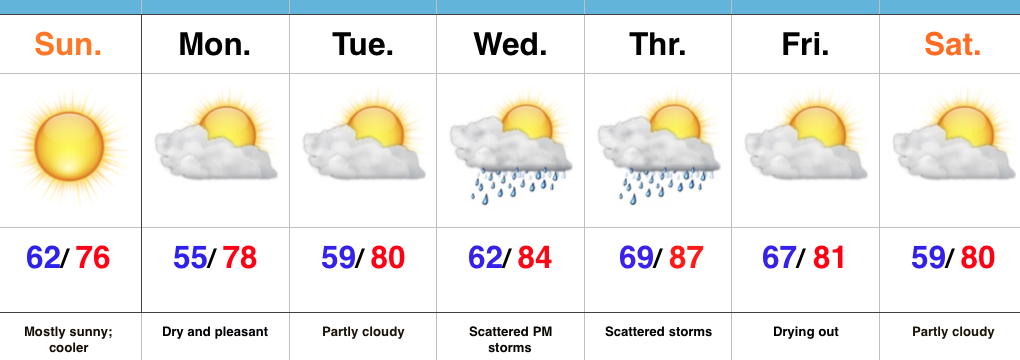
Early Fall Preview…A cold front swept through the state last night and was accompanied by strong storms and heavy rain.  The unsettled conditions are now to our east and in return we’re left with a much cooler, drier, and breezy day.  With low humidity, temperatures running significantly below normal, and a NW breeze in place, you have our approval to begin shifting thoughts to fall. 🙂

Dry and pleasant air will remain in place through early week before we back the air flow around to the SW.  Increasingly muggy conditions will return Wednesday into Thursday and as a cold front interacts with the moist air in place, showers and thunderstorms will be on the increase Wednesday into Thursday.  The good news?  The front should slide to our south and result in dry and pleasant conditions next weekend.

Upcoming 7-Day Precipitation Forecast:

  • Snowfall: 0.00″
  • Rainfall: 0.50″-0.75″

Permanent link to this article: https://indywx.com/2016/08/21/an-early-taste-of-fall/

VIDEO: Unsettled Now, But A Beautiful 2nd Half Of The Weekend Ahead…

You must be logged in to view this content. Click Here to become a member of IndyWX.com for full access.  Already a member of IndyWx.com All-Access?  Log-in here.

Permanent link to this article: https://indywx.com/2016/08/20/video-unsettled-now-but-a-beautiful-2nd-half-of-the-weekend-ahead/

Multi-Day Heavy Rain Event…

Central IN is still in play for a multi-day heavy rain event that begins this weekend and continues into the middle of next week.

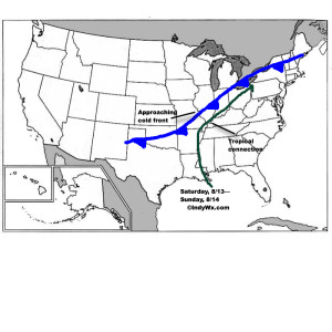
The setup is still one that features a wavy cold front that will halt to a crawl (eventually becoming stationary) over central and southern IN over the weekend.  Additionally, tropical moisture will continue to slowly push north, before curling northeast (following the frontal boundary) into the Ohio Valley.  The image below from Monday displays the setup nicely.

Wknd8:13Despite lackluster model output from our American suite (latest NAM and SREF data, for instance, paints rainfall totals under 1″ across most central IN neighborhoods), the European remains consistent on the evolution of things from this weekend into the middle of next week.  We’ll lean more towards it’s solution at this juncture.  Simply put, when you have a stalled frontal boundary entraining tropical moisture, expect problems.  Precipitable water values will approach and even exceed 2″ at times this weekend.  Dew points will remain in the upper 60s to lower 70s along and south of the boundary.  Where the boundary stalls will be key in determining the heaviest rain totals and resulting flood problems that will ensue.  For now, here’s the best idea we have in regards to local 4″+ totals between this weekend and next Wednesday.
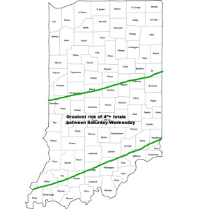
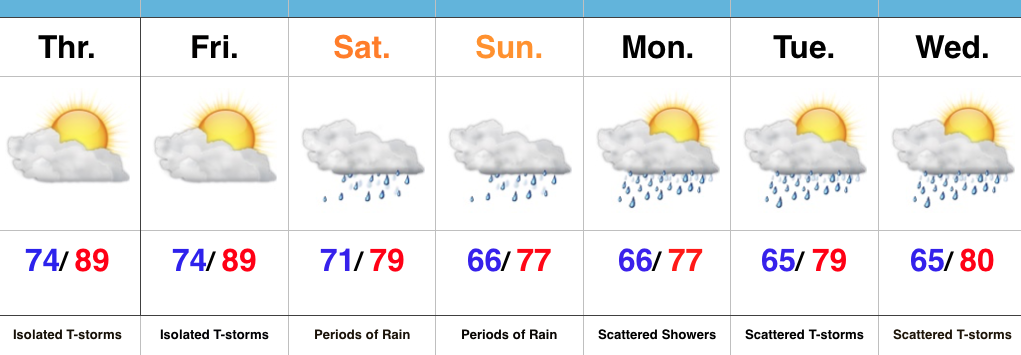
HVYRainTotalsIt should also be pointed out that we’re not looking at all day rains Saturday through Wednesday, but instead “waves” of moisture throughout the period.  Areas of locally heavy rain will be with us, but we’ll also see dry periods in between.  Thankfully, as we move into the latter portions of next week, drier times should return.
We’ll be here through the weekend to keep you updated on things, as well as on social media.  Stay tuned.

Permanent link to this article: https://indywx.com/2016/08/12/multi-day-heavy-rain-event/

A Wet Weekend In Store…

Screen Shot 2016-08-11 at 7.22.58 AMHighlights:

  • Tropical feel
  • Heavy weekend rains
  • Unsettled early next week

Zoning In On Heaviest Rains…It’s about as humid as it can get across central IN.  “Air you can wear” is the appropriate way to describe this humidity and overall sultry feel.  As we’d expect with this tropical air mass, isolated to widely scattered strong storms could pop at any point and result in locally heavy rain.  We’ll “rinse and repeat” today’s forecast to wrap up the work week.

Attention then shifts to a widespread soaking rain event this weekend as two main players “team up” to produce a localized flood threat.  A cold front will sag into central IN while remnant tropical moisture slowly moves north and eventually curls northeast.  Precisely where the front stalls in response to the tropical low moving north will be where heaviest (4″+) rains set up.  Thinking this morning places the greatest risk somewhere between Indianapolis and Louisville, but we caution that we still want to see a couple more model runs before settling on a given area.  Unsettled weather will likely continue into early next week as tropical moisture slowly exits stage right.

Longer term, indications point towards an overall cooler, wetter, back half of August. Times- they are ‘a changing!

Upcoming 7-Day Precipitation Forecast:

  • Snowfall: 0.00″
  • Rainfall: 2.00″-4.00″

Permanent link to this article: https://indywx.com/2016/08/11/a-wet-weekend-in-store/

VIDEO: Weekend Heavy Rain Threat…

You must be logged in to view this content. Click Here to become a member of IndyWX.com for full access.  Already a member of IndyWx.com All-Access?  Log-in here.

Permanent link to this article: https://indywx.com/2016/08/09/video-weekend-heavy-rain-threat/

The Last Month Of Meteorological Summer Is Upon Us…

You must be logged in to view this content. Click Here to become a member of IndyWX.com for full access.  Already a member of IndyWx.com All-Access?  Log-in here.

Permanent link to this article: https://indywx.com/2016/07/30/the-last-month-of-meteorological-summer-is-upon-us/

Storms Fire Later This Afternoon And Evening For Some…

It’s a nice start to the day, though patchy dense fog is impacting some communities this morning.  Sunshine will burn through the fog over the next hour, or two.

Screen Shot 2016-07-29 at 7.43.54 AMThat said, things will change as we progress into the prime heating hours of the afternoon and evening.  Upper level energy will rotate east out of the Plains (this morning) and across Indiana this afternoon and evening.
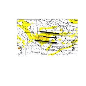
UntitledThis will help ignite thunderstorm development during the afternoon and evening.  While a storm could impact any given neighborhood this evening, best concentration of storms should lie north of the I-70 corridor.  Locally heavy rain will be a good bet with the stronger storms.  Localized rainfall amounts in excess of 2″ will be possible.
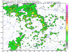
hrrr_ref_indy_13Additional scattered thunderstorm activity will continue Saturday, but there will be many more dry hours than wet/ stormy.
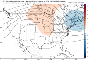
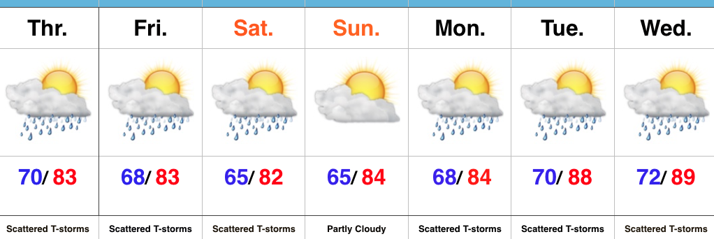
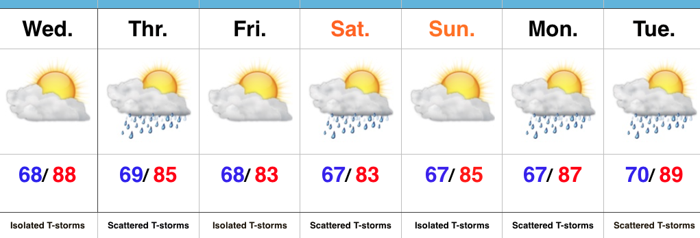
Looking ahead, a shot of heat will come out next week (lower 90 potential), but this will be transient.  By the 8-10 day period, we’re back into an active NW flow type look.  You know the drill by now.  That means potential storm complexes and the worst of the heat to our west, relative to averages.

ecmwf-ens_z500a_us_11

Permanent link to this article: https://indywx.com/2016/07/29/storms-fire-later-this-afternoon-and-evening-for-some/

Storms Increase In Coverage This Afternoon…

Screen Shot 2016-07-28 at 7.27.22 AMHighlights:

  • Storm coverage increases
  • Cooler than days past
  • Unsettled pattern next week

Stormy At Times…Widespread thunderstorms have resulted in as much as 4″-5″ of rain across southeastern IN during the early morning hours.  Flash flooding has resulted (including in and around the Cincy area, as well).  Closer to the home front, upper air energy will combine with a weak surface wave of low pressure to result in an enhanced storm chance this afternoon and evening across central IN.  Some locally heavy rain will accompany the stronger storms that develop, along with vivid lightning.

Scattered storm chances will remain Friday into Saturday, but there will also be plenty of dry hours, as well.  Drier air should keep most of the state rain-free Sunday before an unsettled regime returns for early and middle parts of next week.

Upcoming 7-Day Precipitation Forecast:

  • Snowfall: 0.00″
  • Rainfall: 0.75″-1.25″ (locally heavier totals)

Permanent link to this article: https://indywx.com/2016/07/28/storms-increase-in-coverage-this-afternoon/

Storm Chances, But Plenty Of Dry Time…

Screen Shot 2016-07-27 at 7.14.50 AMHighlights:

  • Storm chances, but timing needs fine tuning
  • Turning slightly cooler over the weekend
  • Unsettled regime continues early next week

More Sunshine Today…Areas of heavy rain resulted in localized flooding across south-central IN yesterday.  While we can’t go with a completely dry forecast today, it will be an overall drier day when compared to Tuesday.  An isolated thunderstorm is possible, but most should remain dry.

Upper level energy and increased moisture will lead to a more widespread coverage of showers and thunderstorms Thursday.  With precipitable water values approaching 2″ in spots Thursday, localized hefty downpours will again be possible.

We’ll continue scattered storm chances this weekend, particularly Saturday, as renewed upper level energy moves overhead.  After a slightly cooler stretch of weather, compared to normal, we’ll begin to heat things back up next week.

Upcoming 7-Day Precipitation Forecast:

  • Snowfall: 0.00″
  • Rainfall: 0.50″-1.00″ (localized heavier totals)

Permanent link to this article: https://indywx.com/2016/07/27/storm-chances-but-plenty-of-dry-time/

Stormy For Some This Morning; Transient Pattern Into August…

You must be logged in to view this content. Click Here to become a member of IndyWX.com for full access.  Already a member of IndyWx.com All-Access?  Log-in here.

Permanent link to this article: https://indywx.com/2016/07/26/stormy-for-some-this-morning-transient-pattern-into-august/

IndyWx.com