You must be logged in to view this content. Click Here to become a member of IndyWX.com for full access. Already a member of IndyWx.com All-Access? Log-in here.
Category: Summer
Permanent link to this article: https://indywx.com/2018/08/20/video-stormy-monday-hint-of-fall-on-the-doorstep/
Aug 19
Taste Of Early Autumn Before A Toasty Labor Day…
An early fall-like air mass will blow into town Tuesday night on the heels of a cold front and associated area of low pressure. Most central Indiana neighborhoods will wake up to temperatures in the 50s Wednesday through Friday mornings. A few communities may even dip into the 40s! Afternoon highs will only top out in the mid to upper 70s with dry conditions during the period.

Get ready for a “hint” of fall for the 2nd half of the work week.
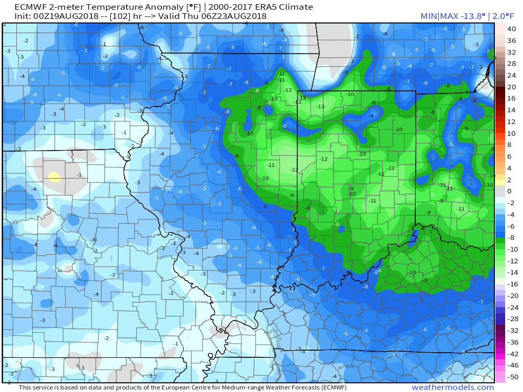
Temperatures will run well below average Wednesday and Thursday.
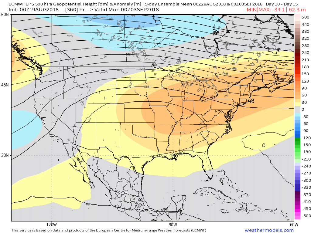
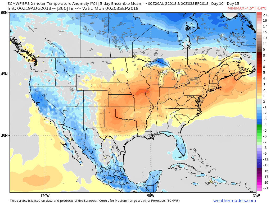
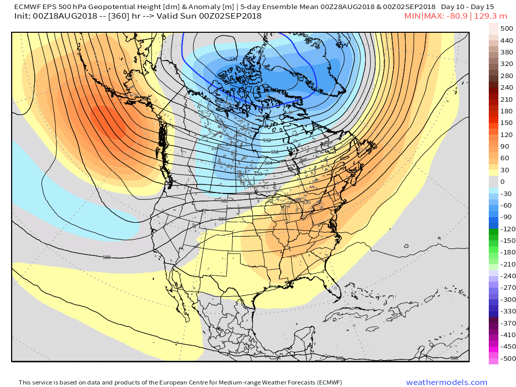
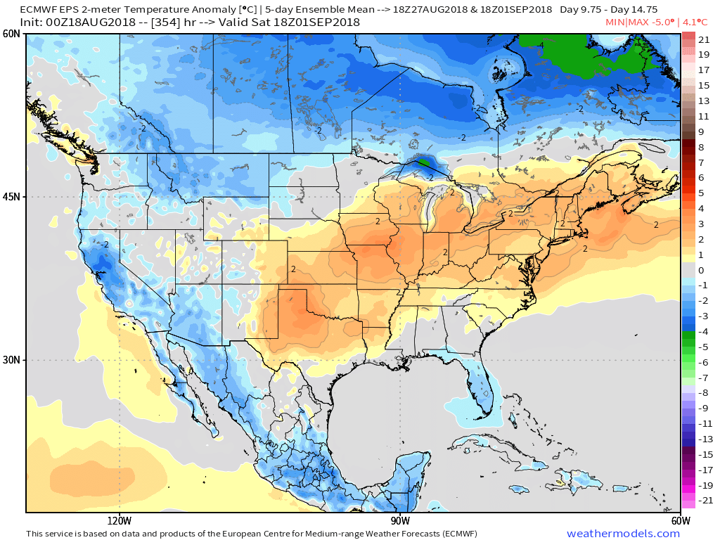
As we’d come to expect this time of year, the coming cool change won’t be a permanent “stick and hold” type deal. An upper ridge will expand as we close August and open September and the result will be renewed summer warmth just in time for the Labor Day weekend. This type of pattern should promote highs at least flirting with the 90° mark and oppressive overnight lows around 70°.
Permanent link to this article: https://indywx.com/2018/08/19/taste-of-early-autumn-before-a-toasty-labor-day/
Aug 18
Early Week Storm Delivers Strong Storms; Taste Of Early Autumn…
After we get rid of the morning fog, a mostly dry weekend is in store for central Indiana. The potential is present for a widely scattered shower for southern and eastern areas (mainly south of the city), but most of the immediate region will remain rain-free through the weekend.
Attention is now focused on a storm system that will deliver a return of unsettled weather to open the work week, followed by a “taste” of fall for midweek:
A surface low will move out of Iowa Monday evening into the Great Lakes region Tuesday. A trailing cold front will sweep through the state Tuesday evening.
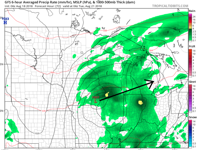
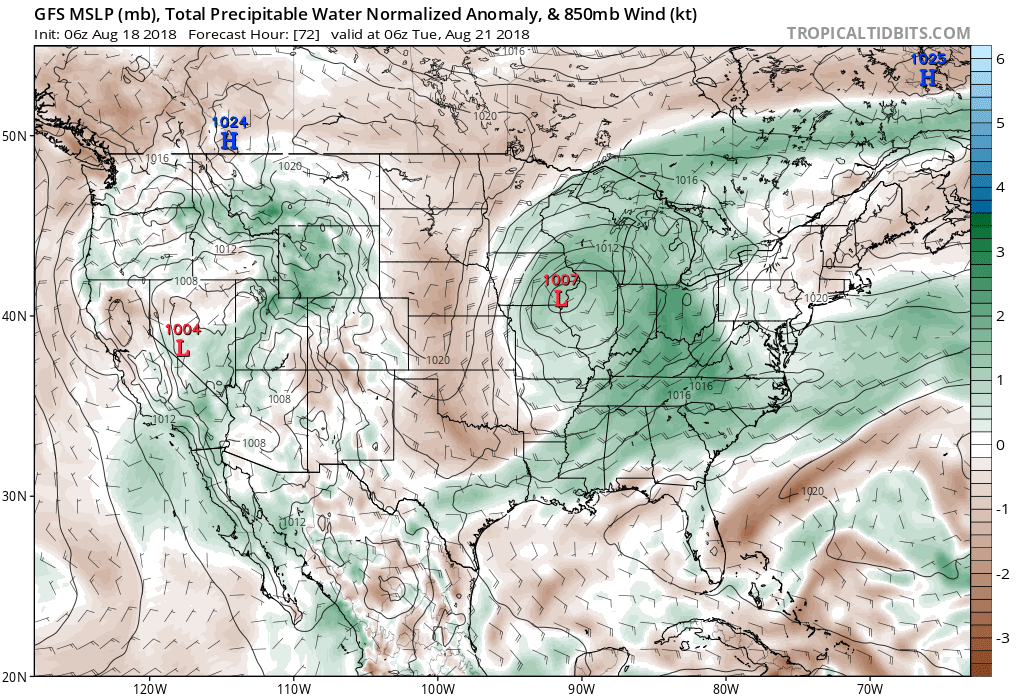 Scattered thunderstorms will return as early as Monday afternoon, but more widespread shower and thunderstorm activity is expected Tuesday. While not a textbook set-up for widespread severe weather by any means, enough ingredients are in place to at least raise an eyebrow for a few severe storms ahead of the cold frontal passage. Don’t be surprised if the ‘marginal’ risk is upgraded to a ‘slight’ risk for Tuesday in future updates from the Storm Prediction Center.
 Once the cold front moves through, a rather abrupt wind shift will drive a much drier and cooler air mass southeast and it’ll feel like early autumn around these parts as we progress through the second half of the work week. Not only will the significant drop in humidity be nice, but some outlying areas away from the city will likely fall into the 40s for overnight lows Thursday and Friday mornings. Highs will only top out in the mid to upper 70s.
 Looking longer term, summer isn’t finished just yet. Ridging will return for the Labor Day weekend and support building warmth as we put a wrap on August and open September.
Permanent link to this article: https://indywx.com/2018/08/18/early-week-storm-delivers-strong-storms-taste-of-early-autumn/
Aug 17
VIDEO: Storms Diminish Tonight; Early Week System Delivers Strong Storms & A Hint Of Fall…
You must be logged in to view this content. Click Here to become a member of IndyWX.com for full access. Already a member of IndyWx.com All-Access? Log-in here.
Permanent link to this article: https://indywx.com/2018/08/17/video-storms-diminish-tonight-early-week-system-delivers-strong-storms-a-hint-of-fall/
Aug 16
VIDEO: Bumpy Start Friday; Early Week Storm Is Followed By A “Hint” Of Fall…
You must be logged in to view this content. Click Here to become a member of IndyWX.com for full access. Already a member of IndyWx.com All-Access? Log-in here.
Permanent link to this article: https://indywx.com/2018/08/16/video-bumpy-start-friday-early-week-storm-is-followed-by-a-hint-of-fall/
Aug 14
VIDEO: Heavy Rain And Cooler Air On The Horizon…
You must be logged in to view this content. Click Here to become a member of IndyWX.com for full access. Already a member of IndyWx.com All-Access? Log-in here.
Permanent link to this article: https://indywx.com/2018/08/14/video-heavy-rain-and-cooler-air-on-the-horizon/
Aug 14
Periods Of Heavy Rain Move In For The 2nd Half Of The Week…
Tuesday will remain dry across central Indiana with plentiful sunshine and warm temperatures. The quiet times will give way to unsettled conditions as we progress through the second half of the week, including periods of locally heavy rain.
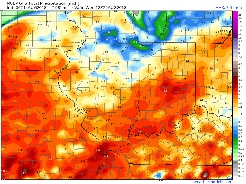
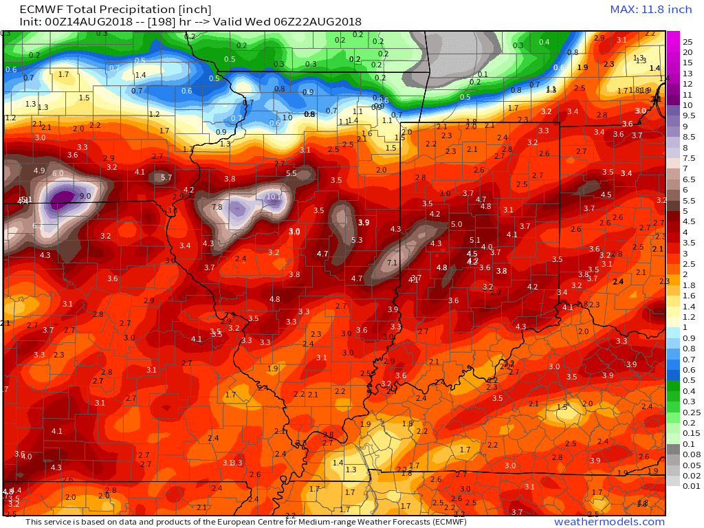
This is all part of a pattern that will remain active around these parts. We note the latest European model delivers three storm systems between now and this time next week. Each of these systems will be capable of producing hefty rainfall across the region.
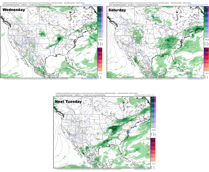 In the more immediate term, after a dry Tuesday, rain will arrive on the scenes Wednesday afternoon.

Forecast radar 1p Wednesday. Image courtesy of weathermodels.com.
Rainfall coverage and overall intensity will increase as Wednesday evening gives way to night, continuing into Thursday morning.
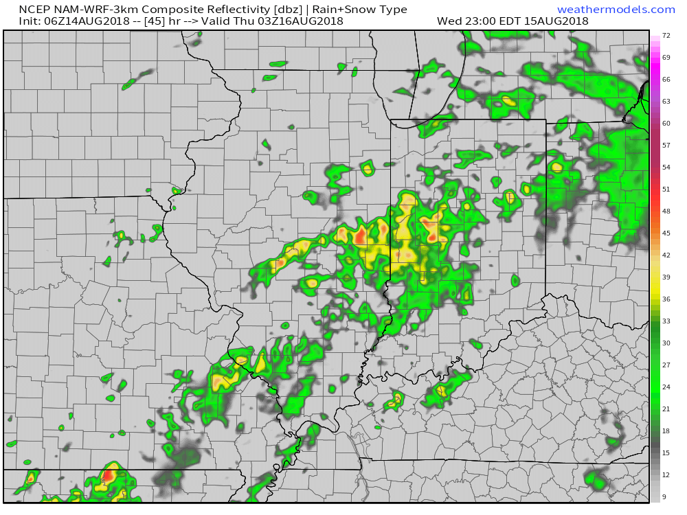
Forecast radar 11p Wednesday. Image courtesy of weathermodels.com.

Forecast radar 6a Thursday. Image courtesy of weathermodels.com.
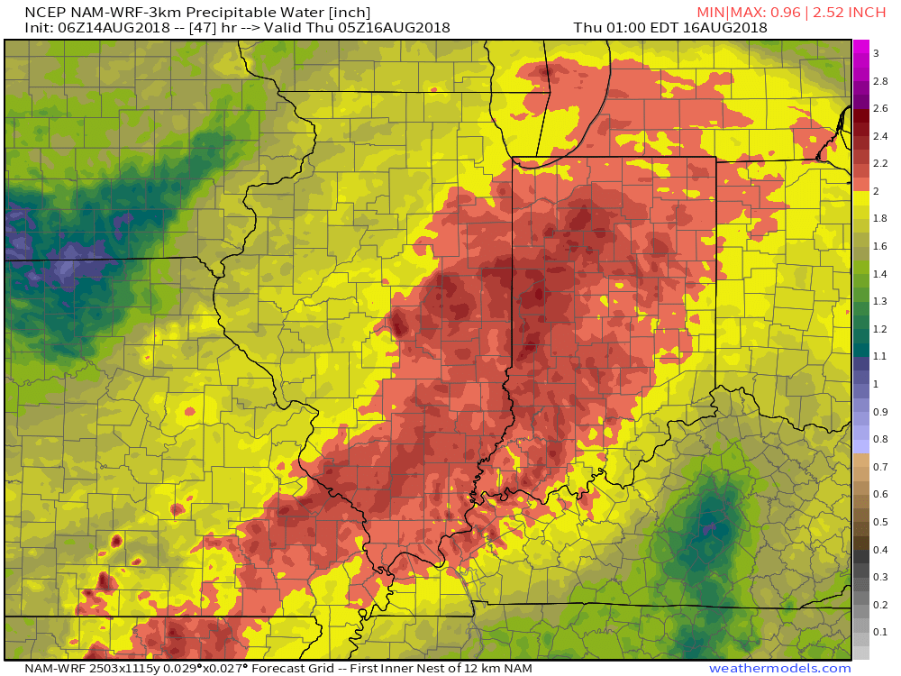
Note the high resolution models suggesting widespread precipitable water values (PWATs) in excess of 2″. This is a significant ingredient that will help fuel heavy rain Wednesday evening into Thursday morning.
 As mentioned above, a couple of other storm systems promise for continued unsettled times over the weekend and on into early next week. When we total things up by the middle of next week, both the GFS and European model agree on widespread 3″ to 5″ totals.
Permanent link to this article: https://indywx.com/2018/08/14/periods-of-heavy-rain-move-in-for-the-2nd-half-of-the-week/
Aug 13
VIDEO: Midweek Storm System Delivers Renewed Heavy Rain Threat…
You must be logged in to view this content. Click Here to become a member of IndyWX.com for full access. Already a member of IndyWx.com All-Access? Log-in here.
Permanent link to this article: https://indywx.com/2018/08/13/video-midweek-storm-system-delivers-renewed-heavy-rain-threat/
Aug 12
Looking At The Week Ahead: Relatively Quiet Open Gives Way To Active Times…
High pressure will dominate our early week weather. With the exception of an isolated shower or thunderstorm across eastern portions of central Indiana this afternoon, most should remain rain-free through the daytime hours Tuesday.
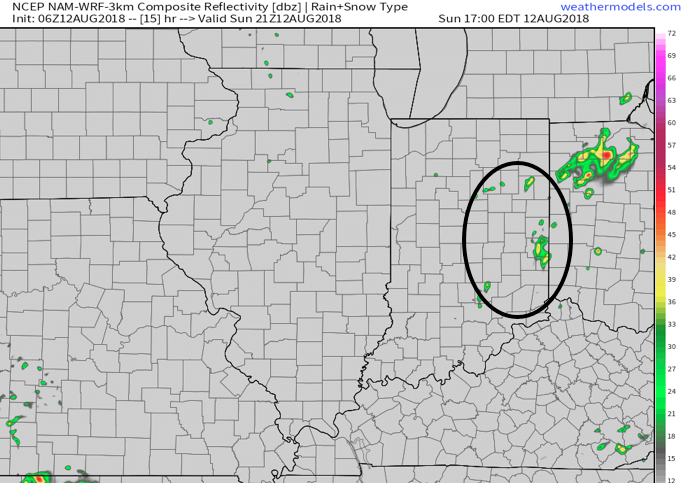
A couple of showers may impact e-central parts of the state later this afternoon. Most will remain rain-free. Image courtesy of weathermodels.com.
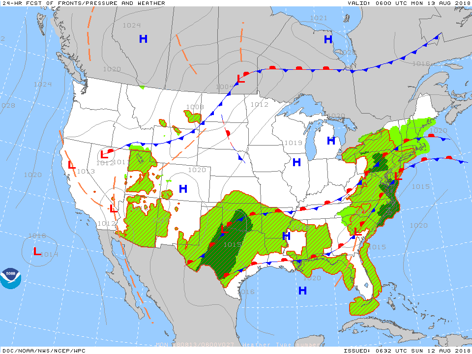
High pressure will keep the majority of the region quiet to open the new week.
The pattern will begin to turn busy once again as we move into midweek. An approaching storm system will increase shower and thunderstorm chances late Tuesday night through Thursday. While it won’t rain the entire time, locally heavy downpours are expected at times during the midweek stretch.
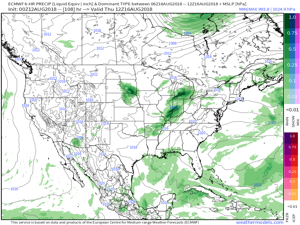 Most of central Indiana can expect to pick up 0.75″ to 1.25″ of rain during the aforementioned period, but there will be locally heavier totals.
 Looking towards next weekend, forecast models generally agree on active times continuing, but disagree on the important specifics. We’ll go with a “blend” right now and increase rain chances again Saturday and Sunday- after a briefly drier Friday. The ranges are anywhere from a flood threat, such as the European currently suggests, to typical scattered showers and thunderstorms, per the latest GFS. Stay tuned as we continue to fine tune through the upcoming week.
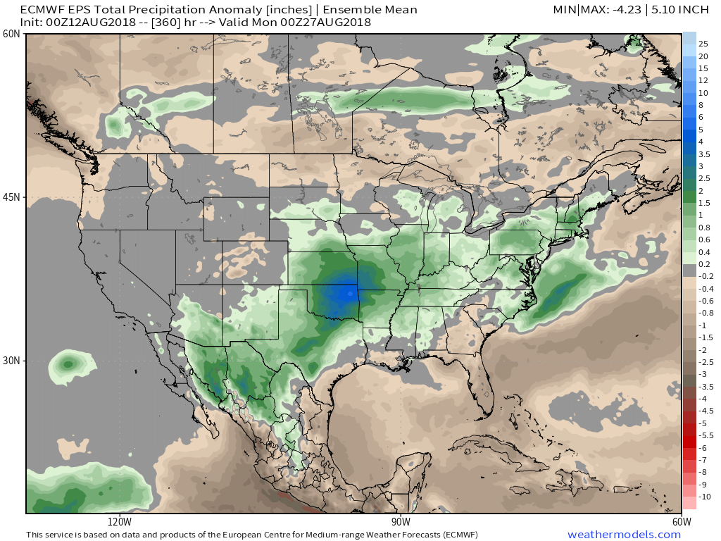
This is all part of a continued active weather pattern that will likely produce above normal precipitation as we close out the month and look towards September…
Permanent link to this article: https://indywx.com/2018/08/12/looking-at-the-week-ahead-relatively-quiet-open-gives-way-to-active-times/
Aug 10
VIDEO: Friday Opens Quiet, But Ends Stormy For Some…
You must be logged in to view this content. Click Here to become a member of IndyWX.com for full access. Already a member of IndyWx.com All-Access? Log-in here.
Permanent link to this article: https://indywx.com/2018/08/10/video-friday-opens-quiet-but-ends-stormy-for-some/
