You must be logged in to view this content. Click Here to become a member of IndyWX.com for full access. Already a member of IndyWx.com All-Access? Log-in here.
Category: Summer
Permanent link to this article: https://indywx.com/2019/04/11/wet-and-active-pattern-on-deck/
Apr 10
Strong Storms Thursday Night; Early Summer Ideas…
The daytime Thursday will be dominated by a summer-like feel as highs approach the 80 degree mark, along with an increasingly gusty SW wind ahead of an approaching cold front. We’ll stay dry through the day and it’s not until we get to the overnight hours when storm chances will begin to increase.
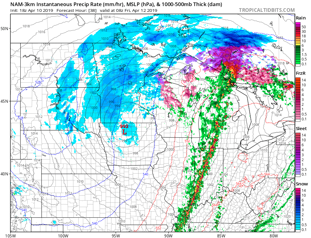
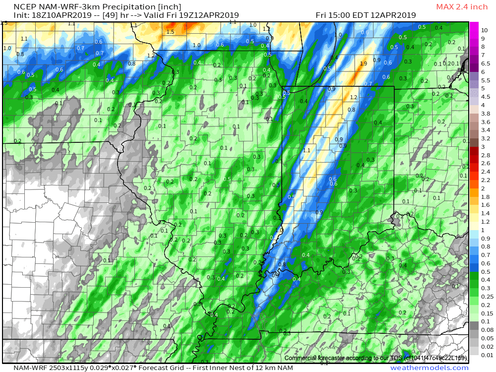
More specifically, we think the hours between 12a and 5a will offer up the best chance of a slow moving line of storms to track across central Indiana. A couple of these storms could produce damaging winds. Locally heavy rainfall can also be expected with widespread amounts of 0.50″ to 1″ with a few 1″+ totals likely by the time we get to sunrise Friday. The rain will be well to our east by lunchtime Friday and a dry close to the day is on tap.
On the heels of this storm will come another wet weather maker Saturday night and Sunday and tomorrow morning’s video update will have more details around timing and rainfall amounts with that system.
Early Summer Ideas
I. Weak El Nino anticipated to persist through the Summer of 2019.
II. Warm SSTs in the Gulf of Mexico and off the Southeast Coast.
We’ll have our complete official Summer Outlook posted during the first week of May, but wanted to share our early thoughts. Overall, a warmer than average summer is expected with average to slightly above normal rainfall, locally.
The warmer than average sea surface temperatures (SSTs) raise concern for the potential of well above average precipitation across the Southeast and MidAtlantic regions. Additionally, those warm water conditions also mean we’ll need to keep close eyes on the potential of tropical activity early on in the season in the Gulf or off the SE coastline.
Much more next month, including graphics!
Talk with you bright and early in the AM!
Permanent link to this article: https://indywx.com/2019/04/10/strong-storms-thursday-night-early-summer-ideas/
Feb 16
2019 Spring Outlook…
2019 IndyWx.com Spring Outlook
Forecaster: Team; Date Issued: 02.16.19
Last spring was a tale of two seasons in itself. March (featured a foot of snow) and April were significantly colder than normal and then we shifted things to summer in May (the last month of meteorological spring was close to 10 degrees above normal). As a whole, it was a quiet severe weather season.
Despite the wild swings, at the end of the day, things “balanced out” nicely across the central Ohio Valley, including central Indiana.
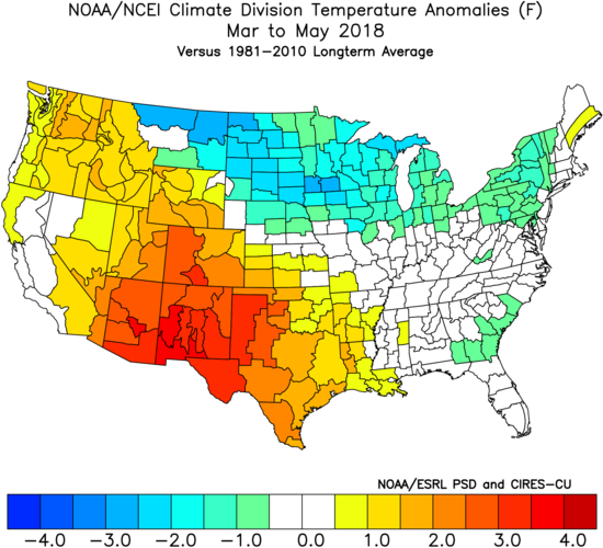
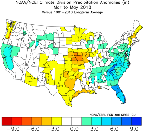
As we look ahead to what the 2019 version holds, here are a few headlines that have our attention:
I. Weak Nino is behaving more like a Nina (Tropical Northern Hemisphere pattern can be thanked for this).
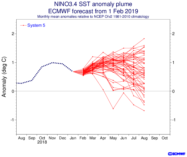
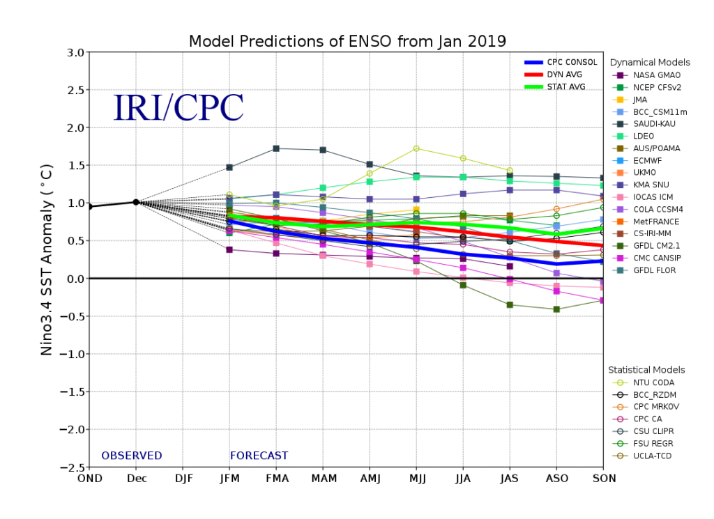
II. Neutral NAO is expected
III. Neutral PDO (Pacific Decadal Oscillation)
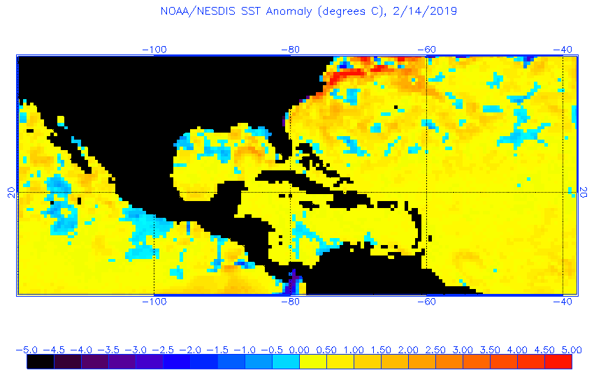
In addition, we’re paying special attention to the SST configuration in the Gulf of Mexico. A warmer than average GOM can most certainly lead to a more “hyper” severe weather season as spring gets going.
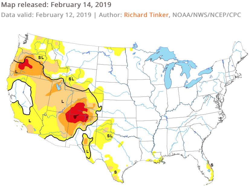
The late winter/ early spring drought monitor can give a hint where early warmth may try and get going. However, this year, we can’t rely on this tool as the Plains and East, including the heart of the #AGbelt, have seen copious amounts of moisture over the winter.
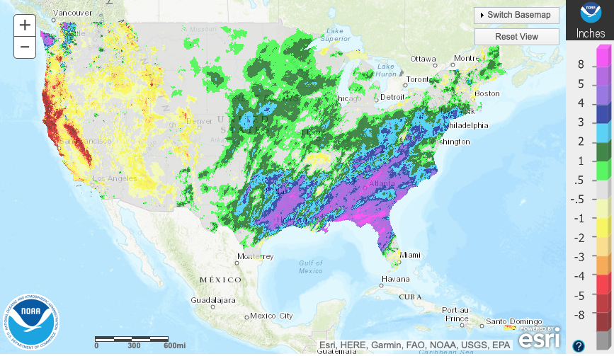

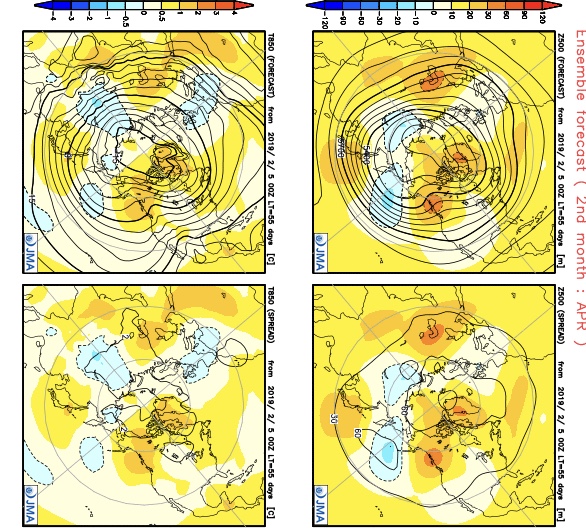
Let’s look at what the model guidance is printing out for meteorological spring:
JMA


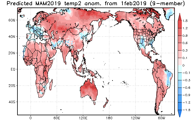
CFSv2

JAMSTEC
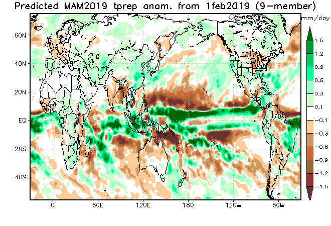
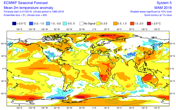
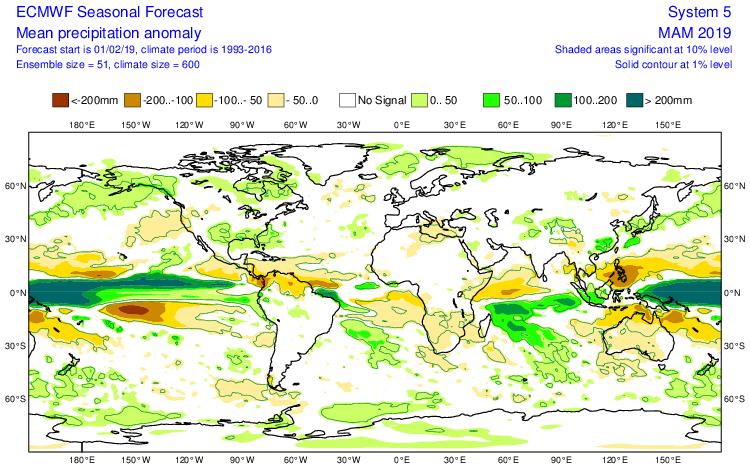
European Seasonal
Summary
We anticipate a slightly warmer than average spring season across not only central Indiana, but the Mid West and Ohio Valley region, as a whole. A weak El Nino is expected to persist into the upcoming summer and the conditions typically associated with such should eventually show themselves (as opposed to more of a Nina-like flavor now) through the spring. We agree with the consensus of model guidance above that March is likely to feature the coldest temperatures, relative to normal, and that’s primarily due to what should be a colder 1st half of the month before more bonafide spring conditions take hold the 2nd half of the month. Precipitation is anticipated to run near average, if not slightly below average, levels through the spring. As for severe weather, we expect a much busier season than last year, especially with the warm SSTs lurking in the Gulf of Mexico.
Permanent link to this article: https://indywx.com/2019/02/16/2019-spring-outlook/
Oct 23
New Month; New Pattern (In Some Aspects) Around The Corner…
October got off to a warm start, but unseasonably chilly conditions have dominated over the past couple of weeks. In fact, we’re on a stretch of (12) consecutive days below average after the summer-like start. The other common theme? Dry, dry, dry. Officially, IND is running close to 1″ below average through the first few weeks of the month. Changes loom- at least to some extent.
 We notice the ensemble data (both the European and GFS) is painting a more active, wetter regime as we move through early November. Given the upper air pattern, we would tend to agree.
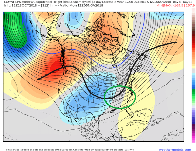

European data, courtesy of Weathermodels.com, paints a much more active picture early November.

GFS data, courtesy of Tropicaltidbits.com, shows the return of a wetter pattern for early November.
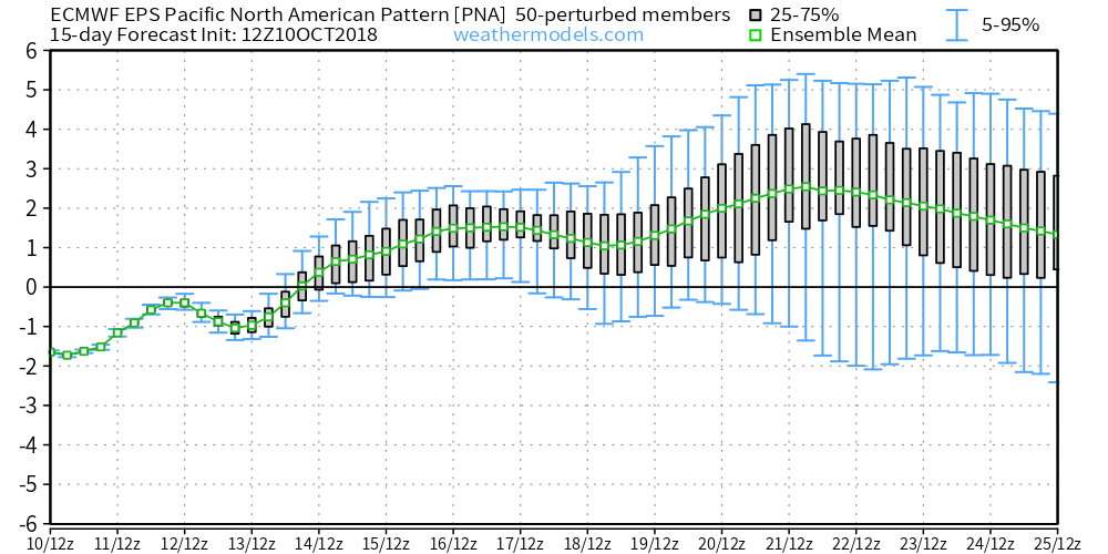
While confident on the return of wet conditions as we traverse the first week or two of November, data is struggling to get a handle on the PNA past the short-term. The PNA, or Pacific North American Pattern, teleconnection is one of our favorites this time of year to “key in” on the medium range pattern. While the NAO and AO get a lot of attention the deeper we get into the cold season, the PNA can be a tremendous tool during transition seasons. We note latest data is trending significantly more towards a positive PNA (compared to previous runs)- which is a colder signal.
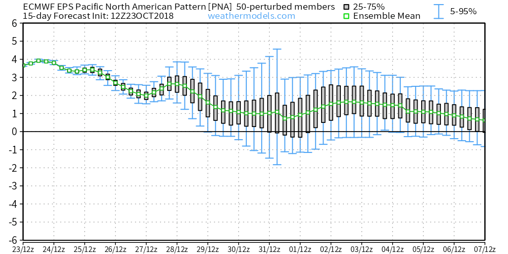 To no surprise, data has trended chillier during today’s 12z update.
 To close, bank on a return of the wet conditions as we move into the mighty month of November. From a temperature perspective, the forecast is much tougher for the first half of November. As things stand now, we continue to favor a relaxation of the anomalous chill overall, but can certainly see where “pops” of cold air can easily sweep in behind what should be an active storm track from the mid-south up into the Mid West and Ohio Valley. Stay tuned.
Permanent link to this article: https://indywx.com/2018/10/23/new-month-new-pattern-in-some-aspects-around-the-corner/
Oct 10
First Frost Of The Season Comes Right On Schedule…
The average date for the first frost and freeze in Indianapolis takes place on October 11th and 14th, respectively. Right on cue, the first frost of the season will take place for most central Indiana neighborhoods over the weekend. If you happen to miss out on the frosty conditions this week, reinforcing chilly air will descend on the region early next week.
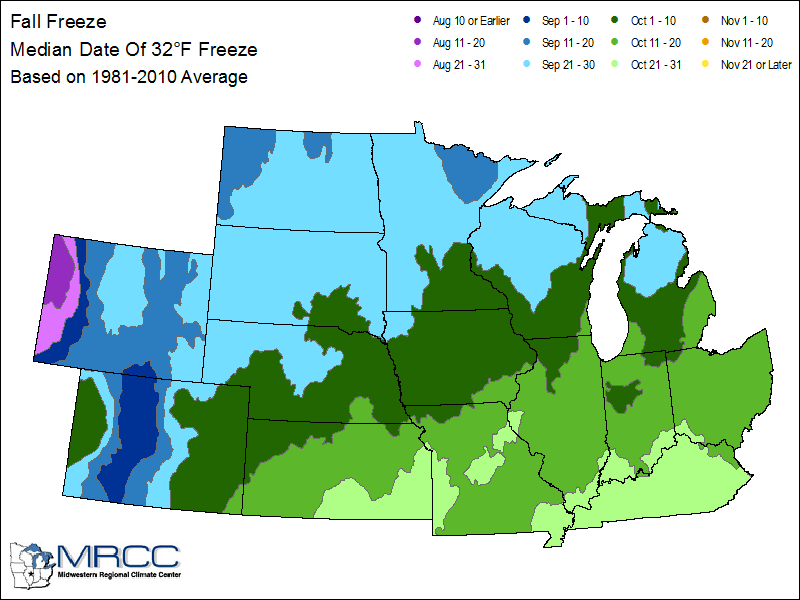
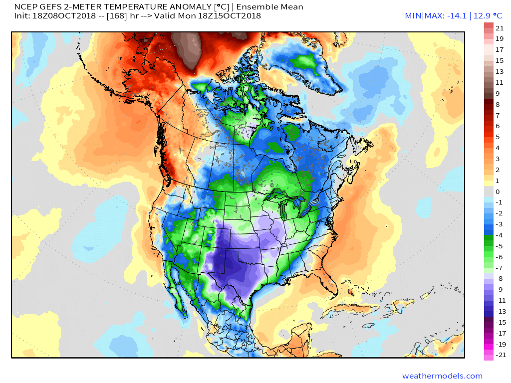
We forecast (3) of the upcoming (7) nights to fall into the 30s. This is, obviously, a significant change from the extended summer like conditions we’ve been dealing with as of late. One primary driver behind the significantly cooler pattern has to do with the change in the PNA. The shift towards a positive PNA will result in the cooler air remaining in place with more staying power than the fleeting cool shots of a few weeks ago.
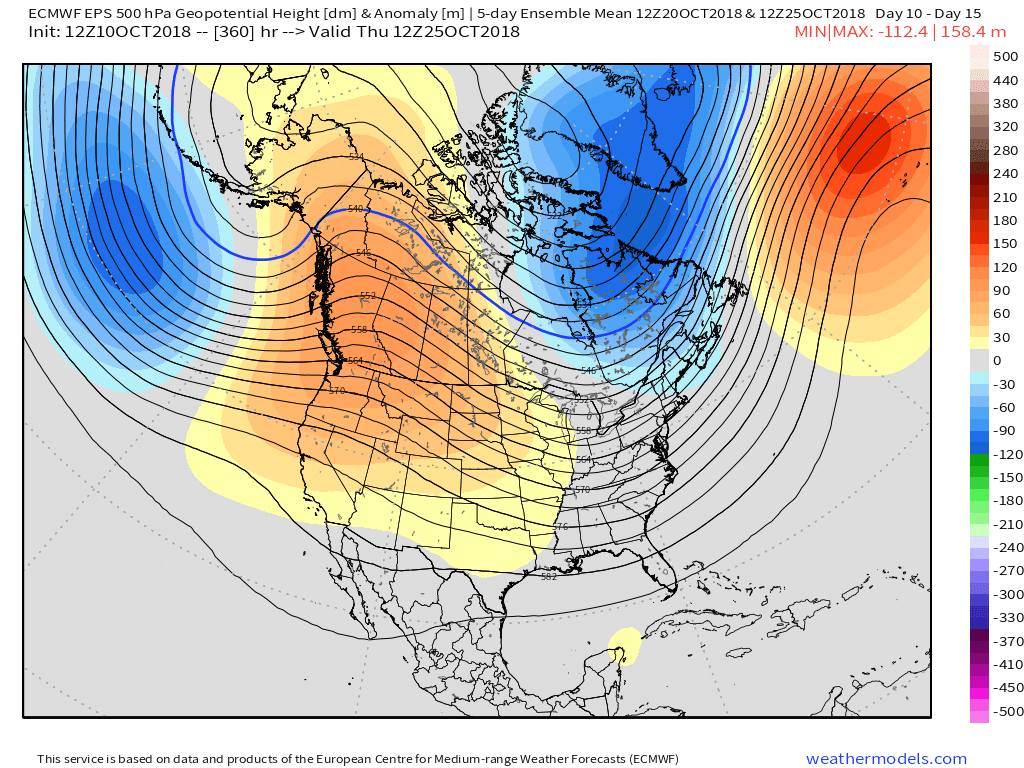
 A series of cold fronts will sweep through the Ohio Valley over the upcoming couple of weeks and each will likely feature progressively cooler conditions.
With the positive PNA in place, it’s no surprise to see the mean trough setting up shop over the eastern portion of the country.
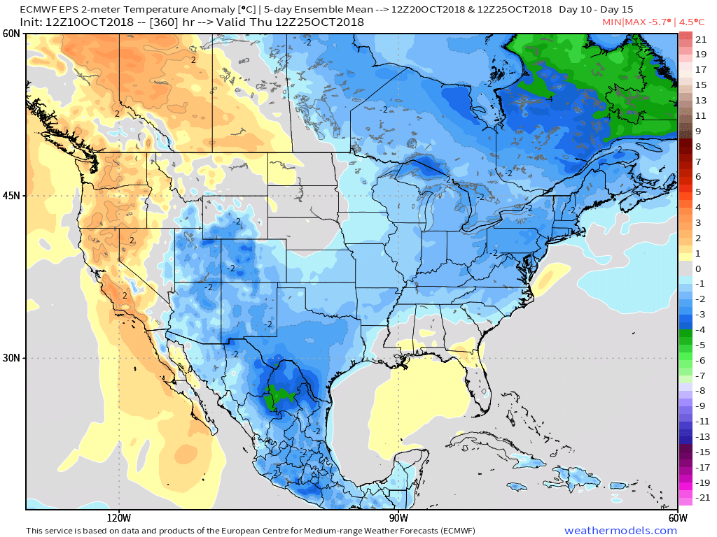
 At the surface, we see the cool pattern taking hold into not only the short-term, but the 10-15 day range, as well.
Permanent link to this article: https://indywx.com/2018/10/10/first-frost-of-the-season-comes-right-on-schedule/
Oct 09
Fall Arrives In Earnest Here…
You must be logged in to view this content. Click Here to become a member of IndyWX.com for full access. Already a member of IndyWx.com All-Access? Log-in here.
Permanent link to this article: https://indywx.com/2018/10/09/fall-arrives-in-earnest-here/
Oct 08
One More Summer-Like Day Before A Big Change…
High pressure and warm southwesterly winds will lead to one more summer-like day before significant changes take place. Plentiful sunshine can be expected Tuesday with temperatures closer to a record high (88° set in 1939) than the average of 68°.
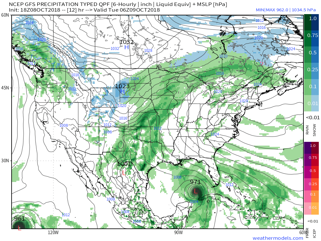
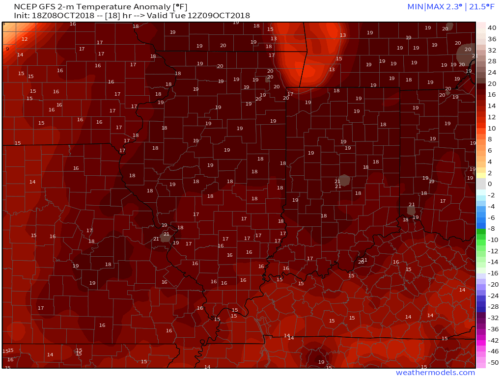 A cold front will sweep through the region Wednesday evening and will lead to a better chance of more concentrated showers and thunderstorms for our hump day. Precipitable water values (PWATs) will approach 2″ Wednesday afternoon which is almost unheard of by October standards. As a result, a couple of the storms may be accompanied by locally heavy rainfall.

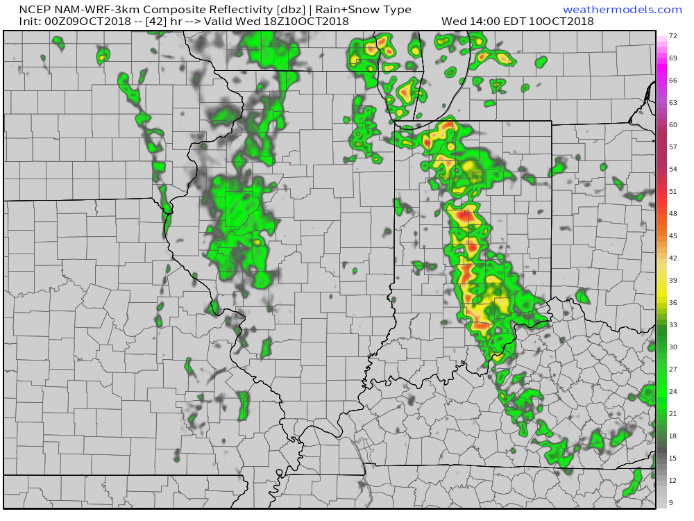 Winds of change will be blowing in earnest Wednesday night and Thursday morning and a legit fall feel will greet us out the door! Most of central Indiana can expect temperatures to be falling into the 40s Thursday morning along with a nice northwest breeze.
 Longer term, a new storm system (including remnant moisture from Sergio) is expected to impact our weekend weather. We’ll trend our forecast wetter with reviewing some of the latest data. Sunday appears to be the wettest day.

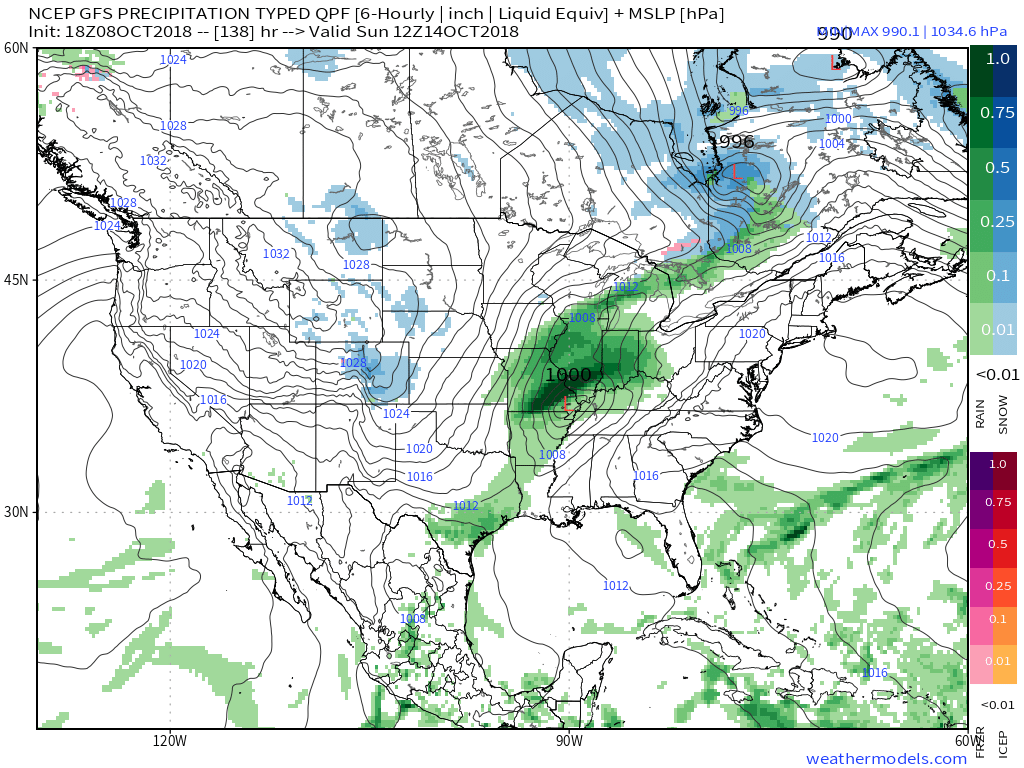 An even more impressive push of fall air will follow on the heels of Sergio’s remnants early next week, including the potential of frost for more of the Ohio Valley, including central Indiana.
Permanent link to this article: https://indywx.com/2018/10/08/one-more-summer-like-day-before-a-big-change/
Oct 08
Watching Michael; November-Like Pattern Looms…
You must be logged in to view this content. Click Here to become a member of IndyWX.com for full access. Already a member of IndyWx.com All-Access? Log-in here.
Permanent link to this article: https://indywx.com/2018/10/08/watching-michael-november-like-pattern-looms/
Oct 07
Looking At The Week Ahead: Significant Changes To A MUCH Cooler Pattern Loom…
We’re opening the new week with the same old unseasonably warm and muggy weather pattern that was with us the majority of last week, but significant changes loom during the week ahead. Ultimately, summer will be laid to rest (finally) and a legitimate, “stick and hold” fall pattern will take hold. The transition will feature a “game changer” of a midweek cold front that will take us from an August to a November feel in as little as 24 hours. Here are some highlights between now and then:
I. A strong ridge will continue to promote an unseasonably warm and muggy feel by early-October standards. Scattered “splash and dash” storms are possible through the early portion of the week, but organized significant rain isn’t anticipated.
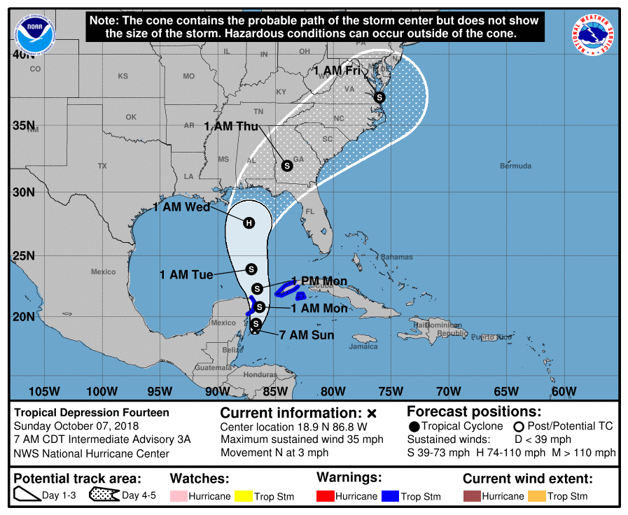
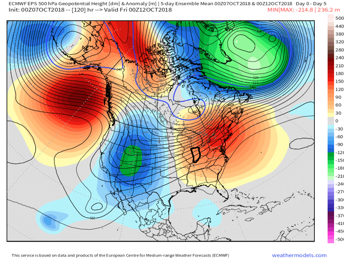 II. TD 14 will strengthen into Tropical Storm Michael later today and eventually a hurricane before making landfall along the Florida panhandle during the middle of the week. The remnant moisture of Michael will then race northeast and impact the flood-ravaged Carolinas during the latter stages of the work week.
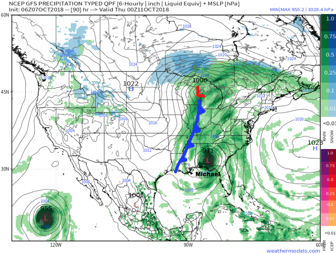
 III. As Michael’s remnant moisture tracks northeast into the Carolinas, a strong cold front will sweep through the Mid West and Ohio Valley. Better chances of organized showers and thunderstorms will arrive ahead of the front Wednesday. Once the front passes, a dramatic wind shift to the northwest will push a MUCH cooler and drier air mass into the region.
 IV. We note the PNA (Pacific North America pattern) is flipping to a positive state and that will drive a more sustained period of colder air during the medium and longer range period- or mid and late October.
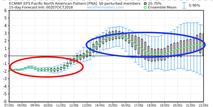
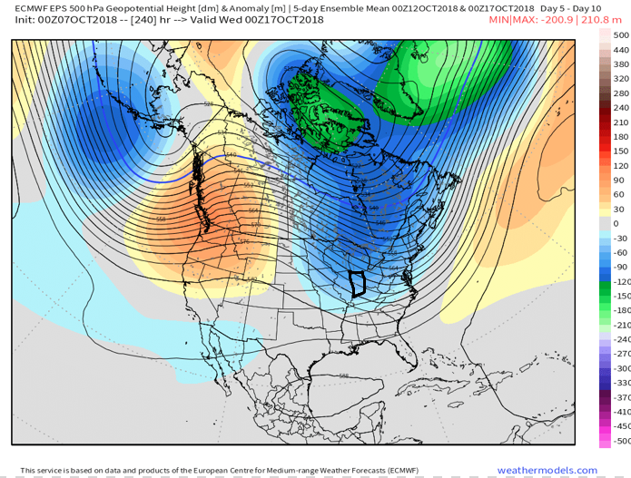
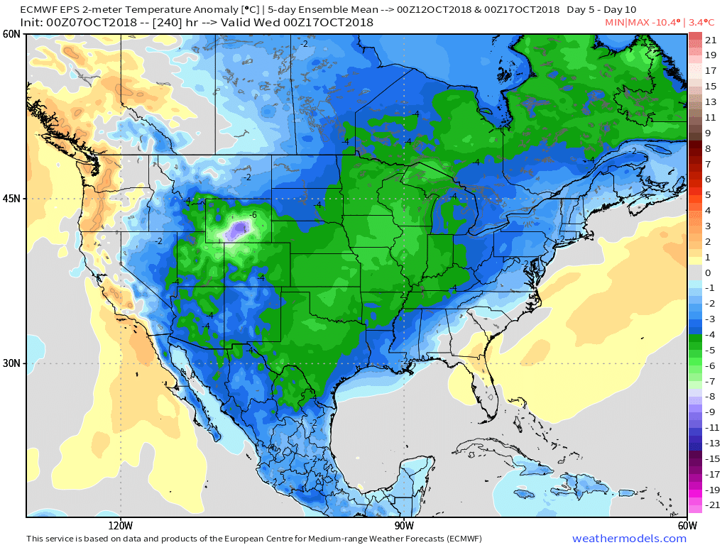 The air will grow cold enough to support the potential of frost during the 5-10 day period on at least a couple of nights. Additionally, reinforcing chilly air may ignite the lake effect to our north and northeast during Week 2… “Times, they are a changing!”
Permanent link to this article: https://indywx.com/2018/10/07/looking-at-the-week-ahead-significant-changes-to-a-much-cooler-pattern-loom/
Oct 03
Storms Return Thursday; Summer-Like Weekend…
You must be logged in to view this content. Click Here to become a member of IndyWX.com for full access. Already a member of IndyWx.com All-Access? Log-in here.
Permanent link to this article: https://indywx.com/2018/10/03/storms-return-thursday-summer-like-weekend/
