You must be logged in to view this content. Click Here to become a member of IndyWX.com for full access. Already a member of IndyWx.com All-Access? Log-in here.
Category: Summer
Permanent link to this article: https://indywx.com/2019/06/21/video-timing-out-storm-impacts-this-weekend-more-july-chatter/
Jun 20
Thursday Evening Rambles: Stormy Weekend On Deck; New European Weeklies Are In…
I. Briefly Refreshing: A badly needed dry stretch of weather will be short-lived- 24 hours at most for the majority of central Indiana, and that’s if you’re lucky. This evening, however, will offer a much drier brand of air building into the area along with dew points and temperatures falling into the middle to upper 50s. Areas of dense fog will be possible Friday morning in spots.
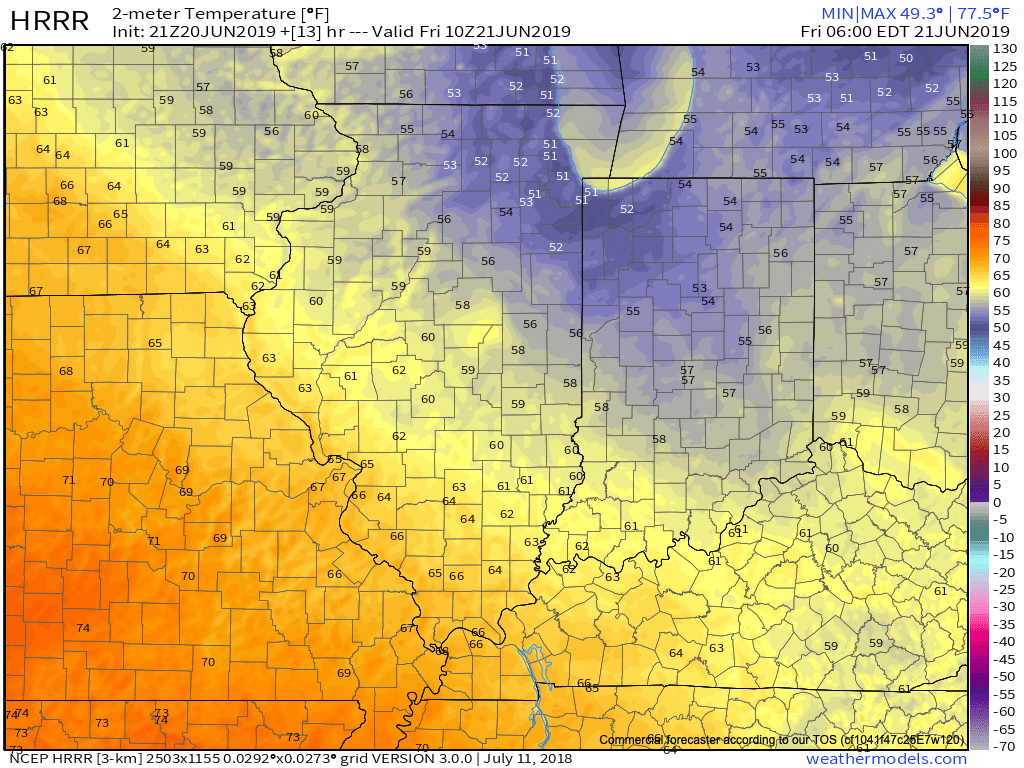
II. Tropical Air Returns: Just as soon as the drier air mass arrives, it’ll depart. We’ll go from morning dew points in the middle 50s Friday to upper 60s by evening and into the lower 70s by Saturday evening. It’s safe to the say that once to Saturday afternoon the humidity will be back with authority.
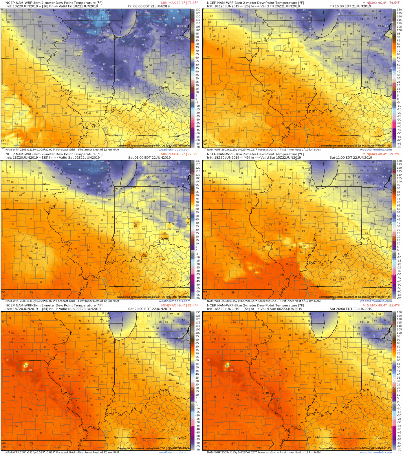
III. Warm Front Provides Focus For Storms: A warm front will lift northeast over the weekend and serve focus for hefty storms clusters to track in a northwest to southeast fashion. The first of a series of these clusters will likely arrive into the state late Friday morning or early afternoon and most likely affect the southwest portion of the state.

We believe the drier air mass will initially serve to shunt the storms to our southwest, but as an increasingly moist air mass lifts north, better chances of storms will return Friday evening into Saturday morning. This is a tough pattern to get specific with timing these storms clusters, but it’s safe to say central Indiana will come under the gun for multiple rounds of storms through the weekend and into early next week.
IV. Warmer; Drier Trends: While we can’t completely eliminate rain and storm chances, the trends continue to move towards a warmer and drier pattern building in here in the medium range (6-10 day period, or the overall period through the middle of next week into next weekend) as an upper level ridge builds over the Ohio Valley.

Enjoy while we have it as we continue to believe the pattern will return to an overall cooler and wetter theme for the bulk of July.
V. NEW European Weeklies: The updated European Weeklies are in and while they keep a warmer than normal pattern in place through the first 1/3 of July, they are bullish on signaling the return of a cooler regime around or shortly after the 10th. After a drier theme early July, wetter conditions are also signaled on the updated model data for the 2nd half of the month.
Permanent link to this article: https://indywx.com/2019/06/20/thursday-evening-rambles-stormy-weekend-on-deck-new-european-weeklies-are-in/
Jun 20
VIDEO: Turning Drier And Cooler This Afternoon; Storms Return This Weekend And Reviewing The NEW JMA Weeklies…
You must be logged in to view this content. Click Here to become a member of IndyWX.com for full access. Already a member of IndyWx.com All-Access? Log-in here.
Permanent link to this article: https://indywx.com/2019/06/20/video-turning-drier-and-cooler-this-afternoon-storms-return-this-weekend-and-reviewing-the-new-jma-weeklies/
Jun 19
Concerned For Significant Flooding Tonight Into Thursday…
The day is opening dry across central Indiana (and sunny for some), but another heavy rain event looms by the end of the day. The culprit? A stalled front remains draped across central Indiana and a surface wave will move along this boundary this afternoon into tonight. A “juicy” airmass will remain intact across the region with precipitable water values topping out at 2.5″ across the southern half of the state. This will promote any shower or thunderstorm that develops to drop very heavy rainfall in a short period of time (1″ to 2″ per hour at times).
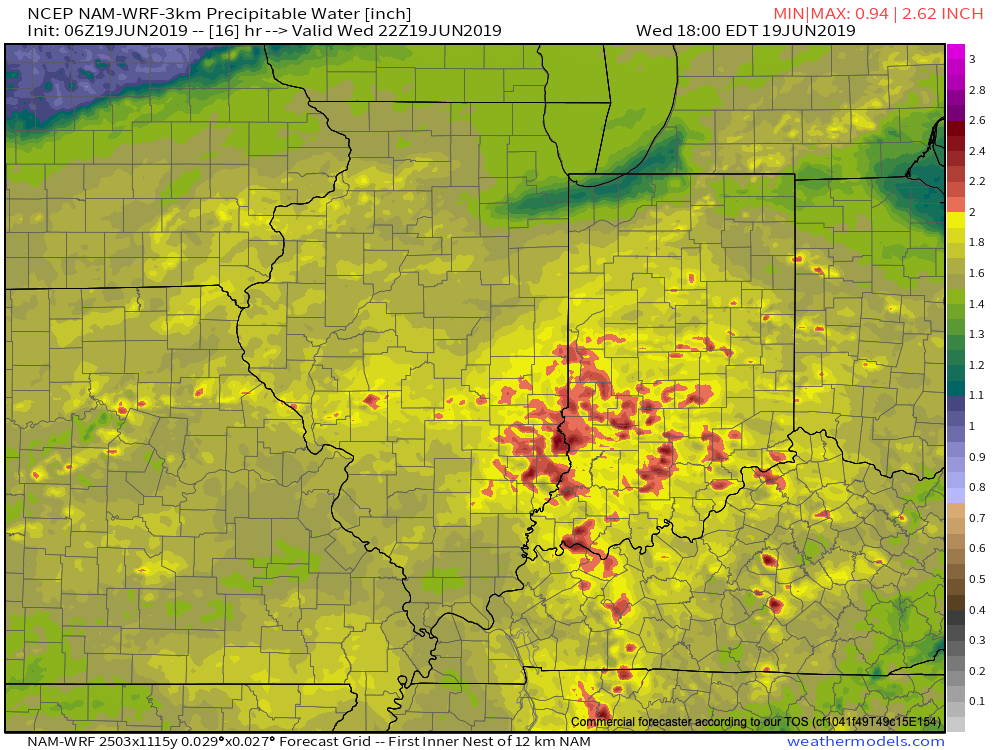
As the surface wave interacts with the tropical air mass in place, widespread showers and thunderstorms will blossom across the region through the afternoon into tonight. Rain will continue into Thursday afternoon.

We’re still also concerned for severe weather this afternoon and evening, including a couple of tornadoes across the southern half of the state.
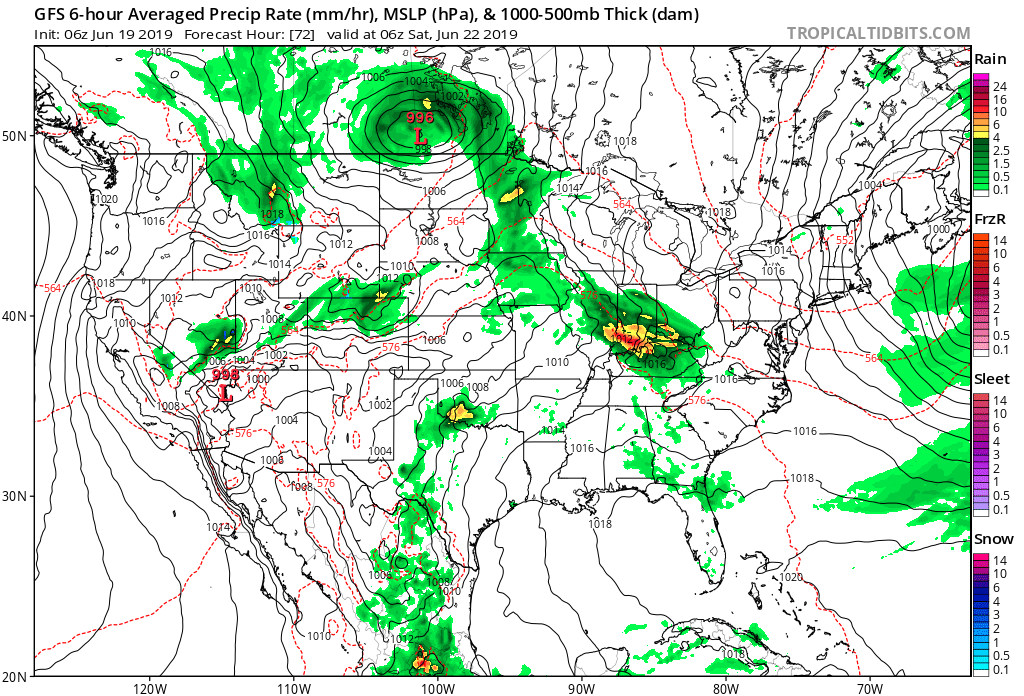
By the time the rain comes to an end Thursday evening, widespread 2″ to 4″ can be expected across the heart of the state, including Indianapolis, itself.
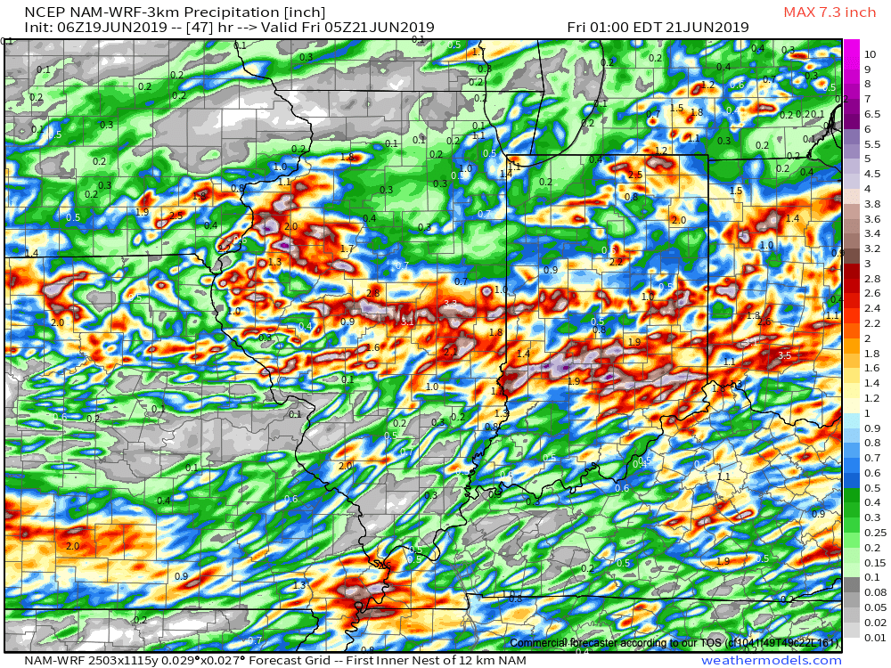
If that’s not enough, heavy rain and thunderstorms will return late Friday and continue in an “off and on” fashion straight through the weekend.
Unfortunately, some central Indiana rain gauges can expect to pick up an additional 5″+ of rain between this afternoon and next Tuesday…
Permanent link to this article: https://indywx.com/2019/06/19/concerned-for-significant-flooding-tonight-into-thursday/
Jun 18
VIDEO: Latest Thoughts On Tomorrow’s Severe Potential And Looking Ahead Through The 1st Half Of July…
You must be logged in to view this content. Click Here to become a member of IndyWX.com for full access. Already a member of IndyWx.com All-Access? Log-in here.
Permanent link to this article: https://indywx.com/2019/06/18/video-latest-thoughts-on-tomorrows-severe-potential-and-looking-ahead-through-the-1st-half-of-july/
Jun 18
VIDEO: Severe Threat Continues To Increase Wednesday PM…
You must be logged in to view this content. Click Here to become a member of IndyWX.com for full access. Already a member of IndyWx.com All-Access? Log-in here.
Permanent link to this article: https://indywx.com/2019/06/18/video-severe-threat-continues-to-increase-wednesday-pm/
Jun 16
VIDEO: A Very Wet Week Is On Deck; Early July Thoughts…
You must be logged in to view this content. Click Here to become a member of IndyWX.com for full access. Already a member of IndyWx.com All-Access? Log-in here.
Permanent link to this article: https://indywx.com/2019/06/16/video-a-very-wet-week-is-on-deck-early-july-thoughts/
Jun 15
VIDEO: Classic Pattern For A Significant Flood Event…
You must be logged in to view this content. Click Here to become a member of IndyWX.com for full access. Already a member of IndyWx.com All-Access? Log-in here.
Permanent link to this article: https://indywx.com/2019/06/15/video-classic-pattern-for-a-significant-flood-event/
Jun 14
Friday Evening All-Access Video Update: A Wet, Stormy Weekend Awaits…
You must be logged in to view this content. Click Here to become a member of IndyWX.com for full access. Already a member of IndyWx.com All-Access? Log-in here.
Permanent link to this article: https://indywx.com/2019/06/14/friday-evening-all-access-video-update-a-wet-stormy-weekend-awaits/
Jun 14
Fall-Like Conditions Set To Be Replaced By Periods Of Heavy Rain…
Temperatures are in the 40s area-wide this morning across central Indiana. Speaking of the 40s, they extend all the way south into the north Georgia mountains as we start our Friday. (Hard to believe for mid June). Widespread below normal temperatures continue to dominate the eastern portion of the country.
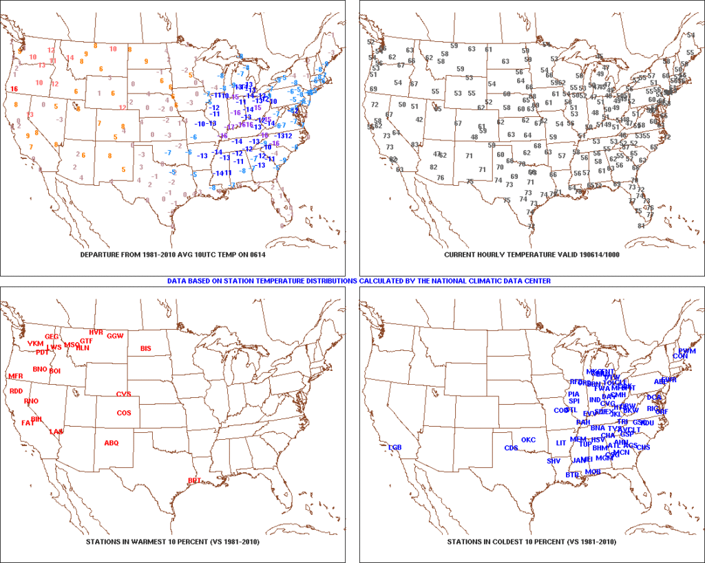
High pressure will remain in control of our weather today and help feature dry conditions with plentiful sunshine and pleasant temperatures. Highs today will top out in the middle 70s after the crisp start to the day.
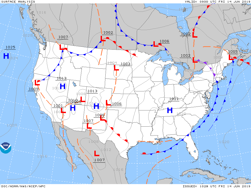
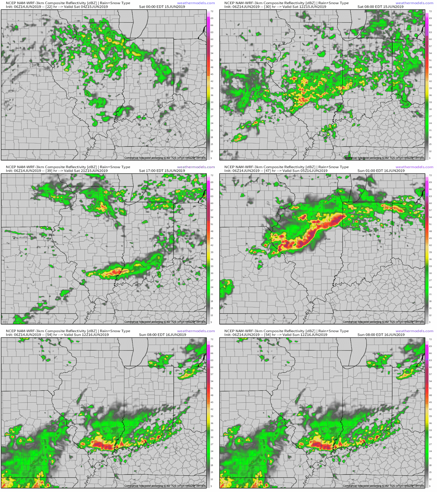
Unfortunately, the cool, dry conditions will quickly give way to an increasingly moist airmass overnight into Saturday morning and rain will follow. The reason? We’ll be on the backside of the area of high pressure with a southwest flow aloft helping transport moisture northeast into the Ohio Valley. At the same time, a series of warm fronts will pass over the weekend, featuring periods of more concentrated storms and associated heavy rainfall. Finally, a cold front will push south Sunday into Monday before stalling out just south of our area Tuesday.
While this may provide a briefly drier period Tuesday, we’ll have to contend with periods of heavy rain and storms before hand. More specific around timing, we think rain may begin as early as 11p to midnight this evening before becoming more widespread and heavier Saturday morning. We’d suggest having a Plan B for outdoor activities this weekend as more time than not, it’ll likely be raining across central Indiana.
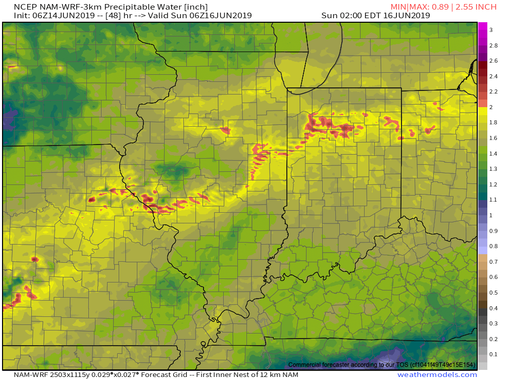
As mentioned earlier, we’ll replace the cool, dry air mass with more of a tropical feel this weekend and at times precipitable water values (PWATs) will approach 2″. This raises our confidence in the potential and likelihood of heavy rainfall.
Widespread 1″ to 2″ rainfall totals can be expected across central Indiana this weekend, with locally heavier amounts. After a briefly drier period Tuesday, rain will return by the middle of next week. Unfortunately, widespread 7-day totals (ending Thursday night) will likely be in the 2.5″ to 3.5″ range across central Indiana…
Permanent link to this article: https://indywx.com/2019/06/14/fall-like-conditions-set-to-be-replaced-by-periods-of-heavy-rain/
