Indy Weather Recap And A Look Ahead

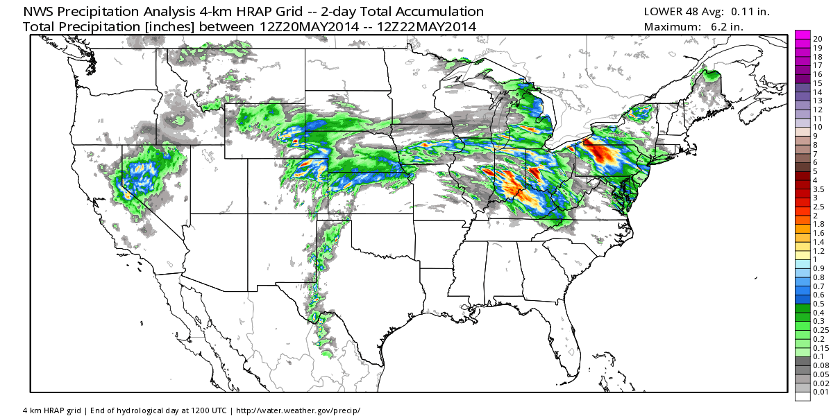
Wednesday was a stormy day across central Indiana, including damaging wind and hail. Flooding was also a concern in some areas.  Officially here at IndyWx.com HQ we picked up 2.21″ of rain Wednesday- most of which fell in a 3 hour time period.  Here’s a cool image from the fine folks at Weatherbell Analytics showcasing the heaviest rainfall.
nws_precip_conus2_2

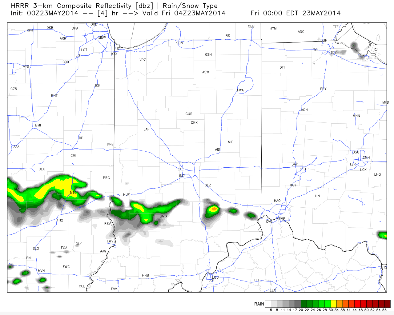
Despite a couple of showers (primarily south of the city) later this evening the upcoming three days will be beautiful and rain-free!
hrrr_ref_indy_5

Temperatures are trending cooler when compared to 24 hours ago and as noted here by the 24 temperature difference, the cooler air to our north will continue to push south tonight.

t0

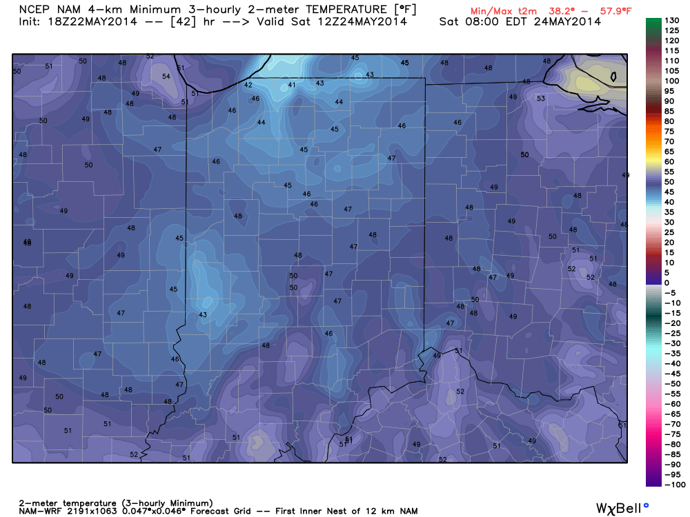
Temperatures and humidity levels will be below normal levels the next couple days before warmth slowly builds Sunday.  Lows Saturday morning will dip into the upper 40s for several communities.
hires_t2m_min_indy_14

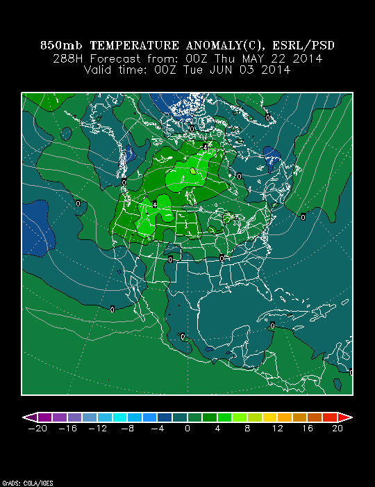
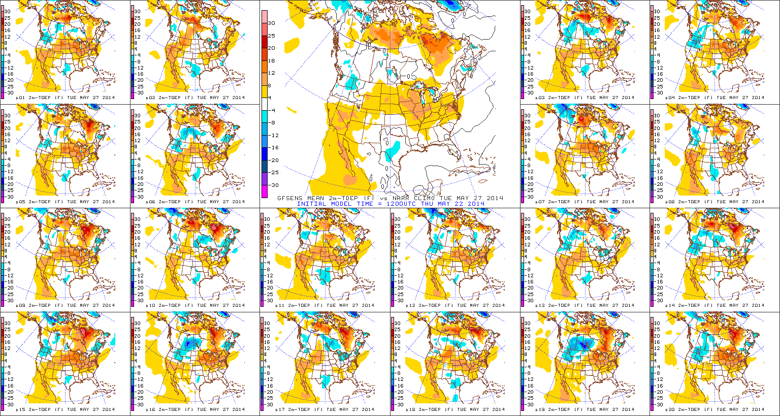
True summer-like heat and humidity will lift north Memorial Day into Tuesday.  Note the temperature anomalies do an about face from Day 1 to Day 5.  Heat and humidity will be on the rebound for the unofficial start to summer, but, as noted above, should remain in the “comfy range” for race day.
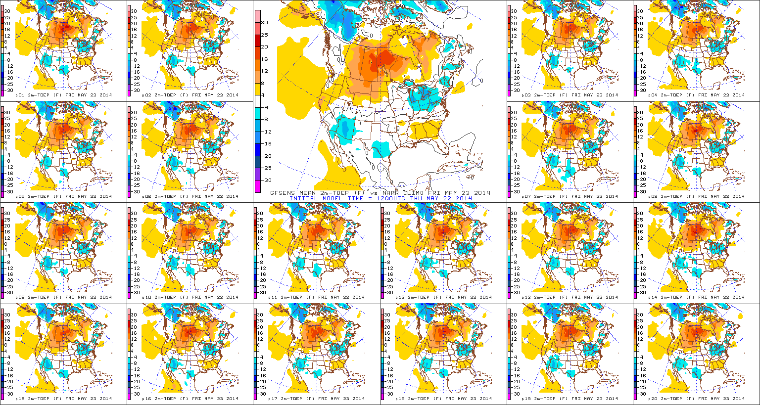
D1

D5

With the increasing warmth and humidity will come a return of scattered shower and thunderstorm chances early next week.

As we look forward to early June, there are indications it could open on the warm side.  Note relative agreement between the CFSv2 (Climate Forecast System version 2), NAEFS, and Physical Science Division model.  Does the warm pattern stick and hold?  Not so fast, my friend… 😉
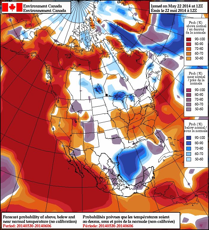
2014052212_054@007_E1_north@america_I_NAEFS@TEMPERATURE_anomaly@probability@combined@week2_186wk1.wk2_20140521.NAsfcTt850_anom_f288_ussm

Friday Forecast: Feeling Like Summer In October

Updated 10.04.13 @ 7:45a

Zionsville, IN Thursday started off with cloudy skies and scattered showers, but rainfall amounts were extremely light for the most part across central Indiana.

Remember you can Follow Us on Twitter @indywx or Friend Us on Facebook (search IndyWx.com) 

Status-weather-clouds-iconFriday: Partly cloudy; 64/ 84

While we cannot rule out an isolated shower or thunderstorm Friday, we think the majority of central Indiana wraps up the work week rain-free. Get outside and enjoy temperatures at summer-like levels. We think we top the middle 80s with continued unseasonably muggy conditions prevailing.

Status-weather-showers-day-iconSaturday: Increasing clouds; late showers and t-storms; 0.40″ 66/ 80

Most of your Saturday looks rain-free and continued unseasonably warm. We’ll note a gusty southwesterly breeze from time to time. As a cold front approaches, skies will begin to cloud up and scattered showers and thunderstorms will develop. Rain chances will be with us in a widely scattered form from late morning on, but the better chances of getting wet appear to arrive Saturday night. We also note the Storm Prediction Center has placed the region in a Slight Risk of severe weather, with damaging winds the primary threat Saturday night. Stay tuned!

Status-weather-showers-day-iconSunday: Cloudy with showers and t-storms- late day clearing; 0.60″ 50/ 66

Showers and thunderstorms will be likely on your way to church Sunday morning, continuing into the afternoon before clearing takes place late. Winds will shift to the northwest and help usher in a MUCH cooler air mass Sunday afternoon. Temperatures will fall through the afternoon Sunday.

Status-weather-clear-iconMonday: Mostly sunny; 43/ 60

“FINALLY.” At least that will be the word IndyWx.com uses to describe Monday’s weather as some true autumn air builds into the region. Monday is shaping up to be a beauty of a day with bright sunshine and crisp, cool temperatures.

Status-weather-clear-iconTuesday: Mostly sunny; 44/ 68

Tuesday is looking to be a carbon copy of Monday thanks to high pressure remaining in control of our weather.  Classic early October weather conditions will prevail early next week.


Status-weather-clouds-iconWednesday & Thursday: Partly cloudy; mid to upper 40s/ lower to middle 70s

Dry conditions will continue as we progress through the middle of next week with moderating temperatures. Highs will return to above normal levels by Wednesday.

Thursday Forecast: Overall Warm Pattern Continues

Updated 09.25.13 @ 4:48p Zionsville, IN Our overall warm pattern will continue through the upcoming period. Unfortunately, we’re talking about a rather dry time of things, as well! Dry &…

You must be logged in to view this content. Click Here to become a member of IndyWX.com for full access.  Already a member of IndyWx.com All-Access?  Log-in here.

Friday Forecast: Grab The Jacket!

Updated 09.12.13 @ 4:59p

Zionsville, IN A series of cold fronts sweep the state tonight.  This will help usher in our first true taste of autumn for the season, just in time for another special football weekend ahead!  Don’t get used to the chilly conditions as resurgent heat, and better rain chances lie ahead. We discuss below!

Capture

Chilly Air Blows Into Town: A series of cold fronts are in progress of blowing through central Indiana. One is already through with another waiting in line. This secondary cold front packs some chilly air behind it and will result in temperatures in the upper 40s for many come morning.  Talk about stark contrast from heat indices in the 100s earlier this week!  We’ll note some instability-driven puffy cumulus clouds forming during the afternoon, but these will clear and give way to a calm, chilly night. Overnight lows Saturday morning will fall into the 30s for outlying areas.

Weak Cold Front Sunday: A weak cold front will lead to afternoon clouds and the threat of an isolated thunderstorm Sunday afternoon/ evening. We think 80-90% of the coverage area remains rain-free for now, but we’ll keep an eye on things and update accordingly.  This boundary will be responsible for keeping things dry and pleasant through early next week.

The Heat Returns: While we don’t anticipate anything nearly as brutal as this past week’s stretch of heat, the thermometer will flirt with the 90 degree mark once again come Wednesday.  Strong southwest winds will blow a warmer, more humid brand of air north bound for mid week and have overnight lows only falling into the lower 70s. A cold front will approach the region late next week, leading to what appears to be some scattered to numerous showers and thunderstorms by next Thursday.

Follow us on Twitter: @IndyWx

Friend us on Facebook: search IndyWx.com