Muggy Air (And Storm Chances) Returns…
 Highlights:
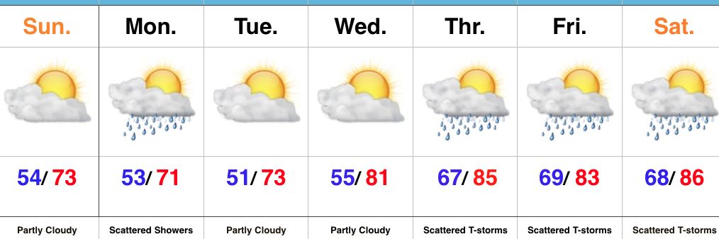
- One more pleasant day
- Humidity increases
- Storm chances return
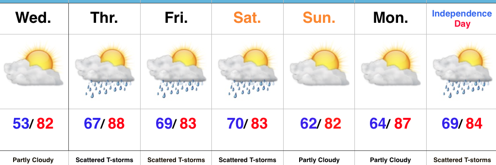
Unsettled Weather Looms…We’ve got one more pleasant day to enjoy, but take advantage of it as changes for a more tropical-feel loom. With that increasingly warm and moist air, we’ll also see an increase in showers and thunderstorms as we wrap up the week. While it won’t rain the entire time, a couple rounds of strong-to-severe thunderstorms are possible during the Thursday afternoon-Friday period.
We think we return to drier conditions late weekend into Monday, but this drier theme likely won’t hold through the holiday period. Scattered showers and thunderstorms return by Independence Day.
Upcoming 7-Day Precipitation Forecast:
- Snowfall: 0.00″
- Rainfall: 1.00″ -1.50″ (locally heavier totals)
 Highlights:
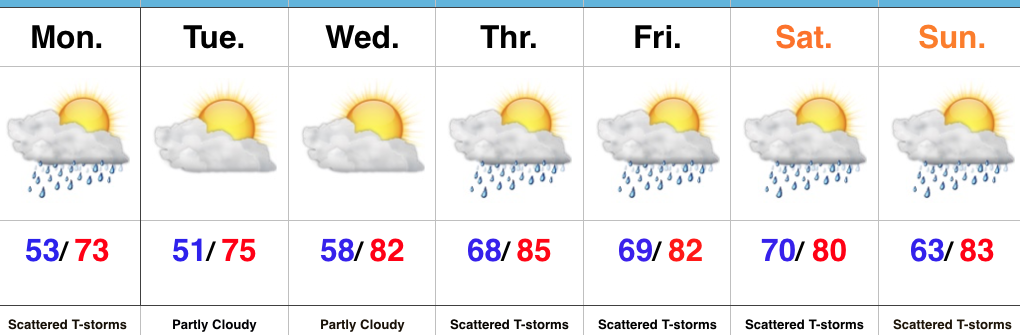
 II: A weak upper level disturbance will drift overhead Monday afternoon and help spark scattered showers and thunderstorms into the evening hours. Not everyone will get wet Monday evening, but a couple gusty storms are possible. Here’s a look at the radar valid at 6p Monday.
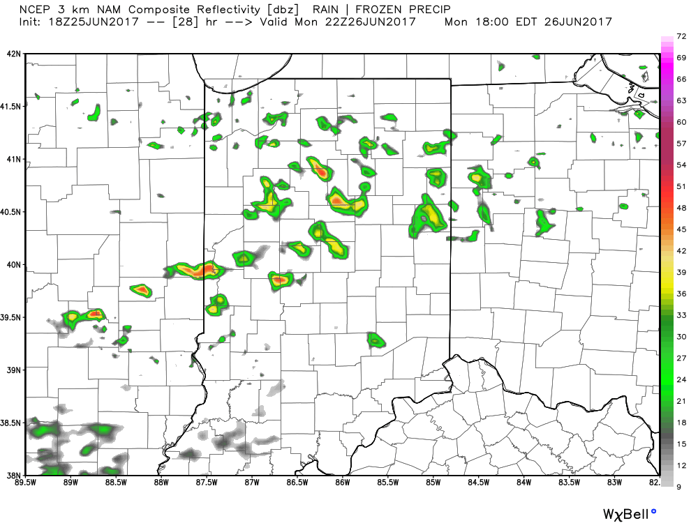 III. After a dry Tuesday and Wednesday, better shower and thunderstorm chances will return to our forecast for late week into next weekend. Additionally, temperatures and humidity levels will return to closer to seasonal norms.
 IV. An active pattern will remain with us as we progress through the first half of June. A busy NW flow aloft will likely send multiple storm clusters southeast into the region and we’ll have to be mindful for the potential of some of these storm complexes containing strong-to-severe storms and excessive rainfall.
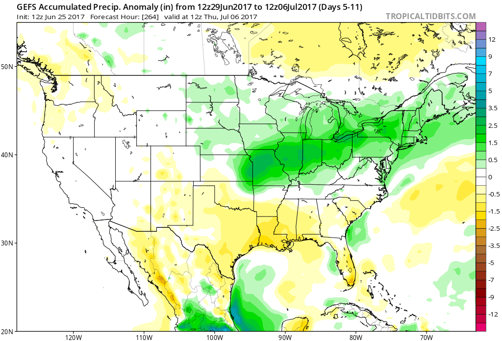
 Highlights:
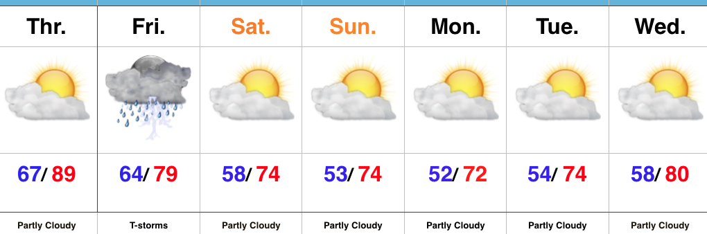 Highlights: