Major Flip On Deck; Discussing Longevity…
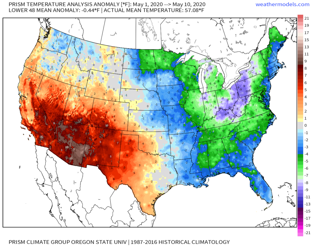
Indianapolis is running a whopping 8° below normal month-to-date. We’ve set new daily and all-time records already this month for the cold. Note the vast nature of this May chill.
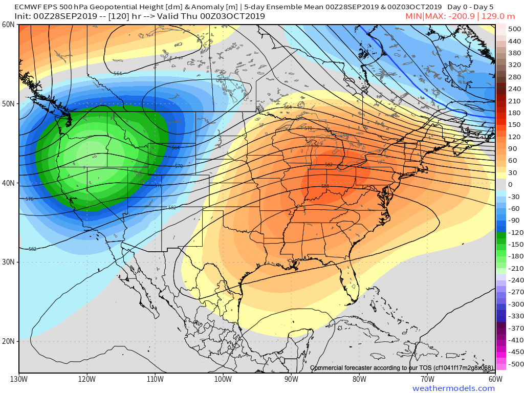
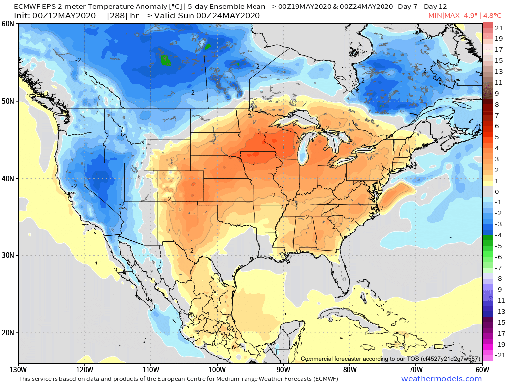
If you’re not a fan of the late season chill, hang in there, as a major flip in the pattern awaits. We alluded to this possibility in our May Outlook and it continues to look like a rather abrupt change is a couple of days away. While we’re dealing with frost this morning in spots across east-central Indiana, it’s looking more and more likely that the first true summer-like surge of air for the season arrives Thursday into the weekend. Warmth will be accompanied by a significant uptick in humidity levels.
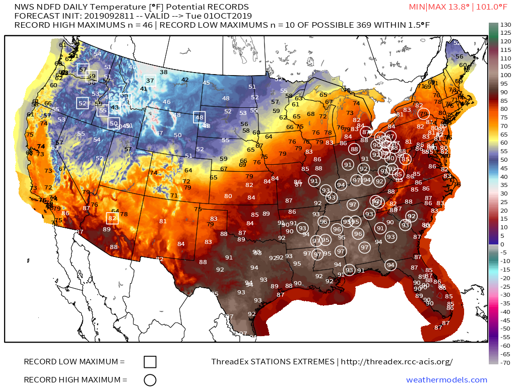
The Week 2 period looks warmest, relative to average, and should feature at least a couple of days with highs approaching the 85°-90° mark.
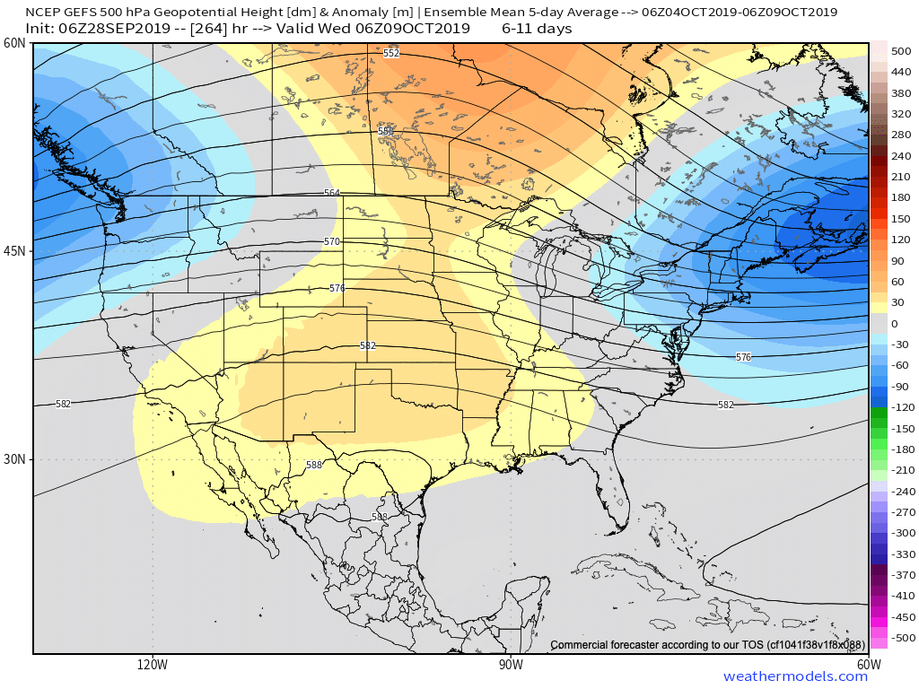
While most data maintains a warmer pattern to close the month, there are a couple of items to pay close attention to as we try and understand the longevity of said warmth.
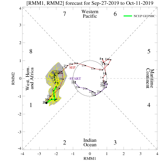
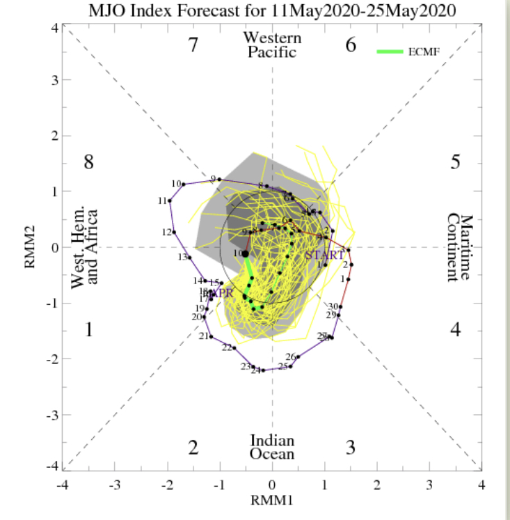
- The MJO is forecast to remain “bottled up” in the wheelhouse through the next couple of weeks. Thereafter, there are indications that the MJO might become more amplified and it’ll be important to keep an eye on what phase(s) it’ll move through as we get set to close May/ open June.
2. The PNA is forecast to take a negative dip which supports the coming flip to warm. However, recent ensemble data is bullish on a move towards a positive (some data shows even strongly so) state around or just after Memorial Day. This would suggest the window of warmth may be limited in duration. Simply based on looking at the chart below, one could build a case for a cool open to meteorological summer.

Finally, on the precipitation front, a wetter pattern is anticipated to accompany the warm change, but longer range data points towards this being only a temporary wetter regime. In fact, recent models are beginning to agree on a dry close to May/ open to June.
Much more later!