You must be logged in to view this content. Click Here to become a member of IndyWX.com for full access. Already a member of IndyWx.com All-Access? Log-in here.
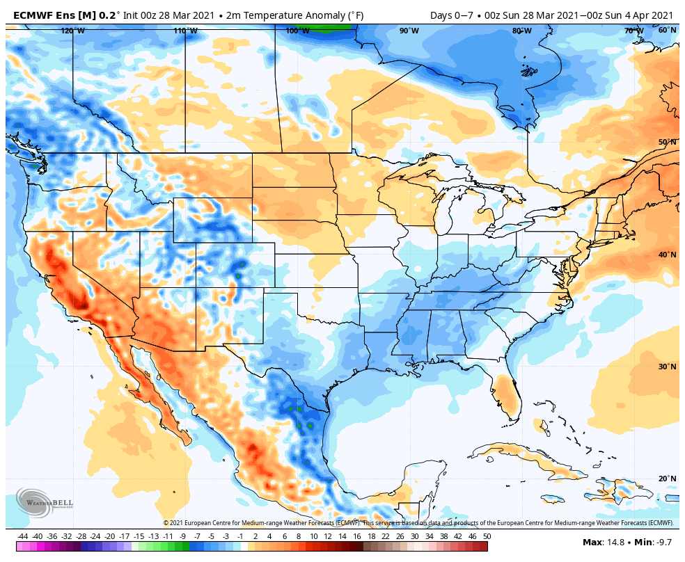
Temperatures will run below normal through the upcoming period from the Ohio Valley into the Southeast. Meanwhile, resurgent warmth will build across the northern Plains.
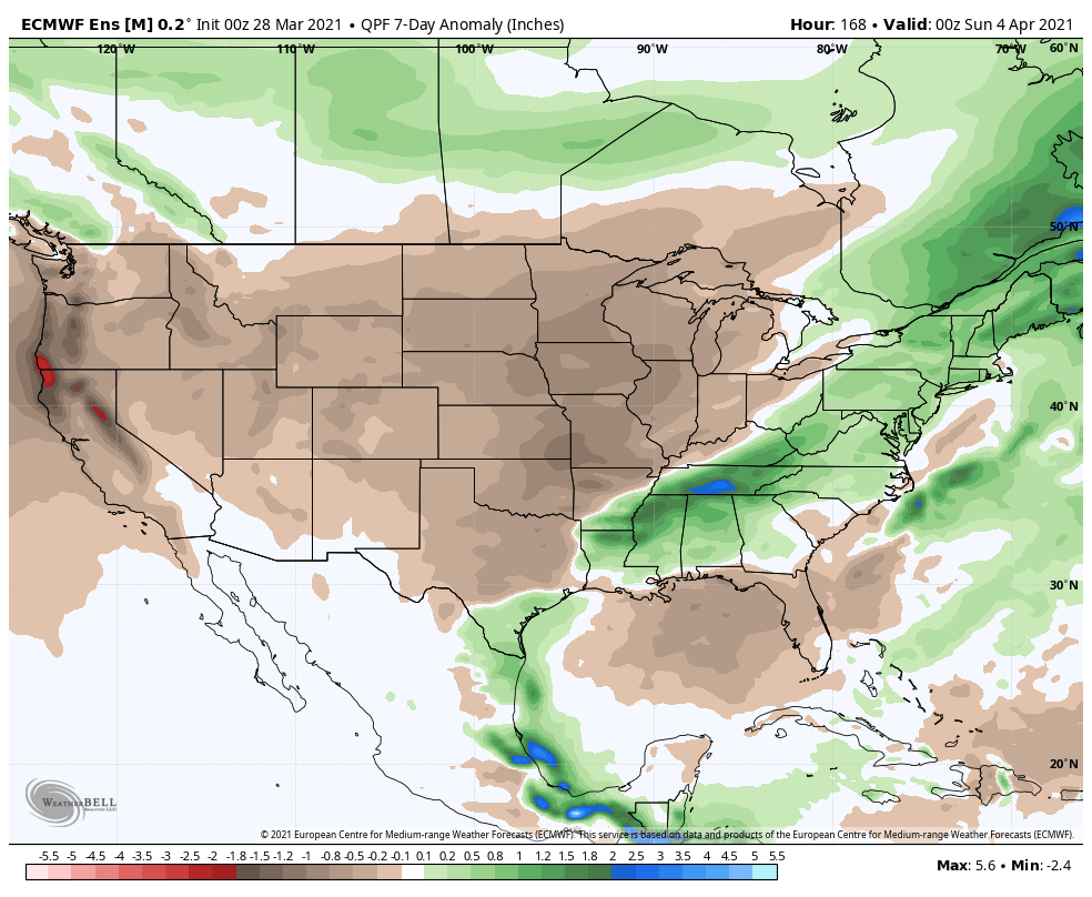
After an active stretch of weather, an overall drier pattern will build in through the upcoming period across the Plains and into the Ohio Valley. Meanwhile, the eastern seaboard will remain wetter than normal.
We forecast central Indiana to receive a half inch or less of rain over the upcoming 7-day period (most of that comes this morning and again with a frontal passage Tuesday night).
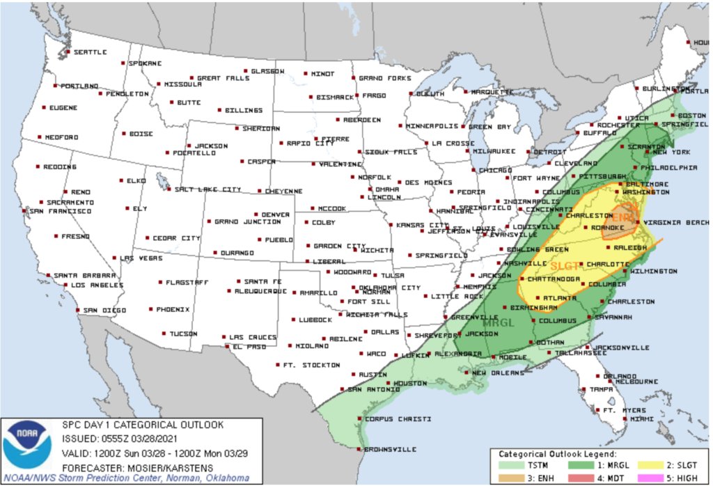
The most active severe weather day of the 7 upcoming will be today- primarily east of the mountains and into the Mid Atlantic region into the Southeast.
Forecast period: 03.28.21 through 04.04.21
You don’t need us to remind y’all just how active and busy things have been over the past couple of weeks. For those weather weary, an extended period of overall quieter weather will build in for the upcoming week. The only exception to that will be some early showers today and again with a frontal passage Tuesday night-predawn Wednesday. The bigger story will be the pop of unseasonably cold air that will arrive on the heels of the passage of the midweek cold front. We’re talking about some neighborhoods falling into the 10s by late week for morning lows. Brrrrr. Thankfully, the cold won’t last more than a couple of days and we’ll be back to moderating conditions as Easter Sunday arrives.
Updated: 03.24.21 @ 9:25p We don’t have any changes to this morning’s Client video package. We’re tracking (2) rounds of rain and storms Thursday, with the more potent round coming…
You must be logged in to view this content. Click Here to become a member of IndyWX.com for full access. Already a member of IndyWx.com All-Access? Log-in here.
After a couple predawn showers Wednesday, the remainder of the day should be quiet and free of any significant rain. However, by this time, eyes will be focused on the possibility of a more significant event on Thursday.
Model guidance is beginning to suggest this will come at the state in (2) waves. The first rain/ storm cluster will likely arrive mid to late Thursday morning and may feature some embedded strong/ severe cells across downstate Indiana. Given the ingredients in play, hail would be the greatest threat from these morning storms across southern Indiana. Further north, across immediate central Indiana, severe weather isn’t expected, but general rain and storms will be a good bet, including locally heavy rain.
11a Thursday forecast radar
We will then likely see a lull in the activity into the early to mid afternoon hours before a second round of storms blows through during the evening. This 2nd wave of storms may feature more of a damaging wind threat from places in and around Bloomington and points south. From this distance, it appears as if the time period between 5p-8p is the one to watch.
6p Thursday forecast radar
While it continues to look like the more substantial severe threat will be south of the region, that isn’t to say the southern portions of the state won’t see a warning or two Thursday and we’ll continue to keep a close eye out as time draws closer.
You must be logged in to view this content. Click Here to become a member of IndyWX.com for full access. Already a member of IndyWx.com All-Access? Log-in here.