You must be logged in to view this content. Click Here to become a member of IndyWX.com for full access. Already a member of IndyWx.com All-Access? Log-in here.
You must be logged in to view this content. Click Here to become a member of IndyWX.com for full access. Already a member of IndyWx.com All-Access? Log-in here.
While we’ll have to deal with showers and storms Wednesday (could have a couple strong cells across southern Indiana), the big deal of the short-term forecast package centers on a strong cold front that will blow through the area this weekend. Ahead of the front, a brief surge of significant heat and humidity will push into town as we wrap up the work week. Friday looks particularly oppressive as heat and humidity combine to push “feels like” temperatures into the lower 90s for many.
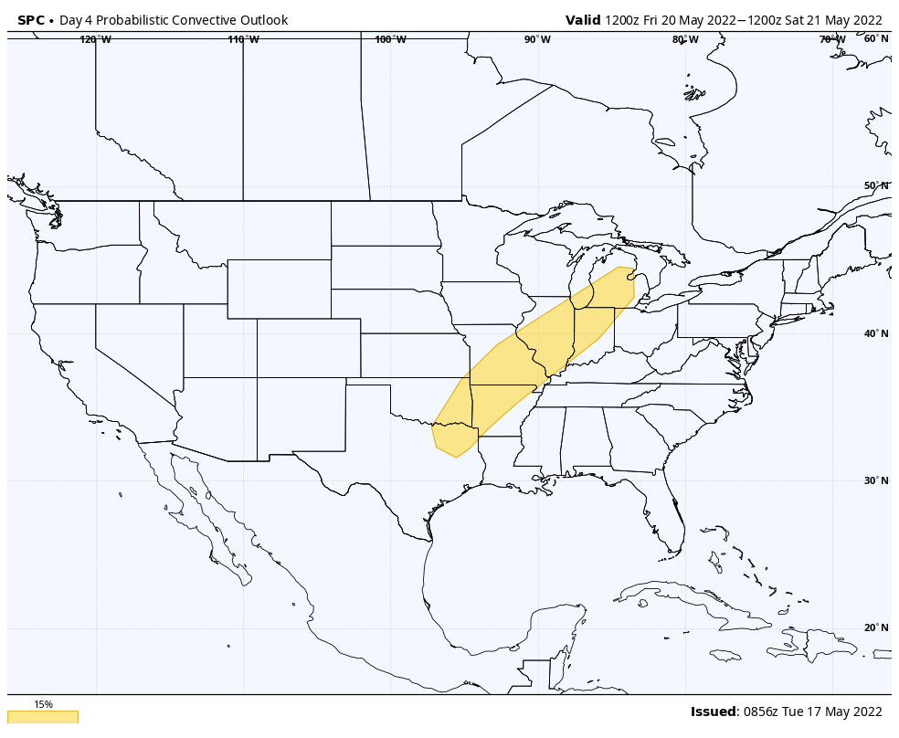
While we’ll have to fine tune timing and deal with the all-important specifics (are we having to deal with cloud cover that could limit instability?) as we get closer, the Storm Prediction Center continues to highlight western and northwestern Indiana in a risk of severe weather Friday. (Most of the storms should impact our state Friday night- still think the majority of the day time will be free of any storms).
As low pressure heads for the Great Lakes and drags a cold front through our region, it wouldn’t surprise me if the SPC hoists an additional risk of severe weather Saturday. Saturday afternoon into predawn Sunday is expected to offer up the most widespread coverage of rain and storms, locally.
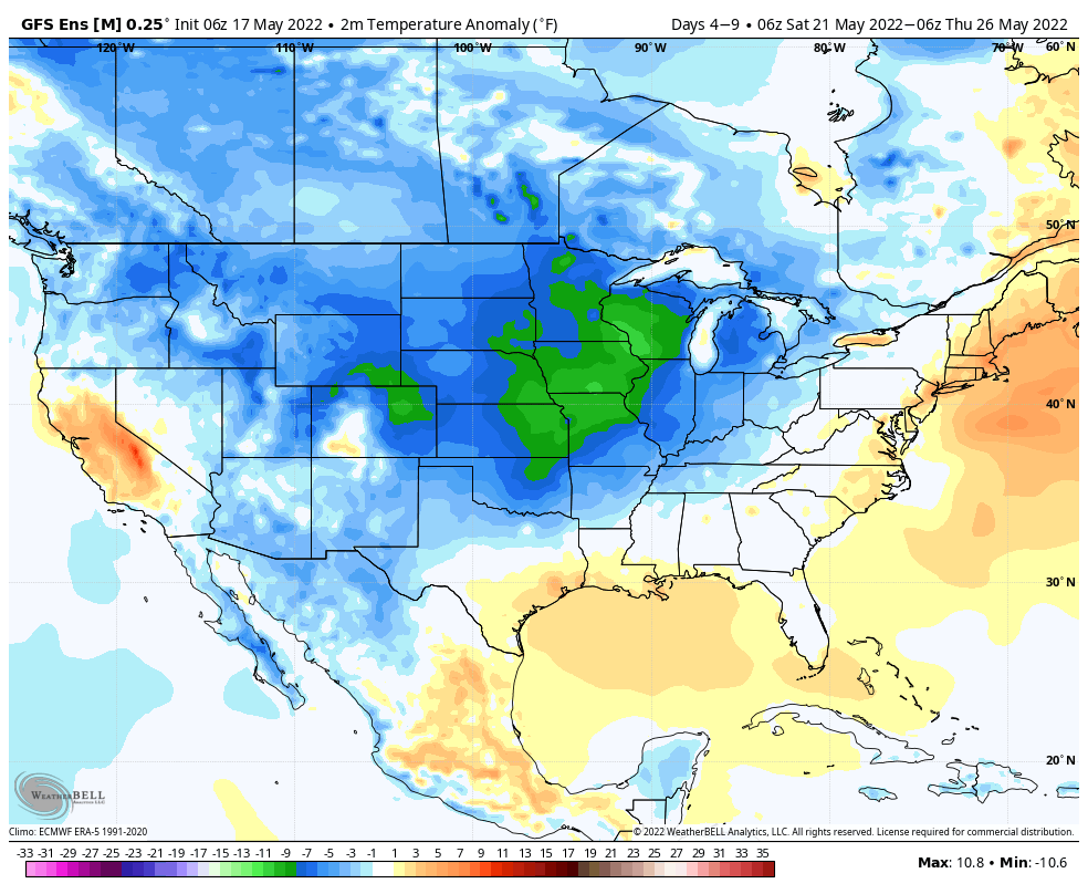
Once the front is off to our east, a MUCH different airmass will blow into town, courtesy of a gusty northwest breeze. We’re talking about highs only in the 60s early next week with lows into the 40s. Talk about a breath of fresh air after the heat and humidity to close the week!
Dry weather should prevail Monday before a new system offers up a soaking Tuesday PM into Wednesday.
You must be logged in to view this content. Click Here to become a member of IndyWX.com for full access. Already a member of IndyWx.com All-Access? Log-in here.
You must be logged in to view this content. Click Here to become a member of IndyWX.com for full access. Already a member of IndyWx.com All-Access? Log-in here.