Multiple Waves Of Heavy Rain On Deck; Severe Storm Risk As Well…
Updated 03.30.24 @ 7:16a
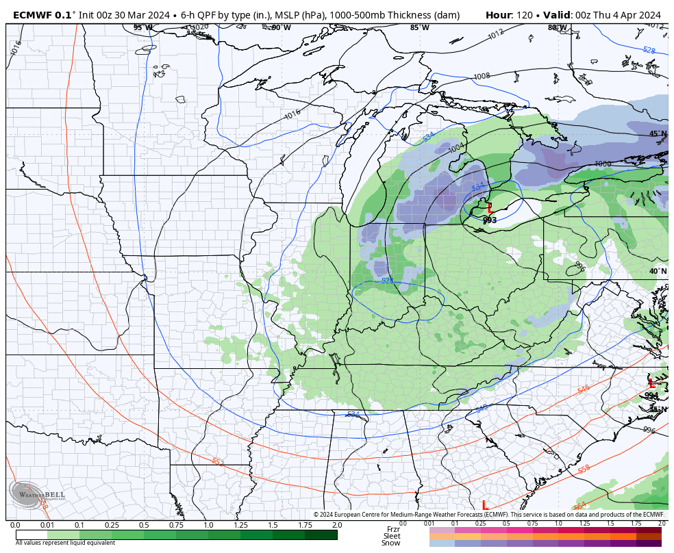
The combination of a quasi-stationary frontal boundary, increasingly warm and humid air, and multiple waves of low pressure riding along the aforementioned boundary will lead to several rounds of locally heavy rain and also pose a strong to severe storm risk as we go through the early stages of the new week.
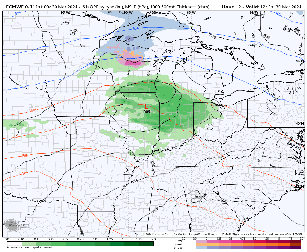
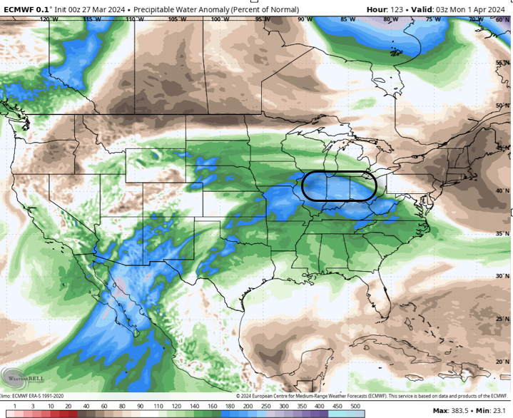
Precipitable water values (PWATs) will approach 1.5” to 2” at times early week (a tough feat to come by this time of year). This only raises confidence in the opportunity for this setup to generate periods of heavy, and eventually excessive, rainfall.
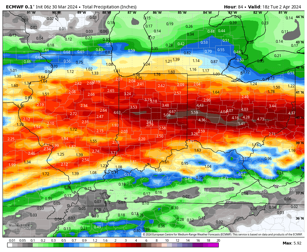
Widespread 3”+ totals can be expected by the time all is said and done, with locally heavier amounts.
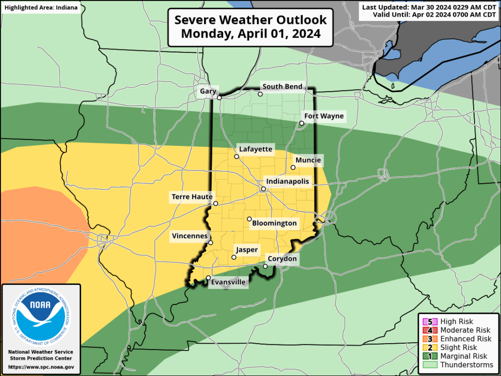
If the heavy rain event wasn’t enough, we also need to be on guard for the threat of severe storms Sunday and Monday.
In particular, it’s Monday’s risk of severe that has us most concerned, including all modes (hail, wind, and a TOR threat). We recommend reviewing your family’s severe weather safety plan and make sure to have a way to receive any warnings that may be issued.
The heavy rain event will come to an end by Tuesday evening, but if we didn’t have enough to track already, we’ll add in the potential of rain to mix with wet snow Wednesday. Regardless, expect a much colder and blustery time of things as this bigger storm departs by midweek.