VIDEO: Short-Lived Warm Up Before Unseasonably Chilly Air Returns…
You must be logged in to view this content. Click Here to become a member of IndyWX.com for full access. Already a member of IndyWx.com All-Access? Log-in here.
You must be logged in to view this content. Click Here to become a member of IndyWX.com for full access. Already a member of IndyWx.com All-Access? Log-in here.
An approaching storm system will help pull spring-like air into the region for at least a couple days later this week. Highs will go into the lower 70s Thursday and middle to upper 70s Friday. After a winter that’s certainly overstaying his welcome, that will feel mighty nice!

Unfortunately, the nice spring-like feel won’t last. A cold front will sweep through the state Saturday with showers and thunderstorms late Friday night into the daytime Saturday, followed by a dramatic wind shift and much colder air for the second half of the weekend behind the frontal passage.
 As upper level energy moves overhead, mixed rain and snow showers will fall early next week.
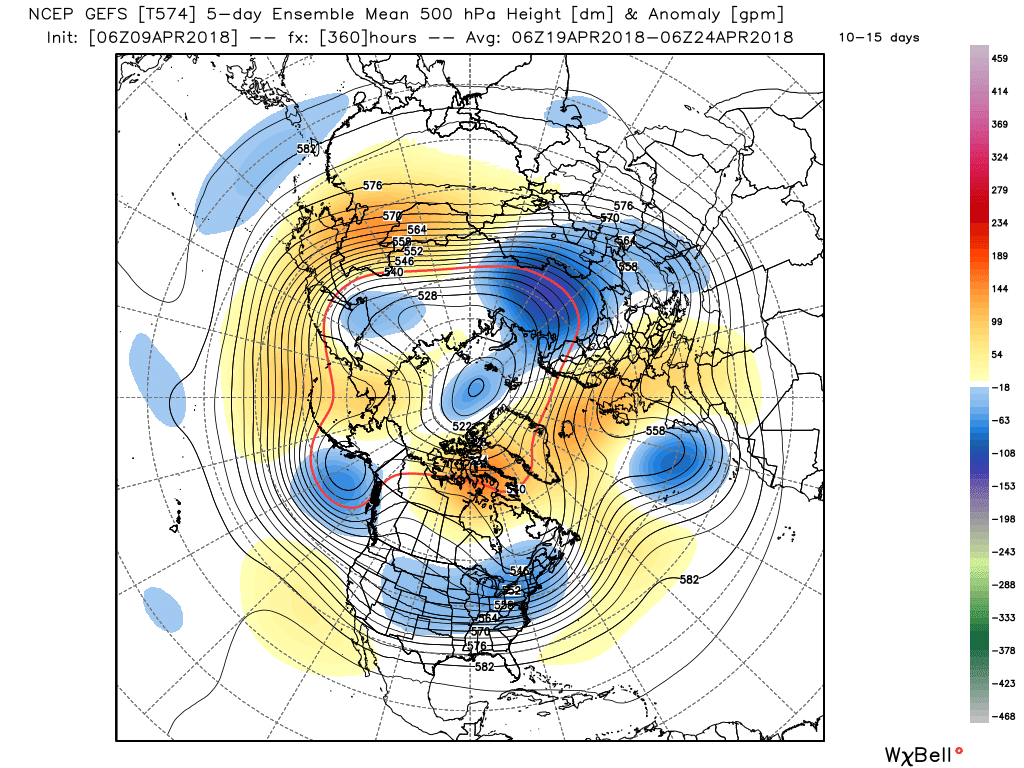
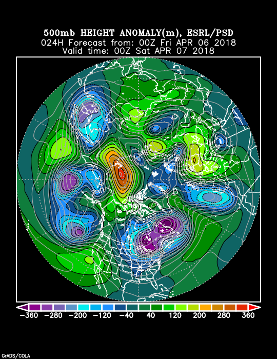
 Longer term, the negative NAO will continue to lead to prolonged colder than average temperatures. At this point, we think this pattern will run at least through the remainder of April.
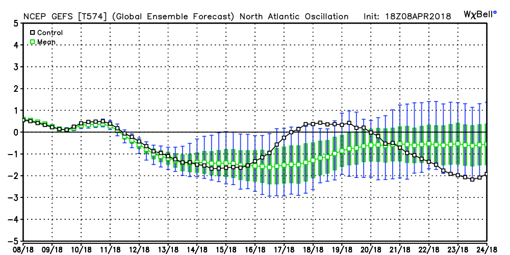 The end result? You know it: a persistent eastern trough and associated colder than average feel…

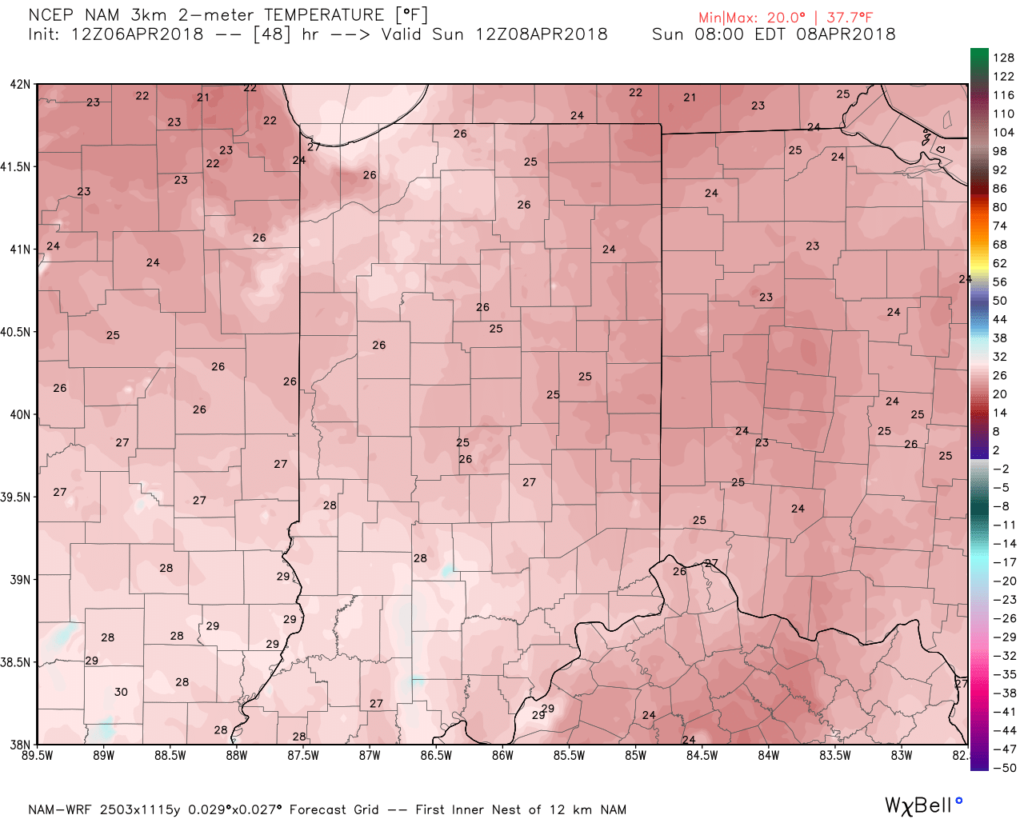
Our Sunday is beginning on a cold, but dry note. Despite starting in the lower and middle 20s, at least we have the sunshine to greet us out the door!
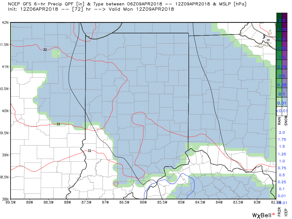
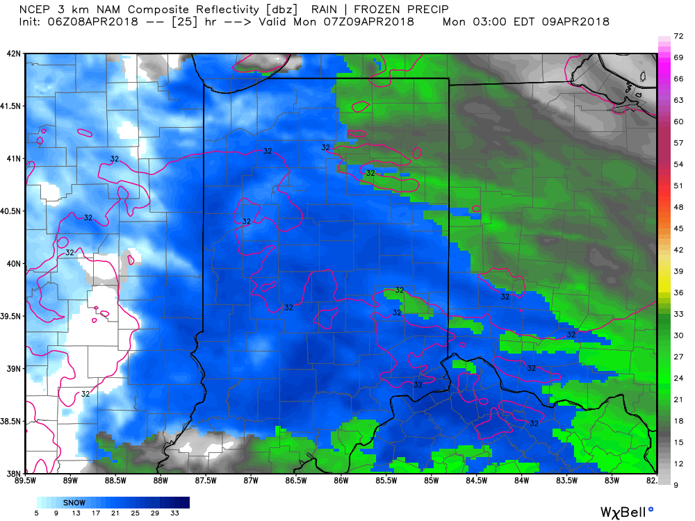
 The clouds we see to our west are associated with a storm system that will deliver another round of accumulating April snow to central Indiana late tonight and early Monday.
We should hold onto the sunshine into the afternoon hours before those clouds begin to increase, eventually lowering and thickening through the evening hours.
Timing: Snow should begin to impact western portions of the state around 10p, or so, before advancing east and reaching the city, itself, around 11p.
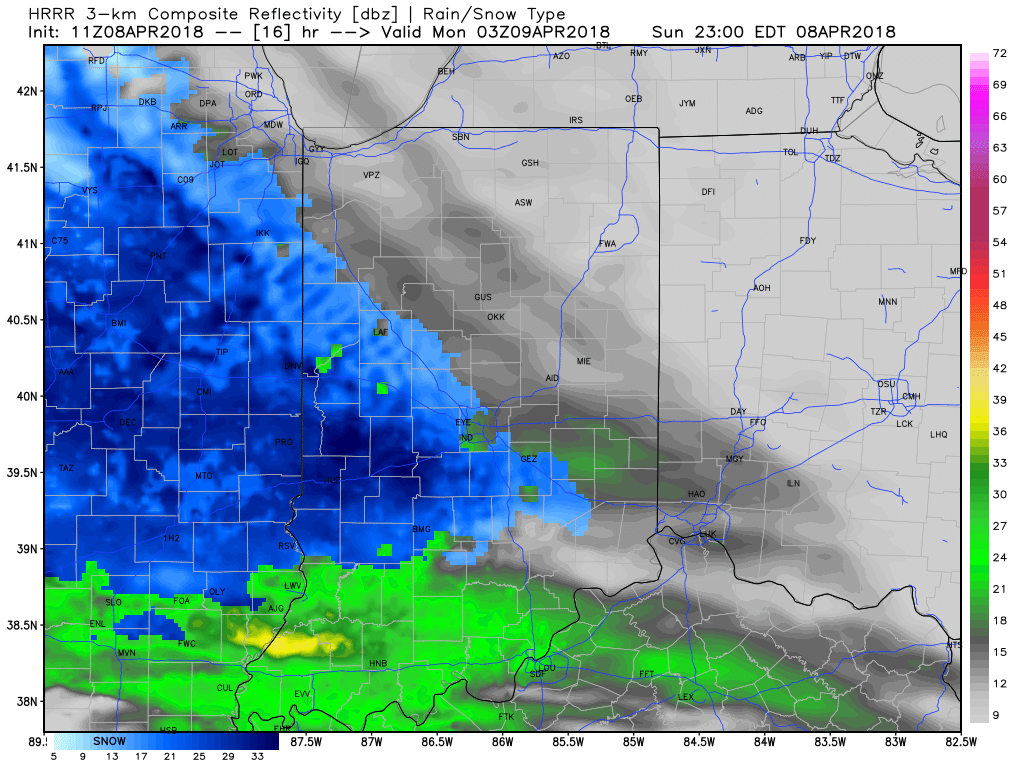 Snow will then overspread the rest of the state during the overnight and come down at a moderate clip at times, especially for the western half of the state.
 Snow will continue through the predawn hours Monday before tapering to snow showers closer to the Monday morning rush.
 While temperatures will hover around freezing through the majority of the event, the recent unseasonably cold conditions will allow the possibility of a few slick spots on area roadways during the overnight and predawn hours. Take it slow if you plan to be out and about early Monday morning.
Accumulation: Most of central Indiana can expect around an inch of wet snow by sunrise Monday, but there will be a few folks (especially west of the I-65 corridor) where a couple of inches of snow will fall.
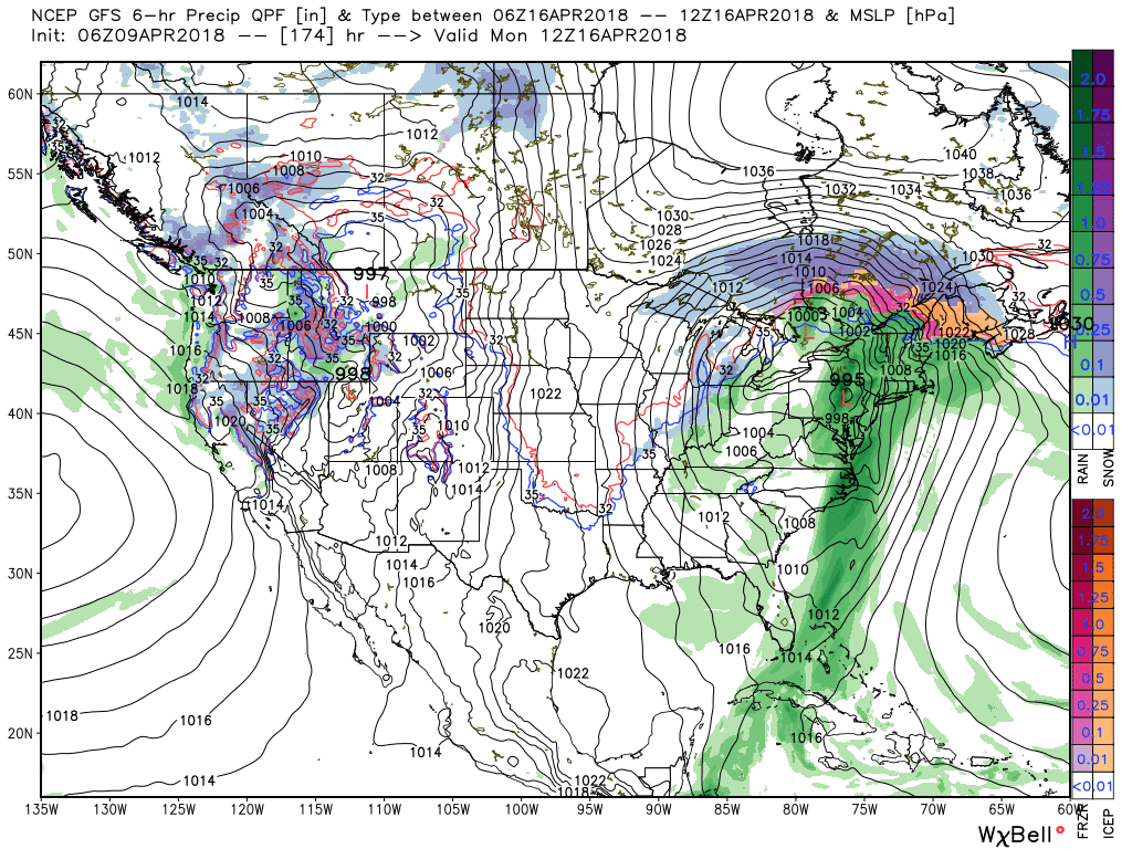
As we look ahead into the upcoming work week, the big story will be a push of spring-like warmth late week (lower 70s Thursday and mid to upper 70s Friday). With that said, the warmth won’t hold as a negative NAO continues to dominate. The end result will be a quick return to unseasonably cold conditions this time next week. That cold will then take us through the balance of the rest of the month…
The weekend will end with more April snow. As we look ahead deeper into next week, a transient, but significant, push of warmth will arrive Thursday and Friday.
You must be logged in to view this content. Click Here to become a member of IndyWX.com for full access. Already a member of IndyWx.com All-Access? Log-in here.
An anomalous pattern will result in unseasonably cold air this weekend. A cold front will blow through the state this evening and while a period of snow will accompany the FROPA (frontal passage), the bigger deal will be the weekend cold. Keep in mind, averages for the weekend include lows of 40° and highs in the lower 60s.
The pattern will deliver a feel more like mid-February (when highs average in the lower 40s and lows fall into middle 20s), as opposed to early-April.
Most of Saturday will be spent in the 30s, and the coldest morning should come Sunday with widespread lows in the middle 20s.

And if the unseasonably cold air isn’t enough, a disturbance will “attack” the cold Sunday night leading to a mix of rain and snow that should transition to mostly snow Sunday night. While this won’t be a big deal, just the fact that we’re talking about snow yet again is getting old for most folks. Unfortunately, the pattern looks to remain colder than average through late April, despite a brief break late next week.