Prolonged Unsettled Stretch Of Weather…

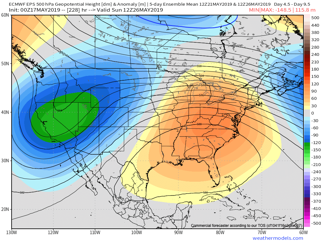
Yesterday was only the beginning of a renewed prolonged stretch of unsettled and stormy weather. A series of fronts will make a move towards the OHV only to stall out and lift north back as a warm front over the upcoming 7-day period. The end result? An extended stretch of wet, stormy conditions.

Rainfall amounts will run above normal over the upcoming 7-day period.

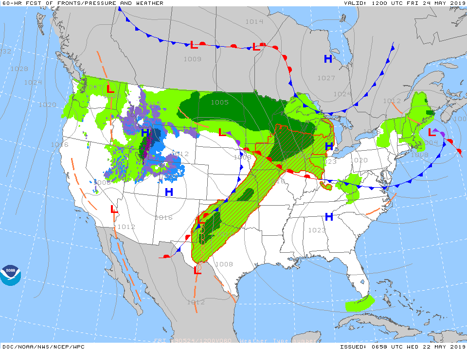
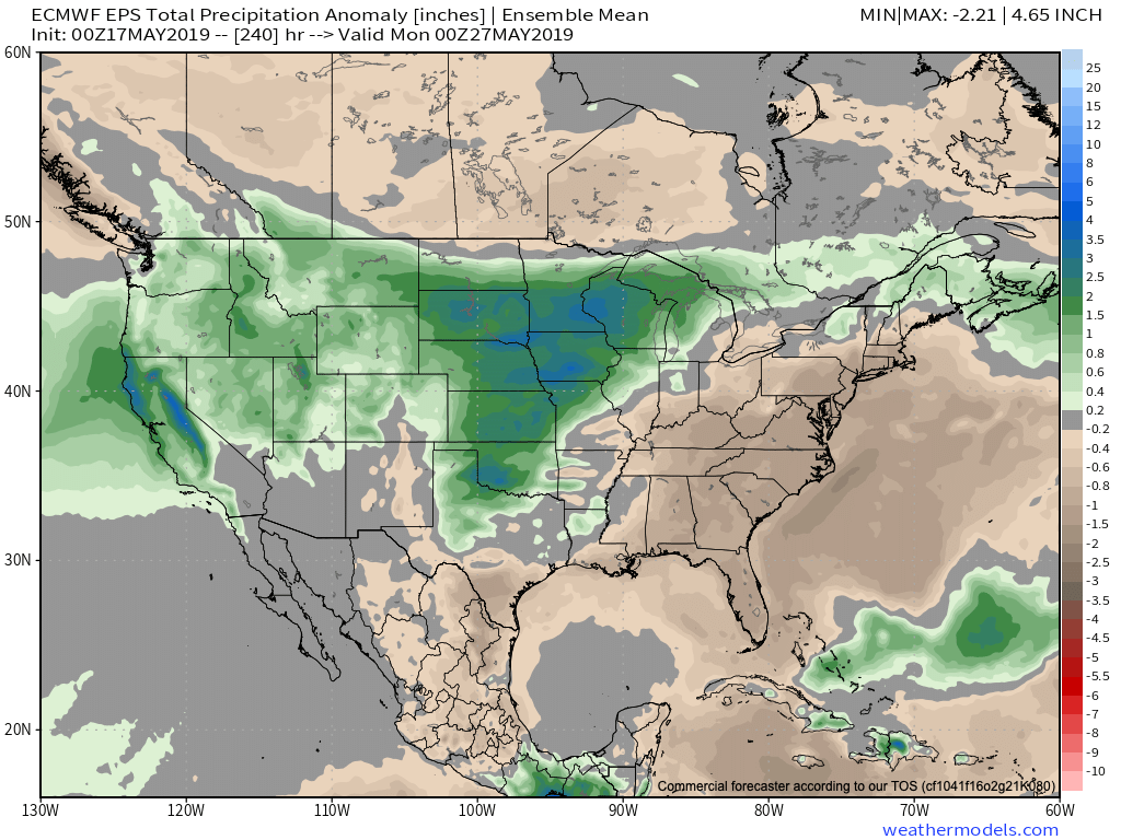
Get used to the setup above with a stalled front nearby and waves of low pressure moving along the associated boundaries from time to time. As these ripples of energy scoot along the front, more enhanced showers and thunderstorms can be expected.

It’s still tough from this distance to say with certainty which day(s) will offer up the most widespread shower and thunderstorm coverage in this pattern, but we continue to lean towards Saturday into Sunday. Stay tuned.

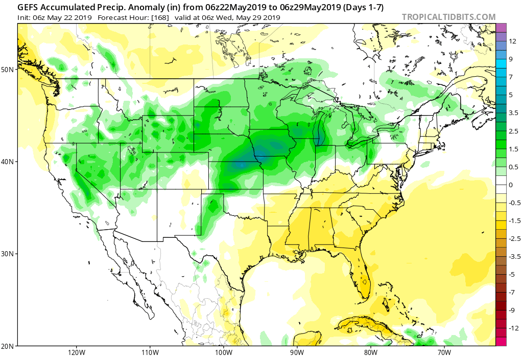
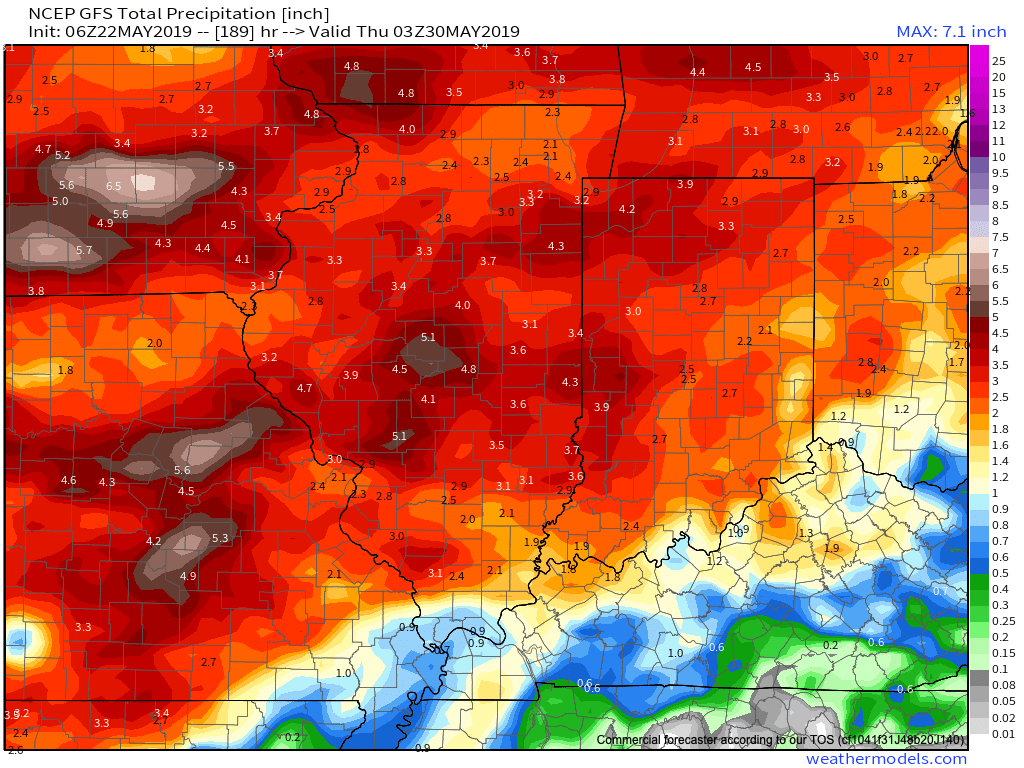
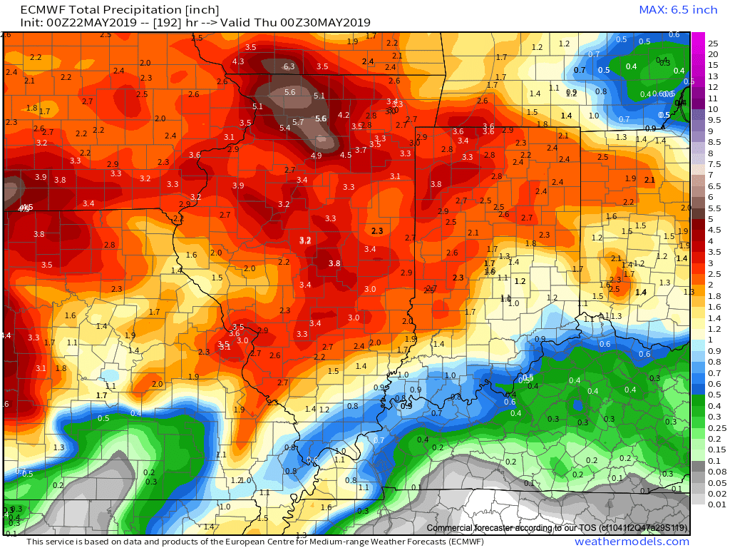
Models agree on widespread 1.5″ to 2.5″ rainfall totals over the upcoming week with locally heavier amounts.

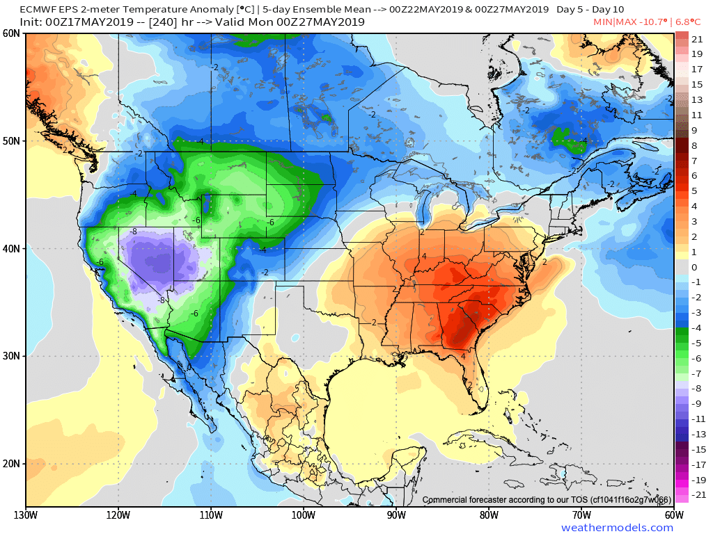
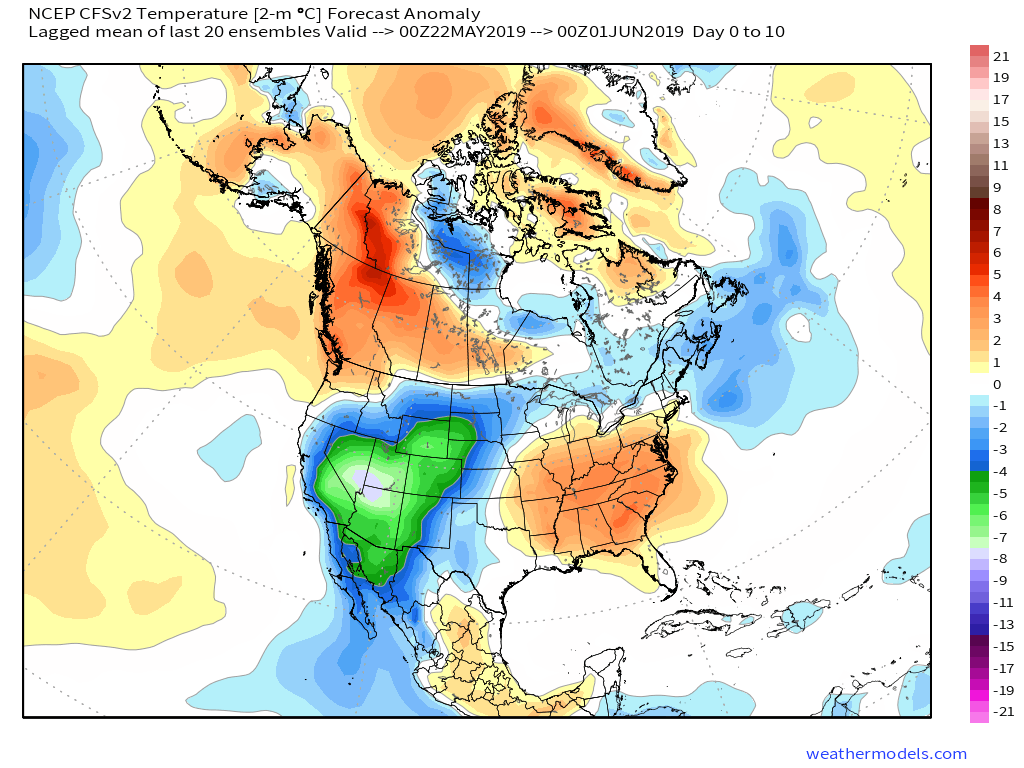
Conditions will also return to a warmer than normal theme into the middle of next week. At times, conditions will become oppressive (depending on which side of the front you find yourself on). If heading to the track, ensure you have means to remain cool and pack the rain gear just to be safe!

More later tonight on the long range, including a video recap of our Summer Outlook.

VIDEO: Tuesday Evening Rambles…

You must be logged in to view this content. Click Here to become a member of IndyWX.com for full access.  Already a member of IndyWx.com All-Access?  Log-in here.

VIDEO: Pleasant Open To The Work Week; Discussing MJO Implications Into June…

You must be logged in to view this content. Click Here to become a member of IndyWX.com for full access.  Already a member of IndyWx.com All-Access?  Log-in here.

VIDEO: Hot Saturday Gives Way To Sunday Storms; Pattern Changes Ahead For Early-June…

A sunny, but hot Saturday is on deck before we introduce strong thunderstorms into the picture for the second half of the weekend. We also look ahead to the pattern…

You must be logged in to view this content. Click Here to become a member of IndyWX.com for full access.  Already a member of IndyWx.com All-Access?  Log-in here.

Sudden “Stick And Hold” Summer? Think Again…

The upcoming couple of weeks sure will feel like summer has arrived. After “pulling teeth” to get any sort of sustained warmth, the flip to warm/ hot and humid conditions is upon us.

This kind of pattern will keep heaviest rain to our northwest, but that’s not to say we won’t deal with storm complexes from time to time that will be plenty capable of depositing a quick hefty amount of water in a short period (case in point yesterday evening).

As we look ahead, the MJO continues to look like it’ll roll right into Phase 1 as we get set to close May and open June. This should ultimately mean the eastern ridge is replaced with more troughiness (may be tough to erode the southeastern ridge- where anomalous heat will likely continue for the foreseeable future) and an associated cooler pattern as we move towards early-June across our region.

As this transition takes shape, the heaviest precipitation totals will likely shift east, including more of our immediate region, as we progress through late-May and into early June. The modeling sees this taking shape nicely.

Though we’ll likely back away from the anomalous warmth and replace things will cooler air as we move into the half-way point of the year, the same ole song and dance is expected from a precipitation perspective: wetter than average, and, at times, excessively so…